Cademario (Cademario)

 Hiking in Cademario
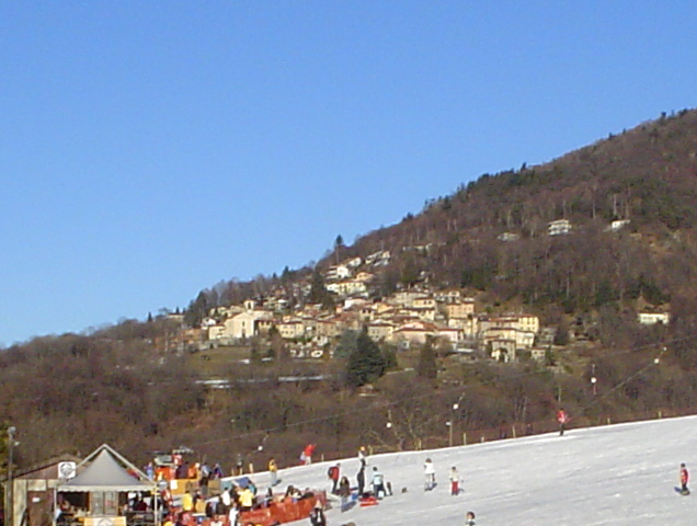
Cademario is a picturesque village located in the Ticino region of Switzerland, particularly known for its stunning views over Lake Lugano and the surrounding mountains. It's an excellent spot for hiking, offering various trails that cater to different skill levels. Here are some highlights of hiking in Cademario:
Trails
-
Sentiero delle Grotte: This trail takes you through beautiful wooded areas and past natural caves. It’s a moderate hike ideal for families and those looking for a leisurely walk while enjoying nature.
-
Cademario to Monte Brè: A more challenging hike leads you from Cademario to the summit of Monte Brè, where you can enjoy panoramic views of the region, including peaks and the lake. It's a rewarding trek for experienced hikers.
-
Cademario Circular Trails: There are several circular routes around Cademario, which allow you to see diverse landscapes, including meadows, forests, and village views. These trails can vary in length and difficulty.
Flora and Fauna
The region around Cademario is rich in flora and fauna. You might encounter various wildflowers, trees, and if you're lucky, you could spot local wildlife, including deer and various bird species.
Best Time to Hike
The best time to hike in Cademario is during the spring and autumn months when the weather is mild, and the scenery is picturesque with blooming flowers or colorful foliage. Summer can be warm, and winter may require special equipment if you're skiing or snowshoeing.
Preparation
- Gear: Sturdy hiking boots, weather-appropriate clothing, water, and snacks are essential.
- Maps and Signage: Familiarize yourself with the local maps and always pay attention to trail signs. The paths are generally well-marked.
- Local Advice: Consider checking in with local tourism offices for trail conditions or guided hike opportunities.
Conclusion
Whether you're an experienced hiker seeking a challenging ascent or someone looking for a serene, leisurely walk, Cademario has something to offer. With its breathtaking views, beautiful landscapes, and well-marked trails, it's a great destination for hiking enthusiasts.
- Страна:

- Почтовый код: 6936
- Телефонный код: 091
- Код автомобильного номера: TI
- Координаты: 46° 1' 0" N, 8° 54' 0" E


- GPS треки (wikiloc): [Ссылка]
- Высота над уровнем моря: 792 м m
- Площадь: 3.96 кв.км
- Население: 796
- Веб сайт: http://www.cademario.ch
- Википедия английская: wiki(en)
- Википедия национальная: wiki(de)
- Хранилище Wikidata: Wikidata: Q68806
- Катеория в википедии: [Ссылка]
- код Freebase: [/m/06wgs9]
- код GeoNames: Альт: [6559632]
- код VIAF: Альт: [151363787]
- ID отношения в OpenStreetMap: [1684639]
- код GND: Альт: [4465869-2]
- идентификатор местоположения ArchINFORM: [12567]
- код LCNAF: Альт: [n87800420]
- код TGN: [4002068]
- идентификатор HDS: [2148]
- код швейцарского муниципалитета: [5161]
Граничит с регионами:


Alto Malcantone
Hiking in Alto Malcantone
Alto Malcantone is a beautiful region in the Canton of Ticino, Switzerland, known for its stunning landscapes, serene forests, and picturesque villages. The area offers a variety of hiking trails suitable for different skill levels, making it a great destination for both novice and experienced hikers. Here are some key points to consider if you’re planning a hike in Alto Malcantone:...
- Страна:
- Почтовый код: 6939
- Телефонный код: 91
- Код автомобильного номера: TI
- Координаты: 46° 2' 0" N, 8° 53' 0" E
- GPS треки (wikiloc): [Ссылка]
- Высота над уровнем моря: 810 м m
- Площадь: 22.1 кв.км
- Население: 1405
- Веб сайт: [Ссылка]


Bioggio
Hiking in Bioggio
Bioggio is a charming village located in the southern part of Switzerland, specifically in the canton of Ticino. Nestled in the hills near the shores of Lake Lugano, it offers stunning scenery and a variety of hiking options suitable for different skill levels....
- Страна:
- Почтовый код: 6934
- Телефонный код: 091
- Код автомобильного номера: TI
- Координаты: 46° 0' 55" N, 8° 54' 6" E
- GPS треки (wikiloc): [Ссылка]
- Высота над уровнем моря: 386 м m
- Площадь: 6.0 кв.км
- Население: 2647
- Веб сайт: [Ссылка]
Aranno
Hiking in Aranno
Aranno is a charming village located in the canton of Ticino, Switzerland. It offers a fantastic setting for hiking enthusiasts, with beautiful landscapes and a variety of trails that cater to different skill levels. Here are some key points about hiking in Aranno:...
- Страна:
- Почтовый код: 6994
- Телефонный код: 91
- Код автомобильного номера: TI
- Координаты: 46° 1' 0" N, 8° 52' 0" E
- GPS треки (wikiloc): [Ссылка]
- Высота над уровнем моря: 707 м m
- Площадь: 2.58 кв.км
- Население: 375
- Веб сайт: [Ссылка]