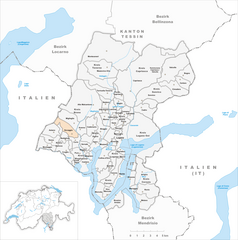
Aranno (Aranno)

 Hiking in Aranno
Aranno is a charming village located in the canton of Ticino, Switzerland. It offers a fantastic setting for hiking enthusiasts, with beautiful landscapes and a variety of trails that cater to different skill levels. Here are some key points about hiking in Aranno:
Trails and Routes
-
Local Trails: Aranno has several local trails that allow hikers to explore the surrounding hills and forests. The trails often feature stunning views of Lake Lugano and the surrounding mountains.
-
Scenic Paths: Many hiking routes typically include scenic paths that take you through picturesque vineyards, chestnut groves, and quaint villages, providing a blend of nature and culture.
-
Difficulty Levels: Trails in the area vary from easy to moderate. Beginners can enjoy leisurely walks, while more experienced hikers may challenge themselves with longer or steeper routes.
Points of Interest
-
Nature and Wildlife: Hikers can enjoy the region's rich biodiversity, including various flora and fauna. Keep an eye out for local wildlife, as Ticino is home to numerous species.
-
Cultural Sites: Along the trails, you may encounter historical landmarks, churches, and traditional Ticinese architecture, which adds cultural depth to your hiking experience.
Practical Tips
-
Weather Considerations: Always check the weather before heading out, as conditions in the mountains can change rapidly.
-
Equipment: Good hiking shoes, water, snacks, and perhaps trekking poles are recommended for a comfortable experience.
-
Navigating Trails: While many trails are well-marked, consider carrying a map or using a GPS app to ensure you stay on track.
-
Local Guidelines: Be mindful of local regulations, such as respecting wildlife and staying on marked paths to protect the environment.
Nearby Hiking Destinations
If you wish to explore beyond Aranno, the nearby region of Lugano offers numerous additional hiking opportunities, including trails in the surrounding mountains and along the lakeside.
Overall, hiking in Aranno can be a delightful way to enjoy the natural beauty and tranquility of the Swiss countryside. Enjoy your hike!
- Страна:

- Почтовый код: 6994
- Телефонный код: 91
- Код автомобильного номера: TI
- Координаты: 46° 1' 0" N, 8° 52' 0" E


- GPS треки (wikiloc): [Ссылка]
- Высота над уровнем моря: 707 м m
- Площадь: 2.58 кв.км
- Население: 375
- Веб сайт: http://www.aranno.ch
- Википедия английская: wiki(en)
- Википедия национальная: wiki(de)
- Хранилище Wikidata: Wikidata: Q68792
- Катеория в википедии: [Ссылка]
- код Freebase: [/m/07789y]
- код GeoNames: Альт: [8015081]
- код VIAF: Альт: [236591696]
- ID отношения в OpenStreetMap: [1684615]
- код GND: Альт: [7527847-9]
- место в MusicBrainz: [9f489df2-41b0-43a3-8800-8d939c9803ae]
- идентификатор HDS: [2132]
- код швейцарского муниципалитета: [5143]
Граничит с регионами:


Alto Malcantone
Hiking in Alto Malcantone
Alto Malcantone is a beautiful region in the Canton of Ticino, Switzerland, known for its stunning landscapes, serene forests, and picturesque villages. The area offers a variety of hiking trails suitable for different skill levels, making it a great destination for both novice and experienced hikers. Here are some key points to consider if you’re planning a hike in Alto Malcantone:...
- Страна:
- Почтовый код: 6939
- Телефонный код: 91
- Код автомобильного номера: TI
- Координаты: 46° 2' 0" N, 8° 53' 0" E
- GPS треки (wikiloc): [Ссылка]
- Высота над уровнем моря: 810 м m
- Площадь: 22.1 кв.км
- Население: 1405
- Веб сайт: [Ссылка]

Novaggio
Hiking in Novaggio
Novaggio is a charming municipality located in the canton of Ticino in southern Switzerland, known for its beautiful landscapes and great hiking opportunities. It is situated near the picturesque Lake Lugano and surrounded by the foothills of the Swiss Alps, making it an excellent destination for outdoor enthusiasts....
- Страна:
- Почтовый код: 6986
- Телефонный код: 091
- Код автомобильного номера: TI
- Координаты: 46° 1' 7" N, 8° 50' 42" E
- GPS треки (wikiloc): [Ссылка]
- Высота над уровнем моря: 833 м m
- Площадь: 4.4 кв.км
- Население: 829
- Веб сайт: [Ссылка]


Bioggio
Hiking in Bioggio
Bioggio is a charming village located in the southern part of Switzerland, specifically in the canton of Ticino. Nestled in the hills near the shores of Lake Lugano, it offers stunning scenery and a variety of hiking options suitable for different skill levels....
- Страна:
- Почтовый код: 6934
- Телефонный код: 091
- Код автомобильного номера: TI
- Координаты: 46° 0' 55" N, 8° 54' 6" E
- GPS треки (wikiloc): [Ссылка]
- Высота над уровнем моря: 386 м m
- Площадь: 6.0 кв.км
- Население: 2647
- Веб сайт: [Ссылка]


Cademario
Hiking in Cademario
Cademario is a picturesque village located in the Ticino region of Switzerland, particularly known for its stunning views over Lake Lugano and the surrounding mountains. It's an excellent spot for hiking, offering various trails that cater to different skill levels. Here are some highlights of hiking in Cademario:...
- Страна:
- Почтовый код: 6936
- Телефонный код: 091
- Код автомобильного номера: TI
- Координаты: 46° 1' 0" N, 8° 54' 0" E
- GPS треки (wikiloc): [Ссылка]
- Высота над уровнем моря: 792 м m
- Площадь: 3.96 кв.км
- Население: 796
- Веб сайт: [Ссылка]


Miglieglia
Hiking in Miglieglia
Miglieglia is a picturesque village located in the Ticino region of Switzerland, nestled in the foothills of the Swiss Alps. It’s an excellent destination for hiking enthusiasts due to its beautiful landscapes, varied terrain, and stunning views. Here’s an overview of hiking in Miglieglia:...
- Страна:
- Почтовый код: 6986
- Телефонный код: 091
- Код автомобильного номера: TI
- Координаты: 46° 1' 53" N, 8° 50' 58" E
- GPS треки (wikiloc): [Ссылка]
- Высота над уровнем моря: 971 м m
- Площадь: 5.13 кв.км
- Население: 311
- Веб сайт: [Ссылка]


Curio
Hiking in Curio
Curio is a small village located in the Ticino canton of Switzerland, known for its stunning natural beauty and proximity to the Lugano area. The region offers a variety of hiking trails suitable for different skill levels, making it a great destination for outdoor enthusiasts....
- Страна:
- Почтовый код: 6986
- Телефонный код: 091
- Код автомобильного номера: TI
- Координаты: 46° 0' 9" N, 8° 52' 27" E
- GPS треки (wikiloc): [Ссылка]
- Высота над уровнем моря: 558 м m
- Площадь: 2.84 кв.км
- Население: 544
- Веб сайт: [Ссылка]