Калестано (Calestano, Calestano)
.svg)
- коммуна Италии
 Hiking in Калестано
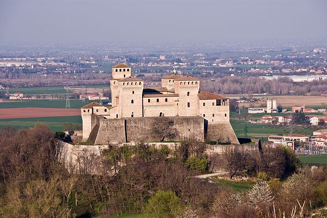
Calestano is a charming town located in the province of Parma, in the Emilia-Romagna region of Italy. It's situated in a picturesque area surrounded by the Apennine Mountains, making it an excellent destination for hiking enthusiasts. Here’s what you can expect when hiking in and around Calestano:
Hiking Trails
-
Sentiero dei Parchi: This scenic trail connects various parks in the region and offers breathtaking views of the Apennines. You can explore diverse ecosystems, including forests, meadows, and rocky outcrops.
-
Monte Fuso: A popular hike that takes you to the summit of Monte Fuso, where you will be rewarded with panoramic views. The trail is well-marked and suitable for hikers of varying abilities.
-
Val Parma Trails: The valleys around Calestano, especially Val Parma, feature several trails that follow the river and allow hikers to enjoy beautiful landscapes, waterfalls, and wildlife.
-
Ancient Paths: Some trails in the area follow historic routes that were used in ancient times, providing a glimpse into the history of the region along with natural beauty.
Best Time to Hike
- Spring and Fall: These seasons are ideal for hiking, as you will experience mild weather and see blooming flora in spring or fall foliage in autumn. Summers can get quite warm, while winters may present snow-covered trails.
What to Bring
- Footwear: Sturdy hiking boots are essential for navigating the varied terrain.
- Clothing: Dress in layers to adapt to changing temperatures, and consider waterproof gear if rain is in the forecast.
- Navigation Tools: A map or GPS device is helpful, as some trails may not be well-signposted.
Local Wildlife and Flora
Calestano’s natural surroundings are rich in biodiversity. Keep your eyes peeled for local wildlife, including deer, foxes, and various bird species. The area is also known for its diverse plant life, particularly in the warmer months.
Safety Tips
- Always inform someone of your hiking plans, especially if you intend to venture on less-traveled paths.
- Carry sufficient water and snacks, especially on longer hikes.
- Be prepared for changing weather conditions and know your limits.
Conclusion
Hiking in Calestano offers a unique blend of natural beauty, history, and tranquility. Whether you are looking for an easy stroll through the woods or a challenging trek up mountains, the area has options that cater to all levels of experience. Enjoy your hike!
- Страна:

- Почтовый код: 43030
- Телефонный код: 0525
- Код автомобильного номера: PR
- Координаты: 44° 36' 2" N, 10° 7' 19" E


- GPS треки (wikiloc): [Ссылка]
- Высота над уровнем моря: 417 м m
- Площадь: 57.36 кв.км
- Население: 2147
- Веб сайт: http://www.comune.calestano.pr.it
- Википедия русская: wiki(ru)
- Википедия английская: wiki(en)
- Википедия национальная: wiki(it)
- Хранилище Wikidata: Wikidata: Q100775
- Катеория в википедии: [Ссылка]
- код Freebase: [/m/0gkdfr]
- код GeoNames: Альт: [6538419]
- ID отношения в OpenStreetMap: [43325]
- место в MusicBrainz: [28ead8eb-c653-4dc6-ba80-7a74d287efd3]
- WOEID: [711728]
- код ISTAT: 034008
- кадастровый код Италии: B408
Граничит с регионами:


Берчето
- коммуна Италии
Hiking in Берчето
Berceto, a charming town located in the Emilia-Romagna region of northern Italy, is surrounded by beautiful landscapes and offers numerous hiking opportunities. Nestled in the Apennine Mountains, the area features lush forests, scenic views, and rich biodiversity, making it an excellent destination for outdoor enthusiasts....
- Страна:
- Почтовый код: 43042
- Телефонный код: 0525
- Код автомобильного номера: PR
- Координаты: 44° 30' 32" N, 9° 59' 28" E
- GPS треки (wikiloc): [Ссылка]
- Высота над уровнем моря: 852 м m
- Площадь: 131.71 кв.км
- Население: 2022
- Веб сайт: [Ссылка]


Корнильо
- коммуна Италии
Hiking in Корнильо
Corniglio is a small town located in the Emilia-Romagna region of Italy, and it is surrounded by beautiful natural landscapes that make it a great destination for hiking enthusiasts. Here are some key points to consider when exploring hiking opportunities in and around Corniglio:...
- Страна:
- Почтовый код: 43021
- Телефонный код: 0521
- Код автомобильного номера: PR
- Координаты: 44° 29' 0" N, 10° 5' 0" E
- GPS треки (wikiloc): [Ссылка]
- Высота над уровнем моря: 690 м m
- Площадь: 165.7 кв.км
- Население: 1863
- Веб сайт: [Ссылка]
Фелино
- коммуна Италии
Hiking in Фелино
Felino is a charming town located in the Emilia-Romagna region of Italy, known for its rich history and beautiful landscapes. The area surrounding Felino offers various hiking opportunities that cater to different skill levels, allowing hikers to explore natural beauty, vineyards, and historical sites....
- Страна:
- Почтовый код: 43035
- Телефонный код: 0521
- Код автомобильного номера: PR
- Координаты: 44° 41' 43" N, 10° 14' 30" E
- GPS треки (wikiloc): [Ссылка]
- Высота над уровнем моря: 180 м m
- Площадь: 38.35 кв.км
- Население: 8873
- Веб сайт: [Ссылка]

Лангирано
- коммуна Италии
Hiking in Лангирано
Langhirano is a beautiful area located in the province of Parma, in the Emilia-Romagna region of Italy. Known for its stunning landscapes, it offers various hiking opportunities that cater to different skill levels. Here’s a brief overview of what to expect when hiking in and around Langhirano:...
- Страна:
- Почтовый код: 43013
- Телефонный код: 0521
- Код автомобильного номера: PR
- Координаты: 44° 37' 0" N, 10° 16' 0" E
- GPS треки (wikiloc): [Ссылка]
- Высота над уровнем моря: 265 м m
- Площадь: 70.84 кв.км
- Население: 10346
- Веб сайт: [Ссылка]


Сала-Баганца
- коммуна Италии
Hiking in Сала-Баганца
Sala Baganza, located in the Emilia-Romagna region of Italy, is a wonderful destination for hiking enthusiasts. It is surrounded by the beautiful landscapes of the Apennines and features several trails that cater to different skill levels....
- Страна:
- Почтовый код: 43038
- Телефонный код: 0521
- Код автомобильного номера: PR
- Координаты: 44° 43' 0" N, 10° 14' 0" E
- GPS треки (wikiloc): [Ссылка]
- Высота над уровнем моря: 176 м m
- Площадь: 30.76 кв.км
- Население: 5622
- Веб сайт: [Ссылка]

Теренцо
- коммуна Италии
Hiking in Теренцо
Terenzo is a small village located in the province of Parma, Italy, and is surrounded by beautiful landscapes that make it a wonderful destination for hiking enthusiasts. The area features rolling hills, lush vineyards, and picturesque countryside, making for a serene hiking experience....
- Страна:
- Почтовый код: 43040
- Телефонный код: 0525
- Код автомобильного номера: PR
- Координаты: 44° 36' 37" N, 10° 5' 24" E
- GPS треки (wikiloc): [Ссылка]
- Высота над уровнем моря: 541 м m
- Площадь: 72.7 кв.км
- Население: 1200
- Веб сайт: [Ссылка]