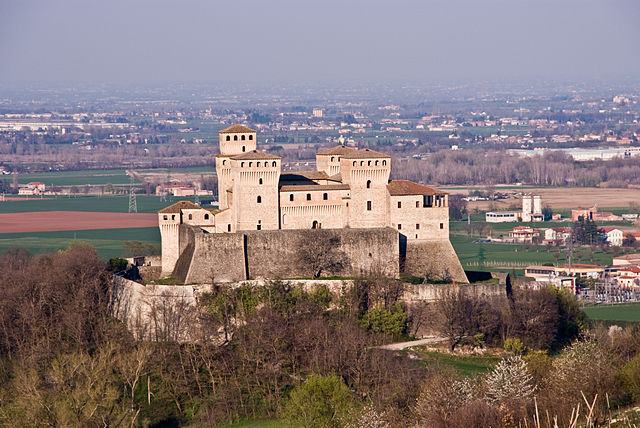
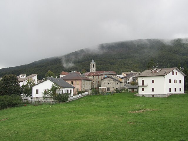
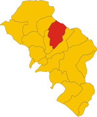
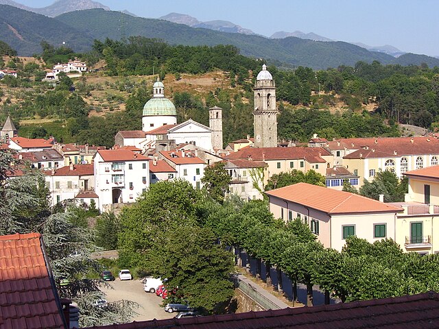
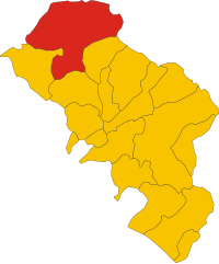
Корнильо (Corniglio, Corniglio)
.svg)
- коммуна Италии
 Hiking in Корнильо
Corniglio is a small town located in the Emilia-Romagna region of Italy, and it is surrounded by beautiful natural landscapes that make it a great destination for hiking enthusiasts. Here are some key points to consider when exploring hiking opportunities in and around Corniglio:
Scenic Trails
-
Natural Reserves: The area is part of the Appennino Tosco-Emiliano National Park, which features diverse flora and fauna. Trails in this park offer a variety of environments, from forested paths to open meadows with stunning views of the surrounding mountains.
-
Many Paths: There are numerous hiking trails that cater to different skill levels. Whether you're looking for a leisurely stroll or a challenging trek, you can find paths that suit your needs.
Popular Hiking Routes
- Sentiero dei Monti: This route offers a fantastic view of the surrounding mountains and valleys. It’s a level to moderate hike, ideal for families and casual walkers.
- Trail to Lago di Corniglio: This trail leads to a scenic lake, where you can enjoy the tranquility of nature and possibly spot some wildlife.
Season and Weather
- Best Times to Hike: The ideal months for hiking in Corniglio are from late spring to early autumn (May to October). During these months, the weather is typically mild, making it perfect for outdoor activities.
- Preparing for Weather: Always check the local weather forecast before you go, as conditions can change rapidly in mountainous areas.
Safety Tips
- Stay on Marked Trails: To protect the natural environment and ensure your safety, make sure to stick to marked paths.
- Hydration and Supplies: Carry sufficient water and snacks, as amenities can be sparse in the more remote trail areas.
- Notify Someone: Always let someone know your hiking plans, especially if you’re venturing into less-traveled areas.
Local Culture
- Cultural Sites: In addition to hiking, Corniglio offers a taste of Italian culture and history. You can visit local churches, historical buildings, and enjoy regional cuisine in the town.
Conclusion
Hiking in Corniglio is an excellent way to experience the natural beauty and cultural richness of the Emilia-Romagna region. Whether you're an experienced hiker or a beginner, the area offers trails that will satisfy both adventurers and casual walkers alike. Always remember to prepare adequately and respect the environment while enjoying your trek!
- Страна:

- Почтовый код: 43021
- Телефонный код: 0521
- Код автомобильного номера: PR
- Координаты: 44° 29' 0" N, 10° 5' 0" E


- GPS треки (wikiloc): [Ссылка]
- Высота над уровнем моря: 690 м m
- Площадь: 165.7 кв.км
- Население: 1863
- Веб сайт: http://www.comune.corniglio.pr.it
- Википедия русская: wiki(ru)
- Википедия английская: wiki(en)
- Википедия национальная: wiki(it)
- Хранилище Wikidata: Wikidata: Q100788
- Катеория в википедии: [Ссылка]
- код Freebase: [/m/0gkdh7]
- код GeoNames: Альт: [6536705]
- код VIAF: Альт: [244766901]
- ID отношения в OpenStreetMap: [43120]
- UN/LOCODE: [ITCRN]
- код ISTAT: 034012
- кадастровый код Италии: D026
Граничит с регионами:


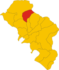
Берчето
- коммуна Италии
Hiking in Берчето
Berceto, a charming town located in the Emilia-Romagna region of northern Italy, is surrounded by beautiful landscapes and offers numerous hiking opportunities. Nestled in the Apennine Mountains, the area features lush forests, scenic views, and rich biodiversity, making it an excellent destination for outdoor enthusiasts....
- Страна:
- Почтовый код: 43042
- Телефонный код: 0525
- Код автомобильного номера: PR
- Координаты: 44° 30' 32" N, 9° 59' 28" E
- GPS треки (wikiloc): [Ссылка]
- Высота над уровнем моря: 852 м m
- Площадь: 131.71 кв.км
- Население: 2022
- Веб сайт: [Ссылка]


Калестано
- коммуна Италии
Hiking in Калестано
Calestano is a charming town located in the province of Parma, in the Emilia-Romagna region of Italy. It's situated in a picturesque area surrounded by the Apennine Mountains, making it an excellent destination for hiking enthusiasts. Here’s what you can expect when hiking in and around Calestano:...
- Страна:
- Почтовый код: 43030
- Телефонный код: 0525
- Код автомобильного номера: PR
- Координаты: 44° 36' 2" N, 10° 7' 19" E
- GPS треки (wikiloc): [Ссылка]
- Высота над уровнем моря: 417 м m
- Площадь: 57.36 кв.км
- Население: 2147
- Веб сайт: [Ссылка]

Лангирано
- коммуна Италии
Hiking in Лангирано
Langhirano is a beautiful area located in the province of Parma, in the Emilia-Romagna region of Italy. Known for its stunning landscapes, it offers various hiking opportunities that cater to different skill levels. Here’s a brief overview of what to expect when hiking in and around Langhirano:...
- Страна:
- Почтовый код: 43013
- Телефонный код: 0521
- Код автомобильного номера: PR
- Координаты: 44° 37' 0" N, 10° 16' 0" E
- GPS треки (wikiloc): [Ссылка]
- Высота над уровнем моря: 265 м m
- Площадь: 70.84 кв.км
- Население: 10346
- Веб сайт: [Ссылка]

Монкьо-делле-Корти
- коммуна Италии
Hiking in Монкьо-делле-Корти
Monchio delle Corti is a picturesque village located in the province of Modena, Italy, nestled within the scenic Apennine Mountains. This region offers a variety of hiking opportunities, with trails that showcase stunning landscapes, rich flora and fauna, and cultural heritage....
- Страна:
- Почтовый код: 43010
- Телефонный код: 0521
- Код автомобильного номера: PR
- Координаты: 44° 24' 44" N, 10° 7' 24" E
- GPS треки (wikiloc): [Ссылка]
- Высота над уровнем моря: 820 м m
- Площадь: 69.04 кв.км
- Население: 893
- Веб сайт: [Ссылка]
Паланцано
- коммуна Италии
Hiking in Паланцано
Palanzano is a charming village located in the Emilia-Romagna region of Italy, nestled in the Appennine Mountains. It's a wonderful destination for hikers, offering various trails that showcase the stunning natural beauty of the surrounding area. Here are some highlights and tips for hiking in Palanzano:...
- Страна:
- Почтовый код: 43025
- Телефонный код: 0521
- Код автомобильного номера: PR
- Координаты: 44° 26' 9" N, 10° 11' 35" E
- GPS треки (wikiloc): [Ссылка]
- Высота над уровнем моря: 691 м m
- Площадь: 69.8 кв.км
- Население: 1123
- Веб сайт: [Ссылка]


Тиццано-Валь-Парма
- коммуна Италии
Hiking in Тиццано-Валь-Парма
Tizzano Val Parma is a picturesque village located in the Emilia-Romagna region of Italy, nestled in the Apennine Mountains. It offers a variety of hiking opportunities amidst stunning natural landscapes, historic sites, and charming rural settings. Here are some highlights and tips for hiking in and around Tizzano Val Parma:...
- Страна:
- Почтовый код: 43028
- Телефонный код: 0521
- Код автомобильного номера: PR
- Координаты: 44° 31' 0" N, 10° 12' 0" E
- GPS треки (wikiloc): [Ссылка]
- Высота над уровнем моря: 800 м m
- Площадь: 78.39 кв.км
- Население: 2083
- Веб сайт: [Ссылка]

Баньоне
- коммуна Италии
Hiking in Баньоне
Bagnone is a charming village located in the Lunigiana region of Tuscany, Italy. It offers a beautiful landscape and numerous hiking opportunities for outdoor enthusiasts. Here are some things to consider when hiking in the Bagnone area:...
- Страна:
- Почтовый код: 54021
- Телефонный код: 0187
- Код автомобильного номера: MS
- Координаты: 44° 18' 53" N, 9° 59' 29" E
- GPS треки (wikiloc): [Ссылка]
- Высота над уровнем моря: 236 м m
- Площадь: 73.94 кв.км
- Население: 1836
- Веб сайт: [Ссылка]

Филаттьера
- коммуна Италии
Hiking in Филаттьера
Filattiera is a charming village located in the province of Massa-Carrara, in the Tuscany region of Italy. Nestled in the Apuan Alps, it offers a variety of hiking opportunities that cater to different skill levels, along with stunning natural scenery and cultural sites....
- Страна:
- Почтовый код: 54023
- Телефонный код: 0187
- Код автомобильного номера: MS
- Координаты: 44° 20' 0" N, 9° 56' 0" E
- GPS треки (wikiloc): [Ссылка]
- Высота над уровнем моря: 213 м m
- Площадь: 48.78 кв.км
- Население: 2285
- Веб сайт: [Ссылка]
Понтремоли
- коммуна Италии
Hiking in Понтремоли
Pontremoli, a charming town in the Lunigiana region of Tuscany, Italy, offers a variety of hiking opportunities for outdoor enthusiasts. Nestled in the Apennine Mountains, it is surrounded by stunning natural landscapes, rich history, and vibrant culture. Here are some key points to consider for hiking in and around Pontremoli:...
- Страна:
- Почтовый код: 54027
- Телефонный код: 0187
- Код автомобильного номера: MS
- Координаты: 44° 22' 34" N, 9° 52' 48" E
- GPS треки (wikiloc): [Ссылка]
- Высота над уровнем моря: 236 м m
- Площадь: 182.48 кв.км
- Население: 7193
- Веб сайт: [Ссылка]