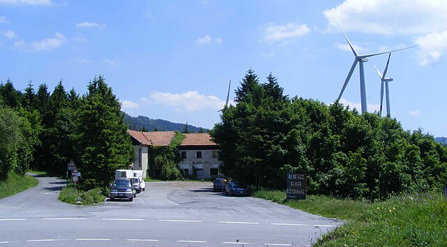
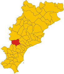
Калиццано (Calizzano, Calizzano)
.svg)
- коммуна Италии
 Hiking in Калиццано
Calizzano is a picturesque village located in the Liguria region of Italy, nestled in the foothills of the Apennines. It offers a variety of hiking opportunities for outdoor enthusiasts, with trails ranging from easy walks to more challenging hikes that provide stunning views of the surrounding landscapes.
Hiking Trails:
-
Sentiero della Libertà: This trail is known for its historical significance and breathtaking scenery. It takes hikers through beautiful woodlands and offers panoramic views of the surrounding valleys.
-
Grotte di Toirano: While not a hike in the traditional sense, the nearby caves offer unique exploratory opportunities and can be combined with hiking in the surrounding areas.
-
Valle di Calizzano: The valley itself provides several trails that vary in difficulty, allowing you to explore diverse terrains, including forests, streams, and meadows.
-
Monte Beigua: For those seeking a challenge, a hike to Monte Beigua can be rewarding. The trail to the summit offers stunning vistas and the chance to experience the rich biodiversity of the area.
Tips for Hiking in Calizzano:
-
Preparation: Ensure you have proper hiking gear, including suitable footwear, clothing for changing weather conditions, and plenty of water and snacks.
-
Maps and Guides: Trail maps are available, and local guides can provide valuable insights into the best paths and hidden gems in the area.
-
Respect Nature: Leave no trace and be mindful of wildlife and local flora. Stick to marked trails to preserve the natural environment.
-
Seasonal Considerations: Spring and early fall are usually the best times for hiking, with mild weather and vibrant scenery.
Overall, hiking in Calizzano provides a wonderful opportunity to immerse yourself in nature while experiencing the rich cultural and natural heritage of the Liguria region.
- Страна:

- Почтовый код: 17057
- Телефонный код: 019
- Код автомобильного номера: SV
- Координаты: 44° 14' 7" N, 8° 6' 55" E


- GPS треки (wikiloc): [Ссылка]
- Высота над уровнем моря: 647 м m
- Площадь: 62.74 кв.км
- Население: 1483
- Веб сайт: http://www.comunedicalizzano.it
- Википедия русская: wiki(ru)
- Википедия английская: wiki(en)
- Википедия национальная: wiki(it)
- Хранилище Wikidata: Wikidata: Q270578
- Катеория в википедии: [Ссылка]
- код Freebase: [/m/0gbzkc]
- код GeoNames: Альт: [6536081]
- ID отношения в OpenStreetMap: [42952]
- WOEID: [711736]
- UN/LOCODE: [ITZZA]
- код ISTAT: 009017
- кадастровый код Италии: B416
Граничит с регионами:


Массимино
- коммуна Италии
Hiking in Массимино
Massimino is not widely recognized as a hiking destination, but it could refer to specific local trails or areas within a broader region. If you're referring to hiking in a specific region known for Massimino, such as an area in Italy, please provide more context....
- Страна:
- Почтовый код: 12071
- Телефонный код: 019
- Код автомобильного номера: SV
- Координаты: 44° 18' 0" N, 8° 4' 0" E
- GPS треки (wikiloc): [Ссылка]
- Высота над уровнем моря: 540 м m
- Площадь: 7.85 кв.км
- Население: 103
- Веб сайт: [Ссылка]

Баньяско
- коммуна Италии
Hiking in Баньяско
Bagnasco, a small town in the province of Cuneo in the Piedmont region of Italy, offers beautiful hiking opportunities for nature lovers and outdoor enthusiasts. Nestled in the Maritime Alps, Bagnasco is surrounded by stunning landscapes, lush forests, and rugged mountain terrain, making it an ideal location for a variety of hiking experiences....
- Страна:
- Почтовый код: 12071
- Телефонный код: 0174
- Код автомобильного номера: CN
- Координаты: 44° 18' 15" N, 8° 2' 43" E
- GPS треки (wikiloc): [Ссылка]
- Высота над уровнем моря: 483 м m
- Площадь: 30.95 кв.км
- Население: 1014
- Веб сайт: [Ссылка]
Гарессио
- коммуна Италии
Hiking in Гарессио
Garessio, located in the Piedmont region of northern Italy, offers a beautiful setting for hiking enthusiasts. Nestled in the Ligurian Alps, it is surrounded by stunning landscapes, diverse flora and fauna, and picturesque views. Here are some highlights about hiking in Garessio:...
- Страна:
- Почтовый код: 12075
- Телефонный код: 0174
- Код автомобильного номера: CN
- Координаты: 44° 12' 0" N, 8° 1' 0" E
- GPS треки (wikiloc): [Ссылка]
- Высота над уровнем моря: 621 м m
- Площадь: 131.29 кв.км
- Население: 3132
- Веб сайт: [Ссылка]
Приола
- коммуна Италии
Hiking in Приола
Priola is a small municipality located in the province of Cuneo in the Piedmont region of Italy. Surrounded by the beautiful landscapes of the Italian Alps, it offers various hiking opportunities that cater to different skill levels and interests....
- Страна:
- Почтовый код: 12070
- Телефонный код: 0174
- Код автомобильного номера: CN
- Координаты: 44° 14' 41" N, 8° 1' 17" E
- GPS треки (wikiloc): [Ссылка]
- Высота над уровнем моря: 537 м m
- Площадь: 27.37 кв.км
- Население: 693
- Веб сайт: [Ссылка]

Бардинето
- коммуна Италии
Hiking in Бардинето
Bardineto is a picturesque village located in the Liguria region of Italy, nestled within the lush countryside of the province of Savona. The area is characterized by its stunning natural landscapes, rolling hills, and mountainous terrain, making it an excellent destination for hiking enthusiasts....
- Страна:
- Почтовый код: 17057
- Телефонный код: 019
- Код автомобильного номера: SV
- Координаты: 44° 11' 32" N, 8° 7' 45" E
- GPS треки (wikiloc): [Ссылка]
- Высота над уровнем моря: 711 м m
- Площадь: 29.79 кв.км
- Население: 744
- Веб сайт: [Ссылка]


Бормида
- коммуна Италии
Hiking in Бормида
Bormida, located in the Liguria region of northwest Italy, offers a beautiful backdrop for hiking enthusiasts. The area is characterized by its stunning landscapes, rich history, and vibrant nature. Here are some highlights about hiking in Bormida:...
- Страна:
- Почтовый код: 17040
- Телефонный код: 019
- Код автомобильного номера: SV
- Координаты: 44° 16' 44" N, 8° 14' 0" E
- GPS треки (wikiloc): [Ссылка]
- Высота над уровнем моря: 485 м m
- Площадь: 22.47 кв.км
- Население: 382
- Веб сайт: [Ссылка]


Мальоло
- коммуна Италии
Hiking in Мальоло
Magliolo is a charming village located in the Liguria region of Italy, nestled in the picturesque hills above the coastal town of Pietra Ligure. The surrounding area offers a variety of hiking opportunities, showcasing the natural beauty of the Italian Riviera....
- Страна:
- Почтовый код: 17020
- Телефонный код: 019
- Код автомобильного номера: SV
- Координаты: 44° 11' 30" N, 8° 15' 1" E
- GPS треки (wikiloc): [Ссылка]
- Высота над уровнем моря: 270 м m
- Площадь: 19.57 кв.км
- Население: 985
- Веб сайт: [Ссылка]


Муриальдо
- коммуна Италии
Hiking in Муриальдо
Murialdo is a small village located in the Liguria region of Italy, known for its beautiful landscapes and outdoor activities, including hiking. The surrounding area is characterized by a mix of lush forests, rolling hills, and stunning views, making it a great destination for hikers of all skill levels....
- Страна:
- Почтовый код: 17013
- Телефонный код: 019
- Код автомобильного номера: SV
- Координаты: 44° 18' 58" N, 8° 9' 41" E
- GPS треки (wikiloc): [Ссылка]
- Высота над уровнем моря: 524 м m
- Площадь: 39.22 кв.км
- Население: 837
- Веб сайт: [Ссылка]

Озилья
- коммуна Италии
Hiking in Озилья
Osiglia is a charming village located in the Piedmont region of Italy, surrounded by the beautiful landscapes of the Ligurian Alps. It's an excellent destination for hiking enthusiasts, offering a variety of trails that cater to different skill levels....
- Страна:
- Почтовый код: 17010
- Телефонный код: 019
- Код автомобильного номера: SV
- Координаты: 44° 16' 52" N, 8° 12' 4" E
- GPS треки (wikiloc): [Ссылка]
- Высота над уровнем моря: 715 м m
- Площадь: 28.17 кв.км
- Население: 464
- Веб сайт: [Ссылка]


Риальто (муниципалитет)
- коммуна Италии
Hiking in Риальто (муниципалитет)
Hiking in Rialto, Liguria, offers a unique experience characterized by stunning coastal views, charming villages, and beautiful landscapes typical of the Italian Riviera. While Rialto itself is a small village located in the mountains above the more famous coastal towns, it serves as a great base for exploring the nearby hiking trails in the surrounding area. Here’s what you can expect when hiking around Rialto:...
- Страна:
- Почтовый код: 17020
- Телефонный код: 019
- Код автомобильного номера: SV
- Координаты: 44° 14' 0" N, 8° 15' 0" E
- GPS треки (wikiloc): [Ссылка]
- Высота над уровнем моря: 376 м m
- Площадь: 19.6 кв.км
- Население: 562
- Веб сайт: [Ссылка]