
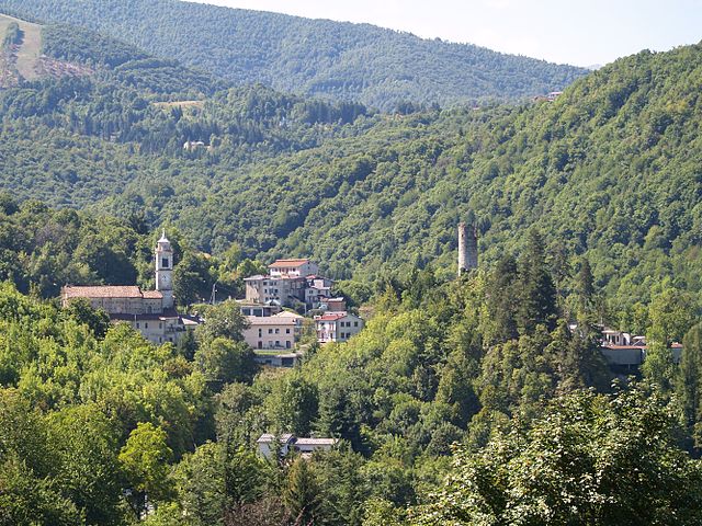
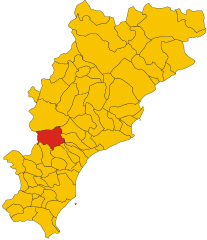
Гарессио (Garessio, Garessio)
- коммуна Италии
 Hiking in Гарессио
Garessio, located in the Piedmont region of northern Italy, offers a beautiful setting for hiking enthusiasts. Nestled in the Ligurian Alps, it is surrounded by stunning landscapes, diverse flora and fauna, and picturesque views. Here are some highlights about hiking in Garessio:
Trails and Terrain
- Variety of Trails: The area features numerous hiking trails that cater to different skill levels, from gentle walks suitable for families to more challenging routes for experienced hikers.
- Scenic Views: Many trails offer breathtaking views of the surrounding mountains, valleys, and historical landmarks. You can often see the nearby Alps and the rolling hills of the region.
- Natural Parks: Garessio is close to natural parks such as the Marguareis Park, home to unique geological formations and rich biodiversity.
Popular Hiking Routes
- Sentiero del Bric: A well-known trail leading to panoramic viewpoints, ideal for both short hikes and longer excursions.
- Colle di Navette: A route that offers stunning mountain views and a chance to encounter local wildlife.
- Punta Marguareis: For more experienced hikers, this trails leads to one of the highest peaks in the area with spectacular scenery.
Tips for Hiking in Garessio
- Prepare Properly: Ensure you have the right footwear and gear, as some trails can be rocky or steep.
- Seasonal Considerations: The best time to hike in Garessio is during the spring and autumn when temperatures are mild, and the landscape is particularly beautiful.
- Stay Hydrated: Always carry enough water and snacks, especially on longer trails.
- Wildlife Awareness: Be mindful of local wildlife; while encounters are rare, keeping a respectful distance is crucial.
Additional Activities
Aside from hiking, Garessio offers opportunities for rock climbing, mountain biking, and exploring local history and culture. Visiting the town itself provides a chance to experience local cuisine and traditions.
Overall, hiking in Garessio can be a rewarding experience, combining physical activity with the chance to immerse yourself in the natural beauty of Italy's mountainous terrain.
- Страна:

- Почтовый код: 12075
- Телефонный код: 0174
- Код автомобильного номера: CN
- Координаты: 44° 12' 0" N, 8° 1' 0" E


- GPS треки (wikiloc): [Ссылка]
- Высота над уровнем моря: 621 м m
- Площадь: 131.29 кв.км
- Население: 3132
- Веб сайт: http://www.comune.garessio.cn.it
- Википедия русская: wiki(ru)
- Википедия английская: wiki(en)
- Википедия национальная: wiki(it)
- Хранилище Wikidata: Wikidata: Q20090
- Катеория в википедии: [Ссылка]
- код Freebase: [/m/0gb9p7]
- код GeoNames: Альт: [6540940]
- код VIAF: Альт: [240557585]
- ID отношения в OpenStreetMap: [42910]
- UN/LOCODE: [ITGAS]
- код ISTAT: 004095
- кадастровый код Италии: D920
Граничит с регионами:

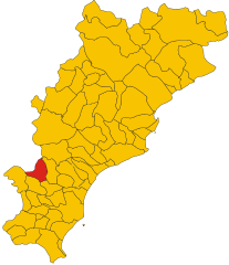
Ормеа
- коммуна Италии
Hiking in Ормеа
Ormea, located in the Liguria region of Italy, is a hidden gem for hiking enthusiasts. Nestled in the Maritime Alps, this charming town offers breathtaking landscapes, rich biodiversity, and a variety of trails suitable for all experience levels. Here are some key points about hiking in and around Ormea:...
- Страна:
- Почтовый код: 12078
- Телефонный код: 0174
- Код автомобильного номера: CN
- Координаты: 44° 9' 0" N, 7° 55' 0" E
- GPS треки (wikiloc): [Ссылка]
- Высота над уровнем моря: 740 м m
- Площадь: 124.5 кв.км
- Население: 1607
- Веб сайт: [Ссылка]

Пампарато
- Коммуна в Италии, располагается в регионе Пьемонт, подчиняется административному центру Кунео.
Hiking in Пампарато
Pamparato is a picturesque town located in the Piedmont region of Italy, specifically in the province of Cuneo. It is nestled in the Maritime Alps, making it an excellent destination for hiking enthusiasts. Here are some highlights and tips for hiking in the Pamparato area:...
- Страна:
- Почтовый код: 12087
- Телефонный код: 0174
- Код автомобильного номера: CN
- Координаты: 44° 17' 0" N, 7° 55' 0" E
- GPS треки (wikiloc): [Ссылка]
- Высота над уровнем моря: 816 м m
- Площадь: 34.51 кв.км
- Население: 298
- Веб сайт: [Ссылка]
Приола
- коммуна Италии
Hiking in Приола
Priola is a small municipality located in the province of Cuneo in the Piedmont region of Italy. Surrounded by the beautiful landscapes of the Italian Alps, it offers various hiking opportunities that cater to different skill levels and interests....
- Страна:
- Почтовый код: 12070
- Телефонный код: 0174
- Код автомобильного номера: CN
- Координаты: 44° 14' 41" N, 8° 1' 17" E
- GPS треки (wikiloc): [Ссылка]
- Высота над уровнем моря: 537 м m
- Площадь: 27.37 кв.км
- Население: 693
- Веб сайт: [Ссылка]
Робурент
- коммуна Италии
Hiking in Робурент
Roburent is a charming mountain village located in the Piedmont region of Italy, nestled in the Cuneo province. This area is part of the Maritime Alps and offers a variety of hiking opportunities that cater to different skill levels. Here are some key points about hiking in and around Roburent:...
- Страна:
- Почтовый код: 12080
- Телефонный код: 0174
- Код автомобильного номера: CN
- Координаты: 44° 19' 0" N, 7° 53' 0" E
- GPS треки (wikiloc): [Ссылка]
- Высота над уровнем моря: 788 м m
- Площадь: 29.81 кв.км
- Население: 496
- Веб сайт: [Ссылка]
Виола
- коммуна Италии
Hiking in Виола
Viola is a charming village located in the Piedmont region of northern Italy, nestled amidst the breathtaking landscape of the Cottian Alps. The area around Viola offers a variety of hiking opportunities suitable for different skill levels, ranging from gentle walks to more challenging treks....
- Страна:
- Почтовый код: 12070
- Телефонный код: 0174
- Код автомобильного номера: CN
- Координаты: 44° 17' 0" N, 7° 58' 0" E
- GPS треки (wikiloc): [Ссылка]
- Высота над уровнем моря: 827 м m
- Площадь: 21.07 кв.км
- Население: 363
- Веб сайт: [Ссылка]

Бардинето
- коммуна Италии
Hiking in Бардинето
Bardineto is a picturesque village located in the Liguria region of Italy, nestled within the lush countryside of the province of Savona. The area is characterized by its stunning natural landscapes, rolling hills, and mountainous terrain, making it an excellent destination for hiking enthusiasts....
- Страна:
- Почтовый код: 17057
- Телефонный код: 019
- Код автомобильного номера: SV
- Координаты: 44° 11' 32" N, 8° 7' 45" E
- GPS треки (wikiloc): [Ссылка]
- Высота над уровнем моря: 711 м m
- Площадь: 29.79 кв.км
- Население: 744
- Веб сайт: [Ссылка]


Калиццано
- коммуна Италии
Hiking in Калиццано
Calizzano is a picturesque village located in the Liguria region of Italy, nestled in the foothills of the Apennines. It offers a variety of hiking opportunities for outdoor enthusiasts, with trails ranging from easy walks to more challenging hikes that provide stunning views of the surrounding landscapes....
- Страна:
- Почтовый код: 17057
- Телефонный код: 019
- Код автомобильного номера: SV
- Координаты: 44° 14' 7" N, 8° 6' 55" E
- GPS треки (wikiloc): [Ссылка]
- Высота над уровнем моря: 647 м m
- Площадь: 62.74 кв.км
- Население: 1483
- Веб сайт: [Ссылка]


Кастельвеккьо-ди-Рокка-Барбена
- коммуна Италии
Hiking in Кастельвеккьо-ди-Рокка-Барбена
Castelvecchio di Rocca Barbena is a charming medieval village located in the Liguria region of Italy, nestled in the foothills of the Alps near the coast. The surrounding landscape offers a variety of hiking opportunities, ranging from easy walks to more challenging trails, all while providing stunning views of the hilly terrain and the Mediterranean Sea....
- Страна:
- Почтовый код: 17034
- Телефонный код: 0182
- Код автомобильного номера: SV
- Координаты: 44° 7' 50" N, 8° 6' 56" E
- GPS треки (wikiloc): [Ссылка]
- Высота над уровнем моря: 420 м m
- Площадь: 16.14 кв.км
- Население: 135
- Веб сайт: [Ссылка]

Эрли
- коммуна Италии
Hiking in Эрли
Erli, located in the eastern part of China, is a relatively lesser-known area that can offer some unique hiking experiences. While it might not be as famous as places like Zhangjiajie or Huangshan, it still presents opportunities for outdoor enthusiasts....
- Страна:
- Почтовый код: 17030
- Телефонный код: 0182
- Код автомобильного номера: SV
- Координаты: 44° 8' 14" N, 8° 6' 15" E
- GPS треки (wikiloc): [Ссылка]
- Высота над уровнем моря: 287 м m
- Площадь: 16.73 кв.км
- Население: 235
- Веб сайт: [Ссылка]


Назино
- коммуна Италии
Hiking in Назино
Nasino, a municipality located in the province of Imperia in the Italian region of Liguria, offers a fantastic array of hiking opportunities, particularly due to its proximity to the Ligurian Alps and the coastline. The area is characterized by its beautiful landscapes, diverse flora and fauna, quaint villages, and scenic views of the Mediterranean Sea....
- Страна:
- Почтовый код: 17030
- Телефонный код: 0182
- Код автомобильного номера: SV
- Координаты: 44° 6' 52" N, 8° 1' 47" E
- GPS треки (wikiloc): [Ссылка]
- Высота над уровнем моря: 335 м m
- Площадь: 22.18 кв.км
- Население: 193
- Веб сайт: [Ссылка]