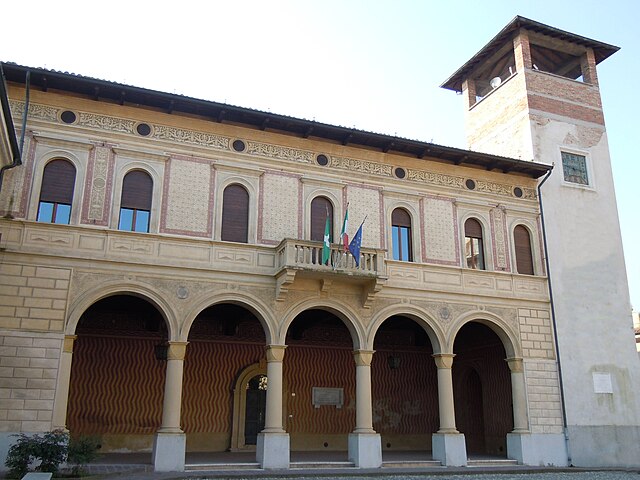
Кальватоне (Calvatone, Calvatone)
.svg)
- коммуна Италии
 Hiking in Кальватоне
Calvatone is a small town located in the Lombardy region of Italy. While it may not be as widely recognized for hiking as some other areas in Italy, it does offer opportunities for outdoor activities and exploration of the surrounding countryside.
Hiking Opportunities:
-
Local Trails: Calvatone is situated in a rural area with access to various trails that can lead you through picturesque landscapes, including fields, vineyards, and woodlands. Look for local signs or maps that indicate paths suitable for hiking.
-
Nearby Natural Parks: Consider exploring nearby natural parks, such as Parco Regionale dell’Oglio Sud, which offers a range of trails along the Oglio River, suitable for hiking, cycling, and bird watching.
-
Cultural Trails: Hiking in this region allows you to combine nature with cultural exploration. You might come across historical sites, charming villages, and traditional Italian architecture along the way.
Tips for Hiking in Calvatone:
-
Check Local Resources: Before heading out, consult local tourism offices for maps and recommendations on the best trails. They can provide up-to-date information on trail conditions and any guided hikes.
-
Weather Considerations: The weather can vary, so ensure you're prepared with appropriate clothing and gear. Check the forecast before heading out.
-
Stay Hydrated: Bring enough water and snacks, especially if you plan on hiking longer trails.
-
Respect Nature: Follow Leave No Trace principles, which include taking your trash home and staying on marked paths to protect the local ecosystem.
Conclusion:
While Calvatone may not be the primary hiking destination in Italy, it offers a unique chance to enjoy the tranquility of the Lombardy countryside. Be sure to take the time to immerse yourself in the natural beauty and cultural heritage of the area while exploring the trails. Happy hiking!
- Страна:

- Почтовый код: 26030
- Телефонный код: 0375
- Код автомобильного номера: CR
- Координаты: 45° 8' 0" N, 10° 27' 0" E


- GPS треки (wikiloc): [Ссылка]
- Высота над уровнем моря: 29 м m
- Площадь: 13.7 кв.км
- Население: 1217
- Веб сайт: http://www.comune.calvatone.cr.it
- Википедия русская: wiki(ru)
- Википедия английская: wiki(en)
- Википедия национальная: wiki(it)
- Хранилище Wikidata: Wikidata: Q42304
- Катеория в википедии: [Ссылка]
- код Freebase: [/m/0gjyg8]
- код GeoNames: Альт: [6540362]
- код VIAF: Альт: [130625244]
- ID отношения в OpenStreetMap: [44260]
- UN/LOCODE: [ITLVJ]
- код Цифрового атласа Римской империи: [10726]
- код ISTAT: 019009
- кадастровый код Италии: B439
Граничит с регионами:


Каннето-сулл'Ольйо
- коммуна Италии
Hiking in Каннето-сулл'Ольйо
Canneto sull'Oglio is a charming town located in the Lombardy region of Italy, and while it may not be as well-known for hiking as some other Italian destinations, it offers scenic landscapes and opportunities for outdoor activities. Here are some tips and information for hiking in and around Canneto sull'Oglio:...
- Страна:
- Почтовый код: 46013
- Телефонный код: 0376
- Код автомобильного номера: MN
- Координаты: 45° 9' 0" N, 10° 23' 0" E
- GPS треки (wikiloc): [Ссылка]
- Высота над уровнем моря: 34 м m
- Площадь: 25.87 кв.км
- Население: 4388
- Веб сайт: [Ссылка]


Торната
- коммуна Италии
Hiking in Торната
It seems that there may be some confusion with the name "Tornata," as it does not correspond to a widely recognized hiking location or region. However, I can provide information on popular hiking areas, as well as tips and advice for hiking in general....
- Страна:
- Почтовый код: 26030
- Телефонный код: 0375
- Код автомобильного номера: CR
- Координаты: 45° 6' 0" N, 10° 26' 0" E
- GPS треки (wikiloc): [Ссылка]
- Высота над уровнем моря: 29 м m
- Площадь: 10.17 кв.км
- Население: 461
- Веб сайт: [Ссылка]

Боццоло
- коммуна Италии
Hiking in Боццоло
Bozzolo is a small town located in the province of Mantua in the Lombardy region of Italy. While it's not widely known as a hiking destination, there are various outdoor activities and natural areas nearby that can provide a great hiking experience....
- Страна:
- Почтовый код: 46012
- Телефонный код: 0376
- Код автомобильного номера: MN
- Координаты: 45° 6' 12" N, 10° 28' 48" E
- GPS треки (wikiloc): [Ссылка]
- Высота над уровнем моря: 30 м m
- Площадь: 18.82 кв.км
- Население: 4190
- Веб сайт: [Ссылка]


Аккуанегра-сул-Кьезе
- коммуна Италии
Hiking in Аккуанегра-сул-Кьезе
Acquanegra sul Chiese is a charming village located in the Lombardy region of Italy, nestled in the foothills of the Alps. While it may not be as widely known as other hiking destinations in Italy, it offers a variety of trails and beautiful natural scenery for those looking for a peaceful hiking experience....
- Страна:
- Почтовый код: 46011
- Телефонный код: 0376
- Код автомобильного номера: MN
- Координаты: 45° 10' 0" N, 10° 26' 0" E
- GPS треки (wikiloc): [Ссылка]
- Высота над уровнем моря: 31 м m
- Площадь: 28.01 кв.км
- Население: 2895
- Веб сайт: [Ссылка]
Piadena Drizzona
Hiking in Piadena Drizzona
Piadena Drizzona is a small town located in the province of Cremona in Lombardy, Italy. While it may not be a well-known hiking destination compared to the more mountainous regions of Italy, the area surrounding Piadena Drizzona does offer opportunities for walking and exploring nature....
- Страна:
- Координаты: 45° 8' 11" N, 10° 21' 38" E
- GPS треки (wikiloc): [Ссылка]