
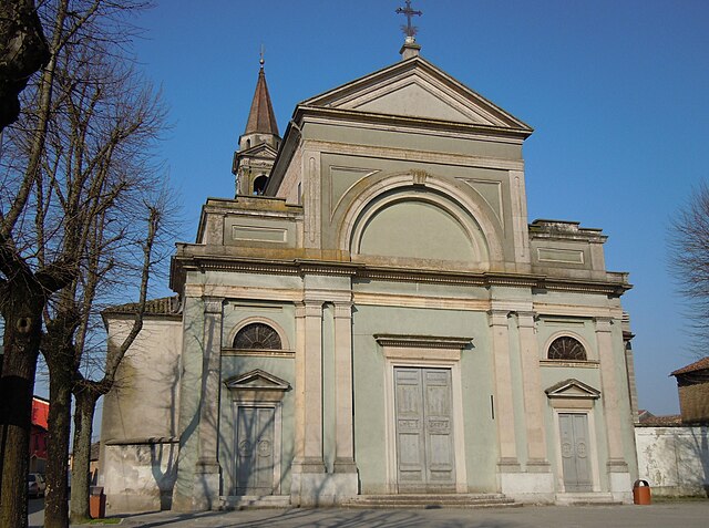
Боццоло (Bozzolo, Bozzolo)
.svg)
- коммуна Италии
 Hiking in Боццоло
Bozzolo is a small town located in the province of Mantua in the Lombardy region of Italy. While it's not widely known as a hiking destination, there are various outdoor activities and natural areas nearby that can provide a great hiking experience.
Hiking Opportunities near Bozzolo
-
Natural Reserves and Parks:
- Parco Regionale del Mincio: Located a bit further west, this regional park follows the Mincio River and offers scenic trails, diverse wildlife, and beautiful landscapes. You can enjoy easy hikes along the riverbanks or more challenging trails deeper into the park.
- Oasi di Castellaro Lagusello: This oasis is a lovely spot for both leisurely walks and nature observation. The trails are relatively flat and perfect for a relaxing day out in nature.
-
Countryside Trails:
- The surrounding countryside of Lombardy offers various paths through fields, vineyards, and rustic landscapes. These trails can provide a unique glimpse into rural Italian life and the regional flora and fauna.
-
Historical Routes:
- You might also consider exploring historical trails that connect various towns and sites in the region. The area is rich in history, and walking through it can lead to discovering charming villages and historical landmarks.
Tips for Hiking in the Area
-
Maps and Guidance: Before heading out, make sure to have a map or GPS device to navigate the trails, as marked trails may not always be clearly signposted.
-
Weather Considerations: Check the weather forecast before your hike. Conditions can change quickly, especially in the shoulder seasons.
-
Local Amenities: Since Bozzolo is a small town, consider bringing snacks and plenty of water, as amenities may be limited along certain trails.
-
Respect Nature and Local Wildlife: When hiking, always stay on marked paths, and practice Leave No Trace principles to help preserve the natural beauty of the area.
While Bozzolo itself might not be a prominent hiking hub, the surrounding areas provide plenty of opportunities to explore the beautiful Italian landscape through hiking.
- Страна:

- Почтовый код: 46012
- Телефонный код: 0376
- Код автомобильного номера: MN
- Координаты: 45° 6' 12" N, 10° 28' 48" E


- GPS треки (wikiloc): [Ссылка]
- Высота над уровнем моря: 30 м m
- Площадь: 18.82 кв.км
- Население: 4190
- Веб сайт: http://www.comune.bozzolo.mn.it
- Википедия русская: wiki(ru)
- Википедия английская: wiki(en)
- Википедия национальная: wiki(it)
- Хранилище Wikidata: Wikidata: Q42966
- Катеория в википедии: [Ссылка]
- код Freebase: [/m/0gj_pt]
- код GeoNames: Альт: [6537230]
- код BNF: [123901870]
- код VIAF: Альт: [140797777]
- ID отношения в OpenStreetMap: [44197]
- код LCNAF: Альт: [n85366755]
- UN/LOCODE: [ITBOZ]
- код ISTAT: 020007
- кадастровый код Италии: B110
Граничит с регионами:

Кальватоне
- коммуна Италии
Hiking in Кальватоне
Calvatone is a small town located in the Lombardy region of Italy. While it may not be as widely recognized for hiking as some other areas in Italy, it does offer opportunities for outdoor activities and exploration of the surrounding countryside....
- Страна:
- Почтовый код: 26030
- Телефонный код: 0375
- Код автомобильного номера: CR
- Координаты: 45° 8' 0" N, 10° 27' 0" E
- GPS треки (wikiloc): [Ссылка]
- Высота над уровнем моря: 29 м m
- Площадь: 13.7 кв.км
- Население: 1217
- Веб сайт: [Ссылка]


Ривароло-Мантовано
- коммуна Италии
Hiking in Ривароло-Мантовано
Rivarolo Mantovano, located in the province of Mantua in the Lombardy region of Italy, offers a variety of hiking opportunities characterized by picturesque landscapes, agricultural fields, and waterways. Here are some key points to consider if you’re planning a hiking trip to this area:...
- Страна:
- Почтовый код: 46017
- Телефонный код: 0376
- Код автомобильного номера: MN
- Координаты: 45° 4' 0" N, 10° 26' 0" E
- GPS треки (wikiloc): [Ссылка]
- Высота над уровнем моря: 26 м m
- Площадь: 25.55 кв.км
- Население: 2553
- Веб сайт: [Ссылка]


Маркария
- коммуна Италии
Hiking in Маркария
Marcaria is a small town located in the Lombardy region of Italy. While it may not be a well-known hiking destination, it is surrounded by beautiful landscapes and natural areas that can provide a pleasant experience for hikers....
- Страна:
- Почтовый код: 46010
- Телефонный код: 0376
- Код автомобильного номера: MN
- Координаты: 45° 7' 0" N, 10° 32' 0" E
- GPS треки (wikiloc): [Ссылка]
- Высота над уровнем моря: 25 м m
- Площадь: 89.79 кв.км
- Население: 6591
- Веб сайт: [Ссылка]


Сан-Мартино-далл'Арджине
- коммуна Италии
Hiking in Сан-Мартино-далл'Арджине
San Martino dall'Argine is a charming town in the Lombardy region of Italy, known for its scenic beauty and tranquil landscapes. While it may not be a frequently mentioned hiking destination compared to more famous locations in Italy, it can offer some lovely walking and hiking opportunities, particularly for those interested in exploring the surrounding countryside....
- Страна:
- Почтовый код: 46010
- Телефонный код: 0376
- Код автомобильного номера: MN
- Координаты: 45° 6' 0" N, 10° 30' 0" E
- GPS треки (wikiloc): [Ссылка]
- Высота над уровнем моря: 29 м m
- Площадь: 16.94 кв.км
- Население: 1742
- Веб сайт: [Ссылка]


Торната
- коммуна Италии
Hiking in Торната
It seems that there may be some confusion with the name "Tornata," as it does not correspond to a widely recognized hiking location or region. However, I can provide information on popular hiking areas, as well as tips and advice for hiking in general....
- Страна:
- Почтовый код: 26030
- Телефонный код: 0375
- Код автомобильного номера: CR
- Координаты: 45° 6' 0" N, 10° 26' 0" E
- GPS треки (wikiloc): [Ссылка]
- Высота над уровнем моря: 29 м m
- Площадь: 10.17 кв.км
- Население: 461
- Веб сайт: [Ссылка]


Аккуанегра-сул-Кьезе
- коммуна Италии
Hiking in Аккуанегра-сул-Кьезе
Acquanegra sul Chiese is a charming village located in the Lombardy region of Italy, nestled in the foothills of the Alps. While it may not be as widely known as other hiking destinations in Italy, it offers a variety of trails and beautiful natural scenery for those looking for a peaceful hiking experience....
- Страна:
- Почтовый код: 46011
- Телефонный код: 0376
- Код автомобильного номера: MN
- Координаты: 45° 10' 0" N, 10° 26' 0" E
- GPS треки (wikiloc): [Ссылка]
- Высота над уровнем моря: 31 м m
- Площадь: 28.01 кв.км
- Население: 2895
- Веб сайт: [Ссылка]