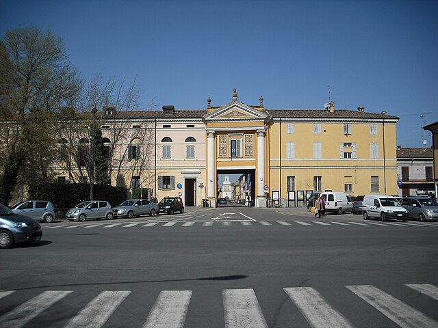
Кампозанто (Camposanto, Camposanto)
.svg)
- коммуна Италии
 Hiking in Кампозанто
Camposanto, often referred to as Camposanto Monumentale, is not primarily known as a hiking destination but rather as a cemetery located in Pisa, Italy, renowned for its sculpture and art. However, if you are looking for hiking opportunities in the broader Tuscan region, here are some suggestions:
-
Tuscany’s Natural Parks: The region surrounding Camposanto boasts several nature parks. The Casentino Forests, Monte Falterona, and Campigna National Park offer a variety of trails ranging from easy walks to more challenging hikes.
-
Via Francigena: This ancient pilgrimage route runs through Tuscany and offers a great hiking experience. Sections of the trail wind through beautiful landscapes, historic villages, and vineyards.
-
Cinqueterre National Park: Although a bit further from Camposanto, it’s worth a mention. The park has stunning coastal hikes with breathtaking views of the Mediterranean Sea and the picturesque villages of Cinque Terre.
-
Apuan Alps: Located northwest of Lucca, this area features rugged terrain with numerous trails that provide stunning views and a chance to explore marble quarries.
-
Monte Pisa: For a more localized hike, consider trails leading to Monte Pisano, which provides lovely views of the Pisa area and the surrounding countryside.
If you’re planning a hike, ensure you have good footwear, carry plenty of water, and check local trail maps or visitor information for specifics on trail conditions and difficulty levels. Always adhere to Leave No Trace principles to help preserve the natural beauty of the region. Happy hiking!
- Страна:

- Почтовый код: 41031
- Телефонный код: 0535
- Код автомобильного номера: MO
- Координаты: 44° 47' 0" N, 11° 8' 0" E


- GPS треки (wikiloc): [Ссылка]
- Высота над уровнем моря: 21 м m
- Площадь: 22.71 кв.км
- Население: 3049
- Веб сайт: http://www.comune.camposanto.mo.it
- Википедия русская: wiki(ru)
- Википедия английская: wiki(en)
- Википедия национальная: wiki(it)
- Хранилище Wikidata: Wikidata: Q100040
- Катеория в википедии: [Ссылка]
- код Freebase: [/m/0gkg2w]
- код GeoNames: Альт: [6538449]
- код VIAF: Альт: [172917715]
- ID отношения в OpenStreetMap: [43610]
- WOEID: [711950]
- UN/LOCODE: [ITECM]
- код ISTAT: 036004
- кадастровый код Италии: B566
Граничит с регионами:
Бомпорто
- коммуна Италии
Hiking in Бомпорто
Bomporto, located in the Emilia-Romagna region of Italy, is a charming area with picturesque landscapes, making it a great destination for hiking enthusiasts. While Bomporto itself may not have extensive hiking trails, there are several options in the surrounding regions that offer beautiful scenery and outdoor experiences....
- Страна:
- Почтовый код: 41030
- Телефонный код: 059
- Код автомобильного номера: MO
- Координаты: 44° 44' 0" N, 11° 2' 0" E
- GPS треки (wikiloc): [Ссылка]
- Высота над уровнем моря: 20 м m
- Площадь: 38.87 кв.км
- Население: 10170
- Веб сайт: [Ссылка]


Финале-Эмилия
- коммуна Италии
Hiking in Финале-Эмилия
Finale Emilia, located in the Emilia-Romagna region of Italy, is not primarily known as a hiking destination compared to the surrounding areas that are more mountainous. However, it offers some pleasant opportunities for walking and enjoying the natural scenery....
- Страна:
- Почтовый код: 41034
- Телефонный код: 0535
- Код автомобильного номера: MO
- Координаты: 44° 49' 55" N, 11° 17' 45" E
- GPS треки (wikiloc): [Ссылка]
- Высота над уровнем моря: 15 м m
- Площадь: 105.13 кв.км
- Население: 15581
- Веб сайт: [Ссылка]


Медолла
- коммуна Италии
Hiking in Медолла
Medolla, located in the Emilia-Romagna region of Italy, is a small town known for its agricultural landscape and proximity to the Po River. While it's not primarily known as a hiking destination, there are opportunities for outdoor activities and exploration of the surrounding countryside....
- Страна:
- Почтовый код: 41036
- Телефонный код: 0535
- Код автомобильного номера: MO
- Координаты: 44° 50' 55" N, 11° 4' 15" E
- GPS треки (wikiloc): [Ссылка]
- Высота над уровнем моря: 22 м m
- Площадь: 27 кв.км
- Население: 6253
- Веб сайт: [Ссылка]
Раварино
- коммуна Италии
Hiking in Раварино
Ravarino is a small town located in the Emilia-Romagna region of Italy, known for its scenic countryside and proximity to larger cities like Modena and Bologna. While Ravarino itself might not be famous for high-profile hiking trails, the surrounding landscapes offer opportunities for nature lovers and hikers looking to explore the beautiful Italian countryside....
- Страна:
- Почтовый код: 41017
- Телефонный код: 059
- Код автомобильного номера: MO
- Координаты: 44° 43' 0" N, 11° 6' 0" E
- GPS треки (wikiloc): [Ссылка]
- Высота над уровнем моря: 23 м m
- Площадь: 28.53 кв.км
- Население: 6132
- Веб сайт: [Ссылка]


СанФеличе-суль-Панаро
- коммуна Италии
Hiking in СанФеличе-суль-Панаро
San Felice sul Panaro is a charming town located in the Emilia-Romagna region of Italy, and while it might not be as widely recognized for hiking as some larger national parks, it offers various outdoor activities and access to beautiful natural landscapes....
- Страна:
- Почтовый код: 41038
- Телефонный код: 0535
- Код автомобильного номера: MO
- Координаты: 44° 50' 3" N, 11° 8' 37" E
- GPS треки (wikiloc): [Ссылка]
- Высота над уровнем моря: 19 м m
- Площадь: 51.66 кв.км
- Население: 10802
- Веб сайт: [Ссылка]
Сан-Просперо
- коммуна Италии
Hiking in Сан-Просперо
San Prospero isn't as commonly recognized as a major hiking destination compared to other regions, so information may vary depending on the specific location and features you're interested in. However, if you’re referring to San Prospero as found in Italian regions or any lesser-known areas, there may be local trails, countryside walks, and unique landscapes to explore....
- Страна:
- Почтовый код: 41030
- Телефонный код: 059
- Код автомобильного номера: MO
- Координаты: 44° 47' 23" N, 11° 1' 20" E
- GPS треки (wikiloc): [Ссылка]
- Высота над уровнем моря: 22 м m
- Площадь: 34.56 кв.км
- Население: 5933
- Веб сайт: [Ссылка]

Кревалькоре
- коммуна Италии
Hiking in Кревалькоре
Crevalcore is a charming town located in the Emilia-Romagna region of Italy, known more for its agricultural landscape than for traditional hiking trails. However, there are opportunities for easy hiking and walking in the surrounding countryside....
- Страна:
- Почтовый код: 40014
- Телефонный код: 051
- Код автомобильного номера: BO
- Координаты: 44° 43' 0" N, 11° 9' 0" E
- GPS треки (wikiloc): [Ссылка]
- Высота над уровнем моря: 20 м m
- Площадь: 102.75 кв.км
- Население: 13501
- Веб сайт: [Ссылка]