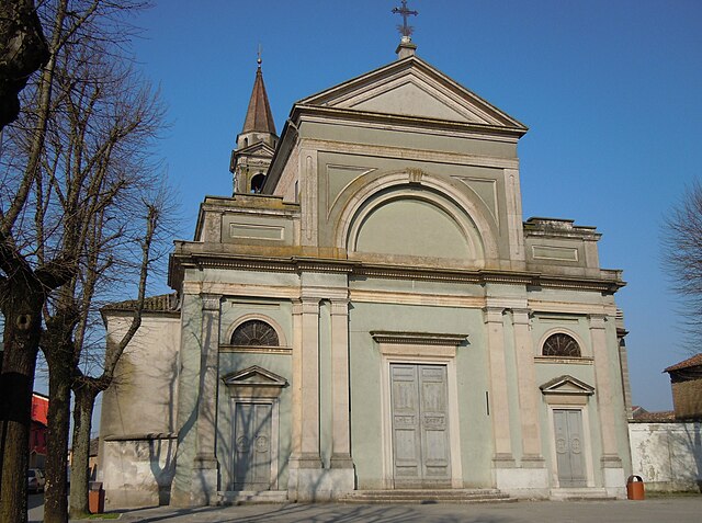
Каннето-сулл'Ольйо (Canneto sull'Oglio, Canneto sull'Oglio)
.svg)
- коммуна Италии
 Hiking in Каннето-сулл'Ольйо
Canneto sull'Oglio is a charming town located in the Lombardy region of Italy, and while it may not be as well-known for hiking as some other Italian destinations, it offers scenic landscapes and opportunities for outdoor activities. Here are some tips and information for hiking in and around Canneto sull'Oglio:
Natural Surroundings
-
Oglio River: The town is situated near the Oglio River, which provides pleasant riverside trails. Hiking along the riverbanks can be a peaceful experience, with opportunities for birdwatching and enjoying the natural beauty of the region.
-
Countryside Trails: The area around Canneto is predominantly agricultural and rural, offering a variety of paths for hiking. You can explore fields, vineyards, and woods, which can provide a quiet and scenic hiking experience.
Local Trails and Parks
-
Parco Oglio Nord: This regional park is not too far from Canneto sull'Oglio. It features several trails along the Oglio River, perfect for both hiking and cycling. The park is known for its lush landscapes and diverse wildlife.
-
Vicinity to Other Hiking Areas: Canneto sull'Oglio is located close to other hiking areas in Lombardy, such as the southern part of Lake Iseo and the hills of Franciacorta. These areas offer more challenging hikes with stunning views.
Hiking Tips
-
Best Time to Visit: The ideal time for hiking in the region is during spring (April to June) or fall (September to October) when the weather is mild and the landscapes are particularly beautiful.
-
Prepare for Varied Terrain: While some trails in and around Canneto sull'Oglio may be flat and easy, others could involve more varied terrain, so suitable footwear is essential.
-
Keep Hydrated and Snack Ready: Always carry enough water and snacks, especially if you plan to explore longer trails or nearby parks.
Local Amenities
-
Cafés and Restaurants: After a day of hiking, you can enjoy local cuisine in the town. Try some regional dishes and wines from Lombardy.
-
Accommodation: If you're planning to stay overnight, look for local guesthouses or bed-and-breakfasts. This will give you the opportunity to explore more trails without rushing.
In summary, while Canneto sull'Oglio may not be a premier hiking destination, it offers lovely walking opportunities in a tranquil setting. Pair your hikes with visits to the surrounding natural parks for a more expansive experience in the beautiful Lombardy region.
- Страна:

- Почтовый код: 46013
- Телефонный код: 0376
- Код автомобильного номера: MN
- Координаты: 45° 9' 0" N, 10° 23' 0" E


- GPS треки (wikiloc): [Ссылка]
- Высота над уровнем моря: 34 м m
- Площадь: 25.87 кв.км
- Население: 4388
- Веб сайт: http://www.comune.canneto.mn.it
- Википедия русская: wiki(ru)
- Википедия английская: wiki(en)
- Википедия национальная: wiki(it)
- Хранилище Wikidata: Wikidata: Q42301
- Катеория в википедии: [Ссылка]
- код Freebase: [/m/0gj_q5]
- код GeoNames: Альт: [6542040]
- код VIAF: Альт: [125691604]
- ID отношения в OpenStreetMap: [44314]
- UN/LOCODE: [ITNGO]
- код ISTAT: 020008
- кадастровый код Италии: B612
Граничит с регионами:


Казальромано
- коммуна Италии
Hiking in Казальромано
Casalromano is a small village located in the Lombardy region of Italy, surrounded by beautiful landscapes that are great for hiking enthusiasts. While it may not be as well-known as larger towns or national parks, the area does offer some charming trails and scenic vistas that capture the essence of the Italian countryside....
- Страна:
- Почтовый код: 46040
- Телефонный код: 0376
- Код автомобильного номера: MN
- Координаты: 45° 12' 0" N, 10° 22' 0" E
- GPS треки (wikiloc): [Ссылка]
- Высота над уровнем моря: 42 м m
- Площадь: 12.03 кв.км
- Население: 1510
- Веб сайт: [Ссылка]


Азола
- коммуна Италии
Hiking in Азола
Asola, located in the Lombardy region of Italy, offers various hiking opportunities that beautifully showcase the area's natural landscapes and cultural heritage. While it may not be as renowned as some of the bigger hiking destinations in Italy, it provides a more tranquil and less crowded experience for those who wish to explore the countryside....
- Страна:
- Почтовый код: 46041
- Телефонный код: 0376
- Код автомобильного номера: MN
- Координаты: 45° 13' 0" N, 10° 25' 0" E
- GPS треки (wikiloc): [Ссылка]
- Высота над уровнем моря: 42 м m
- Площадь: 73.48 кв.км
- Население: 10069
- Веб сайт: [Ссылка]

Кальватоне
- коммуна Италии
Hiking in Кальватоне
Calvatone is a small town located in the Lombardy region of Italy. While it may not be as widely recognized for hiking as some other areas in Italy, it does offer opportunities for outdoor activities and exploration of the surrounding countryside....
- Страна:
- Почтовый код: 26030
- Телефонный код: 0375
- Код автомобильного номера: CR
- Координаты: 45° 8' 0" N, 10° 27' 0" E
- GPS треки (wikiloc): [Ссылка]
- Высота над уровнем моря: 29 м m
- Площадь: 13.7 кв.км
- Население: 1217
- Веб сайт: [Ссылка]


Изола-Доварезе
- коммуна Италии
Hiking in Изола-Доварезе
Isola Dovarese is a charming village located in the province of Cremona in the Lombardy region of Italy. Surrounded by the picturesque landscape of the Po Valley, it offers a less-traveled yet beautiful hiking experience....
- Страна:
- Почтовый код: 26031
- Телефонный код: 0375
- Код автомобильного номера: CR
- Координаты: 45° 10' 33" N, 10° 18' 44" E
- GPS треки (wikiloc): [Ссылка]
- Высота над уровнем моря: 35 м m
- Площадь: 9.47 кв.км
- Население: 1158
- Веб сайт: [Ссылка]


Аккуанегра-сул-Кьезе
- коммуна Италии
Hiking in Аккуанегра-сул-Кьезе
Acquanegra sul Chiese is a charming village located in the Lombardy region of Italy, nestled in the foothills of the Alps. While it may not be as widely known as other hiking destinations in Italy, it offers a variety of trails and beautiful natural scenery for those looking for a peaceful hiking experience....
- Страна:
- Почтовый код: 46011
- Телефонный код: 0376
- Код автомобильного номера: MN
- Координаты: 45° 10' 0" N, 10° 26' 0" E
- GPS треки (wikiloc): [Ссылка]
- Высота над уровнем моря: 31 м m
- Площадь: 28.01 кв.км
- Население: 2895
- Веб сайт: [Ссылка]
Piadena Drizzona
Hiking in Piadena Drizzona
Piadena Drizzona is a small town located in the province of Cremona in Lombardy, Italy. While it may not be a well-known hiking destination compared to the more mountainous regions of Italy, the area surrounding Piadena Drizzona does offer opportunities for walking and exploring nature....
- Страна:
- Координаты: 45° 8' 11" N, 10° 21' 38" E
- GPS треки (wikiloc): [Ссылка]