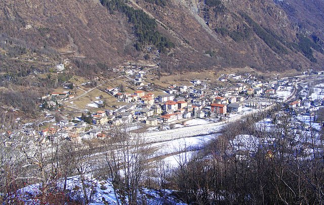
Кантойра (Cantoira, Cantoira)

- коммуна Италии
 Hiking in Кантойра
Cantoira, located in the metropolitan area of Turin in Italy, is a beautiful destination for hiking enthusiasts. Nestled in the Susa Valley, it offers a range of trails that showcase stunning landscapes, lush forests, and panoramic views of the surrounding mountains.
Hiking Trails
-
Path of the Ancient Waterways: This trail takes you along historic irrigation channels (known as "rios"), offering a glimpse into the region's agricultural heritage. The combination of natural beauty and history makes it a rewarding hike.
-
Cantoira - Gorges of the Orco: This route leads you through spectacular gorges with dramatic rock formations and a rich diversity of flora and fauna. The trail varies in difficulty, making it suitable for various skill levels.
-
Mount Jafferau: For those looking for more challenging hikes, the ascent to Mount Jafferau provides breathtaking views and a real adventure. It’s a great opportunity to enjoy the alpine environment, particularly in the summer months.
Best Time to Hike
The ideal seasons for hiking in Cantoira are spring (April to June) and autumn (September to October). During these times, the weather is generally pleasant, and the landscapes are particularly vibrant.
Preparation and Safety
- Gear: Ensure you have suitable hiking boots, weather-appropriate clothing, and enough water and snacks.
- Navigation: While many trails are marked, carrying a map or GPS device is advisable, especially for less trafficked routes.
- Wildlife: The area is home to various wildlife. Be respectful of nature and maintain a safe distance from any animals you encounter.
Local Attractions
In addition to hiking, Cantoira offers cultural experiences, such as quaint villages, local cuisine, and historical sites. Taking some time to explore these can enrich your hiking experience.
Cantoira is certainly a gem for hikers looking for less-traveled paths and stunning natural beauty. Whether you're a novice or an experienced hiker, you'll find plenty to enjoy in this enchanting area.
- Страна:

- Почтовый код: 10070
- Телефонный код: 0123
- Код автомобильного номера: TO
- Координаты: 45° 21' 0" N, 7° 23' 0" E


- GPS треки (wikiloc): [Ссылка]
- Высота над уровнем моря: 750 м m
- Площадь: 23.03 кв.км
- Население: 562
- Веб сайт: http://www.comune.cantoira.to.it/
- Википедия русская: wiki(ru)
- Википедия английская: wiki(en)
- Википедия национальная: wiki(it)
- Хранилище Wikidata: Wikidata: Q9160
- Катеория в википедии: [Ссылка]
- код Freebase: [/m/0g6trk]
- код GeoNames: Альт: [6540908]
- ID отношения в OpenStreetMap: [44779]
- код TGN: [1043836]
- код ISTAT: 001054
- кадастровый код Италии: B637
Граничит с регионами:

Черес
- коммуна Италии
Hiking in Черес
Ceres, located in the Piedmont region of Italy, offers some beautiful hiking opportunities amidst its scenic landscapes, lush forests, and charming villages. The area is characterized by its rolling hills, alpine scenery, and rich biodiversity, making it a great destination for hikers of all levels....
- Страна:
- Почтовый код: 10070
- Телефонный код: 0123
- Код автомобильного номера: TO
- Координаты: 45° 18' 47" N, 7° 23' 19" E
- GPS треки (wikiloc): [Ссылка]
- Высота над уровнем моря: 704 м m
- Площадь: 28.05 кв.км
- Население: 1036
- Веб сайт: [Ссылка]


Кьяламберто
- коммуна Италии
Hiking in Кьяламберто
Chialamberto is a small hamlet located in the Susa Valley in the Piedmont region of Italy, known for its stunning natural beauty and rich cultural heritage. It offers a variety of hiking opportunities that appeal to outdoor enthusiasts of all skill levels. Here are some highlights about hiking in and around Chialamberto:...
- Страна:
- Почтовый код: 10070
- Телефонный код: 0123
- Код автомобильного номера: TO
- Координаты: 45° 22' 0" N, 7° 20' 0" E
- GPS треки (wikiloc): [Ссылка]
- Высота над уровнем моря: 875 м m
- Площадь: 35.45 кв.км
- Население: 343
- Веб сайт: [Ссылка]

Локана
- коммуна Италии
Hiking in Локана
Locana is a beautiful valley located in the Piedmont region of Italy, nestled within the southern part of the Gran Paradiso National Park. It offers a variety of hiking opportunities for different skill levels, from leisurely strolls to more challenging treks. Here are some highlights and tips for hiking in Locana:...
- Страна:
- Почтовый код: 10080
- Телефонный код: 0124
- Код автомобильного номера: TO
- Координаты: 45° 25' 1" N, 7° 27' 31" E
- GPS треки (wikiloc): [Ссылка]
- Высота над уровнем моря: 613 м m
- Площадь: 132.52 кв.км
- Население: 1450
- Веб сайт: [Ссылка]


Монастеро-ди-Ланцо
- коммуна Италии
Hiking in Монастеро-ди-Ланцо
Monastero di Lanzo is a beautiful area located in the Susa Valley of the Piedmont region in Italy, known for its stunning landscapes and rich cultural heritage. The area offers numerous hiking opportunities that cater to various skill levels....
- Страна:
- Почтовый код: 10070
- Телефонный код: 0123
- Код автомобильного номера: TO
- Координаты: 45° 18' 0" N, 7° 26' 0" E
- GPS треки (wikiloc): [Ссылка]
- Высота над уровнем моря: 825 м m
- Площадь: 17.66 кв.км
- Население: 354
- Веб сайт: [Ссылка]