canton of Aix-les-Bains-Sud (canton d'Aix-les-Bains-Sud)
 Hiking in canton of Aix-les-Bains-Sud
Canton d'Aix-les-Bains-Sud, located in the Savoie region of France, offers a beautiful landscape for hiking enthusiasts. Nestled between the Savoie mountains and the stunning Lac du Bourget, the area is known for its diverse trails, ranging from easy walks to more challenging hikes.
Popular Hiking Areas:
-
Lac du Bourget: The largest natural lake in France provides a scenic backdrop with several trails along the lakeshore. You can find flat, easy paths that are perfect for families or those looking for a leisurely stroll.
-
Mont du Chat: A more challenging hike, Mont du Chat offers breathtaking panoramic views of the lake and surrounding mountains. The trail to the summit can be steep but is well worth the effort, especially on clear days.
-
Château de la Roche du Roy: The hiking path leading to the ruins of this castle offers a mix of history and nature, with stunning views over the region.
-
Sentier des Petits Monts: A great option for families, this easy trail allows hikers to explore vineyards and orchards while enjoying views of the Mont Blanc massif in the distance.
Trail Difficulty:
Trails in the area range from easy to difficult:
- Easy Trails: Suitable for families and beginners, often close to the lake with minimal elevation change.
- Moderate Trails: Suitable for hikers with some experience, often featuring more elevation and varying terrain.
- Difficult Trails: For experienced hikers looking for a physical challenge, these trails often involve steeper ascents and rugged paths.
Tips for Hiking in the Area:
- Check Weather Conditions: The weather can change rapidly in the mountains; dress in layers and be prepared for rain.
- Stay Hydrated: Bring enough water and snacks, especially on longer hikes.
- Respect Nature: Follow the Leave No Trace principles; take your trash with you and stay on marked trails.
- Local Guides: Consider hiring a local guide if you're unfamiliar with the area, especially for more challenging hikes.
Best Time to Hike:
Late spring through early autumn (May to October) is typically the best time for hiking, as the weather is generally mild and the trails are clear of snow.
Overall, Canton d'Aix-les-Bains-Sud offers a lovely mix of natural beauty, historical sites, and various hiking options suitable for all levels. Happy hiking!
- Страна:

- Столица: Drumettaz-Clarafond
- Координаты: 45° 39' 44" N, 5° 55' 7" E


- GPS треки (wikiloc): [Ссылка]
- Хранилище Wikidata: Wikidata: Q1724054
- код кантона INSEE: [7335]
Включает регионы:

Экс-ле-Бен
- коммуна во Франции
Hiking in Экс-ле-Бен
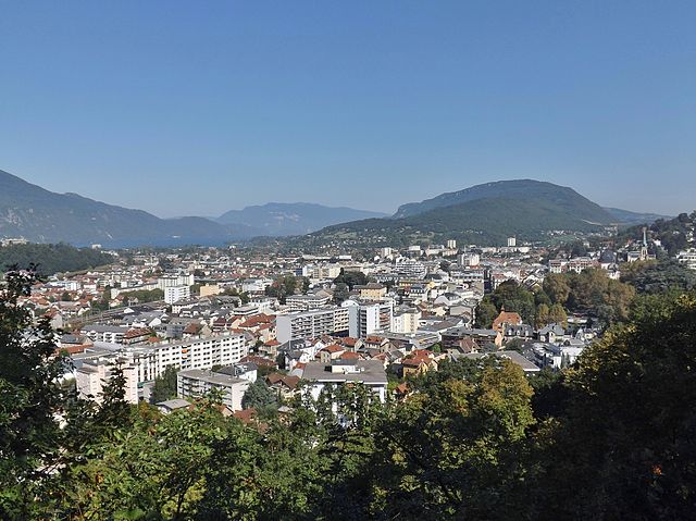
Aix-les-Bains, located in the Savoie region of France, is a beautiful town known for its thermal springs and stunning lakeside scenery. It’s an excellent base for hiking enthusiasts, offering a variety of trails set in the picturesque landscapes of the French Alps and around Lake Bourget, the largest natural lake in France....
- Страна:
- Почтовый код: 73100
- Координаты: 45° 41' 19" N, 5° 54' 54" E
- GPS треки (wikiloc): [Ссылка]
- Площадь: 12.62 кв.км
- Население: 29822
- Веб сайт: [Ссылка]
Вивье-дю-Лак
- коммуна во Франции
Hiking in Вивье-дю-Лак
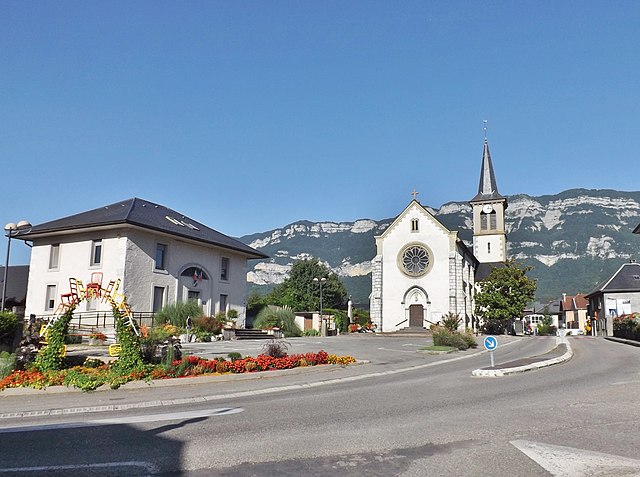
Viviers-du-Lac is a charming commune located in the Savoie department of France, near the shores of Lake Bourget, the largest natural lake in France. The area offers a variety of hiking opportunities that cater to different skill levels, making it an excellent destination for outdoor enthusiasts....
- Страна:
- Почтовый код: 73420
- Координаты: 45° 38' 53" N, 5° 54' 21" E
- GPS треки (wikiloc): [Ссылка]
- Площадь: 3.94 кв.км
- Население: 2203
- Веб сайт: [Ссылка]

Méry
- коммуна во Франции
Hiking in Méry
Méry, a charming village located in the Val-d'Oise department in the Île-de-France region of France, offers some lovely hiking opportunities. The area is characterized by its picturesque landscapes, including forests, hills, and views of the surrounding countryside. Here are some points to consider if you're planning a hiking trip in Méry:...
- Страна:
- Почтовый код: 73420
- Координаты: 45° 38' 32" N, 5° 56' 19" E
- GPS треки (wikiloc): [Ссылка]
- Площадь: 9.07 кв.км
- Население: 1609
- Веб сайт: [Ссылка]


Drumettaz-Clarafond
- коммуна во Франции
Hiking in Drumettaz-Clarafond
Drumettaz-Clarafond is a picturesque commune located near the shores of Lake Bourget in the Savoie region of the French Alps. It offers a variety of hiking opportunities that cater to different skill levels, making it a great destination for outdoor enthusiasts....
- Страна:
- Почтовый код: 73420
- Координаты: 45° 39' 32" N, 5° 56' 14" E
- GPS треки (wikiloc): [Ссылка]
- Площадь: 11.38 кв.км
- Население: 2638
- Веб сайт: [Ссылка]


Mouxy
- коммуна во Франции
Hiking in Mouxy
Mouxy is a charming destination in the French Alps, particularly known for its proximity to Annecy and the surrounding natural beauty. Hiking enthusiasts will find a variety of trails that cater to different skill levels, offering stunning views of landscapes, lakes, and mountains....
- Страна:
- Почтовый код: 73100
- Координаты: 45° 40' 55" N, 5° 56' 4" E
- GPS треки (wikiloc): [Ссылка]
- Площадь: 6.28 кв.км
- Население: 2248
- Веб сайт: [Ссылка]

Voglans
- коммуна во Франции
Hiking in Voglans
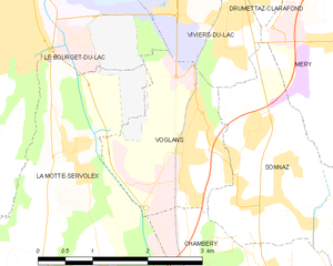
Voglans, located in the Savoie department in the Auvergne-Rhône-Alpes region of southeastern France, offers beautiful hiking opportunities, mainly due to its proximity to the majestic Bauges Massif and Lake Bourget. The region is characterized by stunning landscapes, diverse flora and fauna, and a mix of terrains suitable for various levels of hikers....
- Страна:
- Почтовый код: 73420
- Координаты: 45° 37' 57" N, 5° 53' 45" E
- GPS треки (wikiloc): [Ссылка]
- Площадь: 4.62 кв.км
- Население: 1852
- Веб сайт: [Ссылка]


Tresserve
- коммуна во Франции
Hiking in Tresserve
Tresserve is a charming commune located near Lake Bourget in the Savoie department of the Auvergne-Rhône-Alpes region of France. The area is known for its scenic beauty, encompassing stunning views of both the lake and the surrounding mountains. Here are some highlights and considerations for hiking in and around Tresserve:...
- Страна:
- Почтовый код: 73100
- Координаты: 45° 40' 24" N, 5° 53' 57" E
- GPS треки (wikiloc): [Ссылка]
- Площадь: 2.77 кв.км
- Население: 3076
- Веб сайт: [Ссылка]