
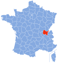
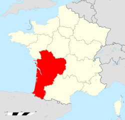
Овернь — Рона — Альпы (Auvergne-Rhône-Alpes, Auvergne-Rhône-Alpes)


- регион Франции
 Hiking in Овернь — Рона — Альпы
Auvergne-Rhône-Alpes is a stunning region in southeastern France known for its diverse landscapes, which include mountains, lakes, and volcanic formations. It offers a wealth of hiking opportunities for all levels of experience. Here are some highlights and notable areas for hiking in this beautiful region:
1.
- Description: This mountainous area features dramatic cliffs, deep gorges, and lush forests. It's part of the Vercors Regional Natural Park, which has numerous marked hiking trails.
- Highlights: A hike along the Gorges de la Bourne is particularly popular, offering breathtaking views and unique geological formations.
2.
- Description: Located to the north of Grenoble, these mountains are renowned for their solitude and serene beauty. The area is known for its limestone cliffs and beautiful valleys.
- Highlights: The "Grand Som" hike is a favorite, leading to a peak with panoramic views, while the "Cirque de Couzan" offers stunning scenery and diverse wildlife.
3.
- Description: This UNESCO Global Geopark features ancient volcanoes, craters, and a unique landscape. The park offers a range of trails for varying skill levels.
- Highlights: The "Puy de Dôme" is a prominent peak with a well-marked trail that leads to its summit, providing expansive views of the surrounding volcanic landscape.
4.
- Description: A more advanced hiking location, this area offers iconic landscapes, glaciers, and high-altitude challenges. The Tour du Mont Blanc is a famous multi-day trek encircling the mountain.
- Highlights: The ascent to the "Aiguille du Midi" provides a unique mountain experience with accessible trails and breathtaking views of the Alps.
5.
- Description: This area features gentle rolling hills and offers a contrast to the mountainous regions. It’s suitable for leisurely hikes and is rich in flora and fauna.
- Highlights: The "Sentier des Douaniers" is a notable trail featuring scenic views of the landscape and local wildlife.
Preparation Tips:
- Weather: The weather can change rapidly in the mountains, so check forecasts and be prepared for varying conditions.
- Gear: Wear suitable hiking boots and carry essentials like water, snacks, a first-aid kit, and a map or GPS.
- Trail Markings: Most trails are well-marked, but it’s advisable to have a good map or app, especially in less frequented areas.
Conclusion
Auvergne-Rhône-Alpes is a hiker's paradise with its incredible diversity of terrain, rich natural beauty, and numerous trails suitable for different levels of hiking experience. Whether you're looking for an easy stroll through picturesque landscapes or a challenging trek among some of France's highest peaks, this region offers it all. Enjoy your hikes and take in the stunning scenery!
- Страна:

- Столица: Лион
- Телефонный код: 04
- Координаты: 45° 44' 25" N, 4° 49' 10" E


- GPS треки (wikiloc): [Ссылка]
- Площадь: 69711 кв.км
- Население: 7877698
- Веб сайт: https://www.auvergnerhonealpes.fr
- Википедия русская: wiki(ru)
- Википедия английская: wiki(en)
- Википедия национальная: wiki(fr)
- Хранилище Wikidata: Wikidata: Q18338206
- Галерея изображений в википедии: [Ссылка]
- Катеория в википедии: [Ссылка]
- Карты в википедии: [Ссылка]
- код Freebase: [/m/012ngly4]
- код GeoNames: Альт: [11071625]
- номер SIREN: [200053767]
- код BNF: [17022816m]
- код VIAF: Альт: [90145542385296640547]
- ID отношения в OpenStreetMap: [3792877]
- идентификатор местоположения ArchINFORM: [2693]
- место в MusicBrainz: [0c8eaaf0-731a-4963-b643-061ff74486f8]
- код темы Quora: [Auvergne-Rhône-Alpes]
- код TGN: [8711848]
- код в энциклопедии «Британника онлайн»: [place/Auvergne-Rhone-Alpes]
- код в Большой каталанской энциклопедии: [22257176]
- код в Encyclopædia Universalis: [auvergne-rhone-alpes-region-administrative]
- учётная запись в Твиттере: Альт: [auvergnerhalpes]
- dmoz: Альт: [World/Français/Régional/Europe/France/Régions/Auvergne-Rhône-Alpes/]
- код канала YouTube: [UC92L_ipy3pz89fxbqK8QizA]
- код NUTS: [FR7]
- код региона Франции INSEE: [84]
- ISO 3166-2: FR-ARA
Включает регионы:


Изер
- департамент Франции
Hiking in Изер
Isère, located in the Auvergne-Rhône-Alpes region of France, offers some of the most beautiful and diverse hiking opportunities in the French Alps. Known for its stunning mountain scenery, charming villages, and rich cultural heritage, Isère is a fantastic destination for hikers of all levels. Here are some highlights of hiking in Isère:...
- Страна:
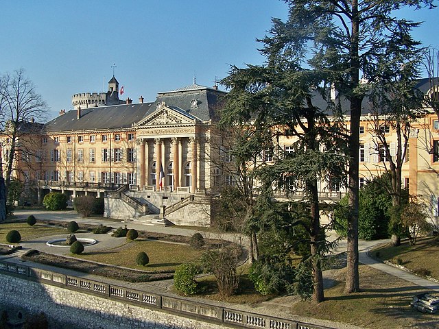
- Столица: Гренобль
- Координаты: 45° 20' 0" N, 5° 30' 0" E
- GPS треки (wikiloc): [Ссылка]
- Высота над уровнем моря: 846 м m
- Площадь: 7431 кв.км
- Население: 1251060
- Веб сайт: [Ссылка]


Луара
- департамент Франции
- Страна:
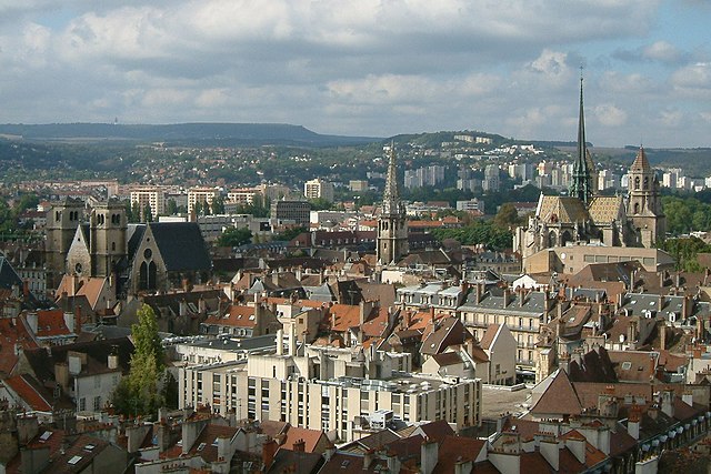
- Столица: Сент-Этьен
- Координаты: 45° 45' 14" N, 4° 13' 29" E
- GPS треки (wikiloc): [Ссылка]
- Площадь: 4781 кв.км
- Население: 759411
- Веб сайт: [Ссылка]


Верхняя Луара
- департамент Франции
- Страна:
- Столица: Ле-Пюи-ан-Веле
- Координаты: 45° 0' 0" N, 4° 0' 0" E
- GPS треки (wikiloc): [Ссылка]
- Площадь: 4977 кв.км
- Население: 227034
- Веб сайт: [Ссылка]


Пюи-де-Дом
- департамент Франции
- Страна:
- Столица: Клермон-Ферран
- Координаты: 45° 42' 0" N, 3° 13' 0" E
- GPS треки (wikiloc): [Ссылка]
- Площадь: 7970 кв.км
- Население: 647501
- Веб сайт: [Ссылка]

Савойя
- департамент Франции
Hiking in Савойя
Savoie, located in the Auvergne-Rhône-Alpes region of France, is a stunning area known for its dramatic landscapes, alpine scenery, and rich cultural heritage. Hiking in Savoie offers a diverse range of trails suitable for all skill levels, from leisurely walks to challenging mountain treks....
- Страна:
- Столица: Шамбери
- Координаты: 45° 35' 0" N, 6° 20' 0" E
- GPS треки (wikiloc): [Ссылка]
- Высота над уровнем моря: 1595 м m
- Площадь: 6028 кв.км
- Население: 428204
- Веб сайт: [Ссылка]


Верхняя Савойя
- департамент Франции
Hiking in Верхняя Савойя
Haute-Savoie, located in the southeastern part of France, is a stunning region of the French Alps known for its breathtaking landscapes, picturesque villages, and a plethora of outdoor activities. Hiking is one of the most popular pursuits in this area, offering trails that cater to all experience levels and showcasing everything from serene lakes to rugged mountain peaks....
- Страна:
- Столица: Анси
- Координаты: 46° 0' 0" N, 6° 20' 0" E
- GPS треки (wikiloc): [Ссылка]
- Высота над уровнем моря: 1160 м m
- Площадь: 4388 кв.км
- Население: 793938
- Веб сайт: [Ссылка]


Лионская метрополия
Hiking in Лионская метрополия
Lyon Metropolis, located in the Auvergne-Rhône-Alpes region of France, offers a variety of hiking options that showcase its diverse landscapes, including hills, vineyards, forests, and rivers. Here are some highlights for hiking in the area:...
- Страна:
- Столица: Лион
- Координаты: 45° 45' 27" N, 4° 51' 14" E
- GPS треки (wikiloc): [Ссылка]
- Площадь: 533.68 кв.км
- Население: 1370678
- Веб сайт: [Ссылка]

Эн
- департамент Франции
Hiking in Эн
Certainly! Ain, a department located in the Auvergne-Rhône-Alpes region of France, offers a diverse range of hiking opportunities, from gentle trails suited for families to more challenging hikes for experienced trekkers. Here are some highlights about hiking in Ain:...
- Страна:
- Столица: Бурк-ан-Брес
- Координаты: 46° 5' 0" N, 5° 20' 0" E
- GPS треки (wikiloc): [Ссылка]
- Площадь: 5762 кв.км
- Население: 631877
- Веб сайт: [Ссылка]


Алье
- департамент Франции
- Страна:
- Столица: Мулен
- Координаты: 46° 20' 0" N, 3° 10' 0" E
- GPS треки (wikiloc): [Ссылка]
- Площадь: 7340 кв.км
- Население: 341613
- Веб сайт: [Ссылка]


Ардеш
- департамент Франции
Hiking in Ардеш
Hiking in the Ardèche region of France offers a remarkable experience for outdoor enthusiasts, with diverse landscapes ranging from dramatic gorges to tranquil forests. Here are some key aspects to consider when hiking in Ardèche:...
- Страна:
- Столица: Прива
- Координаты: 44° 40' 0" N, 4° 25' 0" E
- GPS треки (wikiloc): [Ссылка]
- Площадь: 5529 кв.км
- Население: 324209
- Веб сайт: [Ссылка]


Канталь
- департамент Франции
- Страна:
- Столица: Орийак
- Координаты: 45° 2' 0" N, 3° 6' 0" E
- GPS треки (wikiloc): [Ссылка]
- Площадь: 5726 кв.км
- Население: 146219
- Веб сайт: [Ссылка]


Дром
- департамент во Франции
Hiking in Дром
Hiking in the Drôme department in southeastern France is a fantastic experience, known for its diverse landscapes, charming villages, and rich natural heritage. The area offers a variety of trails suitable for all levels of hikers, from beginners to advanced....
- Страна:
- Столица: Валанс
- Координаты: 44° 45' 0" N, 5° 10' 0" E
- GPS треки (wikiloc): [Ссылка]
- Площадь: 6530 кв.км
- Население: 504637
- Веб сайт: [Ссылка]


Рона
- департамент Франции
Hiking in Рона
Hiking in the Rhône department, located in the Auvergne-Rhône-Alpes region of France, offers a diverse range of landscapes and trails that cater to various skill levels. Here's a breakdown of what you can expect:...
- Страна:
- Столица: Вильфранш-сюр-Сон
- Координаты: 45° 59' 44" N, 4° 43' 10" E
- GPS треки (wikiloc): [Ссылка]
- Площадь: 3249 кв.км
- Население: 1821995
- Веб сайт: [Ссылка]
Граничит с регионами:


Женева
- кантон в Швейцарии
Hiking in Женева
Hiking in the Canton of Geneva offers a unique blend of urban accessibility and stunning natural landscapes. While Geneva itself is well-known for its cosmopolitan atmosphere, the surrounding areas provide numerous opportunities for outdoor enthusiasts....
- Страна:

- Столица: Женева
- Код автомобильного номера: GE
- Координаты: 46° 13' 5" N, 6° 9' 58" E
- GPS треки (wikiloc): [Ссылка]
- Высота над уровнем моря: 375 м m
- Площадь: 282.49 кв.км
- Веб сайт: [Ссылка]

Пьемонт
- регион в Италии
Hiking in Пьемонт
Hiking in the Piedmont region offers a wonderful blend of natural beauty, diverse landscapes, and rich cultural heritage. This area, which generally encompasses the foothills of the Appalachian Mountains and stretches across parts of Virginia, North Carolina, South Carolina, and more, features rolling hills, lush forests, and scenic views. Here are some highlights and tips for hiking in Piedmont:...
- Страна:

- Столица: Турин
- Координаты: 45° 15' 0" N, 7° 55' 0" E
- GPS треки (wikiloc): [Ссылка]
- Высота над уровнем моря: 421 м m
- Площадь: 25402 кв.км
- Население: 4367559
- Веб сайт: [Ссылка]

Валле-д’Аоста
- автономная область и провинция в Италии
Hiking in Валле-д’Аоста
Aosta Valley, located in the northwest of Italy, is a mountainous region known for its stunning landscapes, rich history, and diverse outdoor activities, making it a paradise for hikers. Here’s a comprehensive overview of hiking in Aosta Valley:...
- Страна:
- Столица: Аоста
- Почтовый код: 11100, 11010-11029
- Код автомобильного номера: AO
- Координаты: 45° 43' 0" N, 7° 22' 0" E
- GPS треки (wikiloc): [Ссылка]
- Высота над уровнем моря: 951 м m
- Площадь: 3263.22 кв.км
- Население: 125901
- Веб сайт: [Ссылка]

Лигурия
- регион в Италии
Hiking in Лигурия
Hiking in Liguria, a stunning region located in northwestern Italy, is a fantastic experience due to its diverse landscapes, coastal views, and charming villages. Here are some key highlights:...
- Страна:
- Столица: Генуя
- Координаты: 44° 27' 0" N, 8° 46' 0" E
- GPS треки (wikiloc): [Ссылка]
- Высота над уровнем моря: 250 м m
- Площадь: 5422.0 кв.км
- Население: 1558812
- Веб сайт: [Ссылка]


Во
- кантон в Швейцарии
Hiking in Во
The Canton of Vaud, located in the French-speaking part of Switzerland, is a fantastic destination for hiking enthusiasts. It offers a diverse range of landscapes, from picturesque lakeside trails along Lake Geneva to challenging mountain hikes in the Alps. Here are some highlights of hiking in this beautiful region:...
- Страна:
- Столица: Лозанна
- Код автомобильного номера: VD
- Координаты: 46° 37' 0" N, 6° 33' 0" E
- GPS треки (wikiloc): [Ссылка]
- Высота над уровнем моря: 495 м m
- Площадь: 3212 кв.км
- Веб сайт: [Ссылка]


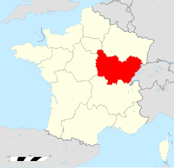
Центральная Долина Луары
- регион Франции
- Страна:
- Столица: Орлеан
- Координаты: 47° 30' 0" N, 1° 45' 0" E
- GPS треки (wikiloc): [Ссылка]
- Площадь: 39151 кв.км
- Население: 2578592
- Веб сайт: [Ссылка]


Прованс — Альпы — Лазурный Берег
- регион Франции
Hiking in Прованс — Альпы — Лазурный Берег
Provence-Alpes-Côte d'Azur (PACA) is a stunning region in southeastern France, known for its diverse landscapes, rich history, and vibrant culture. It offers a wide range of hiking opportunities, from coastal trails along the Mediterranean to rugged paths in the Alps. Here are some key points to consider when hiking in this beautiful region:...
- Страна:
- Столица: Марсель
- Координаты: 44° 0' 0" N, 6° 0' 0" E
- GPS треки (wikiloc): [Ссылка]
- Площадь: 31400 кв.км
- Население: 5007977
- Веб сайт: [Ссылка]
Бургундия — Франш-Конте
- регион Франции
Hiking in Бургундия — Франш-Конте
Bourgogne-Franche-Comté, located in east-central France, is a region rich in natural beauty, history, and diverse landscapes, making it an excellent destination for hiking enthusiasts. Here are some highlights to consider when planning your hiking adventures in the area:...
- Страна:
- Столица: Дижон
- Координаты: 47° 14' 4" N, 6° 1' 50" E
- GPS треки (wikiloc): [Ссылка]
- Площадь: 47784 кв.км
- Население: 2820940
- Веб сайт: [Ссылка]

Новая Аквитания
- регион Франции
- Страна:
- Столица: Бордо
- Координаты: 44° 50' 12" N, 0° 35' 20" E
- GPS треки (wikiloc): [Ссылка]
- Площадь: 84061 кв.км
- Население: 5911482
- Веб сайт: [Ссылка]


Окситания
- регион Франции
- Страна:
- Столица: Тулуза
- Координаты: 43° 38' 56" N, 2° 20' 37" E
- GPS треки (wikiloc): [Ссылка]
- Площадь: 72724 кв.км
- Население: 5774185
- Веб сайт: [Ссылка]


Вале
- кантон в Швейцарии
Hiking in Вале
The Canton of Valais, located in southwestern Switzerland, is a fantastic destination for hiking enthusiasts. Famous for its stunning landscapes dominated by the Alps, the region offers a wide variety of trails suitable for all levels of hikers. Here are some key points to know about hiking in Valais:...
- Страна:
- Столица: Сьон
- Код автомобильного номера: VS
- Координаты: 46° 4' 0" N, 7° 36' 0" E
- GPS треки (wikiloc): [Ссылка]
- Высота над уровнем моря: 512 м m
- Площадь: 5224.50 кв.км
- Веб сайт: [Ссылка]