canton of La Rochette (canton de La Rochette)
 Hiking in canton of La Rochette
Canton de La Rochette, located in the Savoie department of the Auvergne-Rhône-Alpes region in southeastern France, offers a variety of scenic hiking opportunities. The area is characterized by its beautiful landscapes, including mountains, valleys, and forests, making it an excellent destination for outdoor enthusiasts.
Key Features for Hiking in Canton de La Rochette:
-
Scenic Views: The hikes often provide stunning panoramic views of the surrounding Alps, the Combe de Savoie, and lush green valleys, particularly in the spring and summer months.
-
Trail Variety: There are trails suitable for all levels, from leisurely walks to more challenging ascents. Depending on your skill level, you can find marked trails that offer a range of distances and difficulties.
-
Flora and Fauna: The region is rich in biodiversity, with opportunities to spot various wildlife and enjoy diverse plant life, especially in the warmer months.
-
Historical Sites: Some hiking routes may lead you to historical landmarks and traditional alpine villages, allowing you to combine outdoor activity with cultural exploration.
-
Accessibility: Many trails are easily accessible from the nearby towns and can be suited for day hikes. It's advisable to check local maps and signage before heading out, as conditions and trail maintenance may vary.
Recommended Hiking Tips:
-
Check the Weather: Mountain weather can change rapidly, so it’s essential to check forecasts and be prepared for various conditions.
-
Bring the Right Gear: Ensure you have suitable footwear, plenty of water, snacks, and appropriate clothing layers for varying temperatures.
-
Safety First: Always inform someone of your hiking plans, especially if you're going solo. Carry a map or GPS device, and know your route well.
-
Respect Nature: Follow the Leave No Trace principles to preserve the stunning natural environment and respect wildlife.
-
Local Guides: Consider hiring a local guide for a more enriching experience or to explore the area safely.
Conclusion:
Hiking in Canton de La Rochette offers a wonderful blend of natural beauty and outdoor adventure. Whether you are an experienced hiker or a beginner looking to enjoy some fresh air and breathtaking scenery, this area has something to offer for everyone. Always prepare well and check local resources for trail information and conditions before heading out. Enjoy your hike!
- Страна:

- Столица: La Rochette
- Координаты: 45° 28' 9" N, 6° 8' 36" E


- GPS треки (wikiloc): [Ссылка]
- Хранилище Wikidata: Wikidata: Q507199
- код кантона INSEE: [7322]
Включает регионы:


La Croix-de-la-Rochette
- коммуна во Франции
Hiking in La Croix-de-la-Rochette
La Croix-de-la-Rochette is a charming area located in the French Alps, known for its stunning landscapes and outdoor recreational opportunities. Hiking in this region offers a variety of trails suited to different skill levels, ranging from easy walks to more challenging hikes. Here are some highlights of hiking in La Croix-de-la-Rochette:...
- Страна:
- Почтовый код: 73110
- Координаты: 45° 28' 1" N, 6° 7' 8" E
- GPS треки (wikiloc): [Ссылка]
- Площадь: 3.04 кв.км
- Население: 340

Étable
- коммуна во Франции
Hiking in Étable
Étable is a charming area often associated with beautiful landscapes, scenic trails, and diverse ecosystems that make it an attractive destination for hiking enthusiasts. However, since "Étable" refers to various locations in French-speaking regions, I'll provide a general overview of what to expect when hiking in regions that may have this name, such as Étable-sur-Montmel, located in France....
- Страна:
- Почтовый код: 73110
- Координаты: 45° 27' 47" N, 6° 8' 29" E
- GPS треки (wikiloc): [Ссылка]
- Площадь: 2.7 кв.км
- Население: 388


Détrier
- коммуна во Франции
Hiking in Détrier
Détrier is a lesser-known area but offers beautiful landscapes and a variety of hiking options for outdoor enthusiasts. Here are some key points to consider if you're thinking about hiking in the Détrier area:...
- Страна:
- Почтовый код: 73110
- Координаты: 45° 26' 43" N, 6° 5' 55" E
- GPS треки (wikiloc): [Ссылка]
- Площадь: 2.25 кв.км
- Население: 422


La Chapelle-Blanche
Hiking in La Chapelle-Blanche
La Chapelle-Blanche is a charming commune located in the Savoie department in southeastern France. Nestled in the French Alps, it offers a unique hiking experience with stunning mountain views, lush landscapes, and a rich natural environment....
- Страна:
- Почтовый код: 73110
- Координаты: 45° 26' 52" N, 6° 4' 20" E
- GPS треки (wikiloc): [Ссылка]
- Площадь: 4.13 кв.км
- Население: 556
Le Verneil
- коммуна во Франции
Hiking in Le Verneil
Le Verneil, which is often associated with the Verneil massif in the French Alps, is a beautiful area for hiking enthusiasts. The region is known for its stunning alpine landscapes, with dramatic peaks, lush valleys, and crystal-clear lakes....
- Страна:
- Почтовый код: 73110
- Координаты: 45° 27' 47" N, 6° 10' 0" E
- GPS треки (wikiloc): [Ссылка]
- Площадь: 7.52 кв.км
- Население: 96


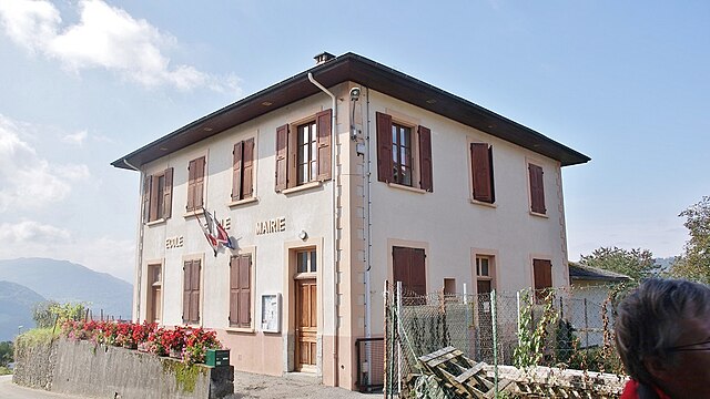
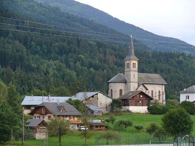
La Rochette
Hiking in La Rochette
La Rochette, located in the Savoie region of the French Alps, offers a range of hiking opportunities for both beginners and experienced hikers. The area is known for its stunning alpine scenery, with impressive mountain views, lush forests, and scenic valleys....
- Страна:
- Почтовый код: 73110
- Координаты: 45° 27' 31" N, 6° 7' 13" E
- GPS треки (wikiloc): [Ссылка]
- Площадь: 4.66 кв.км
- Население: 3694
- Веб сайт: [Ссылка]


Villard-Sallet
- коммуна во Франции
Hiking in Villard-Sallet
Villard-Sallet is a picturesque destination located in the French Alps, known for its stunning landscapes and outdoor activities, particularly hiking. Nestled at the heart of nature, it's a great spot for both novice and experienced hikers. Here are some key highlights and tips for hiking in Villard-Sallet:...
- Страна:
- Почтовый код: 73110
- Координаты: 45° 29' 7" N, 6° 8' 18" E
- GPS треки (wikiloc): [Ссылка]
- Площадь: 3.14 кв.км
- Население: 289

Bourget-en-Huile
- коммуна во Франции
Hiking in Bourget-en-Huile
Bourget-en-Huile is a charming commune located in the Auvergne-Rhône-Alpes region of France. The area is known for its picturesque landscapes and offers a variety of hiking opportunities that cater to different skill levels. Here are some highlights for hiking in and around Bourget-en-Huile:...
- Страна:
- Почтовый код: 73110
- Координаты: 45° 29' 5" N, 6° 12' 25" E
- GPS треки (wikiloc): [Ссылка]
- Площадь: 6.79 кв.км
- Население: 149
- Веб сайт: [Ссылка]
Presle
- коммуна во Франции
Hiking in Presle
Presle, located in the Auvergne-Rhône-Alpes region of France, is a beautiful area known for its stunning landscapes and diverse hiking opportunities. Nestled near the Vercors Mountains, it offers a range of trails suitable for hikers of all skill levels, from leisurely walks to more challenging treks....
- Страна:
- Почтовый код: 73110
- Координаты: 45° 27' 16" N, 6° 8' 18" E
- GPS треки (wikiloc): [Ссылка]
- Площадь: 11.58 кв.км
- Население: 419
La Trinité, Savoie
Hiking in La Trinité, Savoie
La Trinité, located in the Savoie region of the French Alps, offers a stunning backdrop for hiking enthusiasts. While it may be less well-known than some of the more famous alpine areas, the region is characterized by beautiful landscapes, intricate trails, and the opportunity to experience the local flora and fauna....
- Страна:
- Почтовый код: 73110
- Координаты: 45° 29' 55" N, 6° 8' 52" E
- GPS треки (wikiloc): [Ссылка]
- Площадь: 4.88 кв.км
- Население: 342
Rotherens
- коммуна во Франции
Hiking in Rotherens
It looks like there might be a small error in the name "Rotherens." If you're referring to hiking in a specific area, it might be Rotherham in England, Rothenburg in Germany, or perhaps a different location entirely. Each of these places offers a variety of hiking options....
- Страна:
- Почтовый код: 73110
- Координаты: 45° 28' 22" N, 6° 8' 10" E
- GPS треки (wikiloc): [Ссылка]
- Площадь: 1.74 кв.км
- Население: 367


La Table
- коммуна во Франции
Hiking in La Table
La Table, located on the island of La Réunion in the Indian Ocean, is a prominent hiking destination known for its stunning landscapes, unique geological features, and rich biodiversity. Here’s what you need to know about hiking in La Table:...
- Страна:
- Почтовый код: 73110
- Координаты: 45° 28' 48" N, 6° 10' 18" E
- GPS треки (wikiloc): [Ссылка]
- Площадь: 14.85 кв.км
- Население: 475


Le Pontet
- коммуна во Франции
Hiking in Le Pontet
Le Pontet, located in the Savoie region of the French Alps, offers a beautiful setting for hiking enthusiasts. Nestled in the heart of the mountains, this area features a variety of trails that cater to different skill levels, from leisurely walks to challenging hikes....
- Страна:
- Почтовый код: 73110
- Координаты: 45° 29' 54" N, 6° 13' 45" E
- GPS треки (wikiloc): [Ссылка]
- Площадь: 8.66 кв.км
- Население: 131


Arvillard
- коммуна во Франции
Hiking in Arvillard
Arvillard is a charming commune located in the Savoie department of the Auvergne-Rhône-Alpes region in southeastern France. It is well-known for its stunning natural scenery and offers a variety of hikes that cater to different skill levels....
- Страна:
- Почтовый код: 73110
- Координаты: 45° 26' 29" N, 6° 7' 12" E
- GPS треки (wikiloc): [Ссылка]
- Площадь: 29.28 кв.км
- Население: 846
- Веб сайт: [Ссылка]