canton of Moirans-en-Montagne (canton de Moirans-en-Montagne)

 Hiking in canton of Moirans-en-Montagne
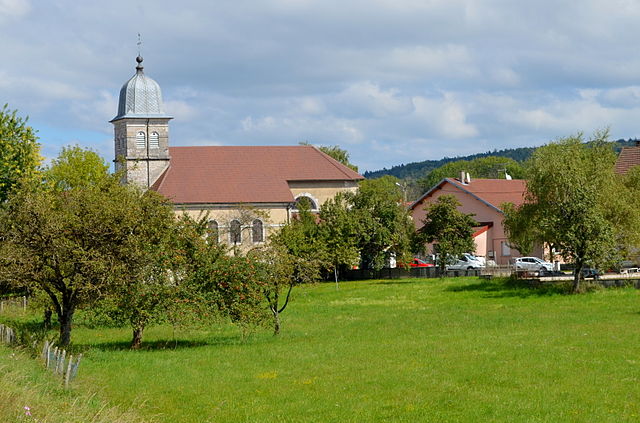
Moirans-en-Montagne is a charming town located in the Jura region of France, known for its beautiful landscapes and outdoor activities, including hiking. The area offers diverse trails that cater to different skill levels, making it suitable for both beginners and experienced hikers.
Trails and Routes:
-
Local Trails: There are various marked trails around Moirans-en-Montagne that showcase the stunning Jura landscapes, characterized by rolling hills, forests, and pastures. Many of these paths also lead to panoramic viewpoints.
-
Lake and River Areas: The proximity to the rivers and nearby lakes provides opportunities for shorter hikes along their banks or more extended routes that connect different bodies of water.
-
Forests: The surrounding forests, particularly the ones in the Jura mountains, offer shaded hiking routes that can be enjoyed during the warmer months. The lush vegetation and wildlife sightings can enhance the hiking experience.
Recommended Hikes:
-
The GR59 (Grande Randonnée): This long-distance trail is part of a larger network that traverses various regions in France. It offers segments that pass through the Jura, providing a more in-depth experience of the area's natural beauty.
-
Mont Noir or Mont d'Or: For those looking for a moderately challenging hike, routes leading to the nearby Mont Noir or Mont d'Or can provide a rewarding climb with excellent views of the surrounding countryside.
Tips for Hiking:
-
Navigation: Ensure you have a good map or GPS device as some paths may not be well-marked, especially in more remote areas.
-
Weather: The weather can change quickly in the Jura region, so it's essential to check forecasts and dress in layers.
-
Safety: While the trails are generally safe, it's always good to inform someone of your hiking plans and carry a first aid kit.
-
Wildlife Awareness: Be respectful of the local wildlife and plants, and follow guidelines to minimize your impact on the environment.
Accessibility:
Moirans-en-Montagne is relatively accessible by car and public transport, making it easy for hikers to reach the starting points of various trails.
Overall, hiking in the Canton of Moirans-en-Montagne offers a wonderful opportunity to experience the natural beauty and tranquility of the Jura region. Whether you're looking for a leisurely stroll or a challenging hike, you'll find options that suit your preference in this stunning landscape.
- Страна:

- Столица: Moirans-en-Montagne
- Координаты: 46° 26' 10" N, 5° 43' 21" E


- GPS треки (wikiloc): [Ссылка]
- Население: 15332
- Википедия английская: wiki(en)
- Википедия национальная: wiki(fr)
- Хранилище Wikidata: Wikidata: Q205962
- код кантона INSEE: [3909]
Включает регионы:


Jeurre
- коммуна во Франции
Hiking in Jeurre
Jeurre is a picturesque small village located in the Jura region of France, known for its stunning natural landscapes and outdoor recreational opportunities. Hiking in and around Jeurre can be a delightful experience, especially for those who appreciate diverse terrains, beautiful forests, and scenic views....
- Страна:
- Почтовый код: 39360
- Координаты: 46° 22' 3" N, 5° 42' 27" E
- GPS треки (wikiloc): [Ссылка]
- Площадь: 6.99 кв.км
- Население: 267


Étival
- коммуна во Франции
Hiking in Étival
Étival, located in the Jura Mountains in France, is a beautiful area for hiking, offering diverse landscapes and a variety of trails for all skill levels. Here’s what you can expect when hiking in and around Étival:...
- Страна:
- Почтовый код: 39130
- Координаты: 46° 30' 26" N, 5° 47' 31" E
- GPS треки (wikiloc): [Ссылка]
- Площадь: 13.83 кв.км
- Население: 306


Martigna
Hiking in Martigna
Martigna, located in the Swiss Alps, offers a wealth of hiking opportunities for both beginners and experienced hikers. The region is known for its stunning landscapes, including mountains, valleys, and pristine lakes, making it an ideal destination for outdoor enthusiasts....
- Страна:
- Почтовый код: 39260
- Координаты: 46° 23' 21" N, 5° 41' 57" E
- GPS треки (wikiloc): [Ссылка]
- Площадь: 8.77 кв.км
- Население: 205

Meussia
- коммуна во Франции
Hiking in Meussia
Meussia is a picturesque village located in the Jura Mountains of France, known for its beautiful landscapes and variety of hiking trails. The region is characterized by its lush forests, rolling hills, and stunning views, making it a great destination for nature enthusiasts and hikers....
- Страна:
- Почтовый код: 39260
- Координаты: 46° 29' 53" N, 5° 43' 30" E
- GPS треки (wikiloc): [Ссылка]
- Площадь: 13.64 кв.км
- Население: 435


Montcusel
- коммуна во Франции
Hiking in Montcusel
Montcusel is a beautiful hiking destination located in the French Alps, known for its stunning landscapes, diverse wildlife, and a variety of trails suitable for different skill levels. Here are some key highlights about hiking in Montcusel:...
- Страна:
- Почтовый код: 39260
- Координаты: 46° 21' 5" N, 5° 39' 30" E
- GPS треки (wikiloc): [Ссылка]
- Площадь: 9.55 кв.км
- Население: 174


Maisod
- коммуна во Франции
Hiking in Maisod
Maisod is a charming village located in the Jura region of France, known for its scenic landscapes and outdoor recreational opportunities, including hiking. The area is characterized by rolling hills, dense forests, and beautiful views of the Jura Mountains and nearby lakes, making it an ideal destination for hikers of all skill levels....
- Страна:
- Почтовый код: 39260
- Координаты: 46° 28' 36" N, 5° 41' 22" E
- GPS треки (wikiloc): [Ссылка]
- Площадь: 7.39 кв.км
- Население: 330


Coyron
- коммуна во Франции
Hiking in Coyron
Coyron is a beautiful hiking destination known for its stunning landscapes and diverse ecosystems. Although there’s limited specific information about a location named Coyron, if you're referring to a well-known hiking area in a region with a similar name, such as the Cayron Valley or surrounding areas in the Alps or other mountainous regions, I can provide some general insights about hiking in such places....
- Страна:
- Почтовый код: 39260
- Координаты: 46° 30' 40" N, 5° 42' 19" E
- GPS треки (wikiloc): [Ссылка]
- Площадь: 5.53 кв.км
- Население: 74


Charchilla
- коммуна во Франции
Hiking in Charchilla
Charchilla, a lesser-known destination, is a great spot for hiking enthusiasts looking for off-the-beaten-path experiences. While specific information on Charchilla can vary depending on the region, here are some general points to consider for hiking in areas similar to Charchilla:...
- Страна:
- Почтовый код: 39260
- Координаты: 46° 27' 57" N, 5° 42' 45" E
- GPS треки (wikiloc): [Ссылка]
- Площадь: 6.84 кв.км
- Население: 273


Lect
- коммуна во Франции
Hiking in Lect
Lect, located in the Jura region of France, offers a variety of hiking opportunities in a picturesque environment characterized by rolling hills, dense forests, and beautiful landscapes. The Jura mountains are known for their diverse flora and fauna, making them a great destination for nature lovers....
- Страна:
- Почтовый код: 39260
- Координаты: 46° 23' 21" N, 5° 40' 33" E
- GPS треки (wikiloc): [Ссылка]
- Высота над уровнем моря: 520 м m
- Площадь: 11.94 кв.км
- Население: 353


Les Crozets
- коммуна во Франции
Hiking in Les Crozets
Les Crozets is a beautiful destination for hiking, particularly known for its stunning vistas and varied terrain. Located in the Jura Mountains in France, this area offers numerous trails suitable for hikers of different skill levels, from easy walks to more challenging treks....
- Страна:
- Почтовый код: 39260
- Координаты: 46° 27' 37" N, 5° 47' 39" E
- GPS треки (wikiloc): [Ссылка]
- Площадь: 7.59 кв.км
- Население: 204


Chancia
- коммуна во Франции
Hiking in Chancia
Chancia might not be widely recognized as a popular hiking destination, but if it were a fictional or lesser-known location, we could imagine a few things about hiking there. Here's a general guide based on common features of hiking in similar scenic areas:...
- Страна:
- Почтовый код: 01590
- Координаты: 46° 20' 46" N, 5° 38' 33" E
- GPS треки (wikiloc): [Ссылка]
- Площадь: 2.41 кв.км
- Население: 218
- Веб сайт: [Ссылка]


Crenans
- коммуна во Франции
Hiking in Crenans
Crenans is not a widely recognized hiking destination, so it’s possible you might be referring to a specific regional area or it could be a misspelling. However, if you meant a location like Cranes (Crenans possibly), it could refer to various regions known for their hiking opportunities....
- Страна:
- Почтовый код: 39260
- Координаты: 46° 27' 27" N, 5° 44' 5" E
- GPS треки (wikiloc): [Ссылка]
- Площадь: 8.82 кв.км
- Население: 241


Châtel-de-Joux
- коммуна во Франции
Hiking in Châtel-de-Joux
Châtel-de-Joux is a picturesque village located in the Jura mountains of France. It's an excellent destination for hiking enthusiasts, offering a variety of trails that cater to different skill levels, with beautiful scenery, lush forests, and views of the surrounding mountains and lakes....
- Страна:
- Почтовый код: 39130
- Координаты: 46° 31' 36" N, 5° 47' 38" E
- GPS треки (wikiloc): [Ссылка]
- Площадь: 14.13 кв.км
- Население: 52


Moirans-en-Montagne
- коммуна во Франции
Hiking in Moirans-en-Montagne
Moirans-en-Montagne is a charming village located in the Jura region of France, known for its stunning natural landscapes and outdoor recreational opportunities. Here are some highlights about hiking in and around Moirans-en-Montagne:...
- Страна:
- Почтовый код: 39260
- Координаты: 46° 25' 54" N, 5° 43' 32" E
- GPS треки (wikiloc): [Ссылка]
- Площадь: 26.56 кв.км
- Население: 2088
- Веб сайт: [Ссылка]


Villards-d'Héria
- коммуна во Франции
Hiking in Villards-d'Héria
Villard-d'Héria is a charming destination in the Jura region of France, known for its stunning natural landscapes and outdoor activities, including several hiking opportunities. When hiking in Villard-d'Héria, you can expect a mix of rolling hills, lush forests, and picturesque valleys. Here are some key highlights and tips for hiking in this area:...
- Страна:
- Почтовый код: 39260
- Координаты: 46° 25' 5" N, 5° 44' 5" E
- GPS треки (wikiloc): [Ссылка]
- Площадь: 9.91 кв.км
- Население: 441


Pratz
Hiking in Pratz
Pratz, located in the Jura mountains of France, offers beautiful trails and stunning scenery for hikers. The Jura region is known for its rolling hills, lush forests, and picturesque lakes, making it a fantastic destination for outdoor enthusiasts....
- Страна:
- Почтовый код: 39170
- Координаты: 46° 22' 43" N, 5° 45' 47" E
- GPS треки (wikiloc): [Ссылка]
- Площадь: 9.85 кв.км
- Население: 563