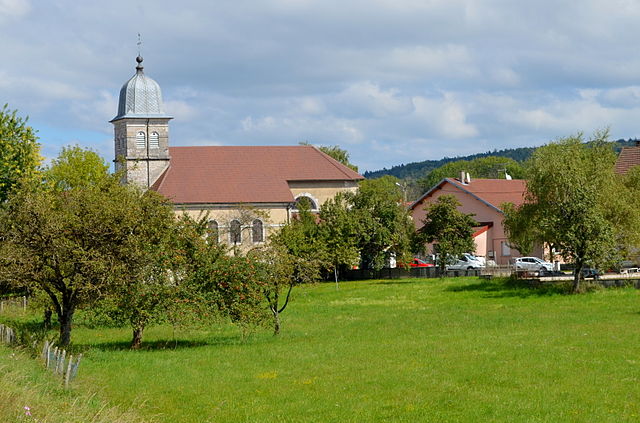
Charchilla (Charchilla)

- коммуна во Франции
 Hiking in Charchilla
Charchilla, a lesser-known destination, is a great spot for hiking enthusiasts looking for off-the-beaten-path experiences. While specific information on Charchilla can vary depending on the region, here are some general points to consider for hiking in areas similar to Charchilla:
-
Scenic Trails: Look for trails that offer diverse landscapes, including forests, hills, riverbanks, or unique geological formations.
-
Difficulty Levels: Ensure you choose a trail that suits your skill level. Beginners may prefer easier, well-marked paths, while experienced hikers can look for more challenging routes.
-
Wildlife and Flora: Areas like Charchilla may also provide opportunities to observe local wildlife and plant species. Have your binoculars ready if you're a nature enthusiast!
-
Local Guides: If you’re unfamiliar with the area, consider hiring a local guide. They can offer insights about the terrain, ensure your safety, and enhance your hiking experience with local knowledge.
-
Weather Conditions: Always check the weather before you go. Conditions can change quickly in mountainous or rural areas, so be prepared with appropriate gear.
-
Safety Precautions: Carry enough water, snacks, and a first-aid kit. It's also wise to have a map or GPS device, and to inform someone about your hiking plans in case of emergencies.
-
Respect the Environment: Follow Leave No Trace principles to minimize your impact on the environment. Stay on marked trails, pack out all trash, and avoid disturbing wildlife.
-
Cultural Aspects: If Charchilla has local communities, there may be cultural or historic sites along the trails. Engaging with local culture can enhance your hiking experience.
Before heading out, make sure to research specific trails and any regulations in the Charchilla area. Happy hiking!
- Страна:

- Почтовый код: 39260
- Координаты: 46° 27' 57" N, 5° 42' 45" E


- GPS треки (wikiloc): [Ссылка]
- Площадь: 6.84 кв.км
- Население: 273
- Википедия английская: wiki(en)
- Википедия национальная: wiki(fr)
- Хранилище Wikidata: Wikidata: Q684392
- Катеория в википедии: [Ссылка]
- код Freebase: [/m/03np2h4]
- код GeoNames: Альт: [6433478]
- номер SIREN: [213901069]
- код BNF: [15258470f]
- код муниципалитета INSEE: 39106
Граничит с регионами:

Meussia
- коммуна во Франции
Hiking in Meussia
Meussia is a picturesque village located in the Jura Mountains of France, known for its beautiful landscapes and variety of hiking trails. The region is characterized by its lush forests, rolling hills, and stunning views, making it a great destination for nature enthusiasts and hikers....
- Страна:
- Почтовый код: 39260
- Координаты: 46° 29' 53" N, 5° 43' 30" E
- GPS треки (wikiloc): [Ссылка]
- Площадь: 13.64 кв.км
- Население: 435


Maisod
- коммуна во Франции
Hiking in Maisod
Maisod is a charming village located in the Jura region of France, known for its scenic landscapes and outdoor recreational opportunities, including hiking. The area is characterized by rolling hills, dense forests, and beautiful views of the Jura Mountains and nearby lakes, making it an ideal destination for hikers of all skill levels....
- Страна:
- Почтовый код: 39260
- Координаты: 46° 28' 36" N, 5° 41' 22" E
- GPS треки (wikiloc): [Ссылка]
- Площадь: 7.39 кв.км
- Население: 330


Crenans
- коммуна во Франции
Hiking in Crenans
Crenans is not a widely recognized hiking destination, so it’s possible you might be referring to a specific regional area or it could be a misspelling. However, if you meant a location like Cranes (Crenans possibly), it could refer to various regions known for their hiking opportunities....
- Страна:
- Почтовый код: 39260
- Координаты: 46° 27' 27" N, 5° 44' 5" E
- GPS треки (wikiloc): [Ссылка]
- Площадь: 8.82 кв.км
- Население: 241


Moirans-en-Montagne
- коммуна во Франции
Hiking in Moirans-en-Montagne
Moirans-en-Montagne is a charming village located in the Jura region of France, known for its stunning natural landscapes and outdoor recreational opportunities. Here are some highlights about hiking in and around Moirans-en-Montagne:...
- Страна:
- Почтовый код: 39260
- Координаты: 46° 25' 54" N, 5° 43' 32" E
- GPS треки (wikiloc): [Ссылка]
- Площадь: 26.56 кв.км
- Население: 2088
- Веб сайт: [Ссылка]