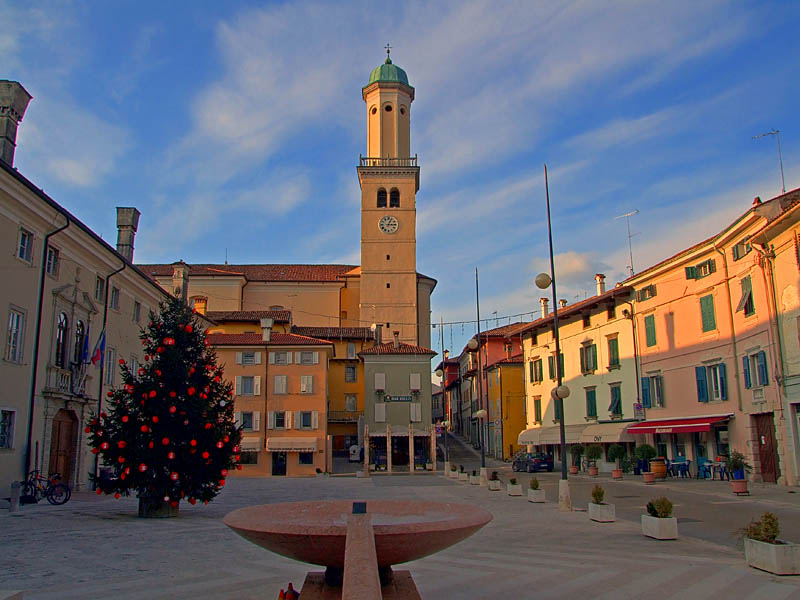
Каприва-дель-Фриули (Capriva del Friuli, Capriva del Friuli)
.svg)
- коммуна Италии
 Hiking in Каприва-дель-Фриули
Capriva del Friuli, located in the beautiful Friuli Venezia Giulia region of northeastern Italy, is a delightful destination for hiking enthusiasts. The area is known for its stunning landscapes, rich culture, and numerous trails that cater to a range of skill levels. Here are some key details about hiking in and around Capriva del Friuli:
Trails and Areas to Explore
-
Collio Region: Capriva del Friuli is situated in the Collio, a hilly area known for its vineyards and dense forests. The rolling hills provide various hiking paths where you can enjoy breathtaking views and experience the local wine culture.
-
The Natural Park of Prealpi Giulie: A short drive from Capriva, this park offers trails that range from easy walks to challenging hikes. You can explore beautiful landscapes, diverse flora and fauna, and enjoy panoramic views of the region.
-
Climbing Trails: For those looking for more adventure, there are climbing routes in the surrounding hills. Many tracks also provide opportunities for rock climbing and bouldering.
-
Historic Trails: Explore trails that connect historic sites, including ancient castles, churches, and ruins around Capriva, enriching your hike with cultural insights.
Recommended Hikes
-
The Via dei Ciliegi (Cherry Tree Trail): This trail offers an enjoyable hike through cherry orchards, especially beautiful in spring when the trees are in bloom.
-
Trail to Castle of Spessa: A moderate hike that takes you to a historic castle with beautiful views of the area.
Preparation Tips
-
Weather Check: The weather can change quickly in the mountains, so it’s always good to check the forecast before heading out.
-
Appropriate Gear: Wear sturdy hiking shoes, bring a hat, sunscreen, and plenty of water to stay hydrated.
-
Local Guidance: Consider hiring a local guide or joining a hiking group to get the most out of your experience, especially if you are unfamiliar with the area.
Additional Activities
After a day of hiking, Capriva del Friuli offers opportunities to taste local wines and cuisines. Take the chance to visit local vineyards, enjoy traditional dishes, and relax in the charming village atmosphere.
Whether you’re seeking a leisurely walk through nature or an invigorating hike with stunning views, Capriva del Friuli has something to offer every hiking enthusiast. Enjoy your adventure!
- Страна:

- Почтовый код: 34070
- Телефонный код: 0481
- Код автомобильного номера: GO
- Координаты: 45° 56' 0" N, 13° 31' 0" E


- GPS треки (wikiloc): [Ссылка]
- Высота над уровнем моря: 49 м m
- Площадь: 6.32 кв.км
- Население: 1717
- Веб сайт: http://www.comune.capriva-del-friuli.go.it/
- Википедия русская: wiki(ru)
- Википедия английская: wiki(en)
- Википедия национальная: wiki(it)
- Хранилище Wikidata: Wikidata: Q53123
- Катеория в википедии: [Ссылка]
- код Freebase: [/m/0gkbz9]
- код GeoNames: Альт: [6536697]
- код VIAF: Альт: [127031353]
- ID отношения в OpenStreetMap: [79265]
- UN/LOCODE: [ITCXF]
- код ISTAT: 031001
- кадастровый код Италии: B712
Граничит с регионами:

Кормонс
- коммуна Италии
Hiking in Кормонс
Cormons, located in the Friuli Venezia Giulia region of northeastern Italy, is surrounded by beautiful landscapes, making it an excellent destination for hiking enthusiasts. The area is characterized by rolling hills, vineyards, and stunning views of the Alps and the Adriatic Sea. Here are some highlights for hiking in and around Cormons:...
- Страна:
- Почтовый код: 34071
- Телефонный код: 0481
- Код автомобильного номера: GO
- Координаты: 45° 57' 0" N, 13° 28' 0" E
- GPS треки (wikiloc): [Ссылка]
- Высота над уровнем моря: 56 м m
- Площадь: 35.09 кв.км
- Население: 7347
- Веб сайт: [Ссылка]
Мораро
- коммуна Италии
Hiking in Мораро
Moraro, located in the northeastern part of Italy near the border with Slovenia, offers a variety of hiking opportunities amidst beautiful landscapes and scenic views. While not as widely known as some other hiking destinations in Italy, the region boasts charming trails that cater to various skill levels, making it an appealing spot for both novice and experienced hikers....
- Страна:
- Почтовый код: 34070
- Телефонный код: 0481
- Код автомобильного номера: GO
- Координаты: 45° 56' 0" N, 13° 30' 0" E
- GPS треки (wikiloc): [Ссылка]
- Высота над уровнем моря: 44 м m
- Площадь: 3.57 кв.км
- Население: 753
- Веб сайт: [Ссылка]
Мосса
- коммуна Италии
Hiking in Мосса
Mossa is a small, picturesque village that is likely located in Slovenia, known for its beautiful landscapes and hiking opportunities. Although it may not be as widely recognized as other hiking destinations, the surrounding areas often offer scenic trails suited for various skill levels. Here's a general overview of what you might expect from hiking in and around Mossa:...
- Страна:
- Почтовый код: 34070
- Телефонный код: 0481
- Код автомобильного номера: GO
- Координаты: 45° 56' 12" N, 13° 32' 58" E
- GPS треки (wikiloc): [Ссылка]
- Высота над уровнем моря: 59 м m
- Площадь: 6.21 кв.км
- Население: 1553
- Веб сайт: [Ссылка]
Сан-Флориано-дель-Коллио
- коммуна Италии
Hiking in Сан-Флориано-дель-Коллио
San Floriano del Collio, located in the enchanting region of Friuli Venezia Giulia in northeastern Italy, offers a wonderful backdrop for hiking enthusiasts. Nestled in the rolling hills of the Collio wine region, this area is famed for its picturesque vineyards, charming villages, and stunning landscapes....
- Страна:
- Почтовый код: 34070
- Телефонный код: 0481
- Код автомобильного номера: GO
- Координаты: 45° 59' 0" N, 13° 35' 0" E
- GPS треки (wikiloc): [Ссылка]
- Высота над уровнем моря: 276 м m
- Площадь: 10.63 кв.км
- Население: 775
- Веб сайт: [Ссылка]
Сан-Лоренцо-Изонтино
- коммуна Италии
Hiking in Сан-Лоренцо-Изонтино
San Lorenzo Isontino, located in the Friuli Venezia Giulia region of Italy, offers a variety of hiking opportunities that cater to different skill levels. The area is characterized by its beautiful landscapes, including the adjacent Carso Triestino, which features unique karst formations, lush forests, and intriguing caves....
- Страна:
- Почтовый код: 34070
- Телефонный код: 0481
- Код автомобильного номера: GO
- Координаты: 45° 56' 0" N, 13° 32' 0" E
- GPS треки (wikiloc): [Ссылка]
- Высота над уровнем моря: 54 м m
- Площадь: 4.4 кв.км
- Население: 1540
- Веб сайт: [Ссылка]