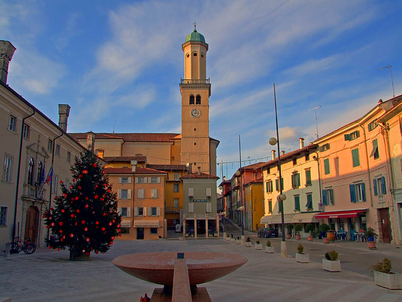
Сан-Флориано-дель-Коллио (San Floriano del Collio, San Floriano del Collio)

- коммуна Италии
 Hiking in Сан-Флориано-дель-Коллио
San Floriano del Collio, located in the enchanting region of Friuli Venezia Giulia in northeastern Italy, offers a wonderful backdrop for hiking enthusiasts. Nestled in the rolling hills of the Collio wine region, this area is famed for its picturesque vineyards, charming villages, and stunning landscapes.
Here are some key points about hiking in San Floriano del Collio:
Scenic Trails
-
Wine Trails: The area around San Floriano is dotted with vineyards, and many hiking trails pass through these scenic landscapes. Walking along these paths allows you to enjoy the view of meticulously arranged vineyards, olive groves, and the backdrop of the Julian Alps.
-
Nature Paths: There are various nature trails that showcase the region's rich biodiversity. These trails often lead through forested areas, providing opportunities to spot local wildlife and native flora.
-
Historical Routes: Some trails in the area take hikers past historical landmarks, including old churches, traditional stone houses, and ancient ruins, adding a cultural dimension to your hike.
Difficulty Levels
The hiking trails vary in difficulty, from easy walks suitable for families to more challenging routes for experienced hikers. Always check the trail markers and maps before heading out to ensure you choose a path that suits your fitness level.
Best Seasons
- Spring and Fall: These seasons are particularly beautiful in this region, with mild weather and vibrant colors in the landscapes. Spring brings blooming wildflowers, while fall showcases the changing colors of vineyards.
- Summer: While summer offers lush green views, it can be quite hot, so plan hikes early in the morning or later in the afternoon to avoid the heat.
Local Amenities
San Floriano del Collio has local accommodations, restaurants, and wineries. After a day of hiking, visitors can enjoy authentic Friulian cuisine and sample local wines, especially white varieties like Friulano and Sauvignon Blanc.
Tips for Hikers
- Stay Hydrated: Bring enough water, especially on warmer days.
- Dress Appropriately: Wear layers, as weather can change quickly. Good hiking shoes are essential.
- Respect Nature: Follow Leave No Trace principles to keep the trails clean.
By exploring the hiking opportunities in San Floriano del Collio, you can experience the natural beauty and cultural richness of this lovely region in Italy.
- Страна:

- Почтовый код: 34070
- Телефонный код: 0481
- Код автомобильного номера: GO
- Координаты: 45° 59' 0" N, 13° 35' 0" E


- GPS треки (wikiloc): [Ссылка]
- Высота над уровнем моря: 276 м m
- Площадь: 10.63 кв.км
- Население: 775
- Веб сайт: http://www.comuni-italiani.it/031/019/
- Википедия русская: wiki(ru)
- Википедия английская: wiki(en)
- Википедия национальная: wiki(it)
- Хранилище Wikidata: Wikidata: Q53141
- Катеория в википедии: [Ссылка]
- код Freebase: [/m/0gkc66]
- код GeoNames: Альт: [6538404]
- код VIAF: Альт: [153778046]
- ID отношения в OpenStreetMap: [79090]
- место в MusicBrainz: [b8b4cbf0-8b70-43eb-b372-a3fed2d7b09b]
- WOEID: [12681620]
- UN/LOCODE: [ITGGD]
- код ISTAT: 031019
- кадастровый код Италии: H845
Граничит с регионами:
Каприва-дель-Фриули
- коммуна Италии
Hiking in Каприва-дель-Фриули
Capriva del Friuli, located in the beautiful Friuli Venezia Giulia region of northeastern Italy, is a delightful destination for hiking enthusiasts. The area is known for its stunning landscapes, rich culture, and numerous trails that cater to a range of skill levels. Here are some key details about hiking in and around Capriva del Friuli:...
- Страна:
- Почтовый код: 34070
- Телефонный код: 0481
- Код автомобильного номера: GO
- Координаты: 45° 56' 0" N, 13° 31' 0" E
- GPS треки (wikiloc): [Ссылка]
- Высота над уровнем моря: 49 м m
- Площадь: 6.32 кв.км
- Население: 1717
- Веб сайт: [Ссылка]

Кормонс
- коммуна Италии
Hiking in Кормонс
Cormons, located in the Friuli Venezia Giulia region of northeastern Italy, is surrounded by beautiful landscapes, making it an excellent destination for hiking enthusiasts. The area is characterized by rolling hills, vineyards, and stunning views of the Alps and the Adriatic Sea. Here are some highlights for hiking in and around Cormons:...
- Страна:
- Почтовый код: 34071
- Телефонный код: 0481
- Код автомобильного номера: GO
- Координаты: 45° 57' 0" N, 13° 28' 0" E
- GPS треки (wikiloc): [Ссылка]
- Высота над уровнем моря: 56 м m
- Площадь: 35.09 кв.км
- Население: 7347
- Веб сайт: [Ссылка]
Мосса
- коммуна Италии
Hiking in Мосса
Mossa is a small, picturesque village that is likely located in Slovenia, known for its beautiful landscapes and hiking opportunities. Although it may not be as widely recognized as other hiking destinations, the surrounding areas often offer scenic trails suited for various skill levels. Here's a general overview of what you might expect from hiking in and around Mossa:...
- Страна:
- Почтовый код: 34070
- Телефонный код: 0481
- Код автомобильного номера: GO
- Координаты: 45° 56' 12" N, 13° 32' 58" E
- GPS треки (wikiloc): [Ссылка]
- Высота над уровнем моря: 59 м m
- Площадь: 6.21 кв.км
- Население: 1553
- Веб сайт: [Ссылка]


Гориция
- город и коммуна в Италии
Hiking in Гориция
Gorizia is a charming town located at the intersection of Italy and Slovenia, surrounded by beautiful natural landscapes that are perfect for hiking enthusiasts. The region offers a mix of cultural, historical, and natural attractions that can enhance your outdoor experience. Here are some key points to consider when hiking in and around Gorizia:...
- Страна:
- Почтовый код: 34170
- Телефонный код: 0481
- Код автомобильного номера: GO
- Координаты: 45° 56' 7" N, 13° 37' 9" E
- GPS треки (wikiloc): [Ссылка]
- Высота над уровнем моря: 84 м m
- Площадь: 41 кв.км
- Население: 34411
- Веб сайт: [Ссылка]


Брда
Hiking in Брда
The Municipality of Brda, located in the western part of Slovenia near the border with Italy, is renowned for its beautiful landscapes, vineyards, and gently rolling hills, making it a fantastic destination for hiking enthusiasts....
- Страна:

- Почтовый код: 5212
- Код автомобильного номера: GO
- Координаты: 46° 0' 27" N, 13° 32' 36" E
- GPS треки (wikiloc): [Ссылка]
- Высота над уровнем моря: 196 м m
- Площадь: 72.0 кв.км
- Веб сайт: [Ссылка]