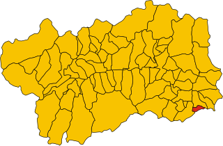
Карема (Carema, Carema)

- коммуна Италии
 Hiking in Карема
Carema is a small village located in the Aosta Valley region of Italy, nestled in the scenic backdrop of the Italian Alps. Here are some highlights and tips for hiking in and around Carema:
Trail Highlights:
-
Valle d'Aosta Trails: The Aosta Valley region is known for its extensive network of hiking trails that cater to all levels of hikers. In Carema itself, you can find trails that lead to picturesque views of the surrounding mountains, meadows, and the charming village.
-
Monte Emilius: This mountain is popular among hikers. You can find several paths that lead up to its summit, offering breathtaking panoramic views of the Aosta Valley and the surrounding peaks.
-
Flora and Fauna: While hiking, you’ll encounter diverse alpine flora and fauna. Keep an eye out for local wildlife like chamois and various species of birds.
Hiking Tips:
-
Best Time to Visit: The ideal hiking season is late spring to early autumn (May to September), when the weather is typically mild and the trails are clear of snow.
-
Trail Maps: It's advisable to carry a detailed map of the area or download hiking apps that provide GPS tracking and trail information.
-
Hiking Gear: Wear sturdy hiking boots and bring layers, as temperatures can vary, especially in higher altitudes. Don't forget essentials like water, snacks, a first-aid kit, and sun protection.
-
Local Guides: Consider hiring a local hiking guide, especially if you're unfamiliar with the area. They can provide valuable insights into the landscape and culture.
Cultural Considerations:
-
Explore Local Culture: While hiking, take the opportunity to explore the cultural heritage of Carema itself, renowned for its historical architecture and local cuisine, including the regional wines.
-
Respect Nature: Follow Leave No Trace principles to preserve the natural beauty of the area. Stick to marked trails and avoid littering.
Conclusion:
Hiking in Carema offers a unique blend of natural beauty, outdoor adventure, and cultural exploration. Whether you're an experienced hiker or a beginner, the Aosta Valley region provides trails that are sure to create memorable experiences. Enjoy your hike!
- Страна:

- Почтовый код: 10010
- Телефонный код: 0125
- Код автомобильного номера: TO
- Координаты: 45° 35' 0" N, 7° 49' 0" E


- GPS треки (wikiloc): [Ссылка]
- Высота над уровнем моря: 349 м m
- Площадь: 10.26 кв.км
- Население: 766
- Веб сайт: http://www.comune.carema.to.it/
- Википедия русская: wiki(ru)
- Википедия английская: wiki(en)
- Википедия национальная: wiki(it)
- Хранилище Wikidata: Wikidata: Q9173
- Катеория в википедии: [Ссылка]
- код Freebase: [/m/0g6tw0]
- код GeoNames: Альт: [6538047]
- ID отношения в OpenStreetMap: [45401]
- UN/LOCODE: [ITCM2]
- код ISTAT: 001057
- кадастровый код Италии: B762
Граничит с регионами:


Квинчинетто
- коммуна Италии
Hiking in Квинчинетто
Quincinetto, located in the Aosta Valley region of Italy, is a fantastic destination for hiking enthusiasts. Nestled in a picturesque valley surrounded by the impressive peaks of the Graian Alps, it offers a variety of trails suitable for different skill levels....
- Страна:
- Почтовый код: 10010
- Телефонный код: 0125
- Код автомобильного номера: TO
- Координаты: 45° 34' 0" N, 7° 48' 0" E
- GPS треки (wikiloc): [Ссылка]
- Высота над уровнем моря: 295 м m
- Площадь: 17.79 кв.км
- Население: 1019
- Веб сайт: [Ссылка]


Сеттимо-Виттоне
- коммуна в Италии
Hiking in Сеттимо-Виттоне
Settimo Vittone is a charming village located in the Aosta Valley region of Italy, nestled in the foothills of the Alps. It offers a variety of hiking opportunities that cater to different skill levels and preferences. Here are some highlights and tips for hiking in and around Settimo Vittone:...
- Страна:
- Почтовый код: 10010
- Телефонный код: 0125
- Код автомобильного номера: TO
- Координаты: 45° 33' 0" N, 7° 50' 0" E
- GPS треки (wikiloc): [Ссылка]
- Высота над уровнем моря: 280 м m
- Площадь: 23.26 кв.км
- Население: 1546
- Веб сайт: [Ссылка]


Доннас
- коммуна Италии
Hiking in Доннас
Donnas, a small town located in the Aosta Valley region of Italy, is surrounded by stunning natural landscapes and offers several hiking opportunities for outdoor enthusiasts. Here are some highlights of hiking in and around Donnas:...
- Страна:
- Почтовый код: 11020
- Телефонный код: 0125
- Код автомобильного номера: AO
- Координаты: 45° 36' 0" N, 7° 46' 0" E
- GPS треки (wikiloc): [Ссылка]
- Высота над уровнем моря: 322 м m
- Площадь: 33.97 кв.км
- Население: 2520
- Веб сайт: [Ссылка]


Лилльян
- коммуна Италии
Hiking in Лилльян
Lillianes is a small village located in the Aosta Valley region of northern Italy, nestled in a picturesque setting at the foot of the Alps. It’s an excellent starting point for various hiking adventures, offering stunning views, rich flora and fauna, and a chance to experience the natural beauty of the region....
- Страна:
- Почтовый код: 11020
- Телефонный код: 0125
- Код автомобильного номера: AO
- Координаты: 45° 38' 0" N, 7° 51' 0" E
- GPS треки (wikiloc): [Ссылка]
- Высота над уровнем моря: 667 м m
- Площадь: 18.55 кв.км
- Население: 456
- Веб сайт: [Ссылка]


Перло
- коммуна в автономном регионе Валле-д’Аоста, Италия
Hiking in Перло
Perloz is a picturesque village located in the Aosta Valley region of Italy, surrounded by stunning alpine scenery, which makes it an excellent destination for hiking enthusiasts. Here are some key points to consider when hiking in Perloz:...
- Страна:
- Почтовый код: 11002
- Телефонный код: 0125
- Код автомобильного номера: AO
- Координаты: 45° 37' 0" N, 7° 49' 0" E
- GPS треки (wikiloc): [Ссылка]
- Высота над уровнем моря: 661 м m
- Площадь: 23.27 кв.км
- Население: 480
- Веб сайт: [Ссылка]

Пон-Сен-Мартен
- коммуна Италии
Hiking in Пон-Сен-Мартен
Pont-Saint-Martin, located in the Aosta Valley of Italy, is a charming town known for its stunning natural landscapes and rich history. Hikers will find a variety of trails ranging from easy walks to more challenging hikes that offer spectacular views of the surrounding mountains and valleys. Here are some details about hiking in this area:...
- Страна:
- Почтовый код: 11026
- Телефонный код: 0125
- Код автомобильного номера: AO
- Координаты: 45° 36' 0" N, 7° 48' 0" E
- GPS треки (wikiloc): [Ссылка]
- Высота над уровнем моря: 345 м m
- Площадь: 6.92 кв.км
- Население: 3763
- Веб сайт: [Ссылка]