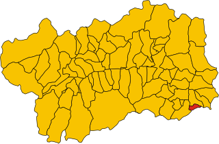
Доннас (Donnas, Donnas)
.svg)
- коммуна Италии
 Hiking in Доннас
Donnas, a small town located in the Aosta Valley region of Italy, is surrounded by stunning natural landscapes and offers several hiking opportunities for outdoor enthusiasts. Here are some highlights of hiking in and around Donnas:
1. Scenic Views
Hiking in the area provides breathtaking views of the surrounding mountains, particularly the Alps. The landscape is characterized by rolling hills, vineyards, and dramatic mountain peaks, making it a picturesque setting for nature lovers.
2. Trails
While Donnas itself may not have extensive hiking trails, it serves as a gateway to various trails in the Aosta Valley. Some popular hiking routes in the vicinity include:
- The Monte Avic Nature Park: Offers several trails with varying levels of difficulty and stunning scenery.
- The paths around the Aosta Valley: Many trails can be accessed from nearby municipalities, such as Aosta and Saint Vincent, which can be reached by a short drive from Donnas.
3. Difficulty Levels
The hikes in this region cater to various skill levels, from beginner-friendly paths to more challenging treks. Be sure to choose trails that match your fitness and experience level.
4. Flora and Fauna
The area is rich in biodiversity, and hikers can enjoy observing local wildlife and plant species. The Aosta Valley is home to various species of flowers, trees, and animals, including deer and various bird species.
5. Local Culture
Hiking in Donnas also provides an opportunity to experience local culture. The region is known for its historical sites, such as castles and traditional villages, which can often be explored along hiking routes.
6. Best Time to Hike
The best time for hiking in Donnas is typically from late spring to early autumn (May to September), when the weather is milder and the trails are more accessible.
7. Amenities
While Donnas is a small town, local amenities such as restaurants and accommodations are available for hikers looking to rest and refuel after a day in the mountains.
Tips for Hikers
- Check Weather Conditions: Always check the weather forecast before heading out.
- Dress Appropriately: Wear layers, as temperatures can change rapidly in the mountains.
- Stay Hydrated: Carry sufficient water, especially on longer hikes.
- Research Trails: Use maps or apps to familiarize yourself with the trails and terrain.
In summary, hiking in Donnas offers a mix of natural beauty and cultural experiences, making it an excellent choice for both new and experienced hikers.
- Страна:

- Почтовый код: 11020
- Телефонный код: 0125
- Код автомобильного номера: AO
- Координаты: 45° 36' 0" N, 7° 46' 0" E


- GPS треки (wikiloc): [Ссылка]
- Высота над уровнем моря: 322 м m
- Площадь: 33.97 кв.км
- Население: 2520
- Веб сайт: http://www.comune.donnas.ao.it
- Википедия русская: wiki(ru)
- Википедия английская: wiki(en)
- Википедия национальная: wiki(it)
- Хранилище Wikidata: Wikidata: Q34998
- Катеория в википедии: [Ссылка]
- Карты в википедии: [Ссылка]
- код Freebase: [/m/0fs_y7]
- код GeoNames: Альт: [6543057]
- ID отношения в OpenStreetMap: [45306]
- код ISTAT: 007023
- кадастровый код Италии: D338
Граничит с регионами:


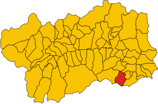
Квинчинетто
- коммуна Италии
Hiking in Квинчинетто
Quincinetto, located in the Aosta Valley region of Italy, is a fantastic destination for hiking enthusiasts. Nestled in a picturesque valley surrounded by the impressive peaks of the Graian Alps, it offers a variety of trails suitable for different skill levels....
- Страна:
- Почтовый код: 10010
- Телефонный код: 0125
- Код автомобильного номера: TO
- Координаты: 45° 34' 0" N, 7° 48' 0" E
- GPS треки (wikiloc): [Ссылка]
- Высота над уровнем моря: 295 м m
- Площадь: 17.79 кв.км
- Население: 1019
- Веб сайт: [Ссылка]


Траверселла
- коммуна в Италии
Hiking in Траверселла
Traversella is a charming village located in the province of Turin, in the Piedmont region of northern Italy. It is nestled in a beautiful valley surrounded by the stunning peaks of the Gran Paradiso National Park, making it a great destination for hiking enthusiasts....
- Страна:
- Почтовый код: 10080
- Телефонный код: 0125
- Код автомобильного номера: TO
- Координаты: 45° 31' 0" N, 7° 45' 0" E
- GPS треки (wikiloc): [Ссылка]
- Высота над уровнем моря: 827 м m
- Площадь: 39.36 кв.км
- Население: 332
- Веб сайт: [Ссылка]


Арна
- коммуна Италии
Hiking in Арна
Arnad is a charming commune located in the Aosta Valley region of Italy, known for its beautiful landscapes and outdoor activities, particularly hiking. Nestled in the foothills of the Alps, Arnad offers a variety of trails suitable for different skill levels, making it an excellent destination for both novice and experienced hikers....
- Страна:
- Почтовый код: 11020
- Телефонный код: 0125
- Код автомобильного номера: AO
- Координаты: 45° 38' 0" N, 7° 43' 0" E
- GPS треки (wikiloc): [Ссылка]
- Высота над уровнем моря: 361 м m
- Площадь: 28.84 кв.км
- Население: 1251
- Веб сайт: [Ссылка]


Бар
- коммуна Италии
Hiking in Бар
Bard is a picturesque village located in the Aosta Valley of northern Italy, known for its stunning scenery and rich history. The surrounding region is a hiker's paradise, offering a variety of trails for different skill levels, making it an ideal destination for both novice and experienced hikers....
- Страна:
- Почтовый код: 11020
- Телефонный код: 0125
- Код автомобильного номера: AO
- Координаты: 45° 37' 0" N, 7° 45' 0" E
- GPS треки (wikiloc): [Ссылка]
- Высота над уровнем моря: 400 м m
- Площадь: 3.03 кв.км
- Население: 113
- Веб сайт: [Ссылка]


Он
- коммуна Италии
Hiking in Он
Hône is a charming town located in the Aosta Valley region of Italy. It is surrounded by stunning natural landscapes, making it an excellent destination for hiking enthusiasts. Here are some highlights and tips for hiking in and around Hône:...
- Страна:
- Почтовый код: 11020
- Телефонный код: 0125
- Код автомобильного номера: AO
- Координаты: 45° 37' 0" N, 7° 44' 0" E
- GPS треки (wikiloc): [Ссылка]
- Высота над уровнем моря: 364 м m
- Площадь: 12.64 кв.км
- Население: 1176
- Веб сайт: [Ссылка]


Перло
- коммуна в автономном регионе Валле-д’Аоста, Италия
Hiking in Перло
Perloz is a picturesque village located in the Aosta Valley region of Italy, surrounded by stunning alpine scenery, which makes it an excellent destination for hiking enthusiasts. Here are some key points to consider when hiking in Perloz:...
- Страна:
- Почтовый код: 11002
- Телефонный код: 0125
- Код автомобильного номера: AO
- Координаты: 45° 37' 0" N, 7° 49' 0" E
- GPS треки (wikiloc): [Ссылка]
- Высота над уровнем моря: 661 м m
- Площадь: 23.27 кв.км
- Население: 480
- Веб сайт: [Ссылка]

Пон-Сен-Мартен
- коммуна Италии
Hiking in Пон-Сен-Мартен
Pont-Saint-Martin, located in the Aosta Valley of Italy, is a charming town known for its stunning natural landscapes and rich history. Hikers will find a variety of trails ranging from easy walks to more challenging hikes that offer spectacular views of the surrounding mountains and valleys. Here are some details about hiking in this area:...
- Страна:
- Почтовый код: 11026
- Телефонный код: 0125
- Код автомобильного номера: AO
- Координаты: 45° 36' 0" N, 7° 48' 0" E
- GPS треки (wikiloc): [Ссылка]
- Высота над уровнем моря: 345 м m
- Площадь: 6.92 кв.км
- Население: 3763
- Веб сайт: [Ссылка]

Понбозе
- коммуна Италии
Hiking in Понбозе
Pontboset is a charming destination for hiking enthusiasts, located in the Aosta Valley region of Italy. The area is known for its stunning natural landscapes, including mountains, valleys, and rich flora and fauna. Here are some key points and recommendations for hiking in Pontboset:...
- Страна:
- Почтовый код: 11020
- Телефонный код: 0125
- Код автомобильного номера: AO
- Координаты: 45° 36' 26" N, 7° 41' 11" E
- GPS треки (wikiloc): [Ссылка]
- Высота над уровнем моря: 780 м m
- Площадь: 33.56 кв.км
- Население: 180
- Веб сайт: [Ссылка]


Карема
- коммуна Италии
Hiking in Карема
Carema is a small village located in the Aosta Valley region of Italy, nestled in the scenic backdrop of the Italian Alps. Here are some highlights and tips for hiking in and around Carema:...
- Страна:
- Почтовый код: 10010
- Телефонный код: 0125
- Код автомобильного номера: TO
- Координаты: 45° 35' 0" N, 7° 49' 0" E
- GPS треки (wikiloc): [Ссылка]
- Высота над уровнем моря: 349 м m
- Площадь: 10.26 кв.км
- Население: 766
- Веб сайт: [Ссылка]