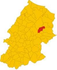
Казакаленда (Casacalenda, Casacalenda)
.svg)
- коммуна Италии
 Hiking in Казакаленда
Casacalenda is a charming village located in the Molise region of Italy, surrounded by beautiful landscapes that are ideal for hiking enthusiasts. The area is characterized by its rolling hills, lush greenery, and a mix of natural and cultural attractions. Here are some highlights for hiking in and around Casacalenda:
Scenic Trails
-
Countryside Paths: You can find numerous trails that meander through vineyards, olive groves, and fields, offering panoramic views of the Molise landscape. Look for local trails that connect to other nearby villages.
-
Nature Reserves: The nearby Collemeluccio-Montedimezzo Nature Reserve offers marked paths suitable for various skill levels. These trails showcase the region's biodiversity, including diverse flora and fauna.
-
Historical Routes: Some trails may lead you to historical landmarks or ruins, allowing you to combine hiking with cultural exploration. Keep an eye out for old churches and ancient stone structures.
Recommendations
-
Difficulty Levels: Most trails in the area range from easy to moderate. It's advisable to check local maps or consult with local hiking guides for information on trail conditions and difficulty.
-
Best Time to Hike: Spring (April to June) and fall (September to October) are ideal seasons due to mild temperatures and blooming nature. Summer can be hot, while winter may bring snow to higher elevations.
-
Preparation: Bring sufficient water, snacks, and a map or GPS device. While some trails are well-marked, others may require navigation skills.
-
Local Guides: If you're unfamiliar with the area, consider hiring a local guide who can provide insights into the landscape, flora, fauna, and cultural history.
Additional Activities
Beyond hiking, you can enjoy local cuisine, visit nearby towns, and immerse yourself in Italian culture. Casacalenda is also an excellent base for exploring the broader Molise region, known for its mountainous terrain and picturesque villages.
Whether you're looking for a leisurely countryside stroll or a more challenging hike, Casacalenda offers a beautiful setting to enjoy the great outdoors.
- Страна:

- Почтовый код: 86043
- Телефонный код: 0874
- Код автомобильного номера: CB
- Координаты: 41° 44' 29" N, 14° 50' 56" E


- GPS треки (wikiloc): [Ссылка]
- Высота над уровнем моря: 670 м m
- Площадь: 67.28 кв.км
- Население: 2049
- Веб сайт: http://www.casacalendacomune.it/
- Википедия русская: wiki(ru)
- Википедия английская: wiki(en)
- Википедия национальная: wiki(it)
- Хранилище Wikidata: Wikidata: Q277423
- Катеория в википедии: [Ссылка]
- код Freebase: [/m/0gnnnp]
- код GeoNames: Альт: [6537500]
- код VIAF: Альт: [130631675]
- ID отношения в OpenStreetMap: [41500]
- WOEID: [712756]
- код TGN: [1043922]
- код Цифрового атласа Римской империи: [30408]
- код ISTAT: 070011
- кадастровый код Италии: B858
Граничит с регионами:


Лупара
- коммуна Италии
Hiking in Лупара
Hiking in the region of Molise, particularly in and around Lupara, offers a unique experience for outdoor enthusiasts. Molise is often less crowded than other Italian regions, providing a more tranquil and pristine natural environment....
- Страна:
- Почтовый код: 86030
- Телефонный код: 0874
- Код автомобильного номера: CB
- Координаты: 41° 46' 0" N, 14° 44' 0" E
- GPS треки (wikiloc): [Ссылка]
- Высота над уровнем моря: 505 м m
- Площадь: 25.87 кв.км
- Население: 483
- Веб сайт: [Ссылка]
Рипаботтони
- коммуна Италии
Hiking in Рипаботтони
Ripabottoni is a small town located in the Molise region of Italy, surrounded by the beautiful Apennine Mountains and lush countryside, making it an excellent destination for hiking enthusiasts. Here are some key points to consider when planning a hiking trip in Ripabottoni:...
- Страна:
- Почтовый код: 86040
- Телефонный код: 0874
- Код автомобильного номера: CB
- Координаты: 41° 41' 0" N, 14° 49' 0" E
- GPS треки (wikiloc): [Ссылка]
- Высота над уровнем моря: 695 м m
- Площадь: 31.96 кв.км
- Население: 531
- Веб сайт: [Ссылка]


Бонефро
- коммуна Италии
Hiking in Бонефро
Bonefro, a small town located in the province of Campobasso in the Molise region of Italy, offers beautiful hiking opportunities amidst a rich natural landscape. Here are some highlights for hiking in and around Bonefro:...
- Страна:
- Почтовый код: 86041
- Телефонный код: 0874
- Код автомобильного номера: CB
- Координаты: 41° 42' 15" N, 14° 56' 9" E
- GPS треки (wikiloc): [Ссылка]
- Высота над уровнем моря: 631 м m
- Площадь: 31.28 кв.км
- Население: 1331
- Веб сайт: [Ссылка]


Гуардьяльфьера
- коммуна Италии
Hiking in Гуардьяльфьера
Guardialfiera is a beautiful destination located in the Molise region of Italy, known for its stunning landscapes and outdoor recreational opportunities, especially hiking. Here are some key points about hiking in Guardialfiera:...
- Страна:
- Почтовый код: 86030
- Телефонный код: 0874
- Код автомобильного номера: CB
- Координаты: 41° 48' 13" N, 14° 47' 36" E
- GPS треки (wikiloc): [Ссылка]
- Высота над уровнем моря: 274 м m
- Площадь: 43.53 кв.км
- Население: 1045
- Веб сайт: [Ссылка]


Ларино
- коммуна Италии
Hiking in Ларино
Larino, located in the Molise region of Italy, is a small town rich in history and natural beauty, making it a charming destination for hiking enthusiasts. The surrounding area offers a variety of hiking trails that cater to different skill levels. Here are some highlights to consider when hiking in Larino:...
- Страна:
- Почтовый код: 86035
- Телефонный код: 0874
- Код автомобильного номера: CB
- Координаты: 41° 48' 0" N, 14° 55' 0" E
- GPS треки (wikiloc): [Ссылка]
- Высота над уровнем моря: 341 м m
- Площадь: 88.77 кв.км
- Население: 6680
- Веб сайт: [Ссылка]

Монторио-ней-Френтани
- коммуна Италии
Hiking in Монторио-ней-Френтани
Montorio nei Frentani is a charming village in the Molise region of Italy, known for its picturesque landscapes and historical significance. Hiking in this area offers a blend of natural beauty, scenic views, and cultural experiences. Here are some highlights and tips for hiking in and around Montorio nei Frentani:...
- Страна:
- Почтовый код: 86040
- Телефонный код: 0874
- Код автомобильного номера: CB
- Координаты: 41° 45' 34" N, 14° 55' 58" E
- GPS треки (wikiloc): [Ссылка]
- Высота над уровнем моря: 654 м m
- Площадь: 31.66 кв.км
- Население: 403
- Веб сайт: [Ссылка]
Морроне-дель-Саннио
- коммуна Италии
Hiking in Морроне-дель-Саннио
Morrone del Sannio is a picturesque area located in the Molise region of Italy, known for its stunning landscapes and rich natural beauty. It offers a variety of hiking opportunities that cater to different skill levels, from leisurely walks to challenging trails. Here are some highlights of hiking in Morrone del Sannio:...
- Страна:
- Почтовый код: 86040
- Телефонный код: 0874
- Код автомобильного номера: CB
- Координаты: 41° 42' 41" N, 14° 46' 46" E
- GPS треки (wikiloc): [Ссылка]
- Высота над уровнем моря: 827 м m
- Площадь: 45.84 кв.км
- Население: 576
- Веб сайт: [Ссылка]
Проввиденти
- коммуна Италии
Hiking in Проввиденти
It seems there might be a misunderstanding, as "Provvidenti" may not refer to a well-known hiking destination. However, if you're looking for hiking information in a specific region, please clarify the location—perhaps it's a different name, or a specific trail or park you're interested in....
- Страна:
- Почтовый код: 86040
- Телефонный код: 0874
- Код автомобильного номера: CB
- Координаты: 41° 43' 0" N, 14° 49' 0" E
- GPS треки (wikiloc): [Ссылка]
- Высота над уровнем моря: 570 м m
- Площадь: 14.03 кв.км
- Население: 112
- Веб сайт: [Ссылка]