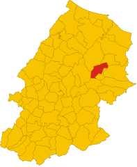
Ларино (Larino, Larino)
.svg)
- коммуна Италии
 Hiking in Ларино
Larino, located in the Molise region of Italy, is a small town rich in history and natural beauty, making it a charming destination for hiking enthusiasts. The surrounding area offers a variety of hiking trails that cater to different skill levels. Here are some highlights to consider when hiking in Larino:
Trails and Landscapes
-
Countryside Trails: The rolling hills and picturesque countryside around Larino provide excellent hiking opportunities, featuring fields, vineyards, and olive groves.
-
Historical Routes: Some trails may lead you to ancient ruins or historic sites, where you can explore the rich heritage of the region, including remnants of Roman architecture.
-
Nature Reserves: Nearby natural reserves or parks may offer dedicated hiking paths, showcasing local flora and fauna. It’s worth checking out the surrounding areas for nature parks that might have more extensive hiking networks.
Key Features
- Elevation and Terrain: The area features varying elevations, so you can choose easier, flat trails or more challenging hikes that may include steeper climbs.
- Scenic Views: Many trails provide stunning panoramic views of the Molise landscape, allowing hikers to enjoy the beauty of both nature and the historical sites dotting the landscape.
Recommendations
- Best Time to Hike: The ideal seasons for hiking in Larino are spring (April to June) and fall (September to October) when temperatures are mild and the scenery is vibrant.
- Local Guides: Consider hiring a local guide for a more enriching experience, especially if you are interested in the history, culture, and wildlife of the area.
- Preparation: Always come prepared with proper hiking gear, sufficient water, and snacks. Check local weather conditions before you set out, and inform someone of your planned route and expected return time.
Additional Activities
Aside from hiking, you can explore the town’s historical sites, enjoy local cuisine in traditional restaurants, and interact with the friendly locals for a truly immersive experience.
Whether you are an experienced hiker or a casual walker, Larino's beautiful landscapes and rich culture offer something special for everyone. Enjoy your hiking adventure!
- Страна:

- Почтовый код: 86035
- Телефонный код: 0874
- Код автомобильного номера: CB
- Координаты: 41° 48' 0" N, 14° 55' 0" E


- GPS треки (wikiloc): [Ссылка]
- Высота над уровнем моря: 341 м m
- Площадь: 88.77 кв.км
- Население: 6680
- Веб сайт: http://www.comune.larino.cb.it
- Википедия русская: wiki(ru)
- Википедия английская: wiki(en)
- Википедия национальная: wiki(it)
- Хранилище Wikidata: Wikidata: Q277643
- Галерея изображений в википедии: [Ссылка]
- Катеория в википедии: [Ссылка]
- код Freebase: [/m/04qqhj]
- код GeoNames: Альт: [6541725]
- код BNF: [121388638]
- код VIAF: Альт: [144267352]
- ID отношения в OpenStreetMap: [41553]
- код GND: Альт: [4215827-8]
- код LCNAF: Альт: [n82061584]
- место в MusicBrainz: [e05dad9a-84e3-40b9-b81b-3cbfa509431c]
- WOEID: [717038]
- UN/LOCODE: [ITLMX]
- Nomisma ID: [larinum]
- код ISTAT: 070031
- кадастровый код Италии: E456
Граничит с регионами:


Казакаленда
- коммуна Италии
Hiking in Казакаленда
Casacalenda is a charming village located in the Molise region of Italy, surrounded by beautiful landscapes that are ideal for hiking enthusiasts. The area is characterized by its rolling hills, lush greenery, and a mix of natural and cultural attractions. Here are some highlights for hiking in and around Casacalenda:...
- Страна:
- Почтовый код: 86043
- Телефонный код: 0874
- Код автомобильного номера: CB
- Координаты: 41° 44' 29" N, 14° 50' 56" E
- GPS треки (wikiloc): [Ссылка]
- Высота над уровнем моря: 670 м m
- Площадь: 67.28 кв.км
- Население: 2049
- Веб сайт: [Ссылка]


Гуардьяльфьера
- коммуна Италии
Hiking in Гуардьяльфьера
Guardialfiera is a beautiful destination located in the Molise region of Italy, known for its stunning landscapes and outdoor recreational opportunities, especially hiking. Here are some key points about hiking in Guardialfiera:...
- Страна:
- Почтовый код: 86030
- Телефонный код: 0874
- Код автомобильного номера: CB
- Координаты: 41° 48' 13" N, 14° 47' 36" E
- GPS треки (wikiloc): [Ссылка]
- Высота над уровнем моря: 274 м m
- Площадь: 43.53 кв.км
- Население: 1045
- Веб сайт: [Ссылка]


Гульонези
- коммуна Италии
Hiking in Гульонези
Guglionesi is a charming village located in the Molise region of Italy, surrounded by beautiful countryside and rolling hills, making it a great destination for hiking enthusiasts. Here's what you can expect when hiking in and around Guglionesi:...
- Страна:
- Почтовый код: 86034
- Телефонный код: 0875
- Код автомобильного номера: CB
- Координаты: 41° 55' 0" N, 14° 55' 0" E
- GPS треки (wikiloc): [Ссылка]
- Высота над уровнем моря: 369 м m
- Площадь: 100.95 кв.км
- Население: 5246
- Веб сайт: [Ссылка]

Монторио-ней-Френтани
- коммуна Италии
Hiking in Монторио-ней-Френтани
Montorio nei Frentani is a charming village in the Molise region of Italy, known for its picturesque landscapes and historical significance. Hiking in this area offers a blend of natural beauty, scenic views, and cultural experiences. Here are some highlights and tips for hiking in and around Montorio nei Frentani:...
- Страна:
- Почтовый код: 86040
- Телефонный код: 0874
- Код автомобильного номера: CB
- Координаты: 41° 45' 34" N, 14° 55' 58" E
- GPS треки (wikiloc): [Ссылка]
- Высота над уровнем моря: 654 м m
- Площадь: 31.66 кв.км
- Население: 403
- Веб сайт: [Ссылка]
Палата
- коммуна Италии
Hiking in Палата
Palata, a small town in the Molise region of Italy, offers a scenic backdrop for hiking enthusiasts. Nestled in the Apennine Mountains, the area is characterized by rolling hills, lush forests, and captivating views. Here are some key points to consider if you're planning to hike in and around Palata:...
- Страна:
- Почтовый код: 86037
- Телефонный код: 0875
- Код автомобильного номера: CB
- Координаты: 41° 53' 16" N, 14° 47' 16" E
- GPS треки (wikiloc): [Ссылка]
- Высота над уровнем моря: 520 м m
- Площадь: 43.82 кв.км
- Население: 1676
- Веб сайт: [Ссылка]


Сан-Мартино-ин-Пенсилис
- коммуна Италии
Hiking in Сан-Мартино-ин-Пенсилис
San Martino in Pensilis is a charming municipality located in the Molise region of Italy. While it may not be as widely known for hiking as some other Italian destinations, it offers a variety of options for those looking to explore its picturesque landscapes....
- Страна:
- Почтовый код: 86046
- Телефонный код: 0875
- Код автомобильного номера: CB
- Координаты: 41° 52' 0" N, 15° 1' 0" E
- GPS треки (wikiloc): [Ссылка]
- Высота над уровнем моря: 15 м m
- Площадь: 100.66 кв.км
- Население: 4752
- Веб сайт: [Ссылка]


Урури
- коммуна Италии
Hiking in Урури
Ururi, although not widely known, is a charming location for outdoor enthusiasts and hikers seeking a mix of adventure and tranquility. Whether nestled in a natural park or surrounded by stunning landscapes, the region typically offers beautiful trails, scenic views, and the opportunity to engage with nature....
- Страна:
- Почтовый код: 86049
- Телефонный код: 0874
- Код автомобильного номера: CB
- Координаты: 41° 49' 0" N, 15° 1' 0" E
- GPS треки (wikiloc): [Ссылка]
- Высота над уровнем моря: 262 м m
- Площадь: 31.65 кв.км
- Население: 2652
- Веб сайт: [Ссылка]