Кастельново-дель-Фриули (Castelnovo del Friuli, Castelnovo del Friuli)
.svg)
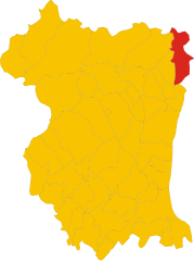
- коммуна Италии
 Hiking in Кастельново-дель-Фриули
Castelnovo del Friuli is a charming municipality located in the Friuli Venezia Giulia region of northern Italy. It's an excellent destination for hiking enthusiasts, as it offers a variety of landscapes, including hills, forests, and stunning views of the surrounding mountains.
Trails and Routes
-
Sentiero del Cormor: This trail follows the Cormor River and offers a scenic hike through lush greenery. It’s suitable for hikers of all levels.
-
Monte Serva: A more challenging hike, this trail leads to the summit of Monte Serva, where you can enjoy panoramic views of the Friulian plain and the surrounding Alps. This hike typically takes several hours, so be sure to bring adequate supplies and water.
-
Sanctuary of Cengledino: A popular pilgrimage route that combines beautiful scenery with cultural heritage. The path to the sanctuary offers a moderate hike and a chance to appreciate the local flora and fauna.
Best Time to Hike
The best time for hiking in Castelnovo del Friuli is during the spring (April to June) and fall (September to October) when the weather is mild and the landscapes are particularly beautiful. Summers can get hot, and winter hikes may require appropriate gear for snow and ice.
Safety Tips
- Preparation: Always check the trail conditions and weather forecast before heading out.
- Gear: Wear appropriate hiking footwear and clothing. Consider trekking poles for more challenging routes.
- Hydration: Bring plenty of water, especially on longer trails.
- Navigation: Familiarize yourself with map reading and GPS tools, as some trails may not be well-marked.
Local Attractions
After a day of hiking, you can explore the local culture and cuisine. Castelnovo del Friuli offers traditional Friulian foods, like frico (fried cheese) and various local wines.
Conclusion
Hiking in Castelnovo del Friuli is an enriching experience that combines natural beauty with cultural exploration. Whether you're a beginner or an experienced hiker, there's something for everyone in this picturesque part of Italy. Enjoy your adventure!
- Страна:

- Почтовый код: 33090
- Телефонный код: 0427
- Код автомобильного номера: PN
- Координаты: 46° 12' 31" N, 12° 53' 37" E


- GPS треки (wikiloc): [Ссылка]
- Высота над уровнем моря: 244 м m
- Площадь: 22.48 кв.км
- Население: 864
- Веб сайт: http://www.comune.castelnovo-del-friuli.pn.it
- Википедия русская: wiki(ru)
- Википедия английская: wiki(en)
- Википедия национальная: wiki(it)
- Хранилище Wikidata: Wikidata: Q53158
- Катеория в википедии: [Ссылка]
- код Freebase: [/m/0gqz3q]
- код GeoNames: Альт: [3179548]
- код BNF: [160761783]
- код VIAF: Альт: [246329995]
- ID отношения в OpenStreetMap: [79176]
- код LCNAF: Альт: [n2003057560]
- код Цифрового атласа Римской империи: [43372]
- код ISTAT: 093011
- кадастровый код Италии: C217
Граничит с регионами:
Клауцетто
- коммуна Италии
Hiking in Клауцетто
Clauzetto is a picturesque village located in the province of Pordenone in the Friuli Venezia Giulia region of Italy. Surrounded by beautiful natural landscapes, it offers various hiking opportunities perfect for outdoor enthusiasts....
- Страна:
- Почтовый код: 33090
- Телефонный код: 0427
- Код автомобильного номера: PN
- Координаты: 46° 14' 0" N, 12° 55' 0" E
- GPS треки (wikiloc): [Ссылка]
- Высота над уровнем моря: 454 м m
- Площадь: 28.31 кв.км
- Население: 380
- Веб сайт: [Ссылка]


Пинцано-аль-Тальяменто
- коммуна Италии
Hiking in Пинцано-аль-Тальяменто
Pinzano al Tagliamento, located in the Friuli Venezia Giulia region of northeastern Italy, is an excellent destination for hiking enthusiasts. The area is characterized by its stunning natural landscapes, including rolling hills, the Tagliamento River, and lush forests....
- Страна:
- Почтовый код: 33094
- Телефонный код: 0432
- Код автомобильного номера: PN
- Координаты: 46° 10' 59" N, 12° 56' 43" E
- GPS треки (wikiloc): [Ссылка]
- Высота над уровнем моря: 201 м m
- Площадь: 21.95 кв.км
- Население: 1514
- Веб сайт: [Ссылка]


Трамонти-ди-Сотто
- коммуна Италии
Hiking in Трамонти-ди-Сотто
Tramonti di Sotto is a picturesque village located in the Friuli Venezia Giulia region of northeastern Italy, nestled within the Julian Alps. The area is known for its natural beauty, offering a range of hiking opportunities suitable for various skill levels. Here are some highlights of hiking in the region:...
- Страна:
- Почтовый код: 33090
- Телефонный код: 0427
- Код автомобильного номера: PN
- Координаты: 46° 17' 0" N, 12° 48' 0" E
- GPS треки (wikiloc): [Ссылка]
- Высота над уровнем моря: 366 м m
- Площадь: 85.55 кв.км
- Население: 367
- Веб сайт: [Ссылка]


Травезио
- коммуна Италии
Hiking in Травезио
Travesio is a picturesque town located in the Friuli-Venezia Giulia region of northeastern Italy. Surrounded by mountains and lush landscapes, it offers a variety of hiking opportunities for both novice and experienced hikers....
- Страна:
- Почтовый код: 33090
- Телефонный код: 0427
- Код автомобильного номера: PN
- Координаты: 46° 11' 52" N, 12° 52' 12" E
- GPS треки (wikiloc): [Ссылка]
- Высота над уровнем моря: 226 м m
- Площадь: 28.38 кв.км
- Население: 1790
- Веб сайт: [Ссылка]

Вито-д'Азио
- коммуна Италии
Hiking in Вито-д'Азио
Vito d'Asio is a picturesque village located in the Friuli Venezia Giulia region of northern Italy. Surrounded by the beautiful landscapes of the eastern Alps, this area offers various hiking opportunities for both beginners and experienced hikers. Here are some highlights and tips for hiking in Vito d'Asio:...
- Страна:
- Почтовый код: 33090
- Телефонный код: 0427
- Код автомобильного номера: PN
- Координаты: 46° 14' 0" N, 12° 56' 0" E
- GPS треки (wikiloc): [Ссылка]
- Высота над уровнем моря: 381 м m
- Площадь: 53.72 кв.км
- Население: 734
- Веб сайт: [Ссылка]