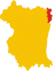
Пинцано-аль-Тальяменто (Pinzano al Tagliamento, Pinzano al Tagliamento)

.svg)
- коммуна Италии
 Hiking in Пинцано-аль-Тальяменто
Pinzano al Tagliamento, located in the Friuli Venezia Giulia region of northeastern Italy, is an excellent destination for hiking enthusiasts. The area is characterized by its stunning natural landscapes, including rolling hills, the Tagliamento River, and lush forests.
Hiking Trails and Routes:
-
Sentiero degli Aranci: This trail offers a moderate hike through scenic orchards and picturesque views of the surrounding countryside. It's suitable for hikers of various skill levels.
-
Cansiglio Forest Trails: A bit further afield, the Cansiglio Forest has numerous trails that meander through one of the oldest forests in Italy. The trails vary in difficulty and provide great opportunities for wildlife spotting.
-
Tagliamento River Path: Following the river, this path allows hikers to enjoy the natural beauty and biodiversity of the riverbanks. Ideal for leisurely walks or more extended hikes.
-
Monte S. Marco: For those seeking a challenge, hiking to Monte S. Marco offers rewarding panoramic views of the surrounding valleys and mountains.
Best Time for Hiking:
- Spring (April to June): Ideal for hiking as the weather is mild and the landscapes are lush and vibrant.
- Fall (September to October): Another great time, with cooler temperatures and beautiful autumn colors.
Tips for Hiking in Pinzano al Tagliamento:
- Footwear: Wear sturdy hiking shoes to navigate the sometimes uneven terrain.
- Water and Snacks: Always carry enough water and some light snacks to keep your energy up during hikes.
- Weather Check: Be sure to check the weather forecast and prepare accordingly; conditions can change quickly in mountainous areas.
- Maps and Navigation: While many trails are well-marked, carrying a map or a GPS device is advisable, especially on longer or less familiar routes.
- Local Regulations: Respect local wildlife and follow any guidelines to preserve the natural environment.
Whether you're a beginner or an experienced hiker, Pinzano al Tagliamento provides a diverse and beautiful setting for outdoor activities. Enjoy your adventure!
- Страна:

- Почтовый код: 33094
- Телефонный код: 0432
- Код автомобильного номера: PN
- Координаты: 46° 10' 59" N, 12° 56' 43" E


- GPS треки (wikiloc): [Ссылка]
- Высота над уровнем моря: 201 м m
- Площадь: 21.95 кв.км
- Население: 1514
- Веб сайт: http://www.comune.pinzanoaltagliamento.pn.it/
- Википедия русская: wiki(ru)
- Википедия английская: wiki(en)
- Википедия национальная: wiki(it)
- Хранилище Wikidata: Wikidata: Q53180
- Катеория в википедии: [Ссылка]
- код Freebase: [/m/0gqzgk]
- код GeoNames: Альт: [6537934]
- код VIAF: Альт: [237021615]
- ID отношения в OpenStreetMap: [79200]
- идентификатор местоположения ArchINFORM: [8558]
- UN/LOCODE: [ITZRJ]
- код ISTAT: 093030
- кадастровый код Италии: G680
Граничит с регионами:
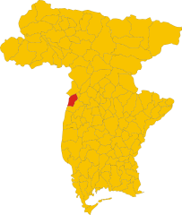
Кастельново-дель-Фриули
- коммуна Италии
Hiking in Кастельново-дель-Фриули
Castelnovo del Friuli is a charming municipality located in the Friuli Venezia Giulia region of northern Italy. It's an excellent destination for hiking enthusiasts, as it offers a variety of landscapes, including hills, forests, and stunning views of the surrounding mountains....
- Страна:
- Почтовый код: 33090
- Телефонный код: 0427
- Код автомобильного номера: PN
- Координаты: 46° 12' 31" N, 12° 53' 37" E
- GPS треки (wikiloc): [Ссылка]
- Высота над уровнем моря: 244 м m
- Площадь: 22.48 кв.км
- Население: 864
- Веб сайт: [Ссылка]
Клауцетто
- коммуна Италии
Hiking in Клауцетто
Clauzetto is a picturesque village located in the province of Pordenone in the Friuli Venezia Giulia region of Italy. Surrounded by beautiful natural landscapes, it offers various hiking opportunities perfect for outdoor enthusiasts....
- Страна:
- Почтовый код: 33090
- Телефонный код: 0427
- Код автомобильного номера: PN
- Координаты: 46° 14' 0" N, 12° 55' 0" E
- GPS треки (wikiloc): [Ссылка]
- Высота над уровнем моря: 454 м m
- Площадь: 28.31 кв.км
- Население: 380
- Веб сайт: [Ссылка]
Секуальс
- коммуна Италии
Hiking in Секуальс
Sequals is a charming town located in northeastern Italy, nestled at the foothills of the Alps. While it may not be as well-known as other hiking destinations in Italy, it offers some beautiful trails and stunning natural scenery for outdoor enthusiasts....
- Страна:
- Почтовый код: 33090
- Телефонный код: 0427
- Код автомобильного номера: PN
- Координаты: 46° 10' 0" N, 12° 50' 0" E
- GPS треки (wikiloc): [Ссылка]
- Высота над уровнем моря: 226 м m
- Площадь: 27.7 кв.км
- Население: 2231
- Веб сайт: [Ссылка]


Спилимберго
- коммуна Италии
Hiking in Спилимберго
Spilimbergo, a charming town in the Friuli Venezia Giulia region of Italy, is surrounded by beautiful landscapes that offer numerous hiking opportunities. The area is rich in natural beauty, including rolling hills, vineyards, and the nearby Alps, making it an excellent destination for outdoor enthusiasts. Here are some key points to consider when planning a hiking trip in Spilimbergo:...
- Страна:
- Почтовый код: 33097
- Телефонный код: 0427
- Код автомобильного номера: PN
- Координаты: 46° 6' 41" N, 12° 54' 6" E
- GPS треки (wikiloc): [Ссылка]
- Высота над уровнем моря: 132 м m
- Площадь: 71.88 кв.км
- Население: 12151
- Веб сайт: [Ссылка]


Травезио
- коммуна Италии
Hiking in Травезио
Travesio is a picturesque town located in the Friuli-Venezia Giulia region of northeastern Italy. Surrounded by mountains and lush landscapes, it offers a variety of hiking opportunities for both novice and experienced hikers....
- Страна:
- Почтовый код: 33090
- Телефонный код: 0427
- Код автомобильного номера: PN
- Координаты: 46° 11' 52" N, 12° 52' 12" E
- GPS треки (wikiloc): [Ссылка]
- Высота над уровнем моря: 226 м m
- Площадь: 28.38 кв.км
- Население: 1790
- Веб сайт: [Ссылка]

Вито-д'Азио
- коммуна Италии
Hiking in Вито-д'Азио
Vito d'Asio is a picturesque village located in the Friuli Venezia Giulia region of northern Italy. Surrounded by the beautiful landscapes of the eastern Alps, this area offers various hiking opportunities for both beginners and experienced hikers. Here are some highlights and tips for hiking in Vito d'Asio:...
- Страна:
- Почтовый код: 33090
- Телефонный код: 0427
- Код автомобильного номера: PN
- Координаты: 46° 14' 0" N, 12° 56' 0" E
- GPS треки (wikiloc): [Ссылка]
- Высота над уровнем моря: 381 м m
- Площадь: 53.72 кв.км
- Население: 734
- Веб сайт: [Ссылка]


Форгария-нель-Фриули
- коммуна Италии
Hiking in Форгария-нель-Фриули
Forgaria nel Friuli is a picturesque town located in the Friuli-Venezia Giulia region of Italy. Nestled near the eastern foothills of the Carnic Alps, it offers a range of hiking opportunities suitable for various skill levels. Here are some highlights of hiking in this area:...
- Страна:
- Почтовый код: 33030
- Телефонный код: 0427
- Код автомобильного номера: UD
- Координаты: 46° 13' 0" N, 12° 58' 0" E
- GPS треки (wikiloc): [Ссылка]
- Высота над уровнем моря: 270 м m
- Площадь: 28.94 кв.км
- Население: 1773
- Веб сайт: [Ссылка]

Рагонья
- коммуна Италии
Hiking in Рагонья
Ragogna is a lovely location situated in the Friuli Venezia Giulia region of northeastern Italy. Nestled in the foothills of the Alps, it offers stunning landscapes and a variety of hiking opportunities. Here are some key points to consider when planning a hike in Ragogna:...
- Страна:
- Почтовый код: 33030
- Телефонный код: 0432
- Код автомобильного номера: UD
- Координаты: 46° 11' 18" N, 12° 59' 42" E
- GPS треки (wikiloc): [Ссылка]
- Высота над уровнем моря: 235 м m
- Площадь: 22.03 кв.км
- Население: 2858
- Веб сайт: [Ссылка]


Сан-Даниэле-дель-Фриули
- коммуна Италии
Hiking in Сан-Даниэле-дель-Фриули
San Daniele del Friuli, located in the Friuli Venezia Giulia region of northeastern Italy, is known not only for its famous prosciutto but also for its picturesque landscapes and hiking opportunities. The area is characterized by rolling hills, vineyards, and lush countryside, making it an appealing destination for hiking enthusiasts....
- Страна:
- Почтовый код: 33038
- Телефонный код: 0432
- Код автомобильного номера: UD
- Координаты: 46° 9' 0" N, 13° 1' 0" E
- GPS треки (wikiloc): [Ссылка]
- Высота над уровнем моря: 252 м m
- Площадь: 34.78 кв.км
- Население: 7987
- Веб сайт: [Ссылка]