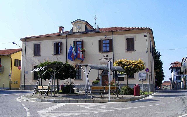
Кавур (Cavour, Cavour)
- коммуна Италии
 Hiking in Кавур
Cavour, located in the Piedmont region of Italy, is a charming town that offers a variety of hiking opportunities for outdoor enthusiasts. Surrounded by beautiful landscapes, including rolling hills, forests, and scenic views of the Alps, Cavour serves as a great base for a range of hiking experiences. Here are some highlights related to hiking in and around Cavour:
Trails and Routes
-
Parco Naturale del Monviso: A bit further from Cavour, this park offers numerous trails with spectacular views of the Monviso mountain. You can find routes that range from easy walks to more challenging hikes.
-
Lago di Cavour: Around the lake, there are gentle trails perfect for leisurely walks, suitable for families and those looking for a more relaxed hiking experience. The area is also great for birdwatching and enjoying nature.
-
Sentiero del Cavour: This is a local trail that connects various points of interest in the region, allowing hikers to explore the surroundings while learning about local history and culture.
Tips for Hiking in Cavour
- Season: Spring and early autumn are ideal for hiking, as the weather is generally mild and the landscapes are vibrant with flora.
- Trail Maps: It’s advisable to obtain local trail maps or use hiking apps to help navigate the routes.
- Prepare for Varied Terrain: Trails can vary from easy to moderate, so wear appropriate footwear and carry water and snacks.
- Local Guides: Consider hiring a local guide for an enriching experience that includes insights into the area's flora, fauna, and history.
Nearby Attractions
- Castello di Cavour: While not a hiking destination, this historic castle can be a stop on your hike, offering a glimpse into the region's past.
- Food and Wine: After your hike, explore the local cuisine. Piedmont is known for its delicious food and wines, making it a perfect reward after a day on the trails.
Conclusion
Hiking in Cavour, Piedmont, offers a beautiful combination of nature, history, and culinary delights. With varying trails suitable for all levels, it’s an excellent destination for those looking to enjoy the great outdoors in Italy. Always check local guidelines and weather conditions before heading out, and ensure you take the necessary precautions for a safe and enjoyable hiking experience.
- Страна:

- Почтовый код: 10061
- Телефонный код: 0121
- Код автомобильного номера: TO
- Координаты: 44° 47' 0" N, 7° 23' 0" E


- GPS треки (wikiloc): [Ссылка]
- Высота над уровнем моря: 300 м m
- Площадь: 48.96 кв.км
- Население: 5492
- Веб сайт: http://www.comune.cavour.to.it/
- Википедия русская: wiki(ru)
- Википедия английская: wiki(en)
- Википедия национальная: wiki(it)
- Хранилище Wikidata: Wikidata: Q9239
- Катеория в википедии: [Ссылка]
- код Freebase: [/m/0g6v78]
- код GeoNames: Альт: [6539897]
- ID отношения в OpenStreetMap: [43604]
- место в MusicBrainz: [84f852ba-3d51-4899-bf6f-c303233c07b4]
- UN/LOCODE: [ITCOU]
- код Цифрового атласа Римской империи: [17202]
- код ISTAT: 001070
- кадастровый код Италии: C404
Граничит с регионами:


Вигоне
- коммуна в Италии
Hiking in Вигоне
Vigone, located in the Piedmont region of Italy, offers a beautiful setting for hiking enthusiasts, especially for those who enjoy traversing through scenic landscapes and charming countryside. While Vigone itself may not be as well-known for extensive hiking trails as some larger national parks or mountain ranges, it provides access to various routes that can cater to different skill levels....
- Страна:
- Почтовый код: 10067
- Телефонный код: 011
- Код автомобильного номера: TO
- Координаты: 44° 51' 0" N, 7° 30' 0" E
- GPS треки (wikiloc): [Ссылка]
- Высота над уровнем моря: 160 м m
- Площадь: 41.15 кв.км
- Население: 5168
- Веб сайт: [Ссылка]


Виллафранка-Пьемонте
- коммуна в Италии
Hiking in Виллафранка-Пьемонте
Villafranca Piemonte is a charming municipality located in the Piedmont region of Italy, not too far from the city of Turin. This area is known for its beautiful landscapes, rich history, and access to various outdoor activities, including hiking. The surrounding countryside features rolling hills, vineyards, and plenty of nature, making it an ideal destination for those who enjoy exploring the great outdoors....
- Страна:
- Почтовый код: 10068
- Телефонный код: 011
- Код автомобильного номера: TO
- Координаты: 44° 47' 0" N, 7° 30' 0" E
- GPS треки (wikiloc): [Ссылка]
- Высота над уровнем моря: 253 м m
- Площадь: 50.79 кв.км
- Население: 4658
- Веб сайт: [Ссылка]
Баньоло-Пьемонте
- коммуна Италии
Hiking in Баньоло-Пьемонте
Bagnolo Piemonte is a picturesque village located in the Province of Cuneo in the Piedmont region of northern Italy. Nestled in the foothills of the Alps, it offers a range of beautiful hiking opportunities suitable for various skill levels....
- Страна:
- Почтовый код: 12031
- Телефонный код: 0175
- Код автомобильного номера: CN
- Координаты: 44° 46' 0" N, 7° 19' 0" E
- GPS треки (wikiloc): [Ссылка]
- Площадь: 63.25 кв.км
- Население: 5969
- Веб сайт: [Ссылка]

Бардже
- коммуна Италии
Hiking in Бардже
Barge is a small town located in the Piedmont region of Italy, surrounded by beautiful natural landscapes, making it a great destination for hiking enthusiasts. Here’s what you can expect when hiking in and around Barge:...
- Страна:
- Почтовый код: 12032
- Телефонный код: 0175
- Код автомобильного номера: CN
- Координаты: 44° 44' 0" N, 7° 19' 0" E
- GPS треки (wikiloc): [Ссылка]
- Высота над уровнем моря: 316 м m
- Площадь: 81.99 кв.км
- Население: 7699
- Веб сайт: [Ссылка]
Бибьяна
- коммуна в Италии
Hiking in Бибьяна
Bibiana, located in the Piedmont region of Italy, is a charming destination for hiking enthusiasts. Nestled in the Susa Valley, it offers stunning landscapes characterized by rolling hills, wooded areas, and panoramic views of the surrounding mountains, including the Alps....
- Страна:
- Почтовый код: 10060
- Телефонный код: 0121
- Код автомобильного номера: TO
- Координаты: 44° 48' 0" N, 7° 17' 0" E
- GPS треки (wikiloc): [Ссылка]
- Высота над уровнем моря: 320 м m
- Площадь: 18.6 кв.км
- Население: 3463
- Веб сайт: [Ссылка]


Брикеразио
- коммуна Италии
Hiking in Брикеразио
Bricherasio is a charming hilltop town located in the Piedmont region of Italy, surrounded by beautiful natural landscapes, making it an excellent place for hiking enthusiasts. The area offers a variety of trails that cater to different levels of experience, from leisurely walks to more challenging hikes....
- Страна:
- Почтовый код: 10060
- Телефонный код: 0121
- Код автомобильного номера: TO
- Координаты: 44° 49' 28" N, 7° 18' 23" E
- GPS треки (wikiloc): [Ссылка]
- Высота над уровнем моря: 400 м m
- Площадь: 22.76 кв.км
- Население: 4608
- Веб сайт: [Ссылка]


Кампильоне-Фениле
- коммуна Италии
Hiking in Кампильоне-Фениле
Campiglione-Fenile is a picturesque village located in the Tuscan region of Italy, near the city of Pistoia. It offers a variety of hiking opportunities, combining beautiful landscapes, historical sites, and the charm of rural Italy. Here are some aspects to consider for hiking in this area:...
- Страна:
- Почтовый код: 10060
- Телефонный код: 0121
- Код автомобильного номера: TO
- Координаты: 44° 48' 10" N, 7° 19' 27" E
- GPS треки (wikiloc): [Ссылка]
- Высота над уровнем моря: 365 м m
- Площадь: 11.09 кв.км
- Население: 1370
- Веб сайт: [Ссылка]
Гарцильяна
- коммуна Италии
Hiking in Гарцильяна
Garzigliana is a small municipality located in the province of Turin in the Piedmont region of Italy. While it may not be as widely known as some of the more prominent hiking destinations, there are opportunities for outdoor enthusiasts to explore the beautiful natural landscapes surrounding the area....
- Страна:
- Почтовый код: 10060
- Телефонный код: 0121
- Код автомобильного номера: TO
- Координаты: 44° 50' 0" N, 7° 22' 0" E
- GPS треки (wikiloc): [Ссылка]
- Высота над уровнем моря: 314 м m
- Площадь: 7.4 кв.км
- Население: 541
- Веб сайт: [Ссылка]

Мачелло
- коммуна Италии
Hiking in Мачелло
It seems like there might be a slight misunderstanding regarding "Macello." If you are referring to a specific location, please clarify, as "Macello" might not be widely recognized as a hiking destination....
- Страна:
- Почтовый код: 10060
- Телефонный код: 0121
- Код автомобильного номера: TO
- Координаты: 44° 51' 0" N, 7° 24' 0" E
- GPS треки (wikiloc): [Ссылка]
- Высота над уровнем моря: 301 м m
- Площадь: 14.14 кв.км
- Население: 1175
- Веб сайт: [Ссылка]