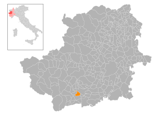
Брикеразио (Bricherasio, Bricherasio)

- коммуна Италии
 Hiking in Брикеразио
Bricherasio is a charming hilltop town located in the Piedmont region of Italy, surrounded by beautiful natural landscapes, making it an excellent place for hiking enthusiasts. The area offers a variety of trails that cater to different levels of experience, from leisurely walks to more challenging hikes.
Hiking Trails
-
Local Trails: The trails around Bricherasio often weave through vineyards, forests, and past small chapels, providing a unique blend of nature and local culture. These paths are typically well-marked and offer stunning views of the surrounding countryside and the Alps.
-
Castello di Bricherasio: A hike to the nearby Castle of Bricherasio can be a rewarding experience. The castle’s ruins offer scenic views, and the trail leading up to it is a moderate hike suitable for many hikers.
-
Val Pellice: Just a short distance from Bricherasio, Val Pellice offers more extensive hiking options. There are numerous trails ranging from easy to difficult, providing access to beautiful valleys, waterfalls, and panoramic vistas. The area is also rich in biodiversity and local flora and fauna.
-
Parco Naturale delle Alpi Marittime: For more adventurous hikers, a drive to the Alpi Marittime Natural Park, about an hour from Bricherasio, opens up a world of high-altitude trekking with breathtaking mountain scenery.
Tips for Hiking in Bricherasio
- Timing: Spring and autumn are ideal seasons for hiking, with mild weather and stunning foliage. Summer can be hot, so early morning hikes are recommended.
- Footwear: Good hiking boots are essential, as some trails may be rocky or uneven.
- Water and Snacks: Always carry enough water and some snacks, especially for longer hikes.
- Trail Maps: It’s advisable to have a trail map or a reliable GPS app, as some trails may not be well-marked.
- Respect Nature: Practice Leave No Trace principles by taking your trash with you and respecting wildlife.
Conclusion
Hiking in and around Bricherasio can be a fulfilling experience for both novice and experienced hikers. With beautiful landscapes, cultural landmarks, and a welcoming atmosphere, this hidden gem in Piedmont offers a unique hiking experience. Whether you’re looking to explore local trails or venture into the surrounding valleys, Bricherasio has something to offer for every outdoor enthusiast.
- Страна:

- Почтовый код: 10060
- Телефонный код: 0121
- Код автомобильного номера: TO
- Координаты: 44° 49' 28" N, 7° 18' 23" E


- GPS треки (wikiloc): [Ссылка]
- Высота над уровнем моря: 400 м m
- Площадь: 22.76 кв.км
- Население: 4608
- Веб сайт: http://www.comune.bricherasio.to.it/
- Википедия русская: wiki(ru)
- Википедия английская: wiki(en)
- Википедия национальная: wiki(it)
- Хранилище Wikidata: Wikidata: Q9080
- Катеория в википедии: [Ссылка]
- код Freebase: [/m/0g6t2d]
- код GeoNames: Альт: [6537258]
- код VIAF: Альт: [304911308]
- ID отношения в OpenStreetMap: [43653]
- код TGN: [1043640]
- UN/LOCODE: [ITBHS]
- код ISTAT: 001035
- кадастровый код Италии: B171
Граничит с регионами:
Праростино
- коммуна Италии
Hiking in Праростино
Prarostino is a charming village located in the Piedmont region of Italy, nestled within the Susa Valley and surrounded by the breathtaking landscapes of the Italian Alps. It is an excellent destination for hiking enthusiasts, thanks to its diverse trails and stunning natural beauty....
- Страна:
- Почтовый код: 10060
- Телефонный код: 0121
- Код автомобильного номера: TO
- Координаты: 44° 52' 0" N, 7° 16' 0" E
- GPS треки (wikiloc): [Ссылка]
- Высота над уровнем моря: 738 м m
- Площадь: 10.51 кв.км
- Население: 1271
- Веб сайт: [Ссылка]

Сан-Секондо-ди-Пинероло
- коммуна в Италии
Hiking in Сан-Секондо-ди-Пинероло
San Secondo di Pinerolo is a charming municipality in the Piedmont region of Italy, located near the foothills of the Susa Valley and the broader Alps. Hiking in this area offers a mix of scenic views, historical sites, and a rich natural environment. Here’s what you can expect:...
- Страна:
- Почтовый код: 10060
- Телефонный код: 0121
- Код автомобильного номера: TO
- Координаты: 44° 52' 0" N, 7° 18' 0" E
- GPS треки (wikiloc): [Ссылка]
- Высота над уровнем моря: 413 м m
- Площадь: 12.57 кв.км
- Население: 3632
- Веб сайт: [Ссылка]


Ангронья
- коммуна Италии
Hiking in Ангронья
Angrogna, located in the Piedmont region of northern Italy, is an excellent destination for hiking enthusiasts. Nestled in the Susa Valley, it offers breathtaking landscapes, rich history, and an array of trails suited for various skill levels. Here are some key highlights about hiking in Angrogna:...
- Страна:
- Почтовый код: 10060
- Телефонный код: 0121
- Код автомобильного номера: TO
- Координаты: 44° 51' 0" N, 7° 13' 0" E
- GPS треки (wikiloc): [Ссылка]
- Высота над уровнем моря: 782 м m
- Площадь: 38.88 кв.км
- Население: 868
- Веб сайт: [Ссылка]
Бибьяна
- коммуна в Италии
Hiking in Бибьяна
Bibiana, located in the Piedmont region of Italy, is a charming destination for hiking enthusiasts. Nestled in the Susa Valley, it offers stunning landscapes characterized by rolling hills, wooded areas, and panoramic views of the surrounding mountains, including the Alps....
- Страна:
- Почтовый код: 10060
- Телефонный код: 0121
- Код автомобильного номера: TO
- Координаты: 44° 48' 0" N, 7° 17' 0" E
- GPS треки (wikiloc): [Ссылка]
- Высота над уровнем моря: 320 м m
- Площадь: 18.6 кв.км
- Население: 3463
- Веб сайт: [Ссылка]


Кампильоне-Фениле
- коммуна Италии
Hiking in Кампильоне-Фениле
Campiglione-Fenile is a picturesque village located in the Tuscan region of Italy, near the city of Pistoia. It offers a variety of hiking opportunities, combining beautiful landscapes, historical sites, and the charm of rural Italy. Here are some aspects to consider for hiking in this area:...
- Страна:
- Почтовый код: 10060
- Телефонный код: 0121
- Код автомобильного номера: TO
- Координаты: 44° 48' 10" N, 7° 19' 27" E
- GPS треки (wikiloc): [Ссылка]
- Высота над уровнем моря: 365 м m
- Площадь: 11.09 кв.км
- Население: 1370
- Веб сайт: [Ссылка]

Кавур
- коммуна Италии
Hiking in Кавур
Cavour, located in the Piedmont region of Italy, is a charming town that offers a variety of hiking opportunities for outdoor enthusiasts. Surrounded by beautiful landscapes, including rolling hills, forests, and scenic views of the Alps, Cavour serves as a great base for a range of hiking experiences. Here are some highlights related to hiking in and around Cavour:...
- Страна:
- Почтовый код: 10061
- Телефонный код: 0121
- Код автомобильного номера: TO
- Координаты: 44° 47' 0" N, 7° 23' 0" E
- GPS треки (wikiloc): [Ссылка]
- Высота над уровнем моря: 300 м m
- Площадь: 48.96 кв.км
- Население: 5492
- Веб сайт: [Ссылка]
Гарцильяна
- коммуна Италии
Hiking in Гарцильяна
Garzigliana is a small municipality located in the province of Turin in the Piedmont region of Italy. While it may not be as widely known as some of the more prominent hiking destinations, there are opportunities for outdoor enthusiasts to explore the beautiful natural landscapes surrounding the area....
- Страна:
- Почтовый код: 10060
- Телефонный код: 0121
- Код автомобильного номера: TO
- Координаты: 44° 50' 0" N, 7° 22' 0" E
- GPS треки (wikiloc): [Ссылка]
- Высота над уровнем моря: 314 м m
- Площадь: 7.4 кв.км
- Население: 541
- Веб сайт: [Ссылка]


Лузерна-Сан-Джованни
- коммуна Италии
Hiking in Лузерна-Сан-Джованни
Luserna San Giovanni, located in the Piedmont region of Italy, is a fantastic destination for hiking enthusiasts. Nestled in the Susa Valley and surrounded by the picturesque foothills of the Alps, it offers a variety of trails that cater to hikers of different skill levels....
- Страна:
- Почтовый код: 10062
- Телефонный код: 0121
- Код автомобильного номера: TO
- Координаты: 44° 49' 0" N, 7° 15' 0" E
- GPS треки (wikiloc): [Ссылка]
- Высота над уровнем моря: 475 м m
- Площадь: 17.74 кв.км
- Население: 7297
- Веб сайт: [Ссылка]

Озаско
- коммуна Италии
Hiking in Озаско
Osasco, located in the Piedmont region of Italy, offers some beautiful hiking opportunities that allow you to explore the stunning landscapes of the area. Although it is primarily known as an urban center, Osasco is surrounded by nature and has access to various trails suited for different skill levels....
- Страна:
- Почтовый код: 10060
- Телефонный код: 0121
- Код автомобильного номера: TO
- Координаты: 44° 51' 0" N, 7° 21' 0" E
- GPS треки (wikiloc): [Ссылка]
- Высота над уровнем моря: 344 м m
- Площадь: 5.49 кв.км
- Население: 1152
- Веб сайт: [Ссылка]