Целле (Celle, Landkreis Celle)

 Hiking in Целле
Celle district, located in Lower Saxony, Germany, offers a variety of hiking opportunities surrounded by beautiful landscapes, historic towns, and natural parks. Here are some highlights for hiking enthusiasts in the area:
Trails and Nature Areas
-
Lüneburg Heath (Lüneburger Heide): Just south of Celle, this famous natural area features heaths, woodlands, and charming villages. You can find numerous well-marked trails that vary in length and difficulty, ideal for leisurely walks or more strenuous hikes.
-
Aller River Trail (Aller-Höhenweg): This scenic trail follows the Aller River and provides picturesque views of the riverbanks, forests, and meadows. It's a great option for both hiking and cycling.
-
Celler Stadtwald: The city forest in Celle offers easy hiking paths where you can enjoy nature without venturing too far from the city. It's perfect for a quick escape into nature.
-
Nature Reserves: Explore the various nature reserves around Celle, such as the Bockelskamp Nature Reserve, where you can see diverse wildlife and enjoy quiet walks through natural settings.
Historical and Cultural Highlights
- Celle’s Old Town: While not a hiking trail per se, exploring the charming half-timbered houses and the historic old town can be a delightful addition to your hiking experience.
- Burg Celle: The Celle Castle and its gardens provide an excellent place to start or end your hike, with historical insights along the way.
Tips for Hiking in Celle District
- Maps and Guides: Make sure to have a good hiking map or use a navigation app that highlights trails. The local tourist information center can provide guidance and resources.
- Weather Considerations: Check the weather before heading out, as conditions can change, especially in wooded areas.
- Footwear and Gear: Wear sturdy hiking boots suitable for variable terrain, and bring along enough water and snacks.
- Wildlife Awareness: Be aware of local wildlife and plants; practice Leave No Trace principles to keep the area clean and safe for nature.
Conclusion
Celle district is a great spot for hikers of all levels, whether you're looking for a peaceful walk in nature or a more challenging trail. With its beautiful landscapes and rich history, there’s much to explore!
- Страна:

- Код автомобильного номера: CE
- Координаты: 52° 34' 48" N, 10° 4' 48" E


- GPS треки (wikiloc): [Ссылка]
- Высота над уровнем моря: 59 м m
- Площадь: 1554.00 кв.км
- Население: 178370
- Веб сайт: http://www.landkreis-celle.de/
- Википедия русская: wiki(ru)
- Википедия английская: wiki(en)
- Википедия национальная: wiki(de)
- Хранилище Wikidata: Wikidata: Q5919
- Галерея изображений в википедии: [Ссылка]
- Катеория в википедии: [Ссылка]
- код Freebase: [/m/013b23]
- код Freebase: [/m/013b23]
- код GeoNames: Альт: [2940212]
- код GeoNames: Альт: [2940212]
- код VIAF: Альт: [132971495]
- код VIAF: Альт: [132971495]
- ID отношения в OpenStreetMap: [62608]
- ID отношения в OpenStreetMap: [62608]
- код GND: Альт: [4009660-9]
- код GND: Альт: [4009660-9]
- идентификатор местоположения ArchINFORM: [2362]
- идентификатор местоположения ArchINFORM: [2362]
- код TGN: [7205912]
- код TGN: [7205912]
- код NLI: [000992137]
- код NLI: [000992137]
- код NUTS: [DE931]
- код NUTS: [DE931]
- код района Германии: 03351
- код района Германии: 03351
Граничит с регионами:
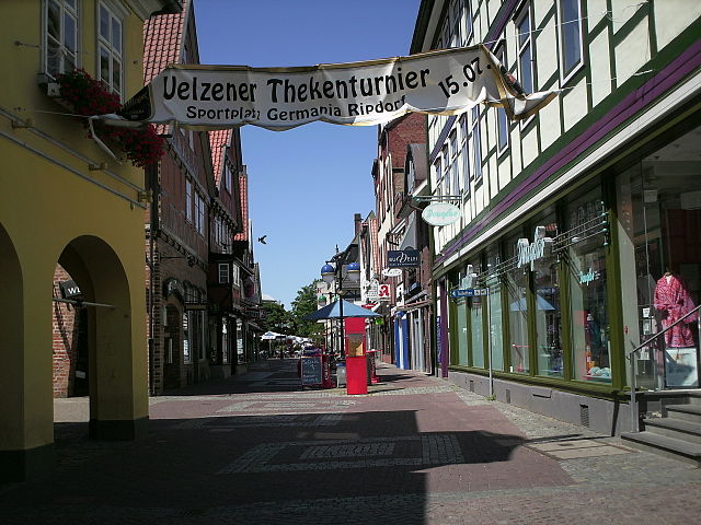

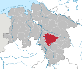
Ильцен
- район в Нижней Саксонии (Германия)
Hiking in Ильцен
Uelzen District in Lower Saxony, Germany, offers a variety of hiking opportunities for outdoor enthusiasts. While it might not be as widely known for hiking as some other regions, it provides beautiful natural scenery, charming villages, and historical sites to explore. Here are some aspects to consider for hiking in Uelzen:...
- Страна:
- Код автомобильного номера: UE
- Координаты: 53° 0' 0" N, 10° 34' 48" E
- GPS треки (wikiloc): [Ссылка]
- Высота над уровнем моря: 32 м m
- Площадь: 1454.00 кв.км
- Население: 92961
- Веб сайт: [Ссылка]


Зольтау-Фаллингбостель
Hiking in Зольтау-Фаллингбостель
Heidekreis, located in Lower Saxony, Germany, offers a variety of hiking opportunities amidst beautiful natural landscapes. The region is characterized by its mix of heathlands, forests, and moorlands, making it an attractive destination for outdoor enthusiasts....
- Страна:
- Столица: Бад-Фаллингбостель
- Код автомобильного номера: HK
- Координаты: 52° 55' 12" N, 9° 45' 0" E
- GPS треки (wikiloc): [Ссылка]
- Высота над уровнем моря: 64 м m
- Площадь: 1873.50 кв.км
- Население: 139641
- Веб сайт: [Ссылка]

Ганновер
- район в Германии
Hiking in Ганновер
The Hanover Region, located in Lower Saxony, Germany, offers a variety of hiking opportunities for both beginners and experienced hikers alike. With its mix of natural landscapes, historical sites, and well-maintained trails, the region is a great destination for outdoor enthusiasts....
- Страна:
- Столица: Ганновер
- Код автомобильного номера: H
- Координаты: 52° 25' 12" N, 9° 43' 12" E
- GPS треки (wikiloc): [Ссылка]
- Высота над уровнем моря: 55 м m
- Площадь: 2291 кв.км
- Население: 1149594
- Веб сайт: [Ссылка]


Гифхорн
- район в земле Нижняя Саксония (Германия)
Hiking in Гифхорн
Gifhorn, located in Lower Saxony, Germany, is surrounded by beautiful landscapes that offer a variety of hiking opportunities. The district is characterized by its picturesque lakes, forests, and gentle hills, making it an attractive destination for hikers of all skill levels....
- Страна:
- Столица: Гифхорн
- Код автомобильного номера: GF
- Координаты: 52° 29' 0" N, 10° 33' 0" E
- GPS треки (wikiloc): [Ссылка]
- Высота над уровнем моря: 63 м m
- Площадь: 1563.00 кв.км
- Население: 174749
- Веб сайт: [Ссылка]