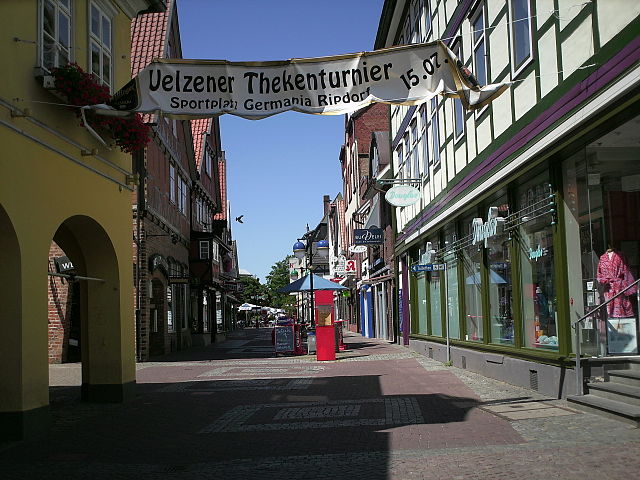
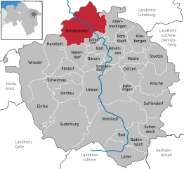
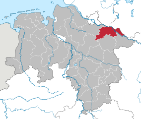
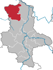
Ильцен (Uelzen District, Landkreis Uelzen)

- район в Нижней Саксонии (Германия)
 Hiking in Ильцен
Uelzen District in Lower Saxony, Germany, offers a variety of hiking opportunities for outdoor enthusiasts. While it might not be as widely known for hiking as some other regions, it provides beautiful natural scenery, charming villages, and historical sites to explore. Here are some aspects to consider for hiking in Uelzen:
Scenic Trails
-
Lüneburg Heath (Lüneburger Heide): Just south of Uelzen, this unique heathland is known for its picturesque landscapes, especially when the heather is in bloom during late summer. There are numerous trails ranging from easy walks to more challenging hikes.
-
The Ilmenau River: Following the Ilmenau River, you can find tranquil paths suitable for leisurely hikes. The riverside offers beautiful views and a chance to observe local wildlife.
-
Historical Sites: While hiking, you might encounter interesting historical buildings and sites. Uelzen itself has some impressive architecture, including the famous Uelzen train station designed by the architect Heinrich Tessenow.
Nature Reserves
- The Radenbachtal Nature Reserve: This region features diverse habitats, including wetlands and woodlands. Trails lead through areas rich in flora and fauna, providing an excellent opportunity for nature observation.
Local Hiking Clubs
- Connecting with local hiking clubs can enhance your experience. They often organize guided hikes and offer valuable knowledge about the best trails and safety tips.
Preparation Tips
- Trail Maps: Ensure you have a good map or download trails on your GPS for navigation, as some areas might be less marked.
- Weather Awareness: The weather can change quickly, so check the forecast before heading out and dress in layers.
- Safety Gear: Wear sturdy hiking boots and carry plenty of water, snacks, and a first-aid kit.
Conclusion
While Uelzen District may not be a major hiking destination, it offers peaceful trails and scenic beauty for those looking to explore the outdoors. Whether you prefer leisurely walks or more vigorous hikes, be sure to enjoy the natural and cultural surroundings of this charming part of Germany.
- Страна:

- Код автомобильного номера: UE
- Координаты: 53° 0' 0" N, 10° 34' 48" E


- GPS треки (wikiloc): [Ссылка]
- Высота над уровнем моря: 32 м m
- Площадь: 1454.00 кв.км
- Население: 92961
- Веб сайт: http://www.landkreis-uelzen.de/
- Википедия русская: wiki(ru)
- Википедия английская: wiki(en)
- Википедия национальная: wiki(de)
- Хранилище Wikidata: Wikidata: Q5915
- Катеория в википедии: [Ссылка]
- код Freebase: [/m/0139d3]
- код Freebase: [/m/0139d3]
- код GeoNames: Альт: [3221049]
- код GeoNames: Альт: [3221049]
- код VIAF: Альт: [145424947]
- код VIAF: Альт: [145424947]
- ID отношения в OpenStreetMap: [62743]
- ID отношения в OpenStreetMap: [62743]
- код GND: Альт: [4061446-3]
- код GND: Альт: [4061446-3]
- идентификатор местоположения ArchINFORM: [9236]
- идентификатор местоположения ArchINFORM: [9236]
- код LCNAF: Альт: [n81055392]
- код LCNAF: Альт: [n81055392]
- код TGN: [7076849]
- код TGN: [7076849]
- код NLI: [000985135]
- код NLI: [000985135]
- код NUTS: [DE93A]
- код NUTS: [DE93A]
- код района Германии: 03360
- код района Германии: 03360
Включает регионы:

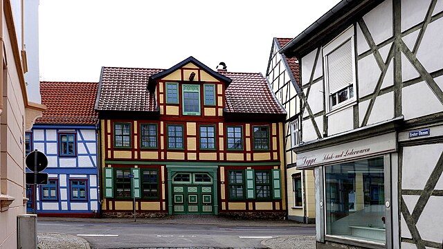
Ильцен
- община Германии
Hiking in Ильцен
Uelzen, located in Lower Saxony, Germany, is a charming town known for its picturesque landscapes and opportunities for hiking. The region surrounding Uelzen offers a variety of trails that cater to different skill levels, making it a great destination for both novice and experienced hikers....
- Страна:
- Почтовый код: 29525
- Телефонный код: 0581
- Код автомобильного номера: UE
- Координаты: 52° 57' 53" N, 10° 33' 57" E
- GPS треки (wikiloc): [Ссылка]
- Высота над уровнем моря: 43 м m
- Площадь: 136.84 кв.км
- Население: 33633
- Веб сайт: [Ссылка]
Wrestedt
Hiking in Wrestedt
Wrestedt is a small town located in the Samtgemeinde area in the Lower Saxony region of Germany. While it may not be as widely known as some larger hiking destinations, it offers some charming trails and beautiful natural scenery that are ideal for hiking enthusiasts....

Suderburg
Hiking in Suderburg
Suderburg is a small town in Lower Saxony, Germany, situated in the Samtgemeinde Suderburg. The region around Suderburg offers a variety of scenic hiking opportunities, combining natural beauty with cultural experiences....
- Страна:
- Координаты: 52° 54' 0" N, 10° 28' 12" E
- GPS треки (wikiloc): [Ссылка]
- Высота над уровнем моря: 61 м m
- Площадь: 249.58 кв.км
- Население: 6850
- Веб сайт: [Ссылка]

Rosche
Hiking in Rosche
Rosche is a small municipality located in the northern part of Germany, within the Samtgemeinde of Oldendorf-Himmelpforten in Lower Saxony. While it may not be as widely known for hiking as some larger regions, it offers scenic beauty and tranquil landscapes that can be attractive to hikers....
- Страна:
- Координаты: 52° 59' 0" N, 10° 45' 0" E
- GPS треки (wikiloc): [Ссылка]
- Площадь: 210.21 кв.км
- Население: 6763
- Веб сайт: [Ссылка]

Aue
Hiking in Aue
Aue, located in the Samtgemeinde of the same name in Lower Saxony, Germany, offers a variety of hiking opportunities for outdoor enthusiasts. This region is characterized by its scenic landscapes, lush forests, rolling hills, and tranquility, making it a great spot for both casual walkers and more experienced hikers....
- Страна:
- Координаты: 52° 52' 0" N, 10° 38' 0" E
- GPS треки (wikiloc): [Ссылка]
- Площадь: 280 кв.км
- Население: 12525
- Веб сайт: [Ссылка]

Бевенсен-Эбсдорф
Hiking in Бевенсен-Эбсдорф
Bevensen-Ebstorf is a lovely area in Lower Saxony, Germany, that offers a variety of hiking opportunities suitable for all skill levels. Here are some highlights and tips for hiking in the region:...
- Страна:
- Координаты: 53° 4' 0" N, 10° 32' 0" E
- GPS треки (wikiloc): [Ссылка]
- Площадь: 479.52 кв.км
- Население: 26504
- Веб сайт: [Ссылка]
Bodenteich
Hiking in Bodenteich
Bodenteich, located in the Samtgemeinde of the German district of Lüchow-Dannenberg, is a charming area that offers various outdoor activities, including hiking. While it may not be as widely known for hilly terrains compared to other regions, it possesses its own unique landscapes and trails that can be quite enjoyable....
Altes Amt Ebstorf
Hiking in Altes Amt Ebstorf
Altes Amt Ebstorf, located in Lower Saxony, Germany, is a lovely area for hiking enthusiasts. The region is known for its beautiful landscapes, including rolling hills, lush forests, and scenic views. Here are some highlights and tips for hiking in Altes Amt Ebstorf:...
- Страна:
- Координаты: 53° 1' 44" N, 10° 24' 47" E
- GPS треки (wikiloc): [Ссылка]
- Площадь: 252.77 кв.км
- Веб сайт: [Ссылка]
Бевенсен
- укрупнённая община Нижней Саксонии
Hiking in Бевенсен
Bevensen, a charming town in Lower Saxony, Germany, is surrounded by beautiful landscapes, making it a great destination for hiking enthusiasts. The area features a variety of trails that allow hikers to explore the natural beauty of the region, including forests, hills, and river valleys....
- Страна:
- Координаты: 53° 4' 43" N, 10° 34' 41" E
- GPS треки (wikiloc): [Ссылка]
- Площадь: 226.66 кв.км
- Веб сайт: [Ссылка]

Биненбюттель
Hiking in Биненбюттель
Bienenbüttel is a small town located in Lower Saxony, Germany, known for its picturesque landscapes and proximity to beautiful natural areas. While the town itself may not be a hiker's mecca, it is surrounded by a variety of trails and opportunities for outdoor enthusiasts. Here’s an overview of what you can expect when hiking in and around Bienenbüttel:...
- Страна:
- Почтовый код: 29553
- Телефонный код: 05823
- Код автомобильного номера: UE
- Координаты: 53° 8' 30" N, 10° 29' 12" E
- GPS треки (wikiloc): [Ссылка]
- Высота над уровнем моря: 30 м m
- Площадь: 99 кв.км
- Население: 6731
- Веб сайт: [Ссылка]
Граничит с регионами:

Hankensbüttel
Hiking in Hankensbüttel
Hankensbüttel, located in the Samtgemeinde of Lower Saxony, Germany, is surrounded by picturesque nature that offers various hiking opportunities. Here are some highlights for hiking in this area:...
- Страна:
- Код автомобильного номера: GF
- Координаты: 52° 43' 0" N, 10° 35' 0" E
- GPS треки (wikiloc): [Ссылка]
- Площадь: 290.27 кв.км
- Население: 9096
- Веб сайт: [Ссылка]

Люнебург
- район Нижней Саксонии
Hiking in Люнебург
Lüneburg district, located in Lower Saxony, Germany, is a wonderful area for hiking enthusiasts. The region is known for its scenic landscapes, featuring rolling hills, forests, rivers, and charming villages. Here are some highlights for hiking in Lüneburg:...
- Страна:
- Столица: Люнебург
- Код автомобильного номера: LG
- Координаты: 53° 15' 0" N, 10° 30' 0" E
- GPS треки (wikiloc): [Ссылка]
- Высота над уровнем моря: 8 м m
- Площадь: 1323.10 кв.км
- Население: 181605
- Веб сайт: [Ссылка]

Люхов-Данненберг
- район в Нижней Саксонии (Германия)
Hiking in Люхов-Данненберг
Lüchow-Dannenberg, located in lower Saxony, Germany, offers a distinctive blend of natural beauty, cultural heritage, and a variety of outdoor activities, making it an excellent region for hiking enthusiasts....
- Страна:
- Столица: Люхов
- Код автомобильного номера: DAN
- Координаты: 53° 0' 0" N, 11° 10' 12" E
- GPS треки (wikiloc): [Ссылка]
- Высота над уровнем моря: 13 м m
- Площадь: 1220.00 кв.км
- Население: 48825
- Веб сайт: [Ссылка]
Целле
Hiking in Целле
Celle district, located in Lower Saxony, Germany, offers a variety of hiking opportunities surrounded by beautiful landscapes, historic towns, and natural parks. Here are some highlights for hiking enthusiasts in the area:...
- Страна:
- Код автомобильного номера: CE
- Координаты: 52° 34' 48" N, 10° 4' 48" E
- GPS треки (wikiloc): [Ссылка]
- Высота над уровнем моря: 59 м m
- Площадь: 1554.00 кв.км
- Население: 178370
- Веб сайт: [Ссылка]


Зольтау-Фаллингбостель
Hiking in Зольтау-Фаллингбостель
Heidekreis, located in Lower Saxony, Germany, offers a variety of hiking opportunities amidst beautiful natural landscapes. The region is characterized by its mix of heathlands, forests, and moorlands, making it an attractive destination for outdoor enthusiasts....
- Страна:
- Столица: Бад-Фаллингбостель
- Код автомобильного номера: HK
- Координаты: 52° 55' 12" N, 9° 45' 0" E
- GPS треки (wikiloc): [Ссылка]
- Высота над уровнем моря: 64 м m
- Площадь: 1873.50 кв.км
- Население: 139641
- Веб сайт: [Ссылка]


Гифхорн
- район в земле Нижняя Саксония (Германия)
Hiking in Гифхорн
Gifhorn, located in Lower Saxony, Germany, is surrounded by beautiful landscapes that offer a variety of hiking opportunities. The district is characterized by its picturesque lakes, forests, and gentle hills, making it an attractive destination for hikers of all skill levels....
- Страна:
- Столица: Гифхорн
- Код автомобильного номера: GF
- Координаты: 52° 29' 0" N, 10° 33' 0" E
- GPS треки (wikiloc): [Ссылка]
- Высота над уровнем моря: 63 м m
- Площадь: 1563.00 кв.км
- Население: 174749
- Веб сайт: [Ссылка]
Зальцведель
Hiking in Зальцведель
Altmarkkreis Salzwedel, located in Saxony-Anhalt, Germany, offers a unique hiking experience characterized by its diverse landscapes, historical sites, and tranquil rural environment. Here’s a guide to help you explore the area safely and enjoyably....
- Страна:
- Столица: Зальцведель
- Код автомобильного номера: SAW
- Координаты: 52° 41' 0" N, 11° 13' 0" E
- GPS треки (wikiloc): [Ссылка]
- Высота над уровнем моря: 41 м m
- Площадь: 2293.05 кв.км
- Население: 86878
- Веб сайт: [Ссылка]