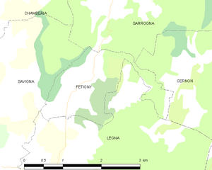
Cernon (Cernon)

- коммуна во Франции
 Hiking in Cernon
Cernon, located in the Jura mountain range of eastern France, offers a beautiful setting for hiking enthusiasts. The Jura is known for its stunning landscapes, rich biodiversity, and a variety of trails that cater to different levels of experience.
Key Highlights of Hiking in Cernon, Jura:
-
Scenic Trails: The area around Cernon features well-marked trails through lush forests, rolling hills, and panoramic viewpoints. Many trails also lead to picturesque lakes and rivers.
-
Diverse Terrain: The Jura mountains are characterized by a mix of rocky outcrops, dense woodlands, and open pastures. This diversity allows for a wide range of hiking experiences, from gentle walks to more challenging mountain hikes.
-
Flora and Fauna: Hikers can enjoy the rich biodiversity of the region. Keep an eye out for various species of birds, deer, and other wildlife. The flora includes a mix of coniferous and deciduous trees, wildflowers, and unique alpine plants.
-
Cultural Points of Interest: Along the trails, you may encounter historical sites, including ancient ruins, chapels, and traditional Jura farms. This rich cultural heritage adds an extra layer of enjoyment to your hike.
-
Local Cuisine: After a day of hiking, you can indulge in the local cuisine. The Jura region is known for its cheese (such as Comté), cured meats, and regional wines, which make for a delightful post-hike meal.
-
Seasonal Hiking: Spring and autumn are particularly beautiful times to hike in the Jura, as the weather is generally mild, and the scenery is stunning. Winter hiking and snowshoeing are also popular in the colder months.
-
Practical Tips:
- Always check local weather conditions before heading out.
- Bring appropriate gear, including sturdy hiking boots, sufficient water, and snacks.
- Follow the marked trails and respect wildlife and nature.
Popular Trails Nearby:
- The Ridge Trail: Offers breathtaking views of the surrounding valleys and the chance to see various lookout points.
- Lake Vouglans Trail: This scenic route around the lake provides opportunities for relaxation and photography.
- The forest paths: These trails are great for families and less experienced hikers, showcasing the natural beauty of the forested areas.
Before heading out, it’s a good idea to consult local hiking maps or guides and possibly connect with local hiking groups for additional advice and information on trail conditions. Happy hiking!
- Страна:

- Почтовый код: 39240
- Координаты: 46° 24' 11" N, 5° 38' 59" E


- GPS треки (wikiloc): [Ссылка]
- Площадь: 16.45 кв.км
- Население: 255
- Википедия английская: wiki(en)
- Википедия национальная: wiki(fr)
- Хранилище Wikidata: Wikidata: Q1142105
- Катеория в википедии: [Ссылка]
- код Freebase: [/m/03np262]
- код GeoNames: Альт: [6448814]
- номер SIREN: [213900863]
- код BNF: [15258450t]
- код муниципалитета INSEE: 39086
Граничит с регионами:


Légna
- коммуна во Франции
Hiking in Légna
Légna is a beautiful hiking destination, often known for its stunning landscapes and diverse trails. While exact details may depend on the specific region or country you are referring to, here are some general highlights of hiking in places like Légna:...
- Страна:
- Почтовый код: 39240
- Координаты: 46° 25' 37" N, 5° 35' 38" E
- GPS треки (wikiloc): [Ссылка]
- Площадь: 10.3 кв.км
- Население: 203


Vescles
- коммуна во Франции
Hiking in Vescles
It seems there might be a minor confusion regarding the location you're referring to as "Vescles." There isn't a well-known hiking area by that name. However, if you meant "Vesicles" or another location that sounds similar, please provide more context or check the spelling....
- Страна:
- Почтовый код: 39240
- Координаты: 46° 21' 37" N, 5° 36' 48" E
- GPS треки (wikiloc): [Ссылка]
- Площадь: 20.27 кв.км
- Население: 197

Fétigny
- коммуна во Франции
Hiking in Fétigny
Fétigny, located in the Jura region of Switzerland, offers a picturesque setting for hiking enthusiasts. The Jura mountain range is known for its rolling hills, lush forests, and scenic views, making it a great destination for outdoor activities....
- Страна:
- Почтовый код: 39240
- Координаты: 46° 26' 31" N, 5° 36' 0" E
- GPS треки (wikiloc): [Ссылка]
- Площадь: 3.3 кв.км
- Население: 88


Onoz
Hiking in Onoz
Onoz is a lovely village located in the Jura region of France, known for its stunning landscapes, rolling hills, and lush forests, making it a fantastic location for hiking enthusiasts. Here are some highlights and tips for hiking in Onoz:...
- Страна:
- Почтовый код: 39270
- Координаты: 46° 27' 20" N, 5° 39' 9" E
- GPS треки (wikiloc): [Ссылка]
- Площадь: 14.85 кв.км
- Население: 76
- Веб сайт: [Ссылка]

Sarrogna
- коммуна во Франции
Hiking in Sarrogna
Sarrogna is a lesser-known hiking destination, but it offers some beautiful trails and scenic views for those looking to explore nature. Located in an area that is often characterized by lush greenery, rolling hills, and a variety of ecosystems, Sarrogna can provide a peaceful escape for hikers of all skill levels....
- Страна:
- Почтовый код: 39270
- Координаты: 46° 28' 3" N, 5° 36' 41" E
- GPS треки (wikiloc): [Ссылка]
- Площадь: 19.87 кв.км
- Население: 228

Аренто
- коммуна во Франции
Hiking in Аренто
Arinthod, located in the Jura department of France, offers a blend of natural beauty and diverse hiking opportunities. The region is characterized by its rolling hills, dense forests, and charming countryside. When hiking in and around Arinthod, you'll find a variety of trails that cater to different skill levels, from leisurely walks to more challenging hikes....
- Страна:
- Почтовый код: 39240
- Координаты: 46° 23' 35" N, 5° 34' 0" E
- GPS треки (wikiloc): [Ссылка]
- Площадь: 19.77 кв.км
- Население: 1092
- Веб сайт: [Ссылка]


Lect
- коммуна во Франции
Hiking in Lect
Lect, located in the Jura region of France, offers a variety of hiking opportunities in a picturesque environment characterized by rolling hills, dense forests, and beautiful landscapes. The Jura mountains are known for their diverse flora and fauna, making them a great destination for nature lovers....
- Страна:
- Почтовый код: 39260
- Координаты: 46° 23' 21" N, 5° 40' 33" E
- GPS треки (wikiloc): [Ссылка]
- Высота над уровнем моря: 520 м m
- Площадь: 11.94 кв.км
- Население: 353