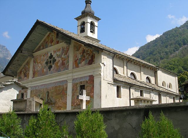
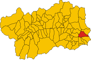
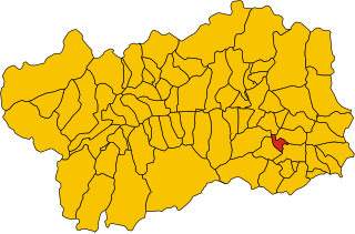
Шаллан-Сен-Виктор (Challand-Saint-Victor, Challand-Saint-Victor)
.svg)
- коммуна Италии
 Hiking in Шаллан-Сен-Виктор
Challand-Saint-Victor is a charming village located in the Aosta Valley region of Italy, known for its picturesque mountain scenery and rich natural landscapes. The area offers a variety of hiking opportunities that cater to different skill levels, making it a great destination for both novice and experienced hikers.
Popular Hiking Trails:
-
Sentiero del Monte Zerbion: This trail takes you up to Monte Zerbion, offering stunning panoramic views of the surrounding valley and mountains. It's a moderately challenging hike, and the ascent provides rewarding vistas.
-
Lago di Blu: This beautiful lake is accessible via a scenic hike that is suitable for families. The trail is well-marked and offers a mix of terrain, making it great for a leisurely day out in nature.
-
Sentiero del Fenêtre: This trail features breathtaking views and passes through lush forests and alpine meadows. It’s a great choice for those looking for a slightly more rugged experience.
Tips for Hiking in Challand-Saint-Victor:
-
Check the Weather: The weather can change rapidly in the mountains, so always check the forecast before setting out.
-
Wear Appropriate Gear: Good hiking boots, weather-appropriate clothing, and a backpack stocked with water, snacks, and a first aid kit are essential.
-
Maps and Navigation: It's wise to have a good map of the area or a GPS device. Many trails are marked, but having a map can help in case the signage is unclear.
-
Start Early: To make the most of your day, consider starting your hike early in the morning. This allows for more time to explore and enjoy the scenery.
-
Respect Nature: Follow the "Leave No Trace" principles. Stay on marked paths and avoid disturbing wildlife.
Amenities:
Challand-Saint-Victor has various amenities for hikers, including local accommodations, restaurants, and shops where you can find gear and supplies. The local cuisine is worth exploring at the end of a long day of hiking, with traditional dishes that highlight the flavors of the Aosta Valley.
Whether you're looking for serene nature walks or challenging mountain hikes, Challand-Saint-Victor provides a beautiful backdrop for your outdoor adventures.
- Страна:

- Почтовый код: 11020
- Телефонный код: 0125
- Код автомобильного номера: AO
- Координаты: 45° 41' 0" N, 7° 42' 0" E


- GPS треки (wikiloc): [Ссылка]
- Высота над уровнем моря: 744 м m
- Площадь: 25 кв.км
- Население: 557
- Веб сайт: http://www.comune.challand-st-victor.ao.it/
- Википедия русская: wiki(ru)
- Википедия английская: wiki(en)
- Википедия национальная: wiki(it)
- Хранилище Wikidata: Wikidata: Q34904
- Катеория в википедии: [Ссылка]
- Карты в википедии: [Ссылка]
- код Freebase: [/m/0fs_v9]
- код GeoNames: Альт: [6535991]
- код VIAF: Альт: [246314662]
- ID отношения в OpenStreetMap: [45702]
- код ISTAT: 007014
- кадастровый код Италии: C594
Граничит с регионами:


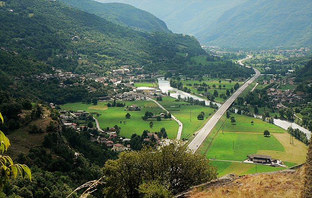
Арна
- коммуна Италии
Hiking in Арна
Arnad is a charming commune located in the Aosta Valley region of Italy, known for its beautiful landscapes and outdoor activities, particularly hiking. Nestled in the foothills of the Alps, Arnad offers a variety of trails suitable for different skill levels, making it an excellent destination for both novice and experienced hikers....
- Страна:
- Почтовый код: 11020
- Телефонный код: 0125
- Код автомобильного номера: AO
- Координаты: 45° 38' 0" N, 7° 43' 0" E
- GPS треки (wikiloc): [Ссылка]
- Высота над уровнем моря: 361 м m
- Площадь: 28.84 кв.км
- Население: 1251
- Веб сайт: [Ссылка]


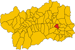
Шаллан-Сент-Ансельм
- коммуна Италии
Hiking in Шаллан-Сент-Ансельм
Challand-Saint-Anselme is a charming village located in the Aosta Valley of Italy, surrounded by beautiful mountainous landscapes, making it an excellent destination for hiking enthusiasts. Here are some highlights and tips for hiking in the area:...
- Страна:
- Почтовый код: 11020
- Телефонный код: 0125
- Код автомобильного номера: AO
- Координаты: 45° 43' 0" N, 7° 44' 0" E
- GPS треки (wikiloc): [Ссылка]
- Высота над уровнем моря: 1030 м m
- Площадь: 27.99 кв.км
- Население: 743
- Веб сайт: [Ссылка]


Эмарез
- коммуна Италии
Hiking in Эмарез
Émarèse is a charming municipality in the Aosta Valley region of northern Italy, known for its stunning natural landscapes, rich history, and outdoor recreational opportunities. Hiking in Émarèse offers a fantastic way to explore the beauty of the Italian Alps and experience the tranquility of nature....
- Страна:
- Почтовый код: 11020
- Телефонный код: 0166
- Код автомобильного номера: AO
- Координаты: 45° 43' 0" N, 7° 42' 0" E
- GPS треки (wikiloc): [Ссылка]
- Высота над уровнем моря: 1170 м m
- Площадь: 10.23 кв.км
- Население: 227
- Веб сайт: [Ссылка]
Иссим
- коммуна Италии
Hiking in Иссим
Issime is a charming municipality located in the Aosta Valley region of Italy, nestled in the Alps. It offers a variety of hiking opportunities that cater to different levels of experience, making it a great destination for outdoor enthusiasts....
- Страна:
- Почтовый код: 11020
- Телефонный код: 0125
- Код автомобильного номера: AO
- Координаты: 45° 41' 0" N, 7° 51' 0" E
- GPS треки (wikiloc): [Ссылка]
- Высота над уровнем моря: 956 м m
- Площадь: 35.38 кв.км
- Население: 413
- Веб сайт: [Ссылка]
Монжове
- коммуна Италии
Hiking in Монжове
Montjovet is a picturesque commune located in the Aosta Valley region of Italy, nestled in the foothills of the Alps. This area is known for its stunning landscapes, diverse ecosystems, and a variety of hiking opportunities that cater to different skill levels. Here are some key points to consider when hiking in Montjovet:...
- Страна:
- Почтовый код: 11020
- Телефонный код: 0166
- Код автомобильного номера: AO
- Координаты: 45° 42' 0" N, 7° 41' 0" E
- GPS треки (wikiloc): [Ссылка]
- Высота над уровнем моря: 406 м m
- Площадь: 18.76 кв.км
- Население: 1774
- Веб сайт: [Ссылка]

Веррес
- коммуна Италии
Hiking in Веррес
Verrès is a charming town located in the Aosta Valley region of Italy, surrounded by beautiful alpine scenery, making it an excellent destination for hiking enthusiasts. The surrounding area offers a variety of trails suitable for different skill levels, from leisurely walks to more challenging alpine hikes....
- Страна:
- Почтовый код: 11029
- Телефонный код: 0125
- Код автомобильного номера: AO
- Координаты: 45° 40' 0" N, 7° 41' 21" E
- GPS треки (wikiloc): [Ссылка]
- Высота над уровнем моря: 391 м m
- Площадь: 8.36 кв.км
- Население: 2642
- Веб сайт: [Ссылка]