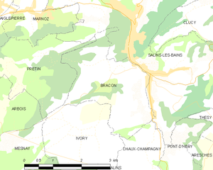
Chaux-Champagny (Chaux-Champagny)

- коммуна во Франции
 Hiking in Chaux-Champagny
Chaux-Champagny is located in the beautiful region of the French Alps, specifically within the Savoie department in the Auvergne-Rhône-Alpes region of France. This area offers a variety of hiking trails that cater to different skill levels and preferences, making it an excellent destination for outdoor enthusiasts.
Hiking Trails
-
Forest Trails: The area is surrounded by lush forests, providing trails that are perfect for leisurely walks and family hikes. These trails are often well-marked and take you through scenic landscapes with opportunities to spot wildlife.
-
Mountain Hikes: For more experienced hikers, there are a number of steeper, more challenging trails that lead to panoramic viewpoints. These trails may involve elevation gain and can provide breathtaking views of the surrounding mountains and valleys.
-
Lakes and Waterfalls: Some hiking routes in the region lead to picturesque lakes and waterfalls, ideal for a scenic picnic break or just to enjoy nature’s beauty.
-
Seasonal Considerations: Keep in mind that the best time for hiking in Chaux-Champagny is typically from late spring to early autumn. Winters can bring snow and make trails more difficult or inaccessible, so it's essential to check trail conditions before heading out.
Essential Tips
- Maps and Guides: It's a good idea to have a map or a GPS device, as some trails can be remote and less marked.
- Equipment: Proper hiking footwear is essential due to varying terrain. Depending on the season, you may need additional gear like trekking poles, waterproof jackets, or layers.
- Weather Awareness: Always check the weather forecast before you set out, as mountain weather can be unpredictable.
- Local Regulations: Be aware of the local guidelines regarding wildlife and trail usage, and make sure to Leave No Trace by keeping the area clean.
Additional Activities
In addition to hiking, the region often offers other outdoor activities such as mountain biking, rock climbing, and in winter, skiing and snowshoeing. Exploring the local culture, cuisine, and alpine villages can also enhance your experience.
Overall, Chaux-Champagny is an inviting destination for hikers looking to experience the stunning natural beauty of the French Alps. Enjoy your adventure!
- Страна:

- Почтовый код: 39110
- Координаты: 46° 53' 45" N, 5° 53' 20" E


- GPS треки (wikiloc): [Ссылка]
- Высота над уровнем моря: 590 м m
- Площадь: 7.33 кв.км
- Население: 75
- Википедия английская: wiki(en)
- Википедия национальная: wiki(fr)
- Хранилище Wikidata: Wikidata: Q818450
- Катеория в википедии: [Ссылка]
- код Freebase: [/m/03np35z]
- код Freebase: [/m/03np35z]
- код GeoNames: Альт: [6616698]
- код GeoNames: Альт: [6616698]
- номер SIREN: [213901333]
- номер SIREN: [213901333]
- код BNF: [15258497g]
- код BNF: [15258497g]
- код муниципалитета INSEE: 39133
- код муниципалитета INSEE: 39133
Граничит с регионами:


Valempoulières
- коммуна во Франции
Hiking in Valempoulières
Valempoulières is a charming commune located in the Jura department of eastern France. While it may not be one of the most famous hiking destinations, it offers beautiful scenery and opportunities for outdoor activities. Here are some highlights for hiking in and around Valempoulières:...
- Страна:
- Почтовый код: 39300
- Координаты: 46° 49' 33" N, 5° 51' 49" E
- GPS треки (wikiloc): [Ссылка]
- Площадь: 16.25 кв.км
- Население: 213

Bracon
- коммуна во Франции
Hiking in Bracon
Hiking in the Bracon area of the Jura Mountains can be a remarkable experience. The Jura region, straddling the border between France and Switzerland, is known for its stunning landscapes, diverse ecosystems, and a rich variety of trails suitable for hikers of all levels....
- Страна:
- Почтовый код: 39110
- Координаты: 46° 55' 50" N, 5° 52' 52" E
- GPS треки (wikiloc): [Ссылка]
- Площадь: 6.29 кв.км
- Население: 267


Ivory
- коммуна во Франции
Hiking in Ivory
Hiking in the Jura Mountains, particularly in the region around Ivory (a small commune in the department of Jura in France), offers stunning landscapes, rich biodiversity, and a variety of trails suited for all skill levels. Here are some highlights and tips for hiking in this area:...
- Страна:
- Почтовый код: 39110
- Координаты: 46° 54' 45" N, 5° 51' 35" E
- GPS треки (wikiloc): [Ссылка]
- Площадь: 9.13 кв.км
- Население: 91


Chilly-sur-Salins
- коммуна во Франции
Hiking in Chilly-sur-Salins
Chilly-sur-Salins is a charming commune located in the Jura department of eastern France, known for its beautiful landscapes and rich natural surroundings, making it a lovely destination for hiking enthusiasts....
- Страна:
- Почтовый код: 39110
- Координаты: 46° 53' 24" N, 5° 52' 2" E
- GPS треки (wikiloc): [Ссылка]
- Площадь: 11.94 кв.км
- Население: 110
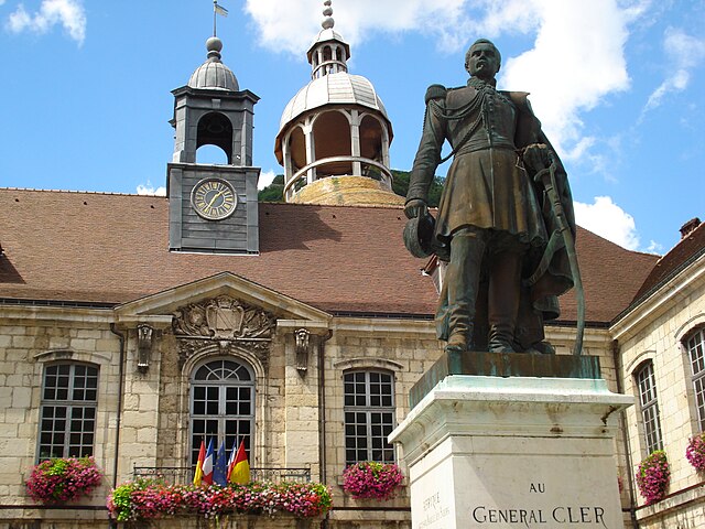

Salins-les-Bains
- коммуна во Франции
Hiking in Salins-les-Bains
Salins-les-Bains, located in the Jura region of France, is known for its beautiful landscapes, rich historical heritage, and therapeutic salt springs. Hiking in this area offers a mix of natural beauty, cultural landmarks, and opportunities to enjoy the unique geology of the Jura Mountains....
- Страна:
- Почтовый код: 39110
- Координаты: 46° 56' 28" N, 5° 52' 42" E
- GPS треки (wikiloc): [Ссылка]
- Высота над уровнем моря: 350 м m
- Площадь: 24.68 кв.км
- Население: 2718
- Веб сайт: [Ссылка]


Pont-d'Héry
- коммуна во Франции
Hiking in Pont-d'Héry
Pont-d'Héry is a charming village located in the Jura region of France, surrounded by beautiful natural scenery that makes it a great destination for hiking enthusiasts. The area features various trails that cater to different skill levels, allowing both beginners and experienced hikers to explore its stunning landscapes....
- Страна:
- Почтовый код: 39110
- Координаты: 46° 52' 17" N, 5° 54' 0" E
- GPS треки (wikiloc): [Ссылка]
- Площадь: 13.54 кв.км
- Население: 244