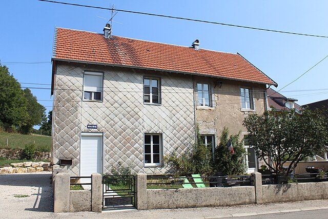
Salins-les-Bains (Salins-les-Bains)

- коммуна во Франции
 Hiking in Salins-les-Bains
Salins-les-Bains, located in the Jura region of France, is known for its beautiful landscapes, rich historical heritage, and therapeutic salt springs. Hiking in this area offers a mix of natural beauty, cultural landmarks, and opportunities to enjoy the unique geology of the Jura Mountains.
Hiking Trails
-
Les Bains de Salins Trail: This trail takes you around the town and showcases some of the historical sites alongside picturesque views of the surrounding forests and hills.
-
Citadel of Salins: Hiking up to the ruins of the citadel provides not just a workout, but also magnificent views of the Salins-les-Bains valley. The trail can be steep but rewarding.
-
Parc Naturel Régional du Haut-Jura: Just a short drive away, this national park offers numerous trails ranging from easy walks to challenging hikes. You can experience beautiful lakes, dense forests, and diverse wildlife.
-
The Combe De Laisia: This trail features limestone cliffs and offers stunning views, particularly in the spring and autumn when the flora is vibrant.
Considerations
- Weather: The weather can change quickly in the Jura, so it's important to check forecasts and dress in layers.
- Equipment: Good hiking boots are essential, and trekking poles can be useful on some of the steeper trails.
- Navigational Aids: While many trails are well-marked, carrying a map or using a hiking app can be beneficial, especially for more remote paths.
Best Times to Hike
The ideal times for hiking in and around Salins-les-Bains are spring (April to June) and autumn (September to October) when the weather is mild, and the landscapes are particularly beautiful. Summer can be popular but may be busier with tourists.
Additional Activities
- Thermal Spas: After a day of hiking, you might want to relax in one of the town's thermal spas that take advantage of the local salt springs.
- Culinary Delights: Don’t miss trying local specialties, including Comté cheese and Jura wine, as part of your hiking experience.
Hiking in Salins-les-Bains combines a love for the outdoors with cultural exploration, making it an ideal destination for hikers of all levels.
- Страна:

- Почтовый код: 39110
- Координаты: 46° 56' 28" N, 5° 52' 42" E


- GPS треки (wikiloc): [Ссылка]
- Высота над уровнем моря: 350 м m
- Площадь: 24.68 кв.км
- Население: 2718
- Веб сайт: http://www.mairie-salinslesbains.fr
- Википедия английская: wiki(en)
- Википедия национальная: wiki(fr)
- Хранилище Wikidata: Wikidata: Q820042
- Катеория в википедии: [Ссылка]
- Карты в википедии: [Ссылка]
- код Freebase: [/m/07q0kc]
- код Freebase: [/m/07q0kc]
- код GeoNames: Альт: [2976413]
- код GeoNames: Альт: [2976413]
- номер SIREN: [213905003]
- номер SIREN: [213905003]
- код BNF: [15258861k]
- код BNF: [15258861k]
- код VIAF: Альт: [168041116]
- код VIAF: Альт: [168041116]
- код GND: Альт: [4473593-5]
- код GND: Альт: [4473593-5]
- код LCNAF: Альт: [n82072967]
- код LCNAF: Альт: [n82072967]
- код тезауруса PACTOLS: [pcrtLY59dv9gsO]
- код тезауруса PACTOLS: [pcrtLY59dv9gsO]
- место в MusicBrainz: [bcff465f-42f9-4f2b-8832-e7b42b183a30]
- место в MusicBrainz: [bcff465f-42f9-4f2b-8832-e7b42b183a30]
- код муниципалитета INSEE: 39500
- код муниципалитета INSEE: 39500
Граничит с регионами:

Abergement-lès-Thésy
- коммуна во Франции
Hiking in Abergement-lès-Thésy
Abergement-lès-Thésy is a charming commune in the Jura department of France, nestled in the picturesque landscape of the Jura mountain range. This area offers a variety of hiking opportunities, appealing to both novice and experienced hikers....
- Страна:
- Почтовый код: 39110
- Координаты: 46° 55' 2" N, 5° 56' 23" E
- GPS треки (wikiloc): [Ссылка]
- Площадь: 4.63 кв.км
- Население: 63


Geraise
- коммуна во Франции
Hiking in Geraise
Geraise, while not a widely recognized hiking destination, may refer to a specific area or trail that could be known locally or under a different name. If it is meant to indicate a less popular or regional hiking area, local resources or hiking clubs can provide you with detailed trail maps, difficulty levels, and any unique features of that environment....
- Страна:
- Почтовый код: 39110
- Координаты: 46° 57' 24" N, 5° 56' 54" E
- GPS треки (wikiloc): [Ссылка]
- Площадь: 6.04 кв.км
- Население: 40


Marnoz
- коммуна во Франции
Hiking in Marnoz
Marnoz is a captivating destination for hiking enthusiasts. Located in the Jura region of France, it offers a variety of trails that cater to different skill levels, from easy strolls to more challenging hikes. The landscape is characterized by lush forests, rolling hills, and panoramic views....
- Страна:
- Почтовый код: 39110
- Координаты: 46° 57' 0" N, 5° 49' 56" E
- GPS треки (wikiloc): [Ссылка]
- Площадь: 4.87 кв.км
- Население: 410

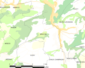
Bracon
- коммуна во Франции
Hiking in Bracon
Hiking in the Bracon area of the Jura Mountains can be a remarkable experience. The Jura region, straddling the border between France and Switzerland, is known for its stunning landscapes, diverse ecosystems, and a rich variety of trails suitable for hikers of all levels....
- Страна:
- Почтовый код: 39110
- Координаты: 46° 55' 50" N, 5° 52' 52" E
- GPS треки (wikiloc): [Ссылка]
- Площадь: 6.29 кв.км
- Население: 267


Clucy
- коммуна во Франции
Hiking in Clucy
It seems like there may be a typo or a misunderstanding regarding "Clucy." If you meant "Cluj," as in Cluj-Napoca, Romania, I can provide some information on hiking in that region. Alternatively, if you were referring to another location, feel free to clarify....
- Страна:
- Почтовый код: 39110
- Координаты: 46° 56' 47" N, 5° 54' 13" E
- GPS треки (wikiloc): [Ссылка]
- Площадь: 5.13 кв.км
- Население: 83


Saizenay
- коммуна во Франции
Hiking in Saizenay
Saizenay is a picturesque area that offers an array of hiking opportunities amid beautiful natural scenery. While specific trails may not be as well-documented as those in more popular hiking destinations, there are still plenty of routes and paths to explore. Here are a few general tips and ideas for hiking in Saizenay:...
- Страна:
- Почтовый код: 39110
- Координаты: 46° 57' 43" N, 5° 54' 54" E
- GPS треки (wikiloc): [Ссылка]
- Площадь: 4.88 кв.км
- Население: 100


Cernans
- коммуна во Франции
Hiking in Cernans
I'm sorry, but there seems to be a misunderstanding. As of my last knowledge update in October 2023, there isn't a widely recognized hiking destination by the name "Cernans." If you meant a specific area or park that could be associated with that name, please provide more context or check the spelling....
- Страна:
- Почтовый код: 39110
- Координаты: 46° 55' 55" N, 5° 55' 54" E
- GPS треки (wikiloc): [Ссылка]
- Площадь: 5.51 кв.км
- Население: 140


Saint-Thiébaud
- коммуна во Франции
Hiking in Saint-Thiébaud
Saint-Thiébaud is a charming area located in the Jura region of France. While it may not be as widely known as some national parks, it offers beautiful landscapes, serene hiking trails, and a chance to connect with nature. Here are some key points to consider when hiking in and around Saint-Thiébaud:...
- Страна:
- Почтовый код: 39110
- Координаты: 46° 58' 19" N, 5° 51' 55" E
- GPS треки (wikiloc): [Ссылка]
- Площадь: 7.94 кв.км
- Население: 62


Pretin
- коммуна во Франции
Hiking in Pretin
It seems like there might be a small confusion with the name "Pretin." If you're referring to a specific hiking location or area, I might not have exact information if it's a less-known or recently developed site....
- Страна:
- Почтовый код: 39110
- Координаты: 46° 56' 11" N, 5° 50' 20" E
- GPS треки (wikiloc): [Ссылка]
- Площадь: 5.44 кв.км
- Население: 63


La Chapelle-sur-Furieuse
- коммуна во Франции
Hiking in La Chapelle-sur-Furieuse
La Chapelle-sur-Furieuse is a picturesque village situated in the Doubs department of France, nestled in the Jura Mountains. It’s a great location for hiking enthusiasts looking to explore the beautiful natural landscapes of this region. Here’s what you can expect when hiking around La Chapelle-sur-Furieuse:...
- Страна:
- Почтовый код: 39110
- Координаты: 46° 59' 52" N, 5° 51' 27" E
- GPS треки (wikiloc): [Ссылка]
- Площадь: 9.03 кв.км
- Население: 322


Chaux-Champagny
- коммуна во Франции
Hiking in Chaux-Champagny
Chaux-Champagny is located in the beautiful region of the French Alps, specifically within the Savoie department in the Auvergne-Rhône-Alpes region of France. This area offers a variety of hiking trails that cater to different skill levels and preferences, making it an excellent destination for outdoor enthusiasts....
- Страна:
- Почтовый код: 39110
- Координаты: 46° 53' 45" N, 5° 53' 20" E
- GPS треки (wikiloc): [Ссылка]
- Высота над уровнем моря: 590 м m
- Площадь: 7.33 кв.км
- Население: 75


Thésy
- коммуна во Франции
Hiking in Thésy
Thésy is a charming area located in the Auvergne-Rhône-Alpes region of France, surrounded by beautiful natural landscapes, including rolling hills, forests, and rivers. While it may not be as well-known as some other hiking destinations in France, it offers a range of outdoor activities and scenic trails for hikers of different skill levels....
- Страна:
- Почтовый код: 39110
- Координаты: 46° 54' 45" N, 5° 55' 24" E
- GPS треки (wikiloc): [Ссылка]
- Площадь: 4.92 кв.км
- Население: 66


Pont-d'Héry
- коммуна во Франции
Hiking in Pont-d'Héry
Pont-d'Héry is a charming village located in the Jura region of France, surrounded by beautiful natural scenery that makes it a great destination for hiking enthusiasts. The area features various trails that cater to different skill levels, allowing both beginners and experienced hikers to explore its stunning landscapes....
- Страна:
- Почтовый код: 39110
- Координаты: 46° 52' 17" N, 5° 54' 0" E
- GPS треки (wikiloc): [Ссылка]
- Площадь: 13.54 кв.км
- Население: 244


Ивре
- коммуна во Франции
Hiking in Ивре
It seems like there might be a little confusion with the name "Ivrey." If you're referring to hiking in a specific region or trail, I would need a bit more information to provide accurate guidance....
- Страна:
- Почтовый код: 39110
- Координаты: 46° 59' 25" N, 5° 53' 39" E
- GPS треки (wikiloc): [Ссылка]
- Площадь: 6.67 кв.км
- Население: 64


Saraz
- коммуна во Франции
Hiking in Saraz
Hiking in Saraz, a region that is often characterized by stunning landscapes, rich biodiversity, and varying terrains, can offer an array of experiences for both beginner and experienced hikers. While specific information about the trails and conditions in Saraz may depend on the particular area or country you are referring to (as "Saraz" can indicate different locations), here are some general tips and insights regarding hiking in a mountainous or scenic area like Saraz:...
- Страна:
- Почтовый код: 25330
- Координаты: 46° 59' 48" N, 5° 58' 58" E
- GPS треки (wikiloc): [Ссылка]
- Площадь: 6.02 кв.км
- Население: 11

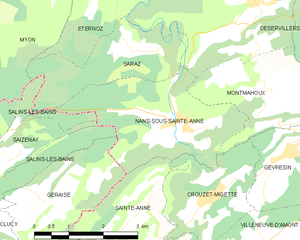
Nans-sous-Sainte-Anne
- коммуна во Франции
Hiking in Nans-sous-Sainte-Anne
Nans-sous-Sainte-Anne is a charming village located in the Jura region of France, known for its stunning natural landscapes, rich biodiversity, and various hiking opportunities. The village is nestled within the Jura Mountains, which offer a mix of lush forests, rolling hills, rivers, and captivating rock formations....
- Страна:
- Почтовый код: 25330
- Координаты: 46° 58' 36" N, 5° 59' 56" E
- GPS треки (wikiloc): [Ссылка]
- Площадь: 8.86 кв.км
- Население: 139

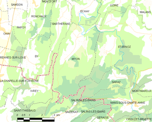
Myon
- коммуна во Франции
Hiking in Myon
Myon is a small commune in the Doubs department of the Bourgogne-Franche-Comté region in eastern France. The area is known for its beautiful natural landscapes, making it a great spot for hiking and enjoying the outdoors....
- Страна:
- Почтовый код: 25440
- Координаты: 47° 1' 29" N, 5° 56' 30" E
- GPS треки (wikiloc): [Ссылка]
- Площадь: 16.06 кв.км
- Население: 194