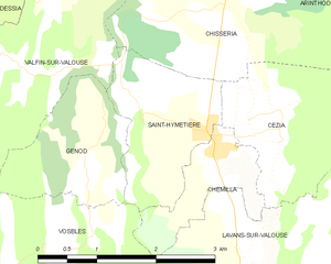
Chemilla (Chemilla)

- коммуна во Франции
 Hiking in Chemilla
Chemilla, located in the region of the Basque Country in Spain, offers beautiful landscapes and diverse hiking opportunities. Here are some key points to consider for hiking in Chemilla:
Trails and Routes
-
Nature Trails: There are several marked hiking trails that take you through lush forests, rolling hills, and picturesque valleys. The trails can vary in difficulty, catering to both beginners and experienced hikers.
-
Scenic Walks: Some trails offer stunning views of the surrounding mountains and coastal areas, making them ideal for photography and enjoying the natural beauty of the region.
-
Cultural Routes: Some paths may lead you through historical sites, small villages, and farms, allowing you to experience the local culture and traditions of the Basque Country.
Best Hiking Tips
- Weather: Check local weather conditions before heading out. The Basque Country can experience sudden weather changes, especially in the mountains.
- Map and Navigation: Always carry a map or GPS device, as some trails may not be well-marked.
- Footwear: Wear sturdy hiking shoes to navigate rocky or uneven terrain.
- Hydration: Bring enough water, especially for longer hikes.
- Wildlife: Be respectful of the local wildlife and observe from a distance.
Local Attractions
- Natural Parks: The nearby natural parks can provide additional hiking options and opportunities to see native flora and fauna.
- Gastronomy: After a day of hiking, explore local eateries to enjoy Basque cuisine, known for its rich flavors and variety.
Safety Considerations
- Inform someone of your hiking plans and expected return time.
- Familiarize yourself with the local emergency contacts.
- Stay on marked trails to protect the environment and ensure your safety.
Hiking in Chemilla can provide a refreshing experience amidst nature, with the added bonus of immersing yourself in the vibrant culture of the Basque Country. Be sure to plan your routes according to your fitness level and preferences for the best experience!
- Страна:

- Почтовый код: 39240
- Координаты: 46° 21' 26" N, 5° 33' 36" E


- GPS треки (wikiloc): [Ссылка]
- Площадь: 1.87 кв.км
- Население: 111
- Википедия английская: wiki(en)
- Википедия национальная: wiki(fr)
- Хранилище Wikidata: Wikidata: Q633964
- Катеория в википедии: [Ссылка]
- код Freebase: [/m/03np38c]
- код GeoNames: Альт: [6433495]
- номер SIREN: [213901374]
- код BNF: [15258501w]
- код муниципалитета INSEE: 39137
Граничит с регионами:


Cézia
- коммуна во Франции
Hiking in Cézia
As of my last update, there's no widely recognized location known as "Cézia" in hiking literature or guides. It’s possible that it could refer to a lesser-known area, a local nickname, or perhaps a typographical error. If you meant a specific region or park and can clarify or provide additional context, I would be more than happy to help!...
- Страна:
- Почтовый код: 39240
- Координаты: 46° 21' 37" N, 5° 34' 29" E
- GPS треки (wikiloc): [Ссылка]
- Площадь: 3.6 кв.км
- Население: 69


Vosbles
- коммуна во Франции
Hiking in Vosbles
It seems there might be a typo in your query, as "Vosbles" doesn't relate to a known hiking destination. If you meant "Vosges," which is a mountain range in northeastern France, I can certainly provide information on that!...
- Страна:
- Почтовый код: 39240
- Координаты: 46° 20' 25" N, 5° 31' 28" E
- GPS треки (wikiloc): [Ссылка]
- Площадь: 12.67 кв.км
- Население: 110

Saint-Hymetière
- коммуна во Франции
Hiking in Saint-Hymetière
Saint-Hymetière, located in France, offers a range of hiking opportunities that cater to different skill levels and preferences. The surrounding natural landscapes include lush forests, rolling hills, and panoramic views that are perfect for outdoor enthusiasts....
- Страна:
- Почтовый код: 39240
- Координаты: 46° 21' 32" N, 5° 33' 37" E
- GPS треки (wikiloc): [Ссылка]
- Площадь: 3.32 кв.км
- Население: 107


Lavans-sur-Valouse
- коммуна во Франции
Hiking in Lavans-sur-Valouse
Lavans-sur-Valouse is a charming commune located in the Jura department of France. Nestled in the picturesque landscapes of the Jura Mountains, it offers a variety of hiking options that cater to different skill levels. Here's what you can expect when hiking in and around Lavans-sur-Valouse:...
- Страна:
- Почтовый код: 39240
- Координаты: 46° 20' 30" N, 5° 33' 53" E
- GPS треки (wikiloc): [Ссылка]
- Площадь: 9.51 кв.км
- Население: 146