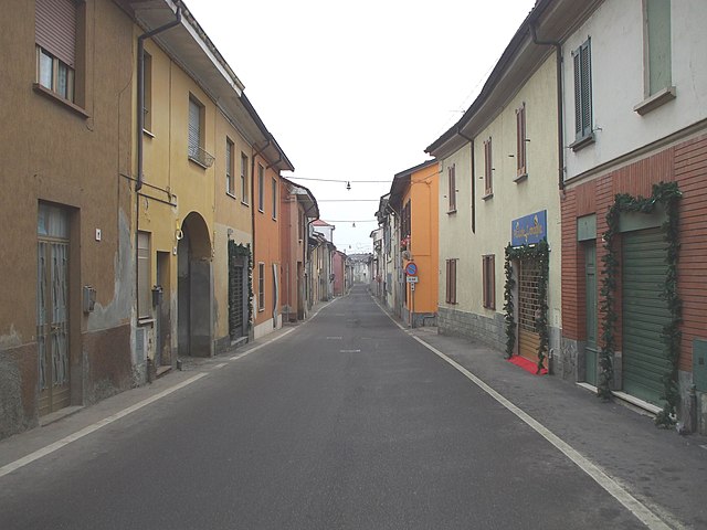
Киньоло-По (Chignolo Po, Chignolo Po)
.svg)
- коммуна Италии
 Hiking in Киньоло-По
Chignolo Po is a small town located in the Lombardy region of Italy, known more for its agricultural landscape than for traditional hiking trails. However, its proximity to larger regions with hiking opportunities makes it a good starting point for exploring the beautiful Italian countryside.
While there may not be dedicated hiking trails specifically within Chignolo Po, here are some suggestions for nearby hiking experiences:
-
Parco della Cava: Located not too far away, this natural park offers gentle trails suitable for leisurely hikes. The area's flora and fauna provide a pleasant environment for walking and enjoying nature.
-
Navigli Canals: The Navigli area features scenic paths along the canals, ideal for hiking and cycling. These paths can lead you through picturesque landscapes with opportunities to stop at quaint villages and traditional restaurants.
-
Oltrepò Pavese: A short drive from Chignolo Po, this region is known for its rolling hills and vineyards. Several hiking routes are available here, offering stunning views and a taste of local wine culture.
-
Parco Regionale dell’Adda Sud: This regional park features various trails that follow the Adda River, with diverse natural environments, cultural landmarks, and historical sites to explore.
When planning your hike, be sure to check local maps or visit local tourist information centers for updated trail information and conditions. It's also a good idea to consider the time of year and weather conditions, as some paths may be more challenging in certain seasons.
If you're looking for a specific type of hiking experience (like longer trails, guided hikes, etc.), please let me know, and I can provide more detailed information!
- Страна:

- Почтовый код: 27013
- Телефонный код: 0382
- Код автомобильного номера: PV
- Координаты: 45° 9' 0" N, 9° 29' 0" E


- GPS треки (wikiloc): [Ссылка]
- Высота над уровнем моря: 88 м m
- Площадь: 23.39 кв.км
- Население: 3982
- Веб сайт: http://www.comune.chignolopo.pv.it
- Википедия русская: wiki(ru)
- Википедия английская: wiki(en)
- Википедия национальная: wiki(it)
- Хранилище Wikidata: Wikidata: Q40948
- Катеория в википедии: [Ссылка]
- код Freebase: [/m/0gjhp3]
- код GeoNames: Альт: [6542964]
- код VIAF: Альт: [247425635]
- ID отношения в OpenStreetMap: [44263]
- код GND: Альт: [7624516-0]
- UN/LOCODE: [ITCIP]
- код ISTAT: 018048
- кадастровый код Италии: C637
Граничит с регионами:


Роттофрено
- коммуна Италии
Hiking in Роттофрено
Rottofreno is a small municipality in the province of Piacenza, located in the Emilia-Romagna region of Northern Italy. While it's not as widely known for its hiking routes as larger national parks or mountainous areas, there are still opportunities for scenic walks and hikes in and around Rottofreno....
- Страна:
- Почтовый код: 29010
- Телефонный код: 0523
- Код автомобильного номера: PC
- Координаты: 45° 3' 29" N, 9° 32' 56" E
- GPS треки (wikiloc): [Ссылка]
- Высота над уровнем моря: 65 м m
- Площадь: 35.17 кв.км
- Население: 12220
- Веб сайт: [Ссылка]
Санта-Кристина-и-Биссоне
- коммуна Италии
Hiking in Санта-Кристина-и-Биссоне
Santa Cristina e Bissone is a picturesque area located in the Italian region of Lombardy, nestled within the beautiful landscape of the Italian Alps. The region is known for its lush greenery, stunning mountain views, and diverse hiking trails suited for various skill levels. Here are some highlights to consider when hiking in this area:...
- Страна:
- Почтовый код: 27010
- Телефонный код: 0382
- Код автомобильного номера: PV
- Координаты: 45° 9' 27" N, 9° 23' 59" E
- GPS треки (wikiloc): [Ссылка]
- Высота над уровнем моря: 71 м m
- Площадь: 22.42 кв.км
- Население: 1951
- Веб сайт: [Ссылка]
Бадия-Павезе
- коммуна Италии
Hiking in Бадия-Павезе
Badia Pavese is a charming town located in the Lombardy region of northern Italy, known for its picturesque landscapes, rolling hills, and historical sites. While it may not be as famous as some of Italy's more renowned hiking destinations, it offers a variety of trails that are perfect for both casual walkers and more experienced hikers....
- Страна:
- Почтовый код: 27017
- Телефонный код: 0382
- Код автомобильного номера: PV
- Координаты: 45° 7' 0" N, 9° 28' 0" E
- GPS треки (wikiloc): [Ссылка]
- Высота над уровнем моря: 55 м m
- Площадь: 5.06 кв.км
- Население: 374
- Веб сайт: [Ссылка]
Монтичелли-Павезе
- коммуна Италии
Hiking in Монтичелли-Павезе
Monticelli Pavese, located in the Lombardy region of northern Italy, offers a beautiful backdrop for hikers seeking to explore the stunning Italian countryside. The terrain is characterized by rolling hills, vineyards, and charming small villages, making it perfect for both casual walkers and more serious hikers....
- Страна:
- Почтовый код: 27010
- Телефонный код: 0382
- Код автомобильного номера: PV
- Координаты: 45° 7' 0" N, 9° 31' 0" E
- GPS треки (wikiloc): [Ссылка]
- Высота над уровнем моря: 53 м m
- Площадь: 20.19 кв.км
- Население: 737
- Веб сайт: [Ссылка]

Мирадоло-Терме
- коммуна Италии
Hiking in Мирадоло-Терме
Miradolo Terme is a charming village located in the Lombardy region of Italy, known for its scenic landscapes and outdoor activities, including hiking. The area around Miradolo Terme offers a variety of trails that cater to different skill levels, making it suitable for both beginners and experienced hikers....
- Страна:
- Почтовый код: 27010
- Телефонный код: 0382
- Код автомобильного номера: PV
- Координаты: 45° 9' 0" N, 9° 29' 0" E
- GPS треки (wikiloc): [Ссылка]
- Высота над уровнем моря: 72 м m
- Площадь: 9.56 кв.км
- Население: 3714
- Веб сайт: [Ссылка]


Сан-Коломбано-аль-Ламбро
- коммуна Италии
Hiking in Сан-Коломбано-аль-Ламбро
San Colombano al Lambro is a charming town located in the Lombardy region of northern Italy, surrounded by beautiful natural landscapes, rolling hills, and vineyards. While it may not be as well-known as some larger national parks or famous hiking areas, it offers a variety of trails that are great for hiking enthusiasts looking to explore the Italian countryside....
- Страна:
- Почтовый код: 20078
- Телефонный код: 0371
- Код автомобильного номера: MI
- Координаты: 45° 11' 0" N, 9° 29' 0" E
- GPS треки (wikiloc): [Ссылка]
- Высота над уровнем моря: 80 м m
- Площадь: 16.55 кв.км
- Население: 7336
- Веб сайт: [Ссылка]


Орио-Литта
- коммуна Италии
Hiking in Орио-Литта
Orio Litta is a charming town located in the Lombardy region of Italy, nestled in the Province of Lodi. While it may not be as widely known for hiking compared to other areas in Italy, it offers several opportunities for outdoor exploration, particularly for those who enjoy peaceful rural landscapes....
- Страна:
- Почтовый код: 26863
- Телефонный код: 0377
- Код автомобильного номера: LO
- Координаты: 45° 9' 39" N, 9° 33' 20" E
- GPS треки (wikiloc): [Ссылка]
- Высота над уровнем моря: 63 м m
- Площадь: 9.78 кв.км
- Население: 2056
- Веб сайт: [Ссылка]