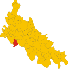
Мирадоло-Терме (Miradolo Terme, Miradolo Terme)
.svg)
- коммуна Италии
 Hiking in Мирадоло-Терме
Miradolo Terme is a charming village located in the Lombardy region of Italy, known for its scenic landscapes and outdoor activities, including hiking. The area around Miradolo Terme offers a variety of trails that cater to different skill levels, making it suitable for both beginners and experienced hikers.
Hiking Trails:
-
Local Nature Trails: The vicinity around Miradolo Terme features several nature trails that meander through lush forests, fields, and along rivers. These trails often provide picturesque views of the surrounding countryside.
-
Oltrepo Pavese Trails: Nearby, the Oltrepo Pavese hills offer more challenging hikes with beautiful vineyard landscapes and panoramic views over the Po Valley. This area is popular for its wine production, and some trails can lead you through vineyards and small wine cellars.
-
Cultural and Historical Routes: Some hiking routes in the area are combined with cultural experiences, where you can explore medieval villages, ancient churches, and local history, providing a rich context to your hike.
Tips for Hiking in Miradolo Terme:
- Preparation: Make sure to wear appropriate hiking footwear and clothing, and always check the weather before heading out.
- Maps and Guides: Consider obtaining a local hiking map or joining guided tours to discover more about the trails and local flora and fauna.
- Hydration and Snacks: Carry enough water and some snacks, especially for longer hikes.
- Respect Nature: As with any outdoor activity, always practice Leave No Trace principles to preserve the natural beauty of the area.
Nearby Activities:
In addition to hiking, you can also explore other activities such as cycling, birdwatching, and enjoying local cuisine in nearby towns. Miradolo Terme's thermal baths are also a great option to relax after a long day of hiking.
Whether you're looking for a leisurely stroll or a more strenuous hike, Miradolo Terme can offer an enjoyable outdoor experience amidst stunning Italian landscapes.
- Страна:

- Почтовый код: 27010
- Телефонный код: 0382
- Код автомобильного номера: PV
- Координаты: 45° 9' 0" N, 9° 29' 0" E


- GPS треки (wikiloc): [Ссылка]
- Высота над уровнем моря: 72 м m
- Площадь: 9.56 кв.км
- Население: 3714
- Веб сайт: http://www.miradoloterme.gov.it
- Википедия русская: wiki(ru)
- Википедия английская: wiki(en)
- Википедия национальная: wiki(it)
- Хранилище Wikidata: Wikidata: Q40527
- Катеория в википедии: [Ссылка]
- код Freebase: [/m/0gjjsr]
- код GeoNames: Альт: [6540360]
- ID отношения в OpenStreetMap: [44353]
- UN/LOCODE: [ITZVF]
- код ISTAT: 018093
- кадастровый код Италии: F238
Граничит с регионами:
Санта-Кристина-и-Биссоне
- коммуна Италии
Hiking in Санта-Кристина-и-Биссоне
Santa Cristina e Bissone is a picturesque area located in the Italian region of Lombardy, nestled within the beautiful landscape of the Italian Alps. The region is known for its lush greenery, stunning mountain views, and diverse hiking trails suited for various skill levels. Here are some highlights to consider when hiking in this area:...
- Страна:
- Почтовый код: 27010
- Телефонный код: 0382
- Код автомобильного номера: PV
- Координаты: 45° 9' 27" N, 9° 23' 59" E
- GPS треки (wikiloc): [Ссылка]
- Высота над уровнем моря: 71 м m
- Площадь: 22.42 кв.км
- Население: 1951
- Веб сайт: [Ссылка]


Инверно-е-Монтелеоне
- коммуна Италии
Hiking in Инверно-е-Монтелеоне
Inverno e Monteleone, located in the Lombardy region of Italy, offers a picturesque backdrop for hiking enthusiasts. This area combines natural beauty with cultural heritage, making it ideal for those looking to explore both landscapes and local history....
- Страна:
- Почтовый код: 27010
- Телефонный код: 0382
- Код автомобильного номера: PV
- Координаты: 45° 12' 0" N, 9° 23' 0" E
- GPS треки (wikiloc): [Ссылка]
- Высота над уровнем моря: 74 м m
- Площадь: 9.64 кв.км
- Население: 1493
- Веб сайт: [Ссылка]


Киньоло-По
- коммуна Италии
Hiking in Киньоло-По
Chignolo Po is a small town located in the Lombardy region of Italy, known more for its agricultural landscape than for traditional hiking trails. However, its proximity to larger regions with hiking opportunities makes it a good starting point for exploring the beautiful Italian countryside....
- Страна:
- Почтовый код: 27013
- Телефонный код: 0382
- Код автомобильного номера: PV
- Координаты: 45° 9' 0" N, 9° 29' 0" E
- GPS треки (wikiloc): [Ссылка]
- Высота над уровнем моря: 88 м m
- Площадь: 23.39 кв.км
- Население: 3982
- Веб сайт: [Ссылка]


Сант-Анджело-Лодиджано
- коммуна Италии
Hiking in Сант-Анджело-Лодиджано
Sant'Angelo Lodigiano, located in the Lombardy region of Italy, offers a picturesque setting for hiking enthusiasts. While it may not be as famous as other Italian hiking destinations, it does have its own charm and opportunities for outdoor activities....
- Страна:
- Почтовый код: 26866
- Телефонный код: 0371
- Код автомобильного номера: LO
- Координаты: 45° 14' 20" N, 9° 24' 35" E
- GPS треки (wikiloc): [Ссылка]
- Высота над уровнем моря: 73 м m
- Площадь: 20.05 кв.км
- Население: 13202
- Веб сайт: [Ссылка]


Сан-Коломбано-аль-Ламбро
- коммуна Италии
Hiking in Сан-Коломбано-аль-Ламбро
San Colombano al Lambro is a charming town located in the Lombardy region of northern Italy, surrounded by beautiful natural landscapes, rolling hills, and vineyards. While it may not be as well-known as some larger national parks or famous hiking areas, it offers a variety of trails that are great for hiking enthusiasts looking to explore the Italian countryside....
- Страна:
- Почтовый код: 20078
- Телефонный код: 0371
- Код автомобильного номера: MI
- Координаты: 45° 11' 0" N, 9° 29' 0" E
- GPS треки (wikiloc): [Ссылка]
- Высота над уровнем моря: 80 м m
- Площадь: 16.55 кв.км
- Население: 7336
- Веб сайт: [Ссылка]

Граффиньяна
- коммуна Италии
Hiking in Граффиньяна
Graffignana is a small town located in the Lombardy region of northern Italy. While it might not be as well-known for hiking as some other areas in Italy, there are still opportunities for outdoor enthusiasts to enjoy nature and engage in hiking activities in and around the town....
- Страна:
- Почтовый код: 26813
- Телефонный код: 0371
- Код автомобильного номера: LO
- Координаты: 45° 12' 27" N, 9° 27' 19" E
- GPS треки (wikiloc): [Ссылка]
- Высота над уровнем моря: 67 м m
- Площадь: 10.92 кв.км
- Население: 2612
- Веб сайт: [Ссылка]