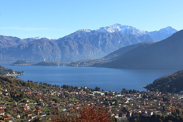
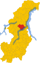
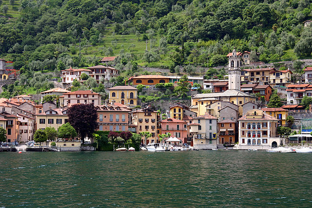
Колонно (Colonno, Colonno)
.svg)
- коммуна Италии
 Hiking in Колонно
Colonno is a beautiful village located on the western shore of Lake Como in Italy, known for its stunning scenery and charming architecture. Hiking around Colonno offers a mix of breathtaking views, historical sites, and opportunities to experience the natural beauty of the region.
Hiking Trails:
-
Sentiero del Viandante:
- This well-known trail runs along the eastern shore of Lake Como and can be accessed from Colonno. It presents a mix of paths through woods and scenic views of the lake. It’s a great option for those looking to enjoy longer hikes, as the entire trail stretches for about 45 kilometers.
-
Hike to the Church of San Giovanni:
- A shorter but rewarding hike that leads to the historic Church of San Giovanni Battista, which offers beautiful views of Colonno and Lake Como. The trail is well-marked and takes about an hour to reach the church.
-
Monte Crocione:
- For a more challenging hike, consider trekking up Monte Crocione, which offers panoramic views of the lake and surrounding mountains. The ascent can be steep, but the vistas from the summit are well worth the effort.
Hiking Tips:
- Weather Conditions: Always check the local weather before heading out, as conditions can change rapidly in mountainous areas.
- Footwear: Wear sturdy hiking boots with good grip, as some trails can be rocky and steep.
- Water and Snacks: Carry enough water and some snacks, especially for longer hikes.
- Trail Maps: While trails are generally well-marked, it’s helpful to have a map or a GPS device.
Best Time to Hike:
- Spring (March to June) and early autumn (September to October) are the best times for hiking in Colonno, as the weather is mild and the landscapes are particularly beautiful.
Local Attractions:
After your hike, you can explore the charming village of Colonno, enjoy a meal at a local trattoria, or relax by the lakeshore. Don't forget to visit the nearby towns of Lenno and Tremezzo for more hiking opportunities and cultural experiences.
Hiking in Colonno is a splendid way to immerse yourself in the natural beauty of Lake Como while experiencing the unique charm of this Italian village. Enjoy your adventure!
- Страна:

- Почтовый код: 22010
- Телефонный код: 031
- Код автомобильного номера: CO
- Координаты: 45° 57' 28" N, 9° 9' 20" E


- GPS треки (wikiloc): [Ссылка]
- Высота над уровнем моря: 215 м m
- Площадь: 5.62 кв.км
- Население: 508
- Веб сайт: http://www.comune.colonno.co.it/
- Википедия русская: wiki(ru)
- Википедия английская: wiki(en)
- Википедия национальная: wiki(it)
- Хранилище Wikidata: Wikidata: Q244449
- Катеория в википедии: [Ссылка]
- код Freebase: [/m/0gh_w9]
- код GeoNames: Альт: [6543106]
- ID отношения в OpenStreetMap: [46582]
- код ISTAT: 013074
- кадастровый код Италии: C902
Граничит с регионами:
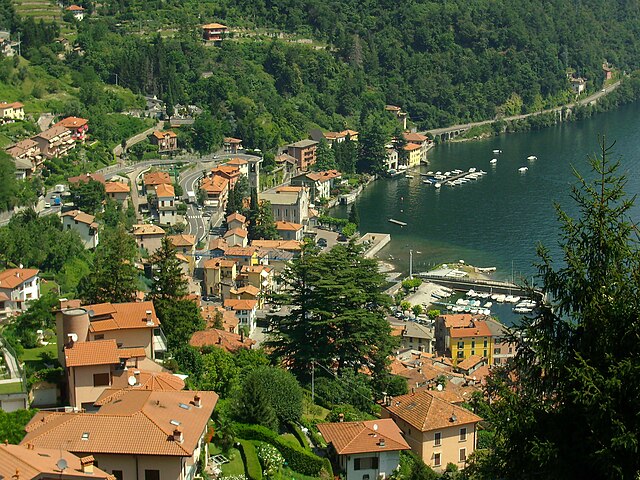
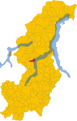
Tremezzina
Hiking in Tremezzina
Tremezzina is a picturesque area located on the western shore of Lake Como in Italy. It consists of several charming towns, including Tremezzo, Lenno, and Mezzegra, all surrounded by stunning landscapes, lush greenery, and breathtaking views of the lake and the surrounding mountains. Here are some highlights about hiking in Tremezzina:...
- Страна:
- Почтовый код: 22016
- Телефонный код: 0344
- Код автомобильного номера: CO
- Координаты: 45° 58' 51" N, 9° 12' 10" E
- GPS треки (wikiloc): [Ссылка]
- Высота над уровнем моря: 200 м m
- Площадь: 29.41 кв.км
- Население: 5118
- Веб сайт: [Ссылка]
Ардженьо
- коммуна Италии
Hiking in Ардженьо
Argegno is a scenic village located on the western shore of Lake Como in Italy, and it serves as a great base for hiking enthusiasts. The area is known for its stunning mountain landscapes, beautiful views of the lake, and charming trails that offer a mix of challenging hikes and leisurely walks....
- Страна:
- Почтовый код: 22010
- Телефонный код: 031
- Код автомобильного номера: CO
- Координаты: 45° 56' 36" N, 9° 7' 42" E
- GPS треки (wikiloc): [Ссылка]
- Высота над уровнем моря: 210 м m
- Площадь: 4.11 кв.км
- Население: 665
- Веб сайт: [Ссылка]
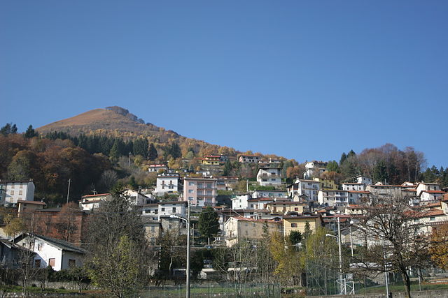
Лайно
- коммуна Италии
Hiking in Лайно
Laino, located in the Calabria region of southern Italy, is surrounded by picturesque landscapes and offers some fantastic opportunities for hiking enthusiasts. The area is characterized by its rugged mountains, lush forests, and stunning views of the surrounding valleys and rivers. Here are some highlights and tips for hiking in Laino:...
- Страна:
- Почтовый код: 22020
- Телефонный код: 031
- Код автомобильного номера: CO
- Координаты: 45° 58' 0" N, 9° 5' 0" E
- GPS треки (wikiloc): [Ссылка]
- Высота над уровнем моря: 700 м m
- Площадь: 6.68 кв.км
- Население: 516
- Веб сайт: [Ссылка]
Леццено
- коммуна Италии
Hiking in Леццено
Lezzeno is a picturesque village located on the eastern shore of Lake Como in Italy. It offers stunning views and a range of beautiful hiking opportunities, attracting both beginners and experienced hikers. Here are some highlights for hiking in and around Lezzeno:...
- Страна:
- Почтовый код: 22025
- Телефонный код: 031
- Код автомобильного номера: CO
- Координаты: 45° 57' 0" N, 9° 12' 0" E
- GPS треки (wikiloc): [Ссылка]
- Высота над уровнем моря: 202 м m
- Площадь: 20.7 кв.км
- Население: 2095
- Веб сайт: [Ссылка]

Сала-Комачина
- коммуна Италии
Hiking in Сала-Комачина
Sala Comacina is a picturesque small town located on the western shore of Lake Como in Italy. It offers opportunities for hiking enthusiasts to explore the stunning natural landscapes and enjoy scenic views of the lake and surrounding mountains. Here are some key highlights and tips for hiking in Sala Comacina:...
- Страна:
- Почтовый код: 22010
- Телефонный код: 0344
- Код автомобильного номера: CO
- Координаты: 45° 58' 0" N, 9° 10' 0" E
- GPS треки (wikiloc): [Ссылка]
- Высота над уровнем моря: 213 м m
- Площадь: 4.73 кв.км
- Население: 538
- Веб сайт: [Ссылка]

Пигра
- коммуна Италии
Hiking in Пигра
Pigra is a beautiful village located in the Lombardy region of Italy, near Lake Como. It offers stunning views and a variety of hiking trails, making it a popular destination for outdoor enthusiasts. Here are some highlights of hiking in Pigra:...
- Страна:
- Почтовый код: 22020
- Телефонный код: 031
- Код автомобильного номера: CO
- Координаты: 45° 57' 0" N, 9° 7' 0" E
- GPS треки (wikiloc): [Ссылка]
- Высота над уровнем моря: 881 м m
- Площадь: 4.53 кв.км
- Население: 244
- Веб сайт: [Ссылка]