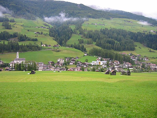
Комелико-Супериоре (Comelico Superiore, Comelico Superiore)
.svg)
- коммуна Италии
 Hiking in Комелико-Супериоре
Comelico Superiore is a beautiful destination located in the Dolomites, specifically in the province of Belluno, Italy. It's part of the Cadore region and is known for its stunning natural landscapes, rich culture, and excellent hiking opportunities. Here are some highlights about hiking in Comelico Superiore:
Scenic Trails
- Diverse Routes: Comelico Superiore offers a variety of hiking trails that cater to different skill levels, from easy walks suitable for families to challenging alpine routes.
- Panoramic Views: Many trails provide breathtaking views of the surrounding Dolomite peaks, lush valleys, and charming villages.
Popular Hiking Routes
- Valle di Sesto: This trail takes you through picturesque landscapes and offers options to extend your hike into more challenging areas.
- Sentiero dei Camosci: This trail is known for its wildlife, especially chamois, and provides stunning views of the mountains.
- Tre Cime di Lavaredo: While technically just outside Comelico Superiore, this iconic area is a must-visit for those in the region. The trails around the Tre Cime offer unforgettable views.
Nature and Wildlife
- The region is part of a UNESCO World Heritage Site and is home to diverse flora and fauna. Hikers may encounter various species of wildlife, including deer, marmots, and a variety of birds.
Cultural Heritage
- As you hike through Comelico Superiore, you'll experience the local culture, visiting quaint villages and historical sites. Many trails lead to ancient churches or through areas that tell the story of the region's history.
Best Time to Hike
- The hiking season usually runs from late spring to early autumn (May to October), with the best times being late spring for blooming flowers and early autumn for vibrant foliage. Always check for trail conditions, especially in the transition months.
Preparation Tips
- Gear Up: Wear appropriate hiking boots, and dress in layers to adapt to changing weather conditions.
- Navigation: While many trails are well-marked, bringing a map or GPS device is advisable.
- Stay Hydrated: Carry plenty of water and snacks, especially on longer hikes.
Local Amenities
- There are a few mountain huts (rifugi) along many trails where you can stop for a meal or refreshment, making it a great way to experience local cuisine.
Overall, hiking in Comelico Superiore combines stunning natural beauty with a rich cultural experience, making it a fantastic destination for hikers of all levels. Always prioritize safety, respect the environment, and enjoy the adventure!
- Страна:

- Почтовый код: 32040
- Телефонный код: 0435
- Код автомобильного номера: BL
- Координаты: 46° 35' 21" N, 12° 30' 53" E


- GPS треки (wikiloc): [Ссылка]
- Высота над уровнем моря: 1210 м m
- Площадь: 96.15 кв.км
- Население: 2157
- Веб сайт: http://www.comelicosuperiore.info
- Википедия русская: wiki(ru)
- Википедия английская: wiki(en)
- Википедия национальная: wiki(it)
- Хранилище Wikidata: Wikidata: Q40141
- Катеория в википедии: [Ссылка]
- код Freebase: [/m/0gk1kg]
- код GeoNames: Альт: [6539660]
- код VIAF: Альт: [237385485]
- ID отношения в OpenStreetMap: [47267]
- код ISTAT: 025015
- кадастровый код Италии: C920
Граничит с регионами:

Сесто
- коммуна в Италии
Hiking in Сесто
Sexten, also known as Sesto, is a stunning destination located in the Dolomites of northern Italy. It offers a fantastic range of hiking opportunities for all levels of experience, all surrounded by breathtaking mountain scenery. Here are some key points to consider when hiking in Sexten:...
- Страна:
- Почтовый код: 39030
- Телефонный код: 0474
- Код автомобильного номера: BZ
- Координаты: 46° 42' 0" N, 12° 21' 0" E
- GPS треки (wikiloc): [Ссылка]
- Высота над уровнем моря: 1310 м m
- Площадь: 80.42 кв.км
- Население: 1906
- Веб сайт: [Ссылка]


Ауронцо-ди-Кадоре
- коммуна Италии
Hiking in Ауронцо-ди-Кадоре
Auronzo di Cadore is a stunning destination located in the Dolomites of northeastern Italy, known for its breathtaking landscapes, rich history, and a plethora of outdoor activities, particularly hiking. Here’s an overview of what to expect when hiking in Auronzo di Cadore:...
- Страна:
- Почтовый код: 32041
- Телефонный код: 0435
- Код автомобильного номера: BL
- Координаты: 46° 33' 0" N, 12° 26' 0" E
- GPS треки (wikiloc): [Ссылка]
- Высота над уровнем моря: 862 м m
- Площадь: 220.65 кв.км
- Население: 3302
- Веб сайт: [Ссылка]
Сан-Николо-ди-Комелико
- коммуна Италии
Hiking in Сан-Николо-ди-Комелико
San Nicolò di Comelico is a picturesque village situated in the Dolomites of Italy, offering stunning hiking opportunities against a backdrop of breathtaking mountain landscapes, lush forests, and tranquil alpine meadows. Here are some highlights and considerations for hiking in this area:...
- Страна:
- Почтовый код: 32040
- Телефонный код: 0435
- Код автомобильного номера: BL
- Координаты: 46° 34' 55" N, 12° 31' 42" E
- GPS треки (wikiloc): [Ссылка]
- Высота над уровнем моря: 1061 м m
- Площадь: 24.16 кв.км
- Население: 390
- Веб сайт: [Ссылка]


Данта-ди-Кадоре
- коммуна Италии
Hiking in Данта-ди-Кадоре
Danta di Cadore is a beautiful mountain village located in the Dolomites, Northeast Italy. It's known for its picturesque landscapes, charming architecture, and numerous hiking opportunities suitable for various skill levels. Here are some highlights and tips for hiking in this area:...
- Страна:
- Почтовый код: 32040
- Телефонный код: 0435
- Код автомобильного номера: BL
- Координаты: 46° 34' 1" N, 12° 31' 14" E
- GPS треки (wikiloc): [Ссылка]
- Высота над уровнем моря: 1398 м m
- Площадь: 7.95 кв.км
- Население: 446
- Веб сайт: [Ссылка]


Картич
Hiking in Картич
Kartitsch is a charming village located in the Austrian Alps, known for its stunning natural landscapes and excellent hiking opportunities. Nestled in the East Tyrol region, it offers a variety of trails that cater to different experience levels. Here are some key highlights for hiking in Kartitsch:...
- Страна:

- Почтовый код: 9941
- Телефонный код: 04848
- Код автомобильного номера: LZ
- Координаты: 46° 43' 0" N, 12° 29' 0" E
- GPS треки (wikiloc): [Ссылка]
- Высота над уровнем моря: 1353 м m
- Площадь: 58.91 кв.км
- Население: 803
- Веб сайт: [Ссылка]