
Кортина-д’Ампеццо (Cortina d'Ampezzo, Cortina d'Ampezzo)
.svg)
- коммуна Италии
 Hiking in Кортина-д’Ампеццо
Cortina d'Ampezzo, located in the Veneto region of Italy, is a renowned destination for hiking enthusiasts, offering stunning landscapes, diverse trails, and breathtaking views of the Dolomites, a UNESCO World Heritage site. Here’s a guide to hiking in this beautiful area:
Trails and Routes
-
Cinque Torri: This area features a series of impressive rock formations and is popular for both hiking and rock climbing. The trail around the Cinque Torri offers panoramic views and can be accessed via the chairlift from Passo Falzarego.
-
Tofane Group: The trails around the Tofane mountains are well-marked and vary in difficulty. The Tofana di Mezzo trail provides an incredible view and is known for its dramatic peaks.
-
Fanes-Sennes-Braies Natural Park: This park offers numerous hiking routes among stunning natural scenery, including lush valleys, pristine lakes, and high-altitude plateaus. Popular hikes include the circuit around Lago di Braies.
-
Lagazuoi: This area is famous for its historical significance from World War I. The hike to the Lagazuoi summit rewards hikers with inspiring views of the surrounding Dolomites and is accessible via a cable car.
-
Path of the Legends (Sentiero delle Leggende): This family-friendly trail combines hiking with storytelling, featuring sculptures and information boards that tell local legends.
Tips for Hiking in Cortina d'Ampezzo
-
Season: The best times for hiking are late spring through early autumn (May to October), as conditions can be unpredictable in winter due to snow.
-
Weather: Always check the weather forecast before heading out. Conditions in the mountains can change rapidly.
-
Equipment: Proper hiking boots, water, snacks, sun protection, and a first-aid kit are recommended. Depending on the difficulty of the trail, consider trekking poles for added support.
-
Guides: Hiring a local guide can enhance your experience, especially for more challenging trails or if you're unfamiliar with the area.
-
Trail Maps: Utilize trail maps and GPS devices to navigate. Local tourist information centers can provide maps and advice.
Accommodations and Amenities
Cortina d'Ampezzo offers a range of accommodations, from luxury hotels to cozy lodges and mountain huts. Post-hike, enjoy local cuisine in the town’s restaurants, which often feature traditional dishes influenced by both Italian and Tyrolean cultures.
Conclusion
Hiking in Cortina d'Ampezzo presents an excellent opportunity to explore the breathtaking Dolomites, with trails for all skill levels. Whether you're looking for a leisurely hike or a challenging adventure, this charming mountain town is a fantastic base for outdoor activities. Always remember to respect nature and follow the Leave No Trace principles during your hikes!
- Страна:

- Почтовый код: 32043
- Телефонный код: 0436
- Код автомобильного номера: BL
- Координаты: 46° 32' 17" N, 12° 8' 14" E


- GPS треки (wikiloc): [Ссылка]
- Высота над уровнем моря: 1224 м m
- Площадь: 252.81 кв.км
- Население: 5852
- Веб сайт: http://www.comunecortinadampezzo.it
- Википедия русская: wiki(ru)
- Википедия английская: wiki(en)
- Википедия национальная: wiki(it)
- Хранилище Wikidata: Wikidata: Q41158
- Галерея изображений в википедии: [Ссылка]
- Катеория в википедии: [Ссылка]
- код Freebase: [/m/02qzmh]
- код GeoNames: Альт: [6538275]
- код VIAF: Альт: [125505521]
- ID отношения в OpenStreetMap: [47235]
- UN/LOCODE: [ITCDF]
- код в энциклопедии «Британника онлайн»: [place/Cortina-dAmpezzo]
- код в Большой каталанской энциклопедии: [0020161]
- код в Большой российской энциклопедии онлайн: [2100366]
- код ISTAT: 025016
- кадастровый код Италии: A266
- код US National Archives: 10044904
Граничит с регионами:

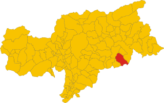
Бадия
- коммуна Италии
Hiking in Бадия
Hiking in Badia, located in the heart of South Tyrol, Italy, offers a unique blend of stunning natural landscapes, rich cultural heritage, and a variety of trails suitable for all skill levels. Here are several important aspects of hiking in this beautiful area:...
- Страна:
- Почтовый код: 39036
- Телефонный код: 0471
- Код автомобильного номера: BZ
- Координаты: 46° 36' 40" N, 11° 53' 40" E
- GPS треки (wikiloc): [Ссылка]
- Высота над уровнем моря: 1315 м m
- Площадь: 83.18 кв.км
- Население: 3491
- Веб сайт: [Ссылка]


Брайес
- коммуна Италии
Hiking in Брайес
Prags, or Braies, is a beautiful area located in the South Tyrol region of Italy, known for its stunning natural landscapes, particularly the Dolomite Mountains. The focal point of this area is the picturesque Lago di Braies (Pragser Wildsee), a striking alpine lake surrounded by imposing peaks and lush forests....
- Страна:
- Почтовый код: 39030
- Телефонный код: 0474
- Код автомобильного номера: BZ
- Координаты: 46° 43' 0" N, 12° 8' 0" E
- GPS треки (wikiloc): [Ссылка]
- Высота над уровнем моря: 1213 м m
- Площадь: 90.25 кв.км
- Население: 652
- Веб сайт: [Ссылка]
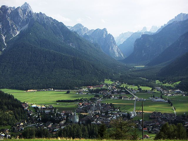

Доббьяко
- коммуна Италии
Hiking in Доббьяко
Toblach, located in the South Tyrol region of northern Italy, is a beautiful destination for hikers, thanks to its stunning landscapes and well-marked trails. Here’s an overview of what you can expect when hiking in Toblach:...
- Страна:
- Почтовый код: 39034
- Телефонный код: 0474
- Код автомобильного номера: BZ
- Координаты: 46° 44' 7" N, 12° 13' 20" E
- GPS треки (wikiloc): [Ссылка]
- Высота над уровнем моря: 1241 м m
- Площадь: 125.42 кв.км
- Население: 3346
- Веб сайт: [Ссылка]


Ауронцо-ди-Кадоре
- коммуна Италии
Hiking in Ауронцо-ди-Кадоре
Auronzo di Cadore is a stunning destination located in the Dolomites of northeastern Italy, known for its breathtaking landscapes, rich history, and a plethora of outdoor activities, particularly hiking. Here’s an overview of what to expect when hiking in Auronzo di Cadore:...
- Страна:
- Почтовый код: 32041
- Телефонный код: 0435
- Код автомобильного номера: BL
- Координаты: 46° 33' 0" N, 12° 26' 0" E
- GPS треки (wikiloc): [Ссылка]
- Высота над уровнем моря: 862 м m
- Площадь: 220.65 кв.км
- Население: 3302
- Веб сайт: [Ссылка]


Ливиналлонго-дель-Коль-ди-Лана
- коммуна Италии
Hiking in Ливиналлонго-дель-Коль-ди-Лана
Livinallongo del Col di Lana is a stunning valley located in the Dolomites of northern Italy. It offers a unique combination of breathtaking landscapes, rich history, and a variety of hiking trails that cater to different skill levels....
- Страна:
- Почтовый код: 32020
- Телефонный код: 0436
- Код автомобильного номера: BL
- Координаты: 46° 29' 0" N, 11° 57' 0" E
- GPS треки (wikiloc): [Ссылка]
- Высота над уровнем моря: 1645 м m
- Площадь: 100.01 кв.км
- Население: 1300
- Веб сайт: [Ссылка]


Колле-Санта-Лучия
- коммуна Италии
Hiking in Колле-Санта-Лучия
Colle Santa Lucia is a picturesque village located in the Dolomites of northern Italy, known for its stunning landscapes and rich cultural heritage. Hiking in this region offers a variety of trails suitable for different skill levels, making it a fantastic destination for both novice and experienced hikers....
- Страна:
- Почтовый код: 32020
- Телефонный код: 0437
- Код автомобильного номера: BL
- Координаты: 46° 26' 55" N, 12° 0' 50" E
- GPS треки (wikiloc): [Ссылка]
- Высота над уровнем моря: 1453 м m
- Площадь: 15.34 кв.км
- Население: 357
- Веб сайт: [Ссылка]


Сан-Вито-Кадоре
- коммуна Италии
Hiking in Сан-Вито-Кадоре
San Vito di Cadore is a picturesque village located in the Dolomites, Italy. It's an excellent destination for hiking enthusiasts, offering a variety of trails amidst stunning mountain scenery, lush forests, and breathtaking views. Here are some key points about hiking in this beautiful area:...
- Страна:
- Почтовый код: 32046
- Телефонный код: 0436
- Код автомобильного номера: BL
- Координаты: 46° 27' 46" N, 12° 12' 22" E
- GPS треки (wikiloc): [Ссылка]
- Высота над уровнем моря: 1011 м m
- Площадь: 61.62 кв.км
- Население: 1865
- Веб сайт: [Ссылка]


Мареббе
- коммуна Италии
Hiking in Мареббе
Mareo is a charming area in the Asturias region of northern Spain, known for its breathtaking natural landscapes, rich biodiversity, and traditional villages. Hiking in Mareo can be a rewarding experience, offering various trails that cater to hikers of different skill levels. Here are a few key points to consider if you plan on hiking in this area:...
- Страна:
- Почтовый код: 39030
- Телефонный код: 0474
- Код автомобильного номера: BZ
- Координаты: 46° 43' 8" N, 11° 55' 1" E
- GPS треки (wikiloc): [Ссылка]
- Высота над уровнем моря: 1186 м m
- Площадь: 160.32 кв.км
- Население: 3037
- Веб сайт: [Ссылка]