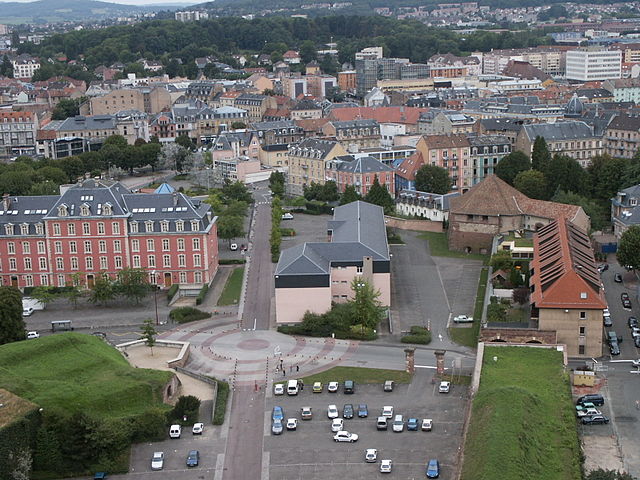
Danjoutin (Danjoutin)

- коммуна во Франции
 Hiking in Danjoutin
Danjoutin is a small commune located in the Bourgogne-Franche-Comté region of eastern France, near the city of Montbéliard. While it may not be as well-known as some larger hiking destinations, there are opportunities for outdoor activities and hiking in the surrounding areas.
Here are some highlights about hiking in and around Danjoutin:
Nearby Natural Areas
-
Forest of the Grand Bois: This area, located close to Danjoutin, offers various trails through forests where you can enjoy nature and potentially spot local wildlife. The lush greenery and peaceful atmosphere make it a great place for a leisurely hike.
-
The Vosges Mountains: A bit farther to the east, the Vosges offer a range of hiking trails from easy walks to more challenging hikes. This mountain range is known for its beautiful landscapes, including lakes, forests, and panoramic views.
-
La Doubs River: Trails along the Doubs River provide scenic views and opportunities for hiking along the river’s banks. The area is rich in flora and fauna, making it a delightful spot for nature lovers.
Trail Tips
- Trail Maps: It's advisable to get a local map or use a hiking app to help navigate the trails in the area, as well-marked paths can vary.
- Difficulty Levels: Be sure to review the difficulty levels of the trails. There are options for all skill levels, from beginners to more experienced hikers.
- Seasons: Spring and fall are optimal seasons for hiking in the region due to mild weather and beautiful scenery. Summer can get warmer, while winter conditions may limit trail access.
Practical Information
- Gear: Make sure to wear appropriate hiking shoes, carry enough water, snacks, and sun protection.
- Local Regulations: Check for any local regulations regarding hiking, especially if you're in nature reserves where rules may apply to protect the environment.
Conclusion
While Danjoutin itself may be a quiet commune, its proximity to natural landscapes makes it a good starting point for discovering the beauty of the Franche-Comté region. Whether you prefer serene forest walks or rugged mountain hiking, you'll find plenty of opportunities to enjoy the outdoors nearby.
- Страна:

- Почтовый код: 90400
- Координаты: 47° 37' 4" N, 6° 51' 50" E


- GPS треки (wikiloc): [Ссылка]
- Площадь: 5.65 кв.км
- Население: 3707
- Веб сайт: http://www.mairiedanjoutin.fr
- Википедия английская: wiki(en)
- Википедия национальная: wiki(fr)
- Хранилище Wikidata: Wikidata: Q816662
- Катеория в википедии: [Ссылка]
- код Freebase: [/m/03mh9dl]
- код Freebase: [/m/03mh9dl]
- код Freebase: [/m/03mh9dl]
- код GeoNames: Альт: [6451890]
- код GeoNames: Альт: [6451890]
- код GeoNames: Альт: [6451890]
- номер SIREN: [219000320]
- номер SIREN: [219000320]
- номер SIREN: [219000320]
- код BNF: [15279973h]
- код BNF: [15279973h]
- код BNF: [15279973h]
- код муниципалитета INSEE: 90032
- код муниципалитета INSEE: 90032
- код муниципалитета INSEE: 90032
Граничит с регионами:

Бельфор
- коммуна во Франции
Hiking in Бельфор
Belfort, a city in northeastern France, is known for its scenic landscapes and historical significance, particularly the impressive citadel built by Vauban. When it comes to hiking, the area surrounding Belfort offers a variety of trails that cater to different skill levels and preferences, showcasing the natural beauty of the region....
- Страна:
- Почтовый код: 90000
- Координаты: 47° 38' 15" N, 6° 51' 46" E
- GPS треки (wikiloc): [Ссылка]
- Высота над уровнем моря: 358 м m
- Площадь: 17.1 кв.км
- Население: 49519
- Веб сайт: [Ссылка]


Andelnans
- коммуна во Франции
Hiking in Andelnans
Andelnans, located in the Haut-Doubs region of France, offers beautiful landscapes and a variety of hiking opportunities. Nestled in the Jura mountain range, this area features rolling hills, dense forests, and picturesque lakes, making it fabulous for outdoor enthusiasts....
- Страна:
- Почтовый код: 90400
- Координаты: 47° 36' 9" N, 6° 52' 7" E
- GPS треки (wikiloc): [Ссылка]
- Площадь: 4.17 кв.км
- Население: 1224


Pérouse
- коммуна во Франции
Hiking in Pérouse
Pérouse is a charming commune located in the Territoire de Belfort department in the Bourgogne-Franche-Comté region of eastern France. While it may not be as well-known for hiking as some larger national parks or mountains in France, there are still plenty of opportunities for outdoor enthusiasts to enjoy the beautiful landscape of this area. Here are some aspects to consider when hiking in and around Pérouse:...
- Страна:
- Почтовый код: 90160
- Координаты: 47° 38' 13" N, 6° 53' 26" E
- GPS треки (wikiloc): [Ссылка]
- Площадь: 4.9 кв.км
- Население: 1157
- Веб сайт: [Ссылка]


Bavilliers
- коммуна во Франции
Hiking in Bavilliers
Bavilliers, a small commune located in the Bourgogne-Franche-Comté region of France, offers a charming backdrop for those interested in hiking. While it may not be as renowned as some larger hiking locales, it provides a unique opportunity to explore the surrounding natural landscapes....
- Страна:
- Почтовый код: 90800
- Координаты: 47° 37' 10" N, 6° 49' 50" E
- GPS треки (wikiloc): [Ссылка]
- Площадь: 4.8 кв.км
- Население: 4826
- Веб сайт: [Ссылка]


Vézelois
- коммуна во Франции
Hiking in Vézelois
Vézelay is a picturesque village located in the Burgundy region of France, renowned for its historical significance and stunning landscapes. It's situated on a hilltop and is famous for the Basilique Sainte-Marie-Madeleine, a UNESCO World Heritage site....
- Страна:
- Почтовый код: 90400
- Координаты: 47° 36' 28" N, 6° 54' 59" E
- GPS треки (wikiloc): [Ссылка]
- Площадь: 9.43 кв.км
- Население: 946
- Веб сайт: [Ссылка]