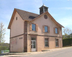
Bavilliers (Bavilliers)

- коммуна во Франции
 Hiking in Bavilliers
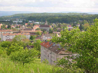
Bavilliers, a small commune located in the Bourgogne-Franche-Comté region of France, offers a charming backdrop for those interested in hiking. While it may not be as renowned as some larger hiking locales, it provides a unique opportunity to explore the surrounding natural landscapes.
Hiking Trails and Routes:
-
Local Pathways: Bavilliers is surrounded by picturesque countryside, and there are numerous local walking paths that can be explored. These trails often lead through forests, fields, and past small streams.
-
Nature Reserves: Nearby nature reserves may offer marked trails for hikers. Exploring these reserves can provide a chance to observe local flora and fauna.
-
Regional Hikes: If you're willing to travel a bit beyond Bavilliers, you can access larger hiking networks in the Jura Mountains or the Vosges, both of which are relatively accessible from this area and offer a variety of trails from easy to challenging.
What to Consider:
- Terrain: The terrain around Bavilliers can vary, but it generally features gentle hills and flat areas, making it suitable for all levels of hikers.
- Weather: Check the weather forecast before heading out, as conditions can change rapidly in this region, especially in spring and autumn.
- Guided Tours: For those new to hiking or wanting to learn more about the area, consider joining a local hiking group or a guided tour. They can provide insight into the region's ecology and history.
Gear and Preparation:
- Footwear: Wear sturdy, comfortable hiking boots suitable for different trail surfaces.
- Hydration and Nutrition: Always carry enough water and snacks to keep your energy levels up.
- Maps and Navigation: It’s a good idea to have a map of the area or use a hiking app to navigate, as some trails may not be well-marked.
Local Attractions:
After your hike, take some time to explore Bavilliers itself. It has a quaint village charm, with local shops and cafes where you can relax and enjoy some regional cuisine.
Overall, while Bavilliers might not be a major hiking destination, it still has plenty to offer for those looking to enjoy a peaceful hike in a beautiful setting.
- Страна:

- Почтовый код: 90800
- Координаты: 47° 37' 10" N, 6° 49' 50" E


- GPS треки (wikiloc): [Ссылка]
- Площадь: 4.8 кв.км
- Население: 4826
- Веб сайт: http://www.bavilliers.fr
- Википедия английская: wiki(en)
- Википедия национальная: wiki(fr)
- Хранилище Wikidata: Wikidata: Q694645
- Катеория в википедии: [Ссылка]
- код Freebase: [/m/03mh90k]
- код Freebase: [/m/03mh90k]
- код Freebase: [/m/03mh90k]
- код GeoNames: Альт: [6452602]
- код GeoNames: Альт: [6452602]
- код GeoNames: Альт: [6452602]
- номер SIREN: [219000080]
- номер SIREN: [219000080]
- номер SIREN: [219000080]
- код BNF: [15279949n]
- код BNF: [15279949n]
- код BNF: [15279949n]
- код Цифрового атласа Римской империи: [42007]
- код Цифрового атласа Римской империи: [42007]
- код Цифрового атласа Римской империи: [42007]
- код муниципалитета INSEE: 90008
- код муниципалитета INSEE: 90008
- код муниципалитета INSEE: 90008
Граничит с регионами:

Бельфор
- коммуна во Франции
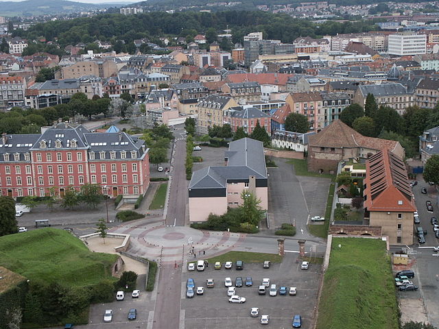
Hiking in Бельфор
Belfort, a city in northeastern France, is known for its scenic landscapes and historical significance, particularly the impressive citadel built by Vauban. When it comes to hiking, the area surrounding Belfort offers a variety of trails that cater to different skill levels and preferences, showcasing the natural beauty of the region....
- Страна:
- Почтовый код: 90000
- Координаты: 47° 38' 15" N, 6° 51' 46" E
- GPS треки (wikiloc): [Ссылка]
- Высота над уровнем моря: 358 м m
- Площадь: 17.1 кв.км
- Население: 49519
- Веб сайт: [Ссылка]


Andelnans
- коммуна во Франции
Hiking in Andelnans
Andelnans, located in the Haut-Doubs region of France, offers beautiful landscapes and a variety of hiking opportunities. Nestled in the Jura mountain range, this area features rolling hills, dense forests, and picturesque lakes, making it fabulous for outdoor enthusiasts....
- Страна:
- Почтовый код: 90400
- Координаты: 47° 36' 9" N, 6° 52' 7" E
- GPS треки (wikiloc): [Ссылка]
- Площадь: 4.17 кв.км
- Население: 1224

Argiésans
- коммуна во Франции
Hiking in Argiésans
Argiésans is a picturesque region known for its stunning natural landscapes, making it an excellent destination for hiking enthusiasts. Nestled in the heart of the Pyrenees, this area offers a variety of trails that cater to different skill levels, from gentle walks to challenging climbs....
- Страна:
- Почтовый код: 90800
- Координаты: 47° 36' 14" N, 6° 49' 22" E
- GPS треки (wikiloc): [Ссылка]
- Площадь: 2.73 кв.км
- Население: 433

Danjoutin
- коммуна во Франции
Hiking in Danjoutin
Danjoutin is a small commune located in the Bourgogne-Franche-Comté region of eastern France, near the city of Montbéliard. While it may not be as well-known as some larger hiking destinations, there are opportunities for outdoor activities and hiking in the surrounding areas....
- Страна:
- Почтовый код: 90400
- Координаты: 47° 37' 4" N, 6° 51' 50" E
- GPS треки (wikiloc): [Ссылка]
- Площадь: 5.65 кв.км
- Население: 3707
- Веб сайт: [Ссылка]


Urcerey
- коммуна во Франции
Hiking in Urcerey
Urcerey is not a widely recognized hiking destination, so it might refer to a specific area with local interest or a less-known name. However, if you meant a popular hiking area or trail with a name similar to Urcerey, please clarify....
- Страна:
- Почтовый код: 90800
- Координаты: 47° 36' 29" N, 6° 48' 33" E
- GPS треки (wikiloc): [Ссылка]
- Площадь: 3.39 кв.км
- Население: 215


Essert
- коммуна во Франции
Hiking in Essert
Hiking in Essert, located in the Territoire de Belfort region of France, offers a delightful combination of natural beauty, picturesque landscapes, and accessibility for outdoor enthusiasts. Here are some highlights and tips for hiking in this area:...
- Страна:
- Почтовый код: 90850
- Координаты: 47° 37' 55" N, 6° 48' 59" E
- GPS треки (wikiloc): [Ссылка]
- Площадь: 7.01 кв.км
- Население: 3268
- Веб сайт: [Ссылка]