
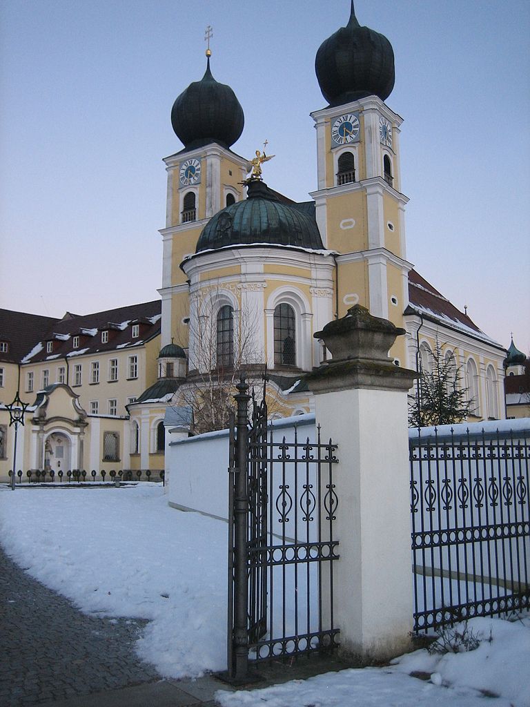
Деггендорф (Deggendorf, Deggendorf)

- Город в Германии, районный центр, расположен в земле Бавария
 Hiking in Деггендорф
Deggendorf, located in the picturesque Bavaria region of Germany, offers a variety of hiking opportunities that are appealing to both novice and experienced hikers. The area is known for its scenic landscapes, including rolling hills, lush forests, and stunning views of the Danube River and the surrounding Bavarian countryside.
Hiking Trails
-
Danube River Trails: The trails along the Danube River provide a scenic experience, allowing hikers to enjoy the river's views and the natural beauty that surrounds it. These trails are generally flat, making them accessible for people of all skill levels.
-
Forest Trails: The nearby forests offer numerous paths through dense woodlands, providing shade and a peaceful atmosphere. These trails vary in difficulty, from easy walks to more challenging routes.
-
Donauradweg: Part of the well-known Danube Cycle Path, this trail can also be enjoyed on foot. It runs parallel to the river and showcases stunning landscapes and quaint villages.
-
Bavarian Forest National Park: Just a short drive from Deggendorf, this national park features extensive hiking networks with well-marked trails. You can enjoy breathtaking views, diverse plant and animal life, and a chance to experience the beauty of Germany's oldest national park.
-
Local Favorites: Trails like the "Ödpeter Runde" or the "Bockelstein" offer local charm and beautiful views, making them great options for shorter hikes with easy access.
Tips for Hiking in Deggendorf
-
Map and Navigation: While many trails are well marked, it’s always a good idea to carry a map or use a hiking app for navigation.
-
Equipment: Wear comfortable, supportive shoes and dress in layers to adapt to changing weather conditions. A light backpack with water and snacks is essential for longer hikes.
-
Safety: Always inform someone of your hiking plans and expected return time. Be mindful of wildlife and stay on designated paths.
-
Best Time to Hike: Spring and autumn are particularly lovely for hiking due to mild temperatures and beautiful foliage. Summers can be warm, while winter hikes can offer a different, serene beauty if you're prepared for snow.
Deggendorf is an excellent base for exploring the Bavarian landscape and immersing yourself in nature. Whether you're looking for a leisurely stroll along the river or a challenging trek through the forests, you'll find something to enjoy.
- Страна:

- Почтовый код: 94469
- Телефонный код: 0991
- Код автомобильного номера: DEG
- Координаты: 48° 50' 41" N, 12° 57' 30" E


- GPS треки (wikiloc): [Ссылка]
- Высота над уровнем моря: 323 м m
- Площадь: 77.21 кв.км
- Население: 31757
- Веб сайт: http://www.deggendorf.de/
- Википедия русская: wiki(ru)
- Википедия английская: wiki(en)
- Википедия национальная: wiki(de)
- Хранилище Wikidata: Wikidata: Q16083
- Катеория в википедии: [Ссылка]
- код Freebase: [/m/04z6h2]
- код GeoNames: Альт: [6558236]
- код VIAF: Альт: [131399771]
- ID отношения в OpenStreetMap: [959809]
- код GND: Альт: [4011295-0]
- идентификатор местоположения ArchINFORM: [9649]
- код LCNAF: Альт: [n84112530]
- место в MusicBrainz: [c97413ba-a802-4e55-9316-aea4d24ff802]
- WOEID: [643988]
- код в энциклопедии «Британника онлайн»: [place/Deggendorf]
- Bavarikon ID: [ODB_A00001437]
- идентификатор муниципалитетов в Германии: 09271119
Граничит с регионами:

Штефанспошинг
Hiking in Штефанспошинг
Stephansposching is a small village in Bavaria, Germany, located near the banks of the River Inn. While it may not be as well-known as some other hiking destinations in the region, its picturesque countryside, rolling hills, and proximity to nature trails make it a lovely spot for outdoor activities....
- Страна:
- Почтовый код: 94569
- Телефонный код: 09931; 09935
- Код автомобильного номера: DEG
- Координаты: 48° 49' 0" N, 12° 48' 0" E
- GPS треки (wikiloc): [Ссылка]
- Высота над уровнем моря: 326 м m
- Площадь: 44.64 кв.км
- Население: 3027
- Веб сайт: [Ссылка]

Мос
Hiking in Мос
Moos, located in Bavaria, Germany, is a charming destination for hiking enthusiasts. The region is characterized by its scenic landscapes, including rolling hills, lush forests, and beautiful lakes. Here are some highlights and tips for hiking in Moos:...
- Страна:
- Почтовый код: 94554
- Телефонный код: 09938
- Код автомобильного номера: DEG
- Координаты: 48° 45' 0" N, 12° 58' 0" E
- GPS треки (wikiloc): [Ссылка]
- Высота над уровнем моря: 316 м m
- Площадь: 32.23 кв.км
- Население: 2181
- Веб сайт: [Ссылка]


Бишофсмайс
Hiking in Бишофсмайс
Bischofsmais is a charming village located in the Bavarian Forest in Germany, making it an excellent destination for hiking enthusiasts. The region is characterized by its lush forests, rolling hills, and stunning views, offering a variety of trails suitable for different skill levels....
- Страна:
- Почтовый код: 94253
- Телефонный код: 09920
- Код автомобильного номера: REG
- Координаты: 48° 55' 0" N, 13° 5' 0" E
- GPS треки (wikiloc): [Ссылка]
- Высота над уровнем моря: 682 м m
- Площадь: 46.28 кв.км
- Население: 3009
- Веб сайт: [Ссылка]

Шауфлинг
Hiking in Шауфлинг
Schaufling, located in the Lower Bavaria region of Germany, is a wonderful spot for hiking enthusiasts. Surrounded by picturesque landscapes, including rolling hills, dense forests, and tranquil rivers, it offers various trails suitable for all skill levels. Here are some highlights for hiking in Schaufling:...
- Страна:
- Почтовый код: 94571
- Телефонный код: 09904
- Код автомобильного номера: DEG
- Координаты: 48° 51' 0" N, 13° 4' 0" E
- GPS треки (wikiloc): [Ссылка]
- Высота над уровнем моря: 443 м m
- Площадь: 25.39 кв.км
- Население: 1471
- Веб сайт: [Ссылка]

Нидеральтайх
Hiking in Нидеральтайх
Niederalteich is a picturesque village in Bavaria, Germany, located in the scenic region of the Danube Valley. It offers a serene environment ideal for hiking enthusiasts who appreciate both nature and culture....
- Страна:
- Почтовый код: 94557
- Телефонный код: 09901
- Код автомобильного номера: DEG
- Координаты: 48° 46' 0" N, 13° 1' 0" E
- GPS треки (wikiloc): [Ссылка]
- Высота над уровнем моря: 312 м m
- Площадь: 9.97 кв.км
- Население: 1802
- Веб сайт: [Ссылка]
Меттен
Hiking in Меттен
Metten is a charming town in Bavaria, Germany, known for its beautiful landscapes and outdoor activities, including hiking. The town is surrounded by lush forests, rolling hills, and the Danube River, making it an ideal location for nature lovers and hikers of all skill levels....
- Страна:
- Почтовый код: 94526
- Телефонный код: 0991
- Код автомобильного номера: DEG
- Координаты: 48° 52' 0" N, 12° 55' 0" E
- GPS треки (wikiloc): [Ссылка]
- Высота над уровнем моря: 318 м m
- Площадь: 11.95 кв.км
- Население: 4191
- Веб сайт: [Ссылка]

Платлинг
Hiking in Платлинг
Plattling, located in Bavaria, Germany, is a charming town that serves as an excellent base for hikers looking to explore the beautiful landscapes of the surrounding region. Nestled along the banks of the Danube River, it offers access to diverse trails suitable for various skill levels. Here are some key points about hiking in and around Plattling:...
- Страна:
- Почтовый код: 94447
- Телефонный код: 09931
- Код автомобильного номера: DEG
- Координаты: 48° 46' 36" N, 12° 52' 25" E
- GPS треки (wikiloc): [Ссылка]
- Высота над уровнем моря: 318 м m
- Площадь: 35.9 кв.км
- Население: 12428
- Веб сайт: [Ссылка]

Графлинг
Hiking in Графлинг
Hiking in Grafling, located in Bavaria, Germany, offers a variety of scenic trails and beautiful landscapes, making it an excellent destination for outdoor enthusiasts. Here are some highlights and tips for hiking in the area:...
- Страна:
- Почтовый код: 94539
- Телефонный код: 0991
- Код автомобильного номера: DEG
- Координаты: 48° 53' 40" N, 12° 58' 30" E
- GPS треки (wikiloc): [Ссылка]
- Высота над уровнем моря: 433 м m
- Площадь: 46.32 кв.км
- Население: 2738
- Веб сайт: [Ссылка]

Хенгерсберг
Hiking in Хенгерсберг
Hengersberg is located in the Bavarian Forest region of Germany, which offers a variety of hiking opportunities amid picturesque landscapes and diverse natural surroundings. Here are some highlights you might appreciate while hiking in Hengersberg:...
- Страна:
- Почтовый код: 94491
- Телефонный код: 09901
- Код автомобильного номера: DEG
- Координаты: 48° 47' 0" N, 13° 3' 0" E
- GPS треки (wikiloc): [Ссылка]
- Высота над уровнем моря: 311 м m
- Площадь: 45.81 кв.км
- Население: 7190
- Веб сайт: [Ссылка]