
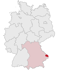
Нижняя Бавария (Lower Bavaria, Niederbayern)


- административный округ в Баварии
 Hiking in Нижняя Бавария
Lower Bavaria, located in the southeastern part of Germany, is a fantastic region for hiking enthusiasts, offering a diverse landscape that includes rolling hills, dense forests, rivers, and picturesque villages. Here are some highlights and tips for hiking in Lower Bavaria:
Highlights
-
München (Munich) to Passau Trail: This long-distance trail follows the banks of the River Danube, showcasing beautiful landscapes and charming towns like Deggendorf and Passau. Ideal for those who enjoy river valley hikes.
-
Bavarian Forest National Park: This area is perfect for more adventurous hikes with well-marked trails that lead through dense forests and up to mountain peaks like the Arber. Wildlife, including deer and lynx, can often be spotted here.
-
Waldnaab Valley: The scenic trails in this region offer beautiful views of the Waldnaab river, limestone rocks, and lush forests. It’s a great area for a half-day hike or a full day of exploration.
-
Vilsalpsee and surrounding trails: Located near the border with Austria, these trails offer breathtaking views of the mountains and lakes, making it perfect for leisurely walks or more challenging hikes.
-
Dreisessel Mountain: Situated at the border triangle of Germany, Czech Republic, and Austria, the summit offers rewarding panoramic views. The paths are well-marked and cater to various skill levels.
-
Regensburg and its surroundings: Explore the trails along the UNESCO-listed medieval city of Regensburg, with options to hike along the Danube or venture into the hills of the nearby Nature Park.
Types of Trails
- Gentle trails for beginners: There are many easy, flat trails suitable for families and those new to hiking.
- Medium trails for recreational hikers: These often feature moderate inclines and provide a good balance of challenge and enjoyment.
- Challenging trails for experienced hikers: These trails may have steep sections, rocky terrain, and require good physical fitness and hiking experience.
Practical Tips
-
Best Season: The best time for hiking in Lower Bavaria is late spring through early fall (May to October), when the weather is generally pleasant and the landscapes are lush.
-
Gear: Invest in good hiking boots and weather-appropriate clothing. A daypack with water, snacks, and a map or GPS is essential.
-
Local Guides: Consider joining guided tours or hiring local guides to enhance your experience, especially if you want to learn about the flora, fauna, and cultural history of the area.
-
Accommodations: There are numerous guesthouses, hotels, and campsites available, catering to hikers looking for overnight stays.
-
Transportation: Public transport options are generally available, making it easy to access trailheads without a car.
Lower Bavaria combines natural beauty with rich cultural experiences. Whether you are looking for a day hike or multi-day trekking, you’ll find plenty of options to suit your preferences. Always respect nature and the local environment while enjoying your hiking adventures!
- Страна:

- Столица: Ландсхут
- Координаты: 48° 41' 25" N, 12° 44' 52" E


- GPS треки (wikiloc): [Ссылка]
- Высота над уровнем моря: 320 м m
- Площадь: 10329.87 кв.км
- Население: 1181472
- Веб сайт: http://www.bezirk-niederbayern.de/
- Википедия русская: wiki(ru)
- Википедия английская: wiki(en)
- Википедия национальная: wiki(de)
- Хранилище Wikidata: Wikidata: Q10559
- Катеория в википедии: [Ссылка]
- Карты в википедии: [Ссылка]
- код GeoNames: Альт: [2863622]
- код BNF: [126523553]
- код VIAF: Альт: [129023089]
- ID отношения в OpenStreetMap: [17593]
- код GND: Альт: [4042177-6]
- код LCNAF: Альт: [n82024316]
- код темы Quora: [Lower-Bavaria]
- код NUTS: [DE22]
- код региона Германии: 092
Включает регионы:

Кельхайм
Hiking in Кельхайм
Kelheim, located in Bavaria, Germany, is a beautiful area for hiking, characterized by its stunning landscapes, historical sites, and natural attractions. Here are some highlights you might consider when planning a hiking trip in Kelheim:...
- Страна:
- Столица: Кельхайм
- Код автомобильного номера: ROL; RID; PAR; MAI; KEH
- Координаты: 48° 49' 48" N, 11° 49' 48" E
- GPS треки (wikiloc): [Ссылка]
- Высота над уровнем моря: 369 м m
- Площадь: 1067.00 кв.км
- Население: 90040
- Веб сайт: [Ссылка]

Ландсхут
Hiking in Ландсхут
Landshut district, located in Bavaria, Germany, offers a variety of hiking opportunities that cater to different skill levels and preferences. The landscape is characterized by rolling hills, picturesque villages, and lush forests, providing a beautiful backdrop for outdoor activities....
- Страна:
- Столица: Ландсхут
- Код автомобильного номера: LA
- Координаты: 48° 34' 14" N, 12° 10' 50" E
- GPS треки (wikiloc): [Ссылка]
- Высота над уровнем моря: 383 м m
- Площадь: 1348 кв.км
- Население: 115644
- Веб сайт: [Ссылка]
Ротталь-Инн
Hiking in Ротталь-Инн
Rottal-Inn, located in Bavaria, Germany, is a picturesque area known for its natural beauty and diverse landscapes, making it an excellent destination for hiking enthusiasts. The region is characterized by rolling hills, lush forests, and charming villages, providing a variety of hiking trails suitable for all skill levels. Here are some highlights to consider when hiking in Rottal-Inn:...
- Страна:
- Столица: Пфаркирхен
- Код автомобильного номера: PAN; VIB; GRI; EG
- Координаты: 48° 25' 12" N, 12° 55' 12" E
- GPS треки (wikiloc): [Ссылка]
- Высота над уровнем моря: 461 м m
- Площадь: 1.28 кв.км
- Население: 104013
- Веб сайт: [Ссылка]


Дингольфинг-Ландау
Hiking in Дингольфинг-Ландау
Dingolfing-Landau, located in Bavaria, Germany, offers a variety of hiking opportunities for enthusiasts of all levels. The region is known for its picturesque landscapes, charming villages, and diverse flora and fauna. Here are some highlights of hiking in Dingolfing-Landau:...
- Страна:
- Столица: Дингольфинг
- Код автомобильного номера: DGF
- Координаты: 48° 40' 12" N, 12° 34' 48" E
- GPS треки (wikiloc): [Ссылка]
- Высота над уровнем моря: 372 м m
- Площадь: 878.00 кв.км
- Население: 75517
- Веб сайт: [Ссылка]
Штраубинг-Боген
Hiking in Штраубинг-Боген
Straubing-Bogen is a beautiful district located in Bavaria, Germany, known for its picturesque landscapes and varied terrain, making it a great destination for hiking enthusiasts. Here are some highlights and tips for hiking in the region:...
- Страна:
- Столица: Штраубинг
- Код автомобильного номера: MAL; BOG; SR
- Координаты: 48° 55' 12" N, 12° 34' 48" E
- GPS треки (wikiloc): [Ссылка]
- Высота над уровнем моря: 337 м m
- Площадь: 1202.24 кв.км
- Население: 81062
- Веб сайт: [Ссылка]
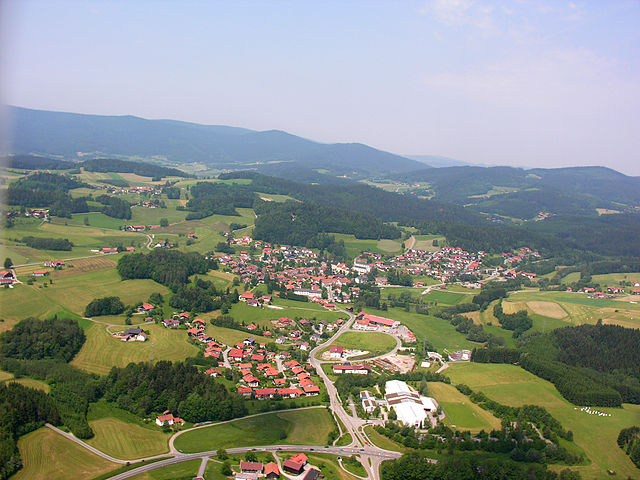
Реген
Hiking in Реген
Hiking in the Regen district, located in Bavaria, Germany, offers a stunning blend of natural beauty, cultural attractions, and outdoor adventure. The region is known for its picturesque landscapes, featuring lush forests, rolling hills, and the scenic Danube and Regen rivers. Here are some highlights and tips for hiking in this area:...
- Страна:
- Столица: Реген
- Код автомобильного номера: REG
- Координаты: 49° 0' 0" N, 13° 10' 12" E
- GPS треки (wikiloc): [Ссылка]
- Высота над уровнем моря: 686 м m
- Площадь: 975.00 кв.км
- Население: 76135
- Веб сайт: [Ссылка]


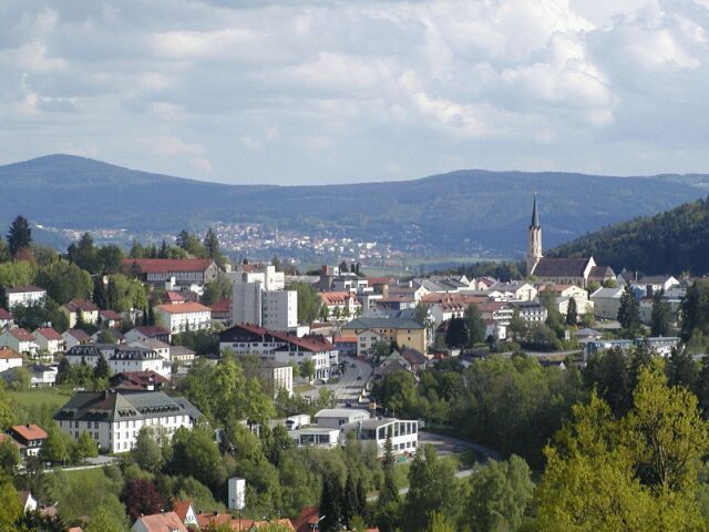
Деггендорф
- район в Баварии
Hiking in Деггендорф
Deggendorf, located in Bavaria, Germany, is a fantastic region for hiking enthusiasts. Nestled at the edge of the Bavarian Forest National Park and alongside the Danube River, it boasts a variety of landscapes and trails suitable for all skill levels....
- Страна:
- Столица: Деггендорф
- Код автомобильного номера: DEG
- Координаты: 48° 49' 48" N, 13° 0' 0" E
- GPS треки (wikiloc): [Ссылка]
- Высота над уровнем моря: 309 м m
- Площадь: 861.00 кв.км
- Население: 115005
- Веб сайт: [Ссылка]
Фрайунг-Графенау
Hiking in Фрайунг-Графенау
Freyung-Grafenau is a beautiful district located in Bavaria, Germany, known for its stunning landscapes, dense forests, and rugged terrain, making it a great destination for hiking enthusiasts. Here are some highlights and trails to consider when hiking in the area:...
- Страна:
- Столица: Фрейунг
- Код автомобильного номера: WOS; GRA; FRG
- Координаты: 48° 49' 48" N, 13° 30' 0" E
- GPS треки (wikiloc): [Ссылка]
- Высота над уровнем моря: 693 м m
- Площадь: 984.00 кв.км
- Население: 75564
- Веб сайт: [Ссылка]

Пассау
Hiking in Пассау
Hiking in the Passau district, located in the southeast of Bavaria, Germany, offers an array of scenic trails and beautiful landscapes characterized by hills, forests, rivers, and charming villages. The Passau area is known for its impressive natural beauty, making it a great destination for hikers of all experience levels. Below are some highlights of hiking in the region:...
- Страна:
- Столица: Пассау
- Код автомобильного номера: PA
- Координаты: 48° 30' 0" N, 13° 19' 48" E
- GPS треки (wikiloc): [Ссылка]
- Высота над уровнем моря: 364 м m
- Площадь: 1530.04 кв.км
- Население: 162355
- Веб сайт: [Ссылка]
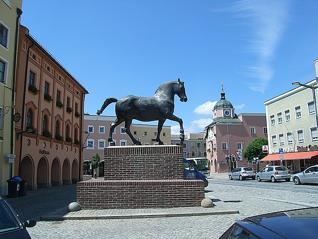
Ландсхут
- город в Баварии, Германия
Hiking in Ландсхут
Landshut, located in Bavaria, Germany, is a charming town with beautiful surrounding landscapes that offer various hiking opportunities. While the town itself is rich in history and culture, the nearby countryside is perfect for outdoor enthusiasts looking to explore nature....
- Страна:
- Почтовый код: 84028–84036
- Телефонный код: 0871
- Код автомобильного номера: LA
- Координаты: 48° 32' 23" N, 12° 9' 3" E
- GPS треки (wikiloc): [Ссылка]
- Высота над уровнем моря: 393 м m
- Площадь: 65700000 кв.км
- Население: 71193
- Веб сайт: [Ссылка]
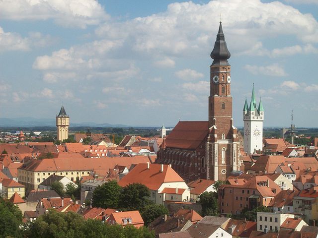
Пассау
- город в Нижней Баварии, или Восточной Баварии, известный как город на трех больших реках: Дунае, Инне и Ильце
Hiking in Пассау
Passau, located at the confluence of the Danube, Inn, and Ilz rivers in Bavaria, Germany, offers a unique mix of cultural and natural hiking experiences. The surrounding region is characterized by scenic landscapes, historic towns, and well-maintained trails, making it an excellent destination for hikers of all levels....
- Страна:
- Почтовый код: 94001; 94036; 94034; 94032
- Телефонный код: 0851
- Код автомобильного номера: PA
- Координаты: 48° 34' 0" N, 13° 28' 0" E
- GPS треки (wikiloc): [Ссылка]
- Высота над уровнем моря: 312 м m
- Площадь: 69580000 кв.км
- Население: 50566
- Веб сайт: [Ссылка]
Штраубинг
- город в Баварии
Hiking in Штраубинг
Straubing, located in Bavaria, Germany, offers a beautiful setting for hiking enthusiasts. The area is characterized by its stunning natural landscapes, rich history, and charming villages. Here are some highlights of hiking in and around Straubing:...
- Страна:
- Почтовый код: 94315
- Телефонный код: 09421
- Код автомобильного номера: SR
- Координаты: 48° 53' 0" N, 12° 34' 0" E
- GPS треки (wikiloc): [Ссылка]
- Высота над уровнем моря: 326 м m
- Площадь: 67.58 кв.км
- Население: 47586
- Веб сайт: [Ссылка]
Граничит с регионами:


Верхний Пфальц
- административный округ Баварии
Hiking in Верхний Пфальц
The Upper Palatinate (Oberpfalz) region in Bavaria, Germany, is known for its scenic landscapes, picturesque villages, and rich cultural heritage, making it an excellent destination for hiking enthusiasts. Here are some highlights and tips for hiking in the Upper Palatinate:...
- Страна:
- Столица: Регенсбург
- Координаты: 49° 18' 0" N, 12° 12' 0" E
- GPS треки (wikiloc): [Ссылка]
- Высота над уровнем моря: 628 м m
- Площадь: 9691.03 кв.км
- Население: 1098378
- Веб сайт: [Ссылка]


Верхняя Бавария
- административный округ в земле Бавария, Германия
Hiking in Верхняя Бавария
Upper Bavaria is a beautiful region in southern Germany, known for its stunning landscapes, charming villages, and a wealth of outdoor activities, particularly hiking. Here are some highlights and tips for hiking in Upper Bavaria:...
- Страна:
- Столица: Мюнхен
- Координаты: 48° 8' 0" N, 11° 34' 0" E
- GPS треки (wikiloc): [Ссылка]
- Высота над уровнем моря: 647 м m
- Площадь: 17529.63 кв.км
- Население: 4588944
- Веб сайт: [Ссылка]