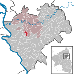
Дессигхофен (Dessighofen, Dessighofen)
Dessighofen is not a widely known hiking destination, so it might not appear in conventional hiking guides. However, if you are referring to a specific location that has similar-sounding names or a local area in a particular region, please share more details so I can provide you with appropriate information about hiking there.
Generally, when exploring a hiking area, you should consider the following:
-
Trail Difficulty: Research the difficulty level of the trails available. Whether you’re a novice or an experienced hiker, knowing what to expect will help you prepare accordingly.
-
Safety and Preparedness: Carry essential gear, such as a map, compass, first aid kit, sufficient water, snacks, and proper clothing for changing weather conditions.
-
Wildlife and Flora: Learn about the local flora and fauna. Respect wildlife and understand what to do if you encounter animals.
-
Campsites and Facilities: If you plan to hike for multiple days, investigate nearby campsites or lodges for accommodation.
-
Leave No Trace: Adhere to the principles of Leave No Trace to minimize your environmental impact while enjoying nature.
If you can clarify the location or provide the correct name, I would be delighted to assist with specific hiking trails, attractions, or tips for that area!
- Страна:

- Почтовый код: 56357
- Телефонный код: 06776
- Код автомобильного номера: EMS
- Координаты: 50° 15' 29" N, 7° 46' 19" E


- GPS треки (wikiloc): [Ссылка]
- Высота над уровнем моря: 240 м m
- Площадь: 3.57 кв.км
- Население: 179
- Веб сайт: http://www.dessighofen.de/
- Википедия русская: wiki(ru)
- Википедия английская: wiki(en)
- Википедия национальная: wiki(de)
- Хранилище Wikidata: Wikidata: Q552335
- Катеория в википедии: [Ссылка]
- код Freebase: [/m/02z3gs3]
- код GeoNames: Альт: [6554012]
- код VIAF: Альт: [237430428]
- ID отношения в OpenStreetMap: [540062]
- код GND: Альт: [4380208-4]
- код Historical Gazetteer: [DESFEN_W5429]
- идентификатор муниципалитетов в Германии: 07141026

