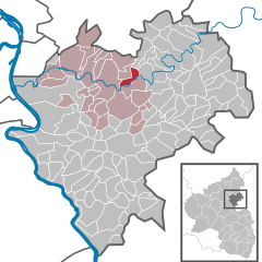
Объединённая община Нассау (Verbandsgemeinde Nassau, Verbandsgemeinde Nassau)

 Hiking in Объединённая община Нассау
Nassau, located in the Verbandsgemeinde of the same name in Rhineland-Palatinate, Germany, is an excellent hiking destination, especially noted for its scenic beauty and rich history. The area is characterized by picturesque landscapes, including the Lahn River, forests, and hills, making it ideal for various hiking trails.
Hiking Trails
-
Wanderweg Nassau: This trail offers stunning views of the surrounding countryside and is well-marked. Hikers can expect a mix of forest trails and open fields.
-
Lahn Hiking Trail (Lahnwanderweg): Following the Lahn River, this trail provides beautiful riverside views and easy access to numerous rest stops along the way.
-
Nassau Nature Park: The park offers several hiking routes through natural landscapes, featuring diverse flora and fauna, making it suitable for nature lovers.
Points of Interest
- Nassau Castle: A historical castle that provides a great backdrop for hiking in the area. The castle and its surroundings can be explored on foot.
- Historical Town Center: The charming medieval center of Nassau is perfect for a rest stop after a day of hiking, with cafes and local shops.
Considerations
- Difficulty Levels: Trails around Nassau cater to various skill levels, from easy walks suitable for families to more challenging hikes for seasoned adventurers.
- Weather: Be mindful of the weather as it can change rapidly, especially in the hilly areas. Ensure you have appropriate gear for rain and varying temperatures.
Best Time to Hike
The best months for hiking in Nassau are late spring to early fall (May to September) when the weather is most favorable. Autumn also offers beautiful scenery with changing leaf colors.
Tips
- Navigation: Most trails are well-marked, but carrying a map or using a hiking app is advisable.
- Local Guides: Consider hiring a local guide if you want to explore less-known trails or learn about local history and natural features.
Nassau offers a blend of cultural heritage and natural beauty, making it a great choice for hiking enthusiasts looking for a memorable experience in the German countryside.
- Страна:

- Столица: Нассау
- Координаты: 50° 19' 0" N, 7° 48' 0" E


- GPS треки (wikiloc): [Ссылка]
- Веб сайт: http://www.vgnassau.de/
- Википедия русская: wiki(ru)
- Википедия английская: wiki(en)
- Википедия национальная: wiki(de)
- Хранилище Wikidata: Wikidata: Q562560
- код Freebase: [/m/02z42qv]
- код GND: Альт: [4122007-9]
- код региона Германии: 071415006
Включает регионы:


Нассау
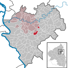
- город в Германии, Рейнланд-Пфальц, Рейн-Лан, Объединённая община Нассау
Hiking in Нассау
Nassau, located in the Rhineland-Palatinate region of Germany, is a lovely destination for hiking enthusiasts. Nestled along the banks of the Lahn River, this small town is surrounded by picturesque natural scenery, including rolling hills, forests, and vineyards....
- Страна:
- Почтовый код: 56377
- Телефонный код: 02604
- Код автомобильного номера: EMS
- Координаты: 50° 18' 57" N, 7° 48' 8" E
- GPS треки (wikiloc): [Ссылка]
- Высота над уровнем моря: 100 м m
- Площадь: 17.51 кв.км
- Население: 4521
- Веб сайт: [Ссылка]
Циммершид
Hiking in Циммершид
Zimmerschied is a small village in Germany, located in the state of Rhineland-Palatinate. The surrounding area offers beautiful landscapes and numerous hiking opportunities, particularly because it is near the wooded hills of the Westerwald region. Here are some highlights you could consider for hiking in and around Zimmerschied:...
- Страна:
- Почтовый код: 56379
- Телефонный код: 02608
- Код автомобильного номера: EMS
- Координаты: 50° 21' 8" N, 7° 46' 57" E
- GPS треки (wikiloc): [Ссылка]
- Высота над уровнем моря: 460 м m
- Площадь: 2.21 кв.км
- Население: 90
- Веб сайт: [Ссылка]
Дессигхофен
Hiking in Дессигхофен
Dessighofen is not a widely known hiking destination, so it might not appear in conventional hiking guides. However, if you are referring to a specific location that has similar-sounding names or a local area in a particular region, please share more details so I can provide you with appropriate information about hiking there....
- Страна:
- Почтовый код: 56357
- Телефонный код: 06776
- Код автомобильного номера: EMS
- Координаты: 50° 15' 29" N, 7° 46' 19" E
- GPS треки (wikiloc): [Ссылка]
- Высота над уровнем моря: 240 м m
- Площадь: 3.57 кв.км
- Население: 179
- Веб сайт: [Ссылка]
Динеталь
Hiking in Динеталь
Dienethal is a picturesque valley that can be found in various regions, but one of the more renowned Dienethals is located in the Austrian state of Styria. Hiking in this region can be a delightful experience, thanks to its stunning landscapes, diverse flora and fauna, and well-marked trails that cater to varying skill levels....
- Страна:
- Почтовый код: 56379
- Телефонный код: 02604
- Код автомобильного номера: EMS
- Координаты: 50° 18' 16" N, 7° 46' 41" E
- GPS треки (wikiloc): [Ссылка]
- Высота над уровнем моря: 150 м m
- Площадь: 1.39 кв.км
- Население: 228
- Веб сайт: [Ссылка]


Аттенхаузен
Hiking in Аттенхаузен
Attenhausen is a picturesque destination for hiking enthusiasts, situated within beautiful natural surroundings. While specific trails can vary in difficulty and length, here are some general aspects to consider for hiking in Attenhausen:...
- Страна:
- Почтовый код: 56370
- Телефонный код: 02604
- Код автомобильного номера: EMS
- Координаты: 50° 17' 31" N, 7° 52' 35" E
- GPS треки (wikiloc): [Ссылка]
- Высота над уровнем моря: 260 м m
- Площадь: 5.85 кв.км
- Население: 414
- Веб сайт: [Ссылка]
Хёмберг
Hiking in Хёмберг
Hömberg is a beautiful area that offers a range of hiking opportunities, suitable for various skill levels. Nestled in the scenic landscape, it features diverse terrains, from rolling hills to dense forests, providing ample chances to connect with nature....
- Страна:
- Почтовый код: 56379
- Телефонный код: 02604
- Код автомобильного номера: EMS
- Координаты: 50° 20' 14" N, 7° 47' 0" E
- GPS треки (wikiloc): [Ссылка]
- Высота над уровнем моря: 372 м m
- Площадь: 4.86 кв.км
- Население: 343
- Веб сайт: [Ссылка]
Лольшид
Hiking in Лольшид
Lollschied, a small village located in the picturesque region of Rhineland-Palatinate, Germany, offers an excellent base for hiking aficionados. Nestled in the scenic landscape of the Hunsrück mountains, Lollschied provides access to beautiful trails that showcase the area's natural beauty and rich cultural history....
- Страна:
- Почтовый код: 56357
- Телефонный код: 06772
- Код автомобильного номера: EMS
- Координаты: 50° 15' 26" N, 7° 52' 11" E
- GPS треки (wikiloc): [Ссылка]
- Высота над уровнем моря: 320 м m
- Площадь: 4.08 кв.км
- Население: 187
- Веб сайт: [Ссылка]
Дорнхольцхаузен
Hiking in Дорнхольцхаузен
Dornholzhausen, a district of the city of Bonn in Germany, is surrounded by beautiful landscapes and offers several hiking opportunities. Here are some highlights for hiking in and around Dornholzhausen:...
- Страна:
- Почтовый код: 56357
- Телефонный код: 02604
- Код автомобильного номера: EMS
- Координаты: 50° 16' 16" N, 7° 47' 23" E
- GPS треки (wikiloc): [Ссылка]
- Высота над уровнем моря: 305 м m
- Площадь: 3.93 кв.км
- Население: 198
- Веб сайт: [Ссылка]
Гайзиг
Hiking in Гайзиг
Geisig is a small town located in the Rhineland-Palatinate region of Germany, and while it may not be as well-known as some of Germany's larger hiking destinations, there are opportunities for hiking and exploring the beautiful surroundings....
- Страна:
- Почтовый код: 56357
- Телефонный код: 06776
- Код автомобильного номера: EMS
- Координаты: 50° 15' 23" N, 7° 47' 28" E
- GPS треки (wikiloc): [Ссылка]
- Высота над уровнем моря: 250 м m
- Площадь: 3.91 кв.км
- Население: 348
- Веб сайт: [Ссылка]
Швайгхаузен
Hiking in Швайгхаузен
Schweighausen, a quaint village located in the Rhine Valley of Germany, is surrounded by stunning nature that makes it a wonderful destination for hiking enthusiasts. Here are some key points to consider if you're planning a hiking trip in or around Schweighausen:...
- Страна:
- Почтовый код: 56377
- Телефонный код: 02604
- Код автомобильного номера: EMS
- Координаты: 50° 16' 56" N, 7° 45' 45" E
- GPS треки (wikiloc): [Ссылка]
- Высота над уровнем моря: 370 м m
- Площадь: 3.66 кв.км
- Население: 216
- Веб сайт: [Ссылка]


Зингхофен
Hiking in Зингхофен
Singhofen, located in the picturesque region of Germany, offers a variety of hiking opportunities that cater to different skill levels and interests. Nestled near the Rhine River, the area is characterized by beautiful landscapes, charming villages, and the natural beauty of the surrounding hills....
- Страна:
- Почтовый код: 56379
- Телефонный код: 02604
- Код автомобильного номера: EMS
- Координаты: 50° 16' 28" N, 7° 50' 11" E
- GPS треки (wikiloc): [Ссылка]
- Высота над уровнем моря: 310 м m
- Площадь: 15.67 кв.км
- Население: 1764
- Веб сайт: [Ссылка]

Обернхоф
Hiking in Обернхоф
Obernhof is a charming village located along the Lahn River in Germany, known for its scenic landscapes and outdoor activities, including hiking. Here are some highlights about hiking in the Obernhof area:...
- Страна:
- Почтовый код: 56379
- Телефонный код: 02604
- Код автомобильного номера: EMS
- Координаты: 50° 19' 9" N, 7° 51' 15" E
- GPS треки (wikiloc): [Ссылка]
- Высота над уровнем моря: 100 м m
- Площадь: 3.85 кв.км
- Население: 375
- Веб сайт: [Ссылка]
Обервис
Hiking in Обервис
Oberwies is a picturesque region offering stunning hiking opportunities, particularly set against the backdrop of the Alps in Germany. It’s known for its beautiful landscapes, diverse trails, and breathtaking views. Here’s a general overview of what you can expect when hiking in Oberwies:...
- Страна:
- Почтовый код: 56379
- Телефонный код: 02604
- Код автомобильного номера: EMS
- Координаты: 50° 17' 19" N, 7° 46' 50" E
- GPS треки (wikiloc): [Ссылка]
- Высота над уровнем моря: 315 м m
- Площадь: 2.02 кв.км
- Население: 137
- Веб сайт: [Ссылка]
Миссельберг
Hiking in Миссельберг
Misselberg is a lesser-known but beautiful hiking destination located in Germany, often characterized by its scenic landscapes and a variety of trails suitable for hikers of all levels. While specific information about Misselberg itself may be limited, here are some general tips and details that could help you enjoy hiking in this region:...
- Страна:
- Почтовый код: 56377
- Телефонный код: 02604
- Код автомобильного номера: EMS
- Координаты: 50° 19' 0" N, 7° 46' 0" E
- GPS треки (wikiloc): [Ссылка]
- Высота над уровнем моря: 260 м m
- Площадь: 0.74 кв.км
- Население: 94
- Веб сайт: [Ссылка]

Поль
Hiking in Поль
Pohl, Germany, is a smaller village located in the state of Rhineland-Palatinate, nestled in scenic landscapes that can be explored through a variety of hiking trails. The region itself is characterized by rolling hills, dense forests, and picturesque vineyards, making it a splendid destination for outdoor enthusiasts....
- Страна:
- Почтовый код: 56357
- Телефонный код: 06772
- Код автомобильного номера: EMS
- Координаты: 50° 15' 3" N, 7° 51' 51" E
- GPS треки (wikiloc): [Ссылка]
- Высота над уровнем моря: 330 м m
- Площадь: 4.23 кв.км
- Население: 338
- Веб сайт: [Ссылка]
Винден
Hiking in Винден
Winden, located in the Rhein-Lahn district of Germany, is surrounded by beautiful landscapes and offers excellent hiking opportunities for outdoor enthusiasts. Here are some key aspects to consider when hiking in this area:...
- Страна:
- Почтовый код: 56379
- Телефонный код: 02604
- Код автомобильного номера: EMS
- Координаты: 50° 20' 23" N, 7° 49' 57" E
- GPS треки (wikiloc): [Ссылка]
- Высота над уровнем моря: 370 м m
- Площадь: 6.99 кв.км
- Население: 711
- Веб сайт: [Ссылка]

Зеельбах
Hiking in Зеельбах
Seelbach, located in the Rhein-Lahn district of Germany, is part of the beautiful Rhineland-Palatinate region, known for its picturesque landscapes, charming villages, and extensive hiking trails. Here are some details about hiking in and around Seelbach:...
- Страна:
- Почтовый код: 56377
- Телефонный код: 02604
- Код автомобильного номера: EMS
- Координаты: 50° 18' 31" N, 7° 52' 21" E
- GPS треки (wikiloc): [Ссылка]
- Высота над уровнем моря: 300 м m
- Площадь: 7.24 кв.км
- Население: 397
- Веб сайт: [Ссылка]
Зульцбах
- муниципалитет в Германии, Рейнланд-Пфальц, Рейн-Лан, Объединённая община Нассау
Hiking in Зульцбах
Sulzbach, located in the Rhein-Lahn district of Germany, offers a variety of hiking opportunities that showcase the natural beauty of the region. The area is characterized by rolling hills, lush forests, and scenic views along the Lahn River....
- Страна:
- Почтовый код: 56379
- Телефонный код: 02604
- Код автомобильного номера: EMS
- Координаты: 50° 18' 13" N, 7° 45' 12" E
- GPS треки (wikiloc): [Ссылка]
- Высота над уровнем моря: 250 м m
- Площадь: 2.22 кв.км
- Население: 197
- Веб сайт: [Ссылка]