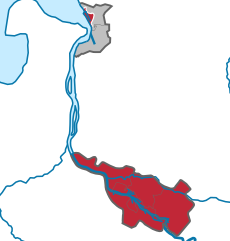
Дипхольц (Diepholz, Landkreis Diepholz)

 Hiking in Дипхольц
Diepholz is a district located in Lower Saxony, Germany, known for its scenic landscapes and outdoor recreational opportunities, including hiking. Here are some insights about hiking in and around Diepholz:
Geography and Landscape
- Nature and Scenery: Diepholz features a mix of flat agricultural land and gentle hills, as well as various water bodies, including lakes and rivers. This diverse terrain offers a range of hiking experiences, from leisurely strolls to more challenging trails.
- Protected Areas: The district is home to several natural reserves and conservation areas that provide unique ecosystems and habitats, which can be explored on foot.
Popular Hiking Areas and Trails
- Diepholzer Moorniederung: This area, known for its peat bogs and wetlands, offers serene hiking paths. The unique landscape supports diverse flora and fauna, making it an interesting spot for nature enthusiasts.
- Lakes and Rivers: Regions around the lakes, such as the Dümmer See, provide enjoyable trails along the water. The picturesque views make this a popular destination for both hiking and picnicking.
- Forest Trails: There are numerous forested areas within the district that offer shaded trails through charming woodlands. These areas are ideal for those looking to immerse themselves in nature.
Hiking Tips
- Trail Maps: It's advisable to carry a map or download a hiking app to help navigate the trails. Local tourism offices can provide resources and up-to-date information.
- Seasonal Considerations: Different seasons may affect trail conditions. Spring and summer offer lush greenery, while autumn presents a colorful landscape. Winter hikes can be beautiful but require appropriate gear.
- Safety: Always inform someone of your hiking plans, especially if you venture into less populated areas. Carry a first-aid kit and ensure you have enough water and snacks.
Local Culture
- Village Life: Hiking through the various small towns and villages can provide insight into local culture, including traditional architecture and possibly local festivals.
- Culinary Delights: After a long hike, consider stopping by local restaurants or cafes to try regional dishes or sample some local German beer.
Conclusion
Hiking in Diepholz offers a blend of natural beauty, tranquility, and cultural experiences. It’s suitable for various skill levels, making it accessible for families, solo hikers, and seasoned trekkers alike. Remember to respect the natural environment and enjoy the adventure!
- Страна:

- Код автомобильного номера: SY; DH
- Координаты: 52° 40' 12" N, 8° 34' 48" E


- GPS треки (wikiloc): [Ссылка]
- Высота над уровнем моря: 52 м m
- Площадь: 1987.00 кв.км
- Население: 209671
- Веб сайт: http://www.diepholz.de
- Википедия русская: wiki(ru)
- Википедия английская: wiki(en)
- Википедия национальная: wiki(de)
- Хранилище Wikidata: Wikidata: Q5956
- Галерея изображений в википедии: [Ссылка]
- Катеория в википедии: [Ссылка]
- Карты в википедии: [Ссылка]
- код Freebase: [/m/013xcl]
- код GeoNames: Альт: [3221024]
- код VIAF: Альт: [136098959]
- ID отношения в OpenStreetMap: [62426]
- код GND: Альт: [4012203-7]
- идентификатор местоположения ArchINFORM: [12456]
- код LCNAF: Альт: [n84238575]
- код TGN: [7076859]
- код ISNI: Альт: [0000 0004 4910 7917]
- код NLI: [001006671]
- код NUTS: [DE922]
- код района Германии: 03251
Включает регионы:


Bruchhausen-Vilsen
Hiking in Bruchhausen-Vilsen
Bruchhausen-Vilsen, located in the Samtgemeinde in Lower Saxony, Germany, is a charming area that's great for hiking and immersing yourself in nature. The region is characterized by its rolling hills, lush forests, and beautiful meadows, making it suitable for both casual walkers and more experienced hikers....
- Страна:
- Координаты: 52° 50' 0" N, 9° 0' 0" E
- GPS треки (wikiloc): [Ссылка]
- Население: 17203
- Веб сайт: [Ссылка]


Зике
Hiking in Зике
Syke is a charming town located in Lower Saxony, Germany, and while it may not be as widely known as some other hiking destinations, it is surrounded by beautiful natural landscapes that provide great opportunities for outdoor activities....
- Страна:
- Почтовый код: 28845–28857
- Телефонный код: 04242; 04240
- Координаты: 52° 54' 58" N, 8° 49' 7" E
- GPS треки (wikiloc): [Ссылка]
- Высота над уровнем моря: 22 м m
- Площадь: 128.11 кв.км
- Население: 24298
- Веб сайт: [Ссылка]


Брухгаузен-Фильзен
- община в земле Нижняя Саксония (Германия)
Hiking in Брухгаузен-Фильзен
Bruchhausen-Vilsen is a charming town located in Lower Saxony, Germany, known for its beautiful landscapes and serene countryside. Hiking in this area can be a delightful experience, offering a mix of nature, culture, and history....
- Страна:
- Почтовый код: 27305
- Телефонный код: 04252
- Код автомобильного номера: DH
- Координаты: 52° 50' 0" N, 9° 0' 0" E
- GPS треки (wikiloc): [Ссылка]
- Высота над уровнем моря: 14 м m
- Площадь: 109.55 кв.км
- Население: 9078
- Веб сайт: [Ссылка]
Граничит с регионами:

Бремен
- город в Германии
Hiking in Бремен
Bremen, while primarily known for its rich history and vibrant cultural scene, doesn't have the extensive hiking trails commonly found in more mountainous regions of Germany. However, there are some lovely outdoor areas and walking opportunities nearby that can satisfy those looking for a hiking experience....
- Страна:
- Почтовый код: 28779; 28777; 28759; 28757; 28755; 28719; 28717; 28359; 28357; 28355; 28329; 28327; 28325; 28309; 28307; 28279; 28277; 28259; 28239; 28237; 28219; 28217; 28215; 28213; 28211; 28209; 28207; 28205; 28203; 28201; 28199; 28197; 28195
- Телефонный код: 0421
- Код автомобильного номера: HB
- Координаты: 53° 4' 37" N, 8° 48' 32" E
- GPS треки (wikiloc): [Ссылка]
- Высота над уровнем моря: 6 м m
- Площадь: 326.18 кв.км
- Население: 568006
- Веб сайт: [Ссылка]


Дельменхорст
- город в Нижней Саксонии, Германия
Hiking in Дельменхорст
Delmenhorst is a town located in Lower Saxony, Germany, near Bremen. While it may not be as widely known for hiking as some other regions, it offers several opportunities for outdoor walking and nature exploration. Here are some insights about hiking in and around Delmenhorst:...
- Страна:
- Почтовый код: 27749–27755
- Телефонный код: 04221
- Код автомобильного номера: DEL
- Координаты: 53° 3' 2" N, 8° 37' 54" E
- GPS треки (wikiloc): [Ссылка]
- Высота над уровнем моря: 7 м m
- Площадь: 62.45 кв.км
- Население: 77045
- Веб сайт: [Ссылка]


Ферден
Hiking in Ферден
Verden, located in Lower Saxony, Germany, is an area that offers various outdoor activities, including hiking. The district is characterized by its lush landscapes, woodlands, and scenic countryside, making it a pleasant spot for nature lovers and hikers alike....
- Страна:
- Код автомобильного номера: VER
- Координаты: 53° 0' 0" N, 9° 10' 12" E
- GPS треки (wikiloc): [Ссылка]
- Высота над уровнем моря: 23 м m
- Площадь: 787.70 кв.км
- Население: 135842
- Веб сайт: [Ссылка]


Оснабрюк
Hiking in Оснабрюк
Osnabrück district, located in Lower Saxony, Germany, offers a variety of hiking opportunities that cater to different skill levels and preferences. The region is characterized by its rolling hills, lush forests, and picturesque landscapes, making it an appealing destination for outdoor enthusiasts....
- Страна:
- Столица: Оснабрюк
- Код автомобильного номера: OS
- Координаты: 52° 19' 48" N, 8° 10' 12" E
- GPS треки (wikiloc): [Ссылка]
- Высота над уровнем моря: 57 м m
- Площадь: 2122.00 кв.км
- Население: 354807
- Веб сайт: [Ссылка]


Фехта
Hiking in Фехта
Vechta is a district located in Lower Saxony, Germany, known for its picturesque landscapes and rural charm. While it may not be as mountainous as other regions in Germany, it offers several opportunities for hiking, especially for those who enjoy gentle walks through nature....
- Страна:
- Код автомобильного номера: VEC
- Координаты: 52° 40' 12" N, 8° 15' 0" E
- GPS треки (wikiloc): [Ссылка]
- Высота над уровнем моря: 27 м m
- Площадь: 813.00 кв.км
- Население: 139671
- Веб сайт: [Ссылка]


Ольденбург
- район германии в Германии, Нижняя Саксония
Hiking in Ольденбург
Oldenburg District, located in Lower Saxony, Germany, offers a variety of landscapes and trails suitable for hiking enthusiasts. While it may not be as mountainous as other regions in Germany, its scenic countryside, woodlands, and lakes provide a wonderful backdrop for outdoor activities....
- Страна:
- Код автомобильного номера: OL
- Координаты: 53° 0' 0" N, 8° 25' 12" E
- GPS треки (wikiloc): [Ссылка]
- Высота над уровнем моря: 25 м m
- Площадь: 1063.00 кв.км
- Население: 129484
- Веб сайт: [Ссылка]


Нинбург
- район Германии (в земле Нижняя Саксония)
Hiking in Нинбург
Nienburg (district) in Lower Saxony, Germany, offers a range of outdoor activities, including hiking, which can be enjoyed in its scenic landscapes. While the region isn't known for high mountains, it features beautiful rolling hills, tranquil rivers, and charming villages, making it an excellent area for hiking enthusiasts who appreciate more gentle terrains and lush nature....
- Страна:
- Код автомобильного номера: NI
- Координаты: 52° 40' 12" N, 9° 10' 12" E
- GPS треки (wikiloc): [Ссылка]
- Высота над уровнем моря: 21 м m
- Площадь: 1399.00 кв.км
- Население: 121503
- Веб сайт: [Ссылка]


Минден-Люббекке
Hiking in Минден-Люббекке
Minden-Lübbecke is a beautiful district in North Rhine-Westphalia, Germany, known for its picturesque landscapes, diverse flora and fauna, and numerous hiking opportunities. Here are some highlights and tips for hiking in the area:...
- Страна:
- Код автомобильного номера: MI
- Координаты: 52° 23' 57" N, 8° 43' 4" E
- GPS треки (wikiloc): [Ссылка]
- Высота над уровнем моря: 58 м m
- Площадь: 1051.97 кв.км
- Веб сайт: [Ссылка]