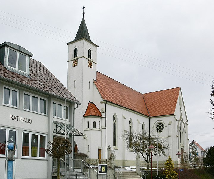
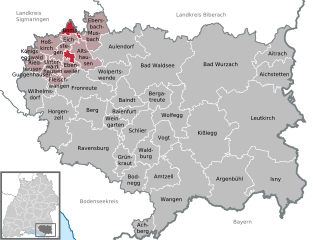
Эбенвайлер (Ebenweiler, Ebenweiler)

 Hiking in Эбенвайлер
Ebenweiler, a picturesque village located in the southern part of Germany, is surrounded by beautiful landscapes that offer great opportunities for hiking. Here are some key points to consider if you’re planning a hiking trip in and around Ebenweiler:
Scenic Trails
-
Variety of Trails: The area features a range of hiking trails suitable for all skill levels. You’ll find everything from gentle walks to more challenging hikes that take you through forested areas, meadows, and hills.
-
Nature Experience: The local flora and fauna are abundant, making hikes around Ebenweiler a great way to connect with nature. Keep an eye out for wildlife and enjoy the tranquility of the region.
Popular Routes
-
Regional Trails: The region may have marked hiking routes that connect to larger paths such as the Swabian Jura or Lake Constance areas, providing opportunities for longer excursions.
-
Local Landmarks: Some trails may lead you to historical landmarks, viewpoints, or local attractions, enhancing your hiking experience. Look for routes that guide you to notable sights in the region.
Amenities
-
Local Accommodation: If you're planning to stay longer, Ebenweiler and nearby villages offer various accommodations, including guesthouses and hotels.
-
Cafés and Rest Stops: Many hiking routes may also lead to local cafés or restaurants, where you can stop for a meal or refreshment before continuing your hike.
Safety and Preparedness
-
Weather Considerations: Ensure you check the weather forecast before heading out as conditions can change, especially in hilly areas.
-
Gear: Make sure to wear appropriate hiking shoes, dress in layers, and carry essentials such as water, snacks, a map, and a first-aid kit.
-
Trail Markings: Pay attention to trail markers to stay on course. Familiarize yourself with the local maps or use a hiking app for navigation.
Best Time to Hike
- Spring and Fall: These seasons are particularly beautiful in the region due to blooming flowers and autumn colors, providing stunning views and comfortable hiking weather.
Overall, hiking in Ebenweiler can be a rewarding experience for those looking to explore the natural beauty of southern Germany. Be prepared, respect nature, and enjoy your adventure!
- Страна:

- Почтовый код: 88370
- Телефонный код: 07584
- Код автомобильного номера: RV
- Координаты: 47° 54' 0" N, 9° 31' 0" E


- GPS треки (wikiloc): [Ссылка]
- Высота над уровнем моря: 595 м m
- Площадь: 10.13 кв.км
- Население: 1213
- Веб сайт: http://www.ebenweiler.de
- Википедия русская: wiki(ru)
- Википедия английская: wiki(en)
- Википедия национальная: wiki(de)
- Хранилище Wikidata: Wikidata: Q533853
- Катеория в википедии: [Ссылка]
- код Freebase: [/m/02p_w2s]
- код GeoNames: Альт: [2934023]
- код VIAF: Альт: [239066752]
- ID отношения в OpenStreetMap: [2808125]
- код GND: Альт: [4218892-1]
- код Historical Gazetteer: [EBELERJN47SV]
- идентификатор муниципалитетов в Германии: 08436024
Граничит с регионами:


Флайшванген
Hiking in Флайшванген
Fleischwangen is a small municipality located in the state of Baden-Württemberg, Germany. It's an area known for its picturesque landscapes, serene forests, and charming rural setting, making it a lovely destination for hiking enthusiasts....
- Страна:
- Почтовый код: 88373
- Телефонный код: 07505
- Код автомобильного номера: RV
- Координаты: 47° 53' 0" N, 9° 29' 0" E
- GPS треки (wikiloc): [Ссылка]
- Высота над уровнем моря: 634 м m
- Площадь: 5.80 кв.км
- Население: 684
- Веб сайт: [Ссылка]
Бомс
Hiking in Бомс
Boms, which is likely referring to a specific region or area (potentially in South Korea), offers unique hiking experiences that showcase beautiful landscapes, diverse flora, and panoramic views. While I may not have specific details about Boms, I can provide guidance on general considerations for hiking in mountainous or hilly areas, as well as tips for enjoying your hike....
- Страна:
- Почтовый код: 88361
- Телефонный код: 07581
- Код автомобильного номера: RV
- Координаты: 47° 58' 35" N, 9° 30' 59" E
- GPS треки (wikiloc): [Ссылка]
- Высота над уровнем моря: 615 м m
- Площадь: 9.56 кв.км
- Население: 636
- Веб сайт: [Ссылка]