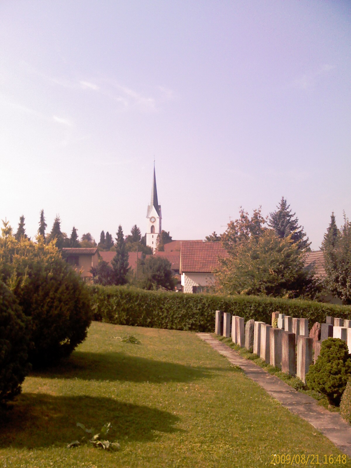
Эглисвиль (Egliswil, Egliswil)

 Hiking in Эглисвиль
Egliswil is a picturesque village located in Switzerland, nestled in the scenic Cantonal region of Aargau. It's surrounded by stunning landscapes, making it a wonderful destination for hiking enthusiasts.
Hiking Trails
Egliswil offers a variety of hiking trails that cater to different skill levels. Here are some highlights:
-
Local Trails: Explore trails that meander through lush meadows, dense forests, and rolling hills. Many paths start right from the village, allowing for easy access to nature.
-
Skyline Panorama: Some trails lead to higher vantage points where you can enjoy panoramic views of the Alps and the surrounding valleys. The vistas are especially beautiful during sunrise or sunset.
-
Cultural Trails: Certain routes may take you past historical sites or local landmarks, offering insight into the region's culture and heritage.
Important Considerations
-
Terrain: The trails can vary in difficulty, so it’s always good to check the local maps or signage for updates and guidance. Make sure to choose a trail that matches your fitness level.
-
Weather Conditions: Weather can change quickly in the Swiss Alps. It’s recommended to check forecasts before setting out and to dress in layers.
-
Safety: Always carry plenty of water, snacks, a first aid kit, and a map or a GPS device. Inform someone about your hiking plans, especially if you’re venturing into less populated areas.
Additional Activities
Besides hiking, Egliswil is situated near other attractions like cycling trails, nature observation spots, and inviting local restaurants where you can enjoy traditional Swiss cuisine.
Getting There
Egliswil is accessible via public transport or by car, with local trains connecting to major Swiss cities. The village serves as a great starting point for further exploration into the heart of Switzerland.
Whether you're looking for a leisurely walk or a challenging hike, Egliswil and its surroundings provide a captivating experience in nature. Happy hiking!
- Страна:

- Почтовый код: 5704
- Телефонный код: 062
- Код автомобильного номера: AG
- Координаты: 47° 21' 6" N, 8° 11' 25" E


- GPS треки (wikiloc): [Ссылка]
- Высота над уровнем моря: 483 м m
- Площадь: 6.29 кв.км
- Население: 1407
- Веб сайт: http://www.egliswil.ch
- Википедия русская: wiki(ru)
- Википедия английская: wiki(en)
- Википедия национальная: wiki(de)
- Хранилище Wikidata: Wikidata: Q65155
- Катеория в википедии: [Ссылка]
- код Freebase: [/m/0fzjvk]
- код GeoNames: Альт: [7285708]
- код VIAF: Альт: [237428418]
- ID отношения в OpenStreetMap: [1684299]
- идентификатор HDS: [1760]
- код швейцарского муниципалитета: [4195]
Граничит с регионами:


Фильмерген
Hiking in Фильмерген
Villmergen, located in the Aargau region of Switzerland, offers a beautiful setting for hiking enthusiasts. While it's a small municipality, it provides access to scenic trails that showcase the charming landscapes of the Swiss countryside....
- Страна:
- Почтовый код: 5612
- Телефонный код: 056
- Код автомобильного номера: AG
- Координаты: 47° 21' 4" N, 8° 14' 28" E
- GPS треки (wikiloc): [Ссылка]
- Высота над уровнем моря: 433 м m
- Площадь: 11.94 кв.км
- Население: 7341
- Веб сайт: [Ссылка]
Зеон
Hiking in Зеон
Seon, located in the Aargau region of Switzerland, is a charming area that offers a range of hiking opportunities. The region is characterized by its picturesque landscapes, including rolling hills, forests, and scenic rivers. Here are some highlights for those interested in hiking in and around Seon:...
- Страна:
- Почтовый код: 5703
- Телефонный код: 062
- Код автомобильного номера: AG
- Координаты: 47° 20' 45" N, 8° 9' 35" E
- GPS треки (wikiloc): [Ссылка]
- Высота над уровнем моря: 445 м m
- Площадь: 9.61 кв.км
- Население: 5227
- Веб сайт: [Ссылка]
Зеенген
Hiking in Зеенген
Seengen, located in the canton of Aargau in Switzerland, offers picturesque landscapes and a variety of hiking opportunities suitable for different skill levels. From gentle lakeside walks to more challenging trails in the surrounding hills, there’s something for everyone....
- Страна:
- Почтовый код: 5707
- Телефонный код: 062
- Код автомобильного номера: AG
- Координаты: 47° 19' 45" N, 8° 12' 32" E
- GPS треки (wikiloc): [Ссылка]
- Высота над уровнем моря: 520 м m
- Площадь: 10.35 кв.км
- Население: 3951
- Веб сайт: [Ссылка]

Динтикон
Hiking in Динтикон
Dintikon is a charming village located in the canton of Aargau, Switzerland. It offers picturesque landscapes and various hiking opportunities for outdoor enthusiasts. Here are some key points about hiking in and around Dintikon:...
- Страна:
- Почтовый код: 5606
- Телефонный код: 056
- Код автомобильного номера: AG
- Координаты: 47° 21' 54" N, 8° 13' 45" E
- GPS треки (wikiloc): [Ссылка]
- Высота над уровнем моря: 449 м m
- Площадь: 3.73 кв.км
- Население: 2192
- Веб сайт: [Ссылка]
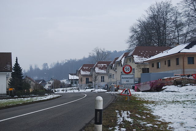

Аммерсвиль
Hiking in Аммерсвиль
Ammerswil is a small village located in the region of Aargau in Switzerland, known for its beautiful landscapes and access to outdoor activities, including hiking. While it may not be as famous as some of the larger Swiss hiking destinations, there are several opportunities for hiking in and around Ammerswil that you might find enjoyable....
- Страна:
- Почтовый код: 5600
- Телефонный код: 062
- Код автомобильного номера: AG
- Координаты: 47° 22' 5" N, 8° 12' 21" E
- GPS треки (wikiloc): [Ссылка]
- Высота над уровнем моря: 464 м m
- Площадь: 3.19 кв.км
- Население: 679
- Веб сайт: [Ссылка]


Ленцбург
Hiking in Ленцбург
Lenzburg, located in the Aargau region of Switzerland, offers a variety of hiking opportunities that showcase the region's stunning landscapes, rich history, and charming villages. Here are some highlights for hiking in and around Lenzburg:...
- Страна:
- Почтовый код: 5600
- Телефонный код: 062
- Код автомобильного номера: AG
- Координаты: 47° 23' 15" N, 8° 10' 49" E
- GPS треки (wikiloc): [Ссылка]
- Высота над уровнем моря: 413 м m
- Площадь: 11.33 кв.км
- Население: 10173
- Веб сайт: [Ссылка]