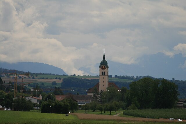
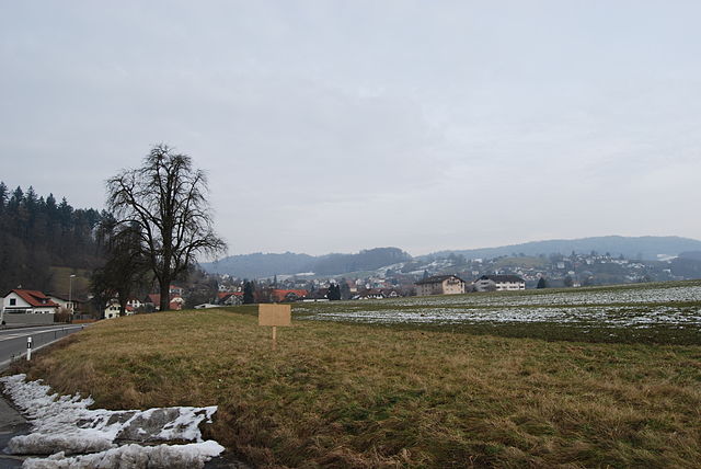
Зеон (Seon, Seon)

 Hiking in Зеон
Seon, located in the Aargau region of Switzerland, is a charming area that offers a range of hiking opportunities. The region is characterized by its picturesque landscapes, including rolling hills, forests, and scenic rivers. Here are some highlights for those interested in hiking in and around Seon:
Hiking Trails
-
Seon to the Reuss River: This trail takes you down to the beautiful Reuss River, where you can enjoy serene views and potentially spot wildlife. The riverside paths are often flat and accessible, making it a great option for families and casual hikers.
-
Hills of Aargau: The surrounding hills provide moderate to challenging hikes with rewarding panoramic views of the Aargau countryside. Look out for trails that incorporate historical sites or viewpoints, as these often enhance the experience.
-
Nature reserves and forests: Seon is surrounded by idyllic forest areas that offer numerous hiking paths. These trails often lead to serene spots perfect for picnicking or simply enjoying nature.
General Tips
-
Trail Maps: Before heading out, it's recommended to grab a trail map from local tourist information centers or check online resources for up-to-date trail information.
-
Weather Conditions: Always check the weather forecast before your hike, as conditions can change rapidly in the Swiss mountains.
-
Gear: Wear appropriate hiking shoes, dress in layers, and carry a backpack with essentials (water, snacks, first aid kit, etc.).
-
Local Guidance: If you're unfamiliar with the area, consider joining a guided hike or local hiking group to get the most out of your experience.
Nearby Attractions
-
Historical Sites: While hiking, you may encounter various historical monuments and charming villages in the region, adding cultural value to your adventure.
-
Culinary Spots: After a hike, enjoy local Swiss cuisine in nearby restaurants or mountain huts, perfect for refueling.
Conclusion
Hiking in Seon, Aargau, offers a mix of natural beauty, historical intrigue, and accessible trails for all skill levels. Whether you're looking for a relaxed stroll or a more vigorous hike, this region has something to offer every type of hiker. Enjoy the stunning scenery and the tranquility of the Swiss outdoors!
- Страна:

- Почтовый код: 5703
- Телефонный код: 062
- Код автомобильного номера: AG
- Координаты: 47° 20' 45" N, 8° 9' 35" E


- GPS треки (wikiloc): [Ссылка]
- Высота над уровнем моря: 445 м m
- Площадь: 9.61 кв.км
- Население: 5227
- Веб сайт: http://www.seon.ch
- Википедия русская: wiki(ru)
- Википедия английская: wiki(en)
- Википедия национальная: wiki(de)
- Хранилище Wikidata: Wikidata: Q64563
- Катеория в википедии: [Ссылка]
- код Freebase: [/m/09jd2n]
- код GeoNames: Альт: [7287154]
- код VIAF: Альт: [168145389]
- ID отношения в OpenStreetMap: [1684425]
- место в MusicBrainz: [748d9ee4-3551-4e83-910c-c395c67e937c]
- идентификатор HDS: [1774]
- код швейцарского муниципалитета: [4209]
Граничит с регионами:
Зеенген
Hiking in Зеенген
Seengen, located in the canton of Aargau in Switzerland, offers picturesque landscapes and a variety of hiking opportunities suitable for different skill levels. From gentle lakeside walks to more challenging trails in the surrounding hills, there’s something for everyone....
- Страна:
- Почтовый код: 5707
- Телефонный код: 062
- Код автомобильного номера: AG
- Координаты: 47° 19' 45" N, 8° 12' 32" E
- GPS треки (wikiloc): [Ссылка]
- Высота над уровнем моря: 520 м m
- Площадь: 10.35 кв.км
- Население: 3951
- Веб сайт: [Ссылка]
Эглисвиль
Hiking in Эглисвиль
Egliswil is a picturesque village located in Switzerland, nestled in the scenic Cantonal region of Aargau. It's surrounded by stunning landscapes, making it a wonderful destination for hiking enthusiasts....
- Страна:
- Почтовый код: 5704
- Телефонный код: 062
- Код автомобильного номера: AG
- Координаты: 47° 21' 6" N, 8° 11' 25" E
- GPS треки (wikiloc): [Ссылка]
- Высота над уровнем моря: 483 м m
- Площадь: 6.29 кв.км
- Население: 1407
- Веб сайт: [Ссылка]


Шафисхайм
Hiking in Шафисхайм
Schafisheim, located in the canton of Aargau, Switzerland, is a charming area that offers various hiking opportunities in a picturesque landscape. While Schafisheim itself is a small village, it serves as a great starting point for exploring the surrounding countryside and nearby trails....
- Страна:
- Почтовый код: 5503
- Телефонный код: 062
- Код автомобильного номера: AG
- Координаты: 47° 22' 25" N, 8° 8' 21" E
- GPS треки (wikiloc): [Ссылка]
- Высота над уровнем моря: 435 м m
- Площадь: 6.33 кв.км
- Население: 3027
- Веб сайт: [Ссылка]