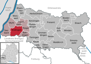
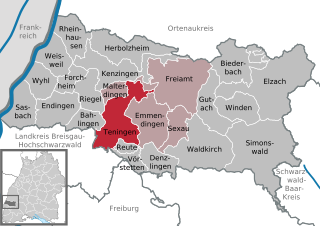
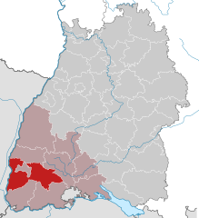
Эммендинген (Emmendingen, Landkreis Emmendingen)

 Hiking in Эммендинген
Emmendingen, located in the southwestern part of Germany in the state of Baden-Württemberg, offers beautiful hiking opportunities with its diverse landscapes, including rolling hills, forests, vineyards, and the scenic Black Forest nearby. Here are some highlights and tips for hiking in the Emmendingen district:
Hiking Trails
-
Kaiserberg Trail: This trail offers stunning views of the surrounding areas and is suitable for various skill levels. It passes through beautiful woods and meadows.
-
Wine Trails: The vineyards around Emmendingen provide wonderful trails that allow you to explore the local wine culture. Hike through the vineyards and enjoy tastings at local wineries.
-
Black Forest Trails: The proximity to the Black Forest means you can access many of its famous hiking routes. Trails like the Westweg offer more challenging hikes with breathtaking views.
-
Nature Reserves: The area is home to several nature reserves where you can hike in serenity while observing local wildlife.
What to Expect
- Varied Terrain: Expect a mix of terrain from flat vineyard paths to more challenging forest trails. Many trails are well-marked and maintained.
- Scenic Views: The rolling hills and forests provide picturesque landscapes, especially during the fall when the foliage changes color.
- Local Flora and Fauna: The region is rich in biodiversity, so keep an eye out for unique plants and wildlife during your hikes.
- Cultural Sites: Many trails may lead you past historical sites, charming villages, or local castles, adding a cultural element to your hike.
Tips for Hiking in Emmendingen
- Check Weather Conditions: The weather in the region can change quickly, especially in the higher elevations, so be prepared for various conditions.
- Proper Gear: Wear good hiking boots and bring layers, as temperatures can fluctuate. A rain jacket and a hat can also be beneficial.
- Stay Hydrated: Bring enough water and snacks, especially for longer hikes.
- Respect Nature: Follow the Leave No Trace principles and stay on marked trails to preserve the natural beauty of the area.
Getting There
Emmendingen is easily accessible by car or public transport, making it a convenient starting point for many hiking trips. Local information centers can provide maps and advice on the best trails to explore based on your interests and skill level.
Whether you’re a casual walker or an experienced hiker, Emmendingen presents a great opportunity to immerse yourself in nature while enjoying the stunning landscapes of the region. Happy hiking!
- Страна:

- Столица: Эммендинген
- Код автомобильного номера: EM
- Координаты: 48° 6' 0" N, 7° 48' 0" E


- GPS треки (wikiloc): [Ссылка]
- Высота над уровнем моря: 352 м m
- Площадь: 679.90 кв.км
- Население: 157399
- Веб сайт: http://www.landkreis-emmendingen.de/
- Википедия русская: wiki(ru)
- Википедия английская: wiki(en)
- Википедия национальная: wiki(de)
- Хранилище Wikidata: Wikidata: Q8193
- Катеория в википедии: [Ссылка]
- код Freebase: [/m/01j_l1]
- код GeoNames: Альт: [2930522]
- код VIAF: Альт: [180769599]
- ID отношения в OpenStreetMap: [1946117]
- код GND: Альт: [4014587-6]
- идентификатор местоположения ArchINFORM: [11056]
- код LCNAF: Альт: [n82069908]
- код TGN: [7188575]
- код NUTS: [DE133]
- код района Германии: 08316
Включает регионы:

Эндинген
Hiking in Эндинген
Endingen am Kaiserstuhl is a picturesque town located in Baden-Württemberg, Germany, known for its beautiful landscapes and vineyards. The region is part of the Kaiserstuhl mountain range and offers various hiking opportunities that cater to different skill levels. Here are some highlights and tips for hiking in this area:...
- Страна:
- Почтовый код: 79346
- Телефонный код: 07642
- Код автомобильного номера: EM
- Координаты: 48° 8' 27" N, 7° 42' 23" E
- GPS треки (wikiloc): [Ссылка]
- Высота над уровнем моря: 186 м m
- Площадь: 26.71 кв.км
- Население: 9225
- Веб сайт: [Ссылка]
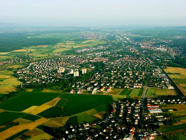

Эммендинген
Hiking in Эммендинген
Emmendingen, located in the Baden-Württemberg region of Germany, offers a variety of hiking opportunities that showcase the beautiful natural landscapes of the area. Here are some highlights for hikers looking to explore this region:...
- Страна:
- Почтовый код: 79312
- Телефонный код: 07641
- Код автомобильного номера: EM
- Координаты: 48° 7' 17" N, 7° 50' 57" E
- GPS треки (wikiloc): [Ссылка]
- Высота над уровнем моря: 201 м m
- Площадь: 33.8 кв.км
- Население: 27642
- Веб сайт: [Ссылка]


Вальдкирх
- город в земле Баден-Вюртемберг (Германия)
Hiking in Вальдкирх
Waldkirch, located in the Black Forest region of Germany, offers a variety of hiking opportunities within its picturesque surroundings. The area is known for its lush green landscapes, scenic views, and charming trails suitable for hikers of all skill levels....
- Страна:
- Почтовый код: 79183
- Телефонный код: 07681
- Код автомобильного номера: EM
- Координаты: 48° 5' 38" N, 7° 57' 39" E
- GPS треки (wikiloc): [Ссылка]
- Высота над уровнем моря: 274 м m
- Площадь: 48.47 кв.км
- Население: 21260
- Веб сайт: [Ссылка]
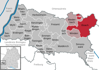
Эльцах
Hiking in Эльцах
Elzach, located in the Black Forest region of Germany, offers a variety of hiking opportunities that cater to different skill levels and preferences. The area is renowned for its beautiful landscapes, dense forests, and charming villages, making it a great destination for nature enthusiasts and hikers....
- Страна:
- Почтовый код: 79215
- Телефонный код: 07682
- Код автомобильного номера: EM
- Координаты: 48° 10' 29" N, 8° 4' 18" E
- GPS треки (wikiloc): [Ссылка]
- Высота над уровнем моря: 361 м m
- Площадь: 75.28 кв.км
- Население: 7296
- Веб сайт: [Ссылка]


Хербольцхайм
Hiking in Хербольцхайм
Herbolzheim, located in the Baden-Württemberg region of Germany, is a charming town that offers access to various hiking opportunities, particularly in the surrounding natural landscapes such as the black forest region and the Rhine Valley. Here are some aspects to consider when hiking in and around Herbolzheim:...
- Страна:
- Почтовый код: 79336
- Телефонный код: 07643
- Код автомобильного номера: EM
- Координаты: 48° 13' 19" N, 7° 46' 39" E
- GPS треки (wikiloc): [Ссылка]
- Высота над уровнем моря: 177 м m
- Площадь: 35.48 кв.км
- Население: 10861
- Веб сайт: [Ссылка]


Балинген
Hiking in Балинген
Bahlingen am Kaiserstuhl is a charming village located in Germany, known for its picturesque landscapes and proximity to the Kaiserstuhl region. The Kaiserstuhl is a volcanic mountain range that offers a variety of hiking opportunities, along with beautiful views of the Rhine Valley and the Black Forest....
- Страна:
- Почтовый код: 79353
- Телефонный код: 07663
- Код автомобильного номера: EM
- Координаты: 48° 7' 22" N, 7° 44' 20" E
- GPS треки (wikiloc): [Ссылка]
- Высота над уровнем моря: 184 м m
- Площадь: 12.66 кв.км
- Население: 4259
- Веб сайт: [Ссылка]


Виль
- муниципалитет в Германии, Баден-Вюртемберг, Административный округ Фрайбург, Эммендинген
Hiking in Виль
Wyhl, located in the state of Baden-Württemberg, Germany, is a lovely area that offers a variety of hiking opportunities, particularly due to its proximity to the beautiful natural landscapes of the Black Forest and the Rhine River. Here are some highlights for hiking in and around Wyhl:...
- Страна:
- Почтовый код: 79369
- Телефонный код: 07642
- Код автомобильного номера: EM
- Координаты: 48° 9' 58" N, 7° 38' 57" E
- GPS треки (wikiloc): [Ссылка]
- Высота над уровнем моря: 175 м m
- Площадь: 16.95 кв.км
- Население: 3860
- Веб сайт: [Ссылка]

Фёрштеттен
Hiking in Фёрштеттен
Vörstetten is a small municipality situated in the Baden-Württemberg region of Germany, near the city of Freiburg. This area is characterized by its beautiful landscapes, including vineyards, rolling hills, and forested areas, making it a wonderful destination for hiking enthusiasts....
- Страна:
- Почтовый код: 79277; 79279
- Телефонный код: 07666
- Код автомобильного номера: EM
- Координаты: 48° 3' 51" N, 7° 50' 57" E
- GPS треки (wikiloc): [Ссылка]
- Высота над уровнем моря: 220 м m
- Площадь: 7.89 кв.км
- Население: 3025
- Веб сайт: [Ссылка]
Бидербах
Hiking in Бидербах
Biederbach is a small village located in the Black Forest region of Germany, known for its picturesque landscapes, dense forests, and scenic hiking trails. Here are some highlights about hiking in and around Biederbach:...
- Страна:
- Почтовый код: 79215
- Телефонный код: 07682
- Код автомобильного номера: EM
- Координаты: 48° 11' 40" N, 8° 1' 13" E
- GPS треки (wikiloc): [Ссылка]
- Высота над уровнем моря: 423 м m
- Площадь: 31.36 кв.км
- Население: 1754
- Веб сайт: [Ссылка]


Винден-им-Эльцталь
Hiking in Винден-им-Эльцталь
Winden im Elztal is a picturesque village located in the Elztal Valley in Germany, surrounded by lush forests and stunning mountain scenery, making it a great destination for hiking enthusiasts. Here are some highlights and tips for hiking in the area:...
- Страна:
- Почтовый код: 79297
- Телефонный код: 07682
- Код автомобильного номера: EM
- Координаты: 48° 9' 13" N, 8° 2' 36" E
- GPS треки (wikiloc): [Ссылка]
- Высота над уровнем моря: 292 м m
- Площадь: 21.96 кв.км
- Население: 2872
- Веб сайт: [Ссылка]


Вайсвайль
Hiking in Вайсвайль
Weisweil, located in the Emmendingen district of Baden-Württemberg, Germany, offers a variety of hiking opportunities that showcase the region's natural beauty. The area is characterized by its picturesque landscapes, including vineyards, forests, and the scenic Rhine River....
- Страна:
- Почтовый код: 79367
- Телефонный код: 07646
- Код автомобильного номера: EM
- Координаты: 48° 12' 1" N, 7° 40' 35" E
- GPS треки (wikiloc): [Ссылка]
- Высота над уровнем моря: 169 м m
- Площадь: 19.09 кв.км
- Население: 2139
- Веб сайт: [Ссылка]


Засбах
Hiking in Засбах
Sasbach am Kaiserstuhl is a charming village located in the Kaiserstuhl region of southwestern Germany, which is known for its stunning landscapes, vineyards, and hiking opportunities. The area is characterized by gentle slopes, rolling vineyards, and picturesque scenery that is particularly breathtaking in the spring and summer when wildflowers bloom....
- Страна:
- Почтовый код: 79361
- Телефонный код: 07642
- Код автомобильного номера: EM
- Координаты: 48° 8' 22" N, 7° 37' 2" E
- GPS треки (wikiloc): [Ссылка]
- Высота над уровнем моря: 181 м m
- Площадь: 20.78 кв.км
- Население: 3447
- Веб сайт: [Ссылка]


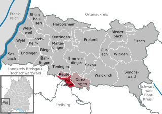
Денцлинген
Hiking in Денцлинген
Denzlingen is a small town in the southwest of Germany, located near Freiburg im Breisgau in the state of Baden-Württemberg. The surrounding region is renowned for its picturesque landscapes, making it an excellent destination for hiking enthusiasts....
- Страна:
- Почтовый код: 79211
- Телефонный код: 07666
- Код автомобильного номера: EM
- Координаты: 48° 4' 0" N, 7° 53' 0" E
- GPS треки (wikiloc): [Ссылка]
- Высота над уровнем моря: 232 м m
- Площадь: 16.95 кв.км
- Население: 13538
- Веб сайт: [Ссылка]


Гутах-им-Брайсгау
Hiking in Гутах-им-Брайсгау
Gutach im Breisgau, located in the scenic Black Forest region of Germany, offers a variety of hiking opportunities for outdoor enthusiasts. The area is known for its beautiful landscapes, including lush forests, rolling hills, and picturesque valleys. Here are some highlights for hiking in and around Gutach im Breisgau:...
- Страна:
- Почтовый код: 79261
- Телефонный код: 07681; 07685
- Код автомобильного номера: EM
- Координаты: 48° 7' 0" N, 7° 59' 0" E
- GPS треки (wikiloc): [Ссылка]
- Высота над уровнем моря: 399 м m
- Площадь: 24.77 кв.км
- Население: 4294
- Веб сайт: [Ссылка]

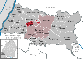
Тенинген
Hiking in Тенинген
Teningen is a charming town in the Freiburg region of Baden-Württemberg, Germany, and is surrounded by beautiful natural landscapes perfect for hiking enthusiasts. The area offers various trails that cater to different skill levels, from easy walks to more challenging hikes....
- Страна:
- Почтовый код: 79331
- Телефонный код: 07663; 07641
- Код автомобильного номера: EM
- Координаты: 48° 7' 46" N, 7° 48' 43" E
- GPS треки (wikiloc): [Ссылка]
- Высота над уровнем моря: 188 м m
- Площадь: 40.27 кв.км
- Население: 11596
- Веб сайт: [Ссылка]


Кенцинген
Hiking in Кенцинген
Kenzingen, a charming town located in the Breisgau region of Germany, offers a variety of hiking opportunities suitable for different skill levels. Nestled near the Black Forest and the Rhine River, the area is characterized by picturesque landscapes, vineyards, and lush forests....
- Страна:
- Почтовый код: 79341
- Телефонный код: 07644
- Код автомобильного номера: EM
- Координаты: 48° 11' 30" N, 7° 46' 6" E
- GPS треки (wikiloc): [Ссылка]
- Высота над уровнем моря: 177 м m
- Площадь: 36.93 кв.км
- Население: 10009
- Веб сайт: [Ссылка]


Форхгайм
Hiking in Форхгайм
Forchheim am Kaiserstuhl, nestled in the picturesque Kaiserstuhl region of Germany, is a delightful destination for hikers with its stunning landscapes, diverse flora, and charming vineyards. This area is known for its mild climate and scenic hills, making it an ideal spot for hiking year-round....
- Страна:
- Почтовый код: 79362
- Телефонный код: 07642
- Код автомобильного номера: EM
- Координаты: 48° 9' 50" N, 7° 42' 9" E
- GPS треки (wikiloc): [Ссылка]
- Высота над уровнем моря: 187 м m
- Площадь: 10.78 кв.км
- Население: 1402
- Веб сайт: [Ссылка]

Мальтердинген
Hiking in Мальтердинген
Malterdingen is a quaint village located in the state of Baden-Württemberg, Germany, nestled in the scenic region of the Ortenau. Its proximity to the Black Forest and the Rhine River makes it a great starting point for several hiking trails that cater to various levels of experience....
- Страна:
- Почтовый код: 79364
- Телефонный код: 07644
- Код автомобильного номера: EM
- Координаты: 48° 10' 0" N, 7° 48' 0" E
- GPS треки (wikiloc): [Ссылка]
- Высота над уровнем моря: 195 м m
- Площадь: 11.14 кв.км
- Население: 3041
- Веб сайт: [Ссылка]

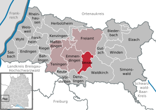
Зексау
Hiking in Зексау
Sexau is a charming municipality located in the state of Baden-Württemberg, Germany, nestled in the picturesque region of the Black Forest. Hiking in and around Sexau offers a fantastic opportunity to explore beautiful landscapes, rich flora and fauna, and serene rural surroundings....
- Страна:
- Почтовый код: 79350
- Телефонный код: 07641
- Код автомобильного номера: EM
- Координаты: 48° 6' 11" N, 7° 54' 33" E
- GPS треки (wikiloc): [Ссылка]
- Высота над уровнем моря: 232 м m
- Площадь: 16.30 кв.км
- Население: 3362
- Веб сайт: [Ссылка]

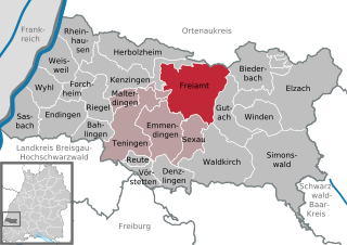
Фрайамт
Hiking in Фрайамт
Freiamt, located in the beautiful Black Forest region of Germany, offers a fantastic range of hiking opportunities for outdoor enthusiasts. Known for its picturesque landscapes, lush forests, rolling hills, and charming villages, Freiamt is a great destination for hikers of all skill levels....
- Страна:
- Почтовый код: 79348
- Телефонный код: 07645
- Код автомобильного номера: EM
- Координаты: 48° 10' 7" N, 7° 54' 46" E
- GPS треки (wikiloc): [Ссылка]
- Высота над уровнем моря: 322 м m
- Площадь: 52.92 кв.км
- Население: 4116
- Веб сайт: [Ссылка]


Зимонсвальд
Hiking in Зимонсвальд
Simonswald is a picturesque village located in the Black Forest region of Germany, known for its beautiful landscapes, dense forests, and charming rural atmosphere. It offers a variety of hiking opportunities for both beginners and experienced trekkers. Here are some highlights and tips for hiking in and around Simonswald:...
- Страна:
- Почтовый код: 79263
- Телефонный код: 07683
- Код автомобильного номера: EM
- Координаты: 48° 6' 1" N, 8° 3' 21" E
- GPS треки (wikiloc): [Ссылка]
- Высота над уровнем моря: 360 м m
- Площадь: 74.31 кв.км
- Население: 3116
- Веб сайт: [Ссылка]


Ригель
Hiking in Ригель
Riegel am Kaiserstuhl is a charming town located in the Baden-Württemberg region of Germany, known for its picturesque landscapes, vineyards, and proximity to the Kaiserstuhl mountain range. Hiking in this area offers a diverse range of trails suitable for various skill levels, making it a fantastic destination for both novice and expert hikers....
- Страна:
- Почтовый код: 79359
- Телефонный код: 07642
- Код автомобильного номера: EM
- Координаты: 48° 9' 0" N, 7° 45' 0" E
- GPS треки (wikiloc): [Ссылка]
- Высота над уровнем моря: 185 м m
- Площадь: 18.34 кв.км
- Население: 3861
- Веб сайт: [Ссылка]


Райнхаузен
Hiking in Райнхаузен
Rheinhausen, situated in the Breisgau region of Germany, offers beautiful hiking opportunities amidst scenic landscapes, vineyards, and the backdrop of the Black Forest. Here’s what you can expect when hiking in this area:...
- Страна:
- Почтовый код: 79365
- Телефонный код: 07643
- Код автомобильного номера: EM
- Координаты: 48° 13' 36" N, 7° 42' 45" E
- GPS треки (wikiloc): [Ссылка]
- Высота над уровнем моря: 174 м m
- Площадь: 22 кв.км
- Население: 3679
- Веб сайт: [Ссылка]

Ройте
Hiking in Ройте
Reute (Breisgau), located in the scenic region of Baden-Württemberg, Germany, offers a variety of hiking opportunities surrounded by stunning landscapes. Nestled in the foothills of the Black Forest, Reute serves as an excellent jumping-off point for exploring the area's natural beauty. Here are some highlights and tips for hiking in the region:...
- Страна:
- Почтовый код: 79276
- Телефонный код: 07641
- Код автомобильного номера: EM
- Координаты: 48° 5' 0" N, 7° 49' 32" E
- GPS треки (wikiloc): [Ссылка]
- Высота над уровнем моря: 954 м m
- Площадь: 4.79 кв.км
- Население: 2915
- Веб сайт: [Ссылка]
Граничит с регионами:

Брайсгау-Верхний Шварцвальд
Hiking in Брайсгау-Верхний Шварцвальд
Breisgau-Hochschwarzwald is a spectacular region in southwestern Germany, known for its diverse landscapes, lush forests, and scenic trails. It's located in the state of Baden-Württemberg and offers a myriad of hiking opportunities suitable for all skill levels. Here are some highlights about hiking in the area:...
- Страна:
- Столица: Фрайбург-им-Брайсгау
- Код автомобильного номера: FR
- Координаты: 47° 57' 0" N, 7° 51' 0" E
- GPS треки (wikiloc): [Ссылка]
- Высота над уровнем моря: 394 м m
- Площадь: 1378.30 кв.км
- Население: 247711
- Веб сайт: [Ссылка]