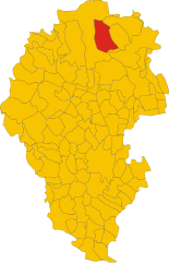
Энего (Enego, Enego)
.svg)
- коммуна Италии
 Hiking in Энего
Enego is a charming town in the Veneto region of northern Italy, situated in the foothills of the Asiago Plateau. It offers beautiful landscapes and a variety of hiking opportunities, making it an excellent destination for outdoor enthusiasts.
Hiking Trails:
-
Sentiero del Viandante: This is a scenic trail that takes you through lush forests and peaceful countryside. The trail is marked and suitable for various skill levels.
-
Monte Cengio: A trail that leads to the summit of Monte Cengio, offering panoramic views of the surrounding area. This route is historical as it played a role during World War I.
-
Altopiano di Asiago: Located nearby, this plateau has numerous trails that cater to both novice and experienced hikers. You can explore meadows, forests, and historic sites along these paths.
-
Sentiero delle Malghe: This trail connects several mountain huts (malghe) and is perfect for those looking to experience local culture and cuisine along with their hike.
Best Time to Hike:
The best time for hiking in Enego is usually from late spring to early autumn (May to September). During this period, the weather is mild, and the landscapes are at their most beautiful with wildflowers in bloom.
Tips for Hiking in Enego:
- Preparation: Make sure to check the weather forecast and dress in layers. Be prepared for sudden weather changes in the mountains.
- Start Early: Begin your hikes early in the day to avoid afternoon heat and have ample time to complete your trails.
- Local Guides: Consider hiring a local guide for less-known trails or for a more in-depth understanding of the area’s history and geography.
Safety:
Always carry enough water, snacks, and a map or GPS device. It's advisable to inform someone about your hiking plans, especially if you’re heading into less-trafficked areas.
Enego and its surrounding areas offer a wonderful mix of natural beauty and cultural heritage, making it a fantastic destination for hiking enthusiasts. Enjoy your adventure!
- Страна:

- Почтовый код: 36052
- Телефонный код: 0424
- Код автомобильного номера: VI
- Координаты: 45° 56' 0" N, 11° 43' 0" E


- GPS треки (wikiloc): [Ссылка]
- Высота над уровнем моря: 800 м m
- Площадь: 52.61 кв.км
- Население: 1645
- Веб сайт: http://www.comune.enego.vi.it
- Википедия русская: wiki(ru)
- Википедия английская: wiki(en)
- Википедия национальная: wiki(it)
- Хранилище Wikidata: Wikidata: Q46939
- Катеория в википедии: [Ссылка]
- код Freebase: [/m/0g8p4y]
- код GeoNames: Альт: [6542993]
- код VIAF: Альт: [236628745]
- ID отношения в OpenStreetMap: [50218]
- код ISTAT: 024039
- кадастровый код Италии: D407
Граничит с регионами:


Гриньо
- коммуна Италии
Hiking in Гриньо
Grigno is a charming town located in the Trentino-Alto Adige/Südtirol region of northern Italy. Nestled in the Valsugana valley, it offers a beautiful backdrop for hiking enthusiasts who appreciate both natural beauty and cultural history. Here are some highlights and general information about hiking in and around Grigno:...
- Страна:
- Почтовый код: 38055
- Телефонный код: 0461
- Код автомобильного номера: TN
- Координаты: 46° 1' 0" N, 11° 38' 0" E
- GPS треки (wikiloc): [Ссылка]
- Высота над уровнем моря: 263 м m
- Площадь: 46.39 кв.км
- Население: 2193
- Веб сайт: [Ссылка]


Арсье
- коммуна Италии
Hiking in Арсье
Arsiè is a charming town located in the province of Belluno, in the Veneto region of Italy. It is situated at the foothills of the Dolomites, making it a fantastic destination for hiking enthusiasts. The surrounding landscapes are characterized by stunning mountain scenery, lush forests, and picturesque valleys....
- Страна:
- Почтовый код: 32030
- Телефонный код: 0439
- Код автомобильного номера: BL
- Координаты: 45° 59' 0" N, 11° 45' 0" E
- GPS треки (wikiloc): [Ссылка]
- Высота над уровнем моря: 315 м m
- Площадь: 64.76 кв.км
- Население: 2275
- Веб сайт: [Ссылка]
Фоца
- коммуна Италии
Hiking in Фоца
Foza is a lovely destination for hiking enthusiasts, located in the Veneto region of Italy, specifically in the province of Vicenza. Nestled in the foothills of the Venetian Prealps, it offers stunning landscapes, rich flora and fauna, and a variety of trails suitable for different skill levels....
- Страна:
- Почтовый код: 36010
- Телефонный код: 0424
- Код автомобильного номера: VI
- Координаты: 45° 54' 0" N, 11° 38' 0" E
- GPS треки (wikiloc): [Ссылка]
- Высота над уровнем моря: 1083 м m
- Площадь: 35.21 кв.км
- Население: 693
- Веб сайт: [Ссылка]

Галлио
- коммуна Италии
Hiking in Галлио
Gallio is a charming town located in the province of Vicenza, in the Veneto region of Italy, and is part of the Asiago Plateau, a renowned area for outdoor activities, including hiking. The landscape is characterized by lush forests, rolling hills, and stunning mountain views, making it a fantastic destination for hikers of all levels....
- Страна:
- Почтовый код: 36032
- Телефонный код: 0424
- Код автомобильного номера: VI
- Координаты: 45° 53' 0" N, 11° 33' 0" E
- GPS треки (wikiloc): [Ссылка]
- Высота над уровнем моря: 1093 м m
- Площадь: 47.87 кв.км
- Население: 2389
- Веб сайт: [Ссылка]


Азиаго
- коммуна Италии
Hiking in Азиаго
Asiago is a beautiful town located in the Veneto region of Italy, known for its stunning landscapes, rich history, and delicious cheese. The surrounding area offers numerous hiking opportunities, making it a popular destination for outdoor enthusiasts....
- Страна:
- Почтовый код: 36012
- Телефонный код: 0424
- Код автомобильного номера: VI
- Координаты: 45° 52' 0" N, 11° 31' 0" E
- GPS треки (wikiloc): [Ссылка]
- Высота над уровнем моря: 1001 м m
- Площадь: 162.95 кв.км
- Население: 6441
- Веб сайт: [Ссылка]